Cook's Copse

Wood, Forest in Sussex Horsham

England

Cook's Copse

Downs Link near Horsham The Downs Link walking and cycling path near Horsham in West Sussex.  The path follows a dismantled railway line.  It also forms part of route 223 of the National Cycle Network.
Downs Link near Horsham Credit: Malc McDonald

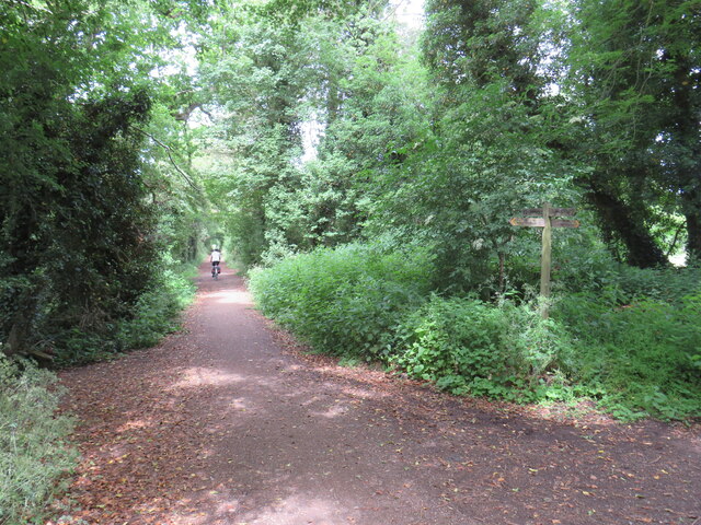
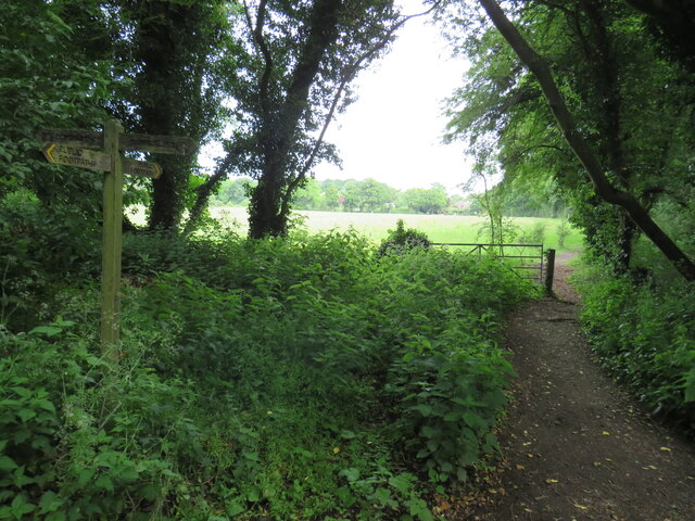
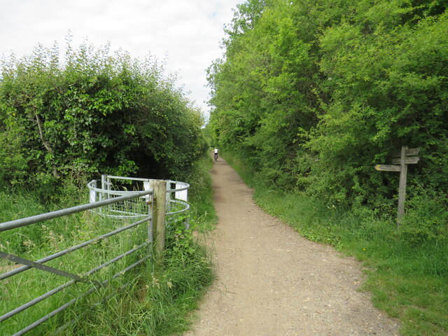
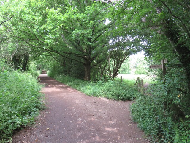
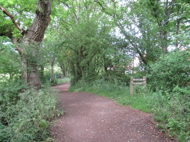
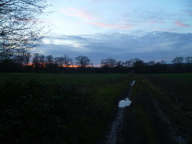
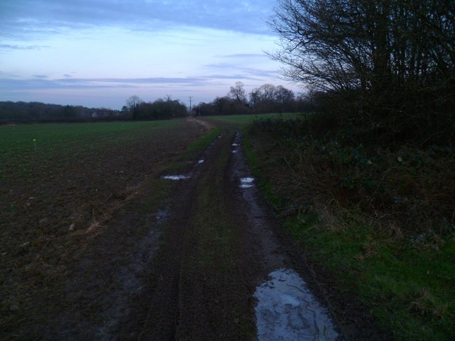
Cook's Copse is a picturesque woodland located in the county of Sussex, England. Covering an area of approximately 20 acres, it is situated on the outskirts of a small village and is a popular destination for nature lovers and outdoor enthusiasts.

The copse is characterized by its diverse range of tree species, including oak, beech, and ash, creating a rich and vibrant forest. The dense canopy provides a tranquil and shaded environment, making it an ideal spot for walking, wildlife observation, and picnicking.

Visitors to Cook's Copse can explore a network of well-maintained trails that wind through the woodland, allowing them to fully immerse themselves in the natural beauty of the area. The paths are lined with wildflowers and ferns, adding a touch of color and texture to the already picturesque setting.

The copse is home to a variety of wildlife, including deer, foxes, and a wide array of bird species. Birdwatchers can expect to spot woodpeckers, owls, and warblers amongst others. With its abundance of flora and fauna, Cook's Copse offers a unique opportunity to connect with nature and experience the tranquility of the countryside.

Historically, Cook's Copse has been an important local resource, providing timber for construction and fuel. Today, it is managed by a local conservation group that ensures the preservation of its natural habitat and promotes responsible and sustainable use of the woodland.

Overall, Cook's Copse is a hidden gem in Sussex, offering visitors a chance to escape the hustle and bustle of everyday life and immerse themselves in the beauty of nature.

If you have any feedback on the listing, please let us know in the comments section below.

Cook's Copse Images

Images are sourced within 2km of 51.076041/-0.38527413 or Grid Reference TQ1331. Thanks to Geograph Open Source API. All images are credited.

Downs Link near Horsham The Downs Link walking and cycling path near Horsham in West Sussex.  The path follows a dismantled railway line.  It also forms part of route 223 of the National Cycle Network.
Downs Link near Horsham
The Downs Link walking and cycling path near Horsham in West Sussex. The path follows a dismantled railway line. It also forms part of route 223 of the National Cycle Network.
Public footpath near Horsham A public footpath near Horsham in West Sussex.
Public footpath near Horsham
A public footpath near Horsham in West Sussex.
Downs Link, near Slinfold A view of the Downs Link path near Slinfold in West Sussex.  The path follows a dismantled railway line.  It also forms part of route 223 of the National Cycle Network.
Downs Link, near Slinfold
A view of the Downs Link path near Slinfold in West Sussex. The path follows a dismantled railway line. It also forms part of route 223 of the National Cycle Network.
Downs Link, near Slinfold The Downs Link path near Slinfold in West Sussex, with a footpath leading off to the right.  The path follows a dismantled railway line.  It also forms part of route 223 of the National Cycle Network.
Downs Link, near Slinfold
The Downs Link path near Slinfold in West Sussex, with a footpath leading off to the right. The path follows a dismantled railway line. It also forms part of route 223 of the National Cycle Network.
Downs Link approaching Slinfold A view of the Downs Link path as it approaches Slinfold in West Sussex.  The path follows a dismantled railway line.  It also forms part of route 223 of the National Cycle Network.
Downs Link approaching Slinfold
A view of the Downs Link path as it approaches Slinfold in West Sussex. The path follows a dismantled railway line. It also forms part of route 223 of the National Cycle Network.
Hayes Lane, Slinfold, near Horsham Hayes Lane is a minor road in the village of Slinfold, near Horsham.
Hayes Lane, Slinfold, near Horsham
Hayes Lane is a minor road in the village of Slinfold, near Horsham.
Downs Link at Slinfold, near Horsham The path to the left of the houses forms part of the Downs Link path, which follows a dismantled railway line.  The path also forms part of route 223 of the National Cycle Network.
Downs Link at Slinfold, near Horsham
The path to the left of the houses forms part of the Downs Link path, which follows a dismantled railway line. The path also forms part of route 223 of the National Cycle Network.
Slinfold shop Shop and post office - with the benefit of some parking.
Slinfold shop
Shop and post office - with the benefit of some parking.
Bridleway leaves A29 just east of roundabout with A281
Drive at Mulberry Place goes eastwards from A29
A29 goes northwards from drive at Mulberry Place
A29 goes northwards from bridleway
Footpath goes east from A29
Rowhook Road crosses the A29 For a view the other way see <a title="https://www.geograph.org.uk/photo/4051939" href="https://www.geograph.org.uk/photo/4051939">Link</a>.
Rowhook Road crosses the A29
For a view the other way see Link.
Industrial units at Richmond Stud on the A29
Warnham Manor seen from footpath See also <a title="https://www.geograph.org.uk/photo/2071947" href="https://www.geograph.org.uk/photo/2071947">Link</a>.
Warnham Manor seen from footpath
See also Link.
Muddy and icy path at sunset
Muddy and icy path going towards Warnham Manor
Show me another place!

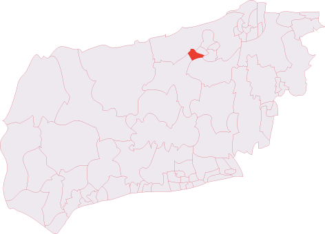
Cook's Copse is located at Grid Ref: TQ1331 (Lat: 51.076041, Lng: -0.38527413)

Administrative County: West Sussex

District: Horsham

Police Authority: Sussex

What 3 Words

///agrees.gladiator.inflamed. Near Slinfold, West Sussex

Related Wikis

Slinfold Stream and Quarry

Slinfold Stream and Quarry is a 2.3-hectare (5.7-acre) geological Site of Special Scientific Interest west of Horsham in West Sussex. It is a Geological...

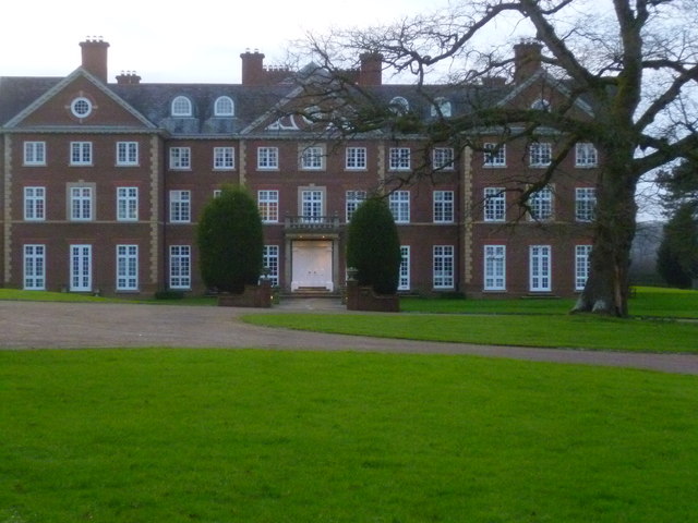
Field Place, Warnham

Field Place is a Grade I listed house in Warnham, West Sussex, England. It is the birthplace of the poet Percy Bysshe Shelley, born there in 1792. The...

Slinfold

Slinfold is a village and civil parish in the Horsham District of West Sussex, England. == Geography == The village is almost 4 miles (6.4 km) west of...

Broadbridge Heath

Broadbridge Heath is a village and civil parish in the Horsham district of West Sussex, England. It is about two miles (3 km) west from the historic centre...

Slinfold railway station

Slinfold railway station was on the Cranleigh Line and served the village of Slinfold in West Sussex. == History == The line had a single track and opened...

Broadbridge Heath F.C.

Broadbridge Heath Football Club is a football club based in Broadbridge Heath, near Horsham, in West Sussex, England. They are currently members of the...

Tanbridge House School

Tanbridge House School is a coeducational secondary school located in Horsham, West Sussex, England. Its current head master is Mr Sheridan who started...

Horsham Tanbridge & Broadbridge Heath (electoral division)

Horsham Tanbridge & Broadbridge Heath is an electoral division of West Sussex in England, and returns one member to sit on West Sussex County Council....

Nearby Amenities

Located within 500m of 51.076041,-0.38527413
Rapkyns Care Village
Place: hamlet
Lat/Long: 51.0760209/-0.3829476
Rapkyns Farm
Place: farm
Lat/Long: 51.0753738/-0.3798147
Nowhurst Farm
Place: farm
Lat/Long: 51.0789621/-0.3888926
Pondfield Farm
Place: farm
Lat/Long: 51.0767385/-0.3851245
Barrier: stile
Foot: yes
Material: wood
Stile: stepover
Lat/Long: 51.0764597/-0.3803044
Barrier: stile
Foot: yes
Material: wood
Stile: stepover
Lat/Long: 51.076103/-0.3788516
Barrier: stile
Foot: yes
Material: wood
Stile: stepover
Lat/Long: 51.0761935/-0.3807611
Barrier: stile
Foot: yes
Material: wood
Stile: stepover
Lat/Long: 51.0782065/-0.3884657
Barrier: kissing_gate
Foot: yes
Lat/Long: 51.0788671/-0.3891242
The data included in this document is from www.openstreetmap.org. The data is made available under ODbL.

Have you been to Cook's Copse?

Leave your review of Cook's Copse below (or comments, questions and feedback).