Legsby Wood
Wood, Forest in Lincolnshire West Lindsey
England
Legsby Wood

Legsby Wood is a charming woodland located in the county of Lincolnshire, England. Covering an area of approximately 37 hectares, this forested area is a haven of natural beauty and tranquility. It is situated near the village of Legsby, which adds to its appeal as a recreational spot for locals and tourists alike.
The wood is predominantly composed of broadleaf trees, including oak, birch, and beech, which provide a diverse and vibrant ecosystem. The dense canopy creates a shaded and cool environment, making it an ideal retreat during hot summer months. The forest floor is covered in a thick layer of leaf litter, creating a natural carpet that enhances the woodland's enchanting atmosphere.
Legsby Wood is home to a variety of wildlife, including mammals, birds, and insects. Deer can often be spotted gracefully wandering through the trees, while squirrels scurry about in search of food. The woodland is also a popular nesting site for numerous bird species, providing a safe habitat for their young.
For nature enthusiasts, Legsby Wood offers a range of recreational activities. Visitors can explore the numerous walking trails that wind through the forest, allowing them to fully immerse themselves in the natural surroundings. The wood also boasts a picnic area, where families and friends can enjoy a leisurely lunch amidst the peaceful ambiance.
Overall, Legsby Wood is a treasured natural resource in Lincolnshire. Its picturesque beauty and diverse wildlife make it a popular destination for those seeking a peaceful escape from the hustle and bustle of everyday life.
If you have any feedback on the listing, please let us know in the comments section below.
Legsby Wood Images
Images are sourced within 2km of 53.366322/-0.30331612 or Grid Reference TF1286. Thanks to Geograph Open Source API. All images are credited.

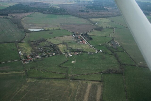


![Linwood Moats: aerial 2023 (1) See: <span class="nowrap"><a title="https://www.heritagegateway.org.uk/Gateway/Results_Single.aspx?uid=MLI50300&amp;resourceID=1006" rel="nofollow ugc noopener" href="https://www.heritagegateway.org.uk/Gateway/Results_Single.aspx?uid=MLI50300&amp;resourceID=1006">Link</a><img style="margin-left:2px;" alt="External link" title="External link - shift click to open in new window" src="https://s1.geograph.org.uk/img/external.png" width="10" height="10"/></span>
Probably the remains of the larger of two manors, recorded in the Domesday Book, and held by Alfred of Lincoln... there was a sharp decline [in population] on the 17th century... In 1607 the manor house was &#039;decayed&#039;... The earthworks used to be scheduled, but have been ploughed out, and so are no longer scheduled.&quot;
See also <a href="https://www.geograph.org.uk/photo/6340097">TF1185 : Moated site, Linwood: aerial 2019 (1)</a>],
<a href="https://www.geograph.org.uk/photo/6340104">TF1185 : Moated site to the south of Linwood: aerial 2019 (2)</a> and
<a href="https://www.geograph.org.uk/photo/6340108">TF1185 : Moated site to the south of Linwood: aerial 2019 (3)</a>.](https://s0.geograph.org.uk/geophotos/07/42/72/7427216_cfb4e0f1.jpg)
![Linwood Moats: aerial 2023 (2) See: <span class="nowrap"><a title="https://www.heritagegateway.org.uk/Gateway/Results_Single.aspx?uid=MLI50300&amp;resourceID=1006" rel="nofollow ugc noopener" href="https://www.heritagegateway.org.uk/Gateway/Results_Single.aspx?uid=MLI50300&amp;resourceID=1006">Link</a><img style="margin-left:2px;" alt="External link" title="External link - shift click to open in new window" src="https://s1.geograph.org.uk/img/external.png" width="10" height="10"/></span>
&quot;Probably the remains of the larger of two manors, recorded in the Domesday Book, and held by Alfred of Lincoln... there was a sharp decline [in population] on the 17th century... In 1607 the manor house was &#039;decayed&#039;... The earthworks used to be scheduled, but have been ploughed out, and so are no longer scheduled.&quot;
See also <a href="https://www.geograph.org.uk/photo/6340097">TF1185 : Moated site, Linwood: aerial 2019 (1)</a>],
<a href="https://www.geograph.org.uk/photo/7427216">TF1185 : Linwood Moats: aerial 2023 (1)</a>,
<a href="https://www.geograph.org.uk/photo/6340104">TF1185 : Moated site to the south of Linwood: aerial 2019 (2)</a> and
<a href="https://www.geograph.org.uk/photo/6340108">TF1185 : Moated site to the south of Linwood: aerial 2019 (3)</a>.](https://s3.geograph.org.uk/geophotos/07/42/72/7427231_3738b5c2.jpg)


Legsby Wood is located at Grid Ref: TF1286 (Lat: 53.366322, Lng: -0.30331612)
Administrative County: Lincolnshire
District: West Lindsey
Police Authority: Lincolnshire
What 3 Words
///parsnip.solids.cried. Near Market Rasen, Lincolnshire
Nearby Locations
Related Wikis

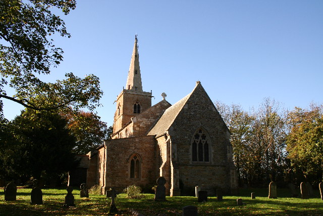
Legsby
Legsby (otherwise Legesby) is a small village and civil parish in the West Lindsey district of Lincolnshire, England. The population of the civil parish...

Market Rasen Racecourse
Market Rasen Racecourse is a National Hunt racecourse in the town of Market Rasen, in Lincolnshire, England. It is owned and operated by Jockey Club Racecourses...
Linwood, Lincolnshire
Linwood is a small village and civil parish in the West Lindsey district of Lincolnshire, England, on the minor B1202 road about 2 miles (3 km) south from...
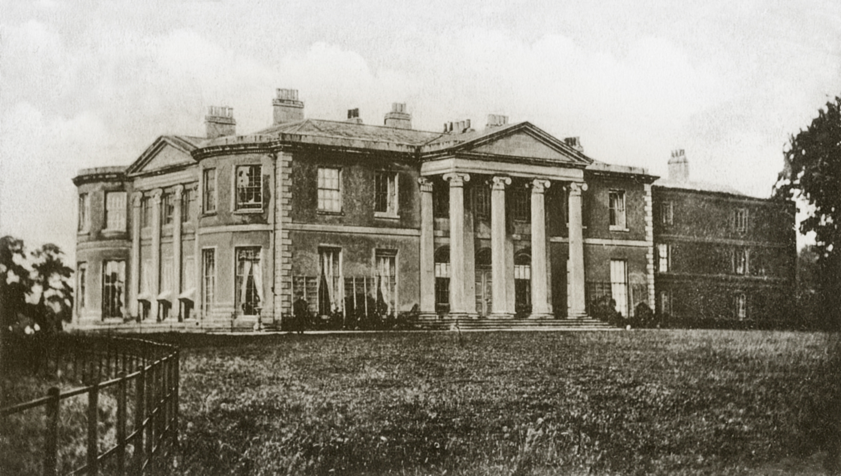
Willingham House
Willingham House was a country house in North Willingham (near Market Rasen), Lincolnshire, England. It was built around 1790 for Ayscoghe Boucherett...

De Aston School
De Aston School is a mixed secondary school with academy status in Market Rasen, Lincolnshire, England. It also has a sixth form but no longer has a boarding...

Market Rasen railway station
Market Rasen railway station serves the market town of Market Rasen in Lincolnshire, England. == History == It was built by the Great Grimsby and Sheffield...
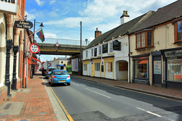
Market Rasen
Market Rasen ( RAY-zən) is a market town and civil parish within the West Lindsey district of Lincolnshire, England. The River Rase runs through it east...
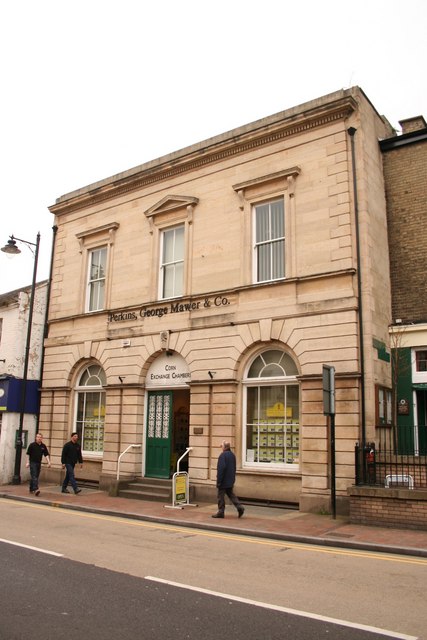
Corn Exchange, Market Rasen
The Corn Exchange is a commercial building in Queen Street, Market Rasen, Lincolnshire, England. The structure, which is used as the offices of a firm...
Nearby Amenities
Located within 500m of 53.366322,-0.30331612Have you been to Legsby Wood?
Leave your review of Legsby Wood below (or comments, questions and feedback).