Birch Copse

Wood, Forest in Sussex Horsham

England

Birch Copse

Downs Link near Horsham The Downs Link walking and cycling path near Horsham in West Sussex.  The path follows a dismantled railway line.  It also forms part of route 223 of the National Cycle Network.
Downs Link near Horsham Credit: Malc McDonald

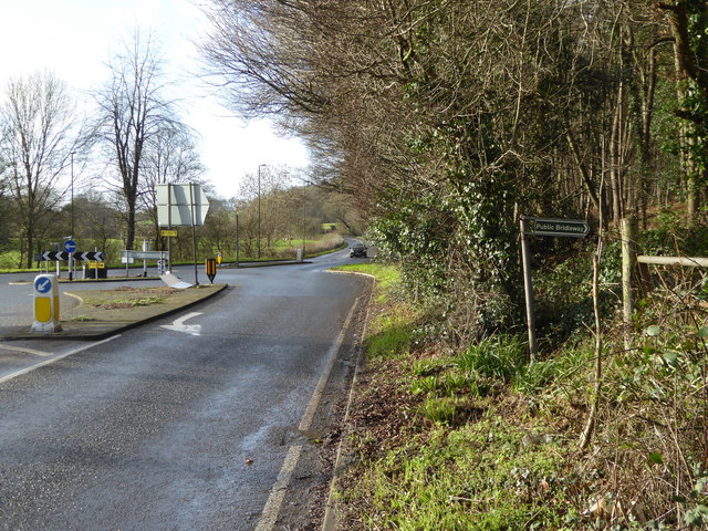
Birch Copse is a serene and picturesque woodland located in Sussex, England. Covering an area of approximately 50 acres, this enchanting forest is a haven for nature enthusiasts and those seeking tranquility amidst the bustling city.

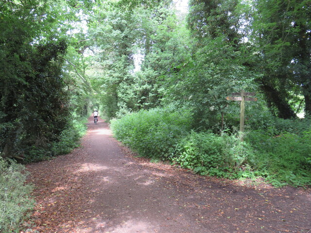
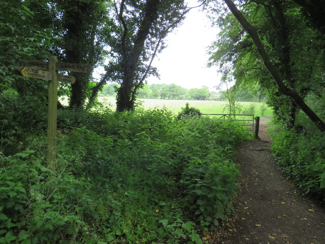
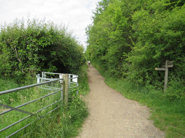
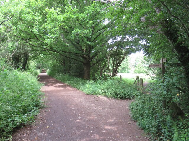
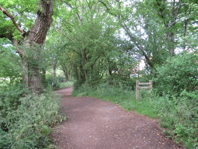
The copse is predominantly made up of birch trees, hence its name, which create a stunning backdrop with their slender trunks and delicate leaves. These trees provide a beautiful canopy, allowing dappled sunlight to filter through, creating a magical atmosphere within the woodland.

The forest floor is adorned with a rich carpet of moss, ferns, and wildflowers, adding to the natural beauty of the copse. It is home to a diverse range of flora and fauna, with various species of birds, butterflies, and small mammals thriving in this habitat.

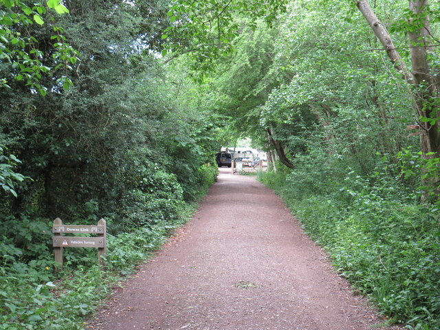
Birch Copse offers a network of well-maintained trails, making it an ideal location for leisurely walks and hikes. The paths wind through the trees, offering glimpses of stunning vistas and hidden corners waiting to be explored. Along the trails, visitors may come across babbling brooks and small ponds, adding to the charm of the woodland.

The copse is managed by the local council, ensuring the preservation of its natural beauty and the protection of its inhabitants. There are designated picnic areas and benches scattered throughout, allowing visitors to take in the serenity of the surroundings and enjoy a peaceful break in nature.

Overall, Birch Copse in Sussex is a remarkable woodland sanctuary, offering a refuge from the fast-paced modern world and providing a place for visitors to connect with nature in all its glory.

If you have any feedback on the listing, please let us know in the comments section below.

Birch Copse Images

Images are sourced within 2km of 51.075569/-0.39284208 or Grid Reference TQ1231. Thanks to Geograph Open Source API. All images are credited.

Downs Link near Horsham The Downs Link walking and cycling path near Horsham in West Sussex.  The path follows a dismantled railway line.  It also forms part of route 223 of the National Cycle Network.
Downs Link near Horsham
The Downs Link walking and cycling path near Horsham in West Sussex. The path follows a dismantled railway line. It also forms part of route 223 of the National Cycle Network.
Public footpath near Horsham A public footpath near Horsham in West Sussex.
Public footpath near Horsham
A public footpath near Horsham in West Sussex.
Downs Link, near Slinfold A view of the Downs Link path near Slinfold in West Sussex.  The path follows a dismantled railway line.  It also forms part of route 223 of the National Cycle Network.
Downs Link, near Slinfold
A view of the Downs Link path near Slinfold in West Sussex. The path follows a dismantled railway line. It also forms part of route 223 of the National Cycle Network.
Downs Link, near Slinfold The Downs Link path near Slinfold in West Sussex, with a footpath leading off to the right.  The path follows a dismantled railway line.  It also forms part of route 223 of the National Cycle Network.
Downs Link, near Slinfold
The Downs Link path near Slinfold in West Sussex, with a footpath leading off to the right. The path follows a dismantled railway line. It also forms part of route 223 of the National Cycle Network.
Downs Link approaching Slinfold A view of the Downs Link path as it approaches Slinfold in West Sussex.  The path follows a dismantled railway line.  It also forms part of route 223 of the National Cycle Network.
Downs Link approaching Slinfold
A view of the Downs Link path as it approaches Slinfold in West Sussex. The path follows a dismantled railway line. It also forms part of route 223 of the National Cycle Network.
Hayes Lane, Slinfold, near Horsham Hayes Lane is a minor road in the village of Slinfold, near Horsham.
Hayes Lane, Slinfold, near Horsham
Hayes Lane is a minor road in the village of Slinfold, near Horsham.
Downs Link at Slinfold, near Horsham The path to the left of the houses forms part of the Downs Link path, which follows a dismantled railway line.  The path also forms part of route 223 of the National Cycle Network.
Downs Link at Slinfold, near Horsham
The path to the left of the houses forms part of the Downs Link path, which follows a dismantled railway line. The path also forms part of route 223 of the National Cycle Network.
Downs Link at Slinfold, near Horsham A view of the Downs Link path passing through Slinfold in West Sussex.  The path follows a dismantled railway line.  It also forms part of route 223 of the National Cycle Network.  In this view, the path is approaching the site of Slinfold railway station.
Downs Link at Slinfold, near Horsham
A view of the Downs Link path passing through Slinfold in West Sussex. The path follows a dismantled railway line. It also forms part of route 223 of the National Cycle Network. In this view, the path is approaching the site of Slinfold railway station.
Houses at former railway station, Slinfold The building in this image stands alongside the former railway station at Slinfold, in West Sussex.  The station closed in 1965 and has since been demolished.

The driveway which heads off to the right forms part of the Downs Link path, which follows the dismantled railway line.  The Downs Link path itself forms part of route 223 of the National Cycle Network.

More information about Slinfold station, including photographs taken when it was still open as a railway station, can be found on the Disused Stations website: <span class="nowrap"><a title="http://www.disused-stations.org.uk/s/slinfold/" rel="nofollow ugc noopener" href="http://www.disused-stations.org.uk/s/slinfold/">Link</a><img style="margin-left:2px;" alt="External link" title="External link - shift click to open in new window" src="https://s1.geograph.org.uk/img/external.png" width="10" height="10"/></span>
Houses at former railway station, Slinfold
The building in this image stands alongside the former railway station at Slinfold, in West Sussex. The station closed in 1965 and has since been demolished. The driveway which heads off to the right forms part of the Downs Link path, which follows the dismantled railway line. The Downs Link path itself forms part of route 223 of the National Cycle Network. More information about Slinfold station, including photographs taken when it was still open as a railway station, can be found on the Disused Stations website: LinkExternal link
Downs Link, near Slinfold A view of the Downs Link path as it approaches Slinfold in West Sussex.  The path follows a dismantled railway line.  It also forms part of route 223 of the National Cycle Network.

Here, the path passes beneath the A29 road.  The railway closed in 1965, the subway taking the path beneath the road is clearly a more recent feature.
Downs Link, near Slinfold
A view of the Downs Link path as it approaches Slinfold in West Sussex. The path follows a dismantled railway line. It also forms part of route 223 of the National Cycle Network. Here, the path passes beneath the A29 road. The railway closed in 1965, the subway taking the path beneath the road is clearly a more recent feature.
Slinfold shop Shop and post office - with the benefit of some parking.
Slinfold shop
Shop and post office - with the benefit of some parking.
Bridleway leaves A29 just east of roundabout with A281
Drive at Mulberry Place goes eastwards from A29
A29 goes northwards from drive at Mulberry Place
Bridleway to farm west of A29
A29 goes northwards from bridleway
Footpath goes east from A29
Muddy footpath west of A29
Show me another place!

Birch Copse is located at Grid Ref: TQ1231 (Lat: 51.075569, Lng: -0.39284208)

Administrative County: West Sussex

District: Horsham

Police Authority: Sussex

What 3 Words

///magpie.artist.repaying. Near Slinfold, West Sussex

Related Wikis

Slinfold Stream and Quarry

Slinfold Stream and Quarry is a 2.3-hectare (5.7-acre) geological Site of Special Scientific Interest west of Horsham in West Sussex. It is a Geological...

Slinfold

Slinfold is a village and civil parish in the Horsham District of West Sussex, England. == Geography == The village is almost 4 miles (6.4 km) west of...

Slinfold railway station

Slinfold railway station was on the Cranleigh Line and served the village of Slinfold in West Sussex. == History == The line had a single track and opened...

Field Place, Warnham

Field Place is a Grade I listed house in Warnham, West Sussex, England. It is the birthplace of the poet Percy Bysshe Shelley, born there in 1792. The...

Nearby Amenities

Located within 500m of 51.075569,-0.39284208
Barrier: stile
Lat/Long: 51.0790596/-0.3916994
Fixme: this footpath coninues...
Lat/Long: 51.0794659/-0.3915623
Nowhurst Farm
Place: farm
Lat/Long: 51.0789621/-0.3888926
Barrier: stile
Foot: yes
Material: wood
Stile: stepover
Lat/Long: 51.0782065/-0.3884657
Barrier: kissing_gate
Foot: yes
Lat/Long: 51.0788671/-0.3891242
The data included in this document is from www.openstreetmap.org. The data is made available under ODbL.

Have you been to Birch Copse?

Leave your review of Birch Copse below (or comments, questions and feedback).