Hall Land Rough
Wood, Forest in Sussex Horsham
England
Hall Land Rough

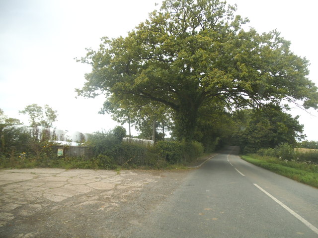
Hall Land Rough is a woodland area located in Sussex, England. Covering an approximate area of [insert size], it is a part of the larger Sussex forest region. The woodland is characterized by its diverse range of trees, including oak, ash, birch, and beech, which create a dense canopy and provide shelter for a variety of wildlife.
The forest floor is covered in a thick layer of leaf litter, creating a natural habitat for insects, small mammals, and fungi. This rich ecosystem supports a wide array of flora and fauna, including rare and protected species such as the dormouse and the lesser spotted woodpecker.
Hall Land Rough is a popular destination for nature enthusiasts, hikers, and photographers due to its picturesque scenery and abundant wildlife. The woodland offers numerous well-maintained trails and paths, allowing visitors to explore its beauty at their own pace. Additionally, there are designated picnic areas and benches throughout the forest, providing a perfect spot for visitors to relax and enjoy the tranquil surroundings.
Conservation efforts are in place to protect and preserve the natural habitat of Hall Land Rough. These efforts include controlled burning, selective tree thinning, and the creation of artificial nesting sites for birds. Local conservation groups often organize educational walks and talks to raise awareness about the importance of maintaining the biodiversity of the woodland.
Overall, Hall Land Rough in Sussex is a stunning woodland that showcases the beauty of nature in its purest form. With its diverse range of trees, abundant wildlife, and well-maintained trails, it offers a unique and enchanting experience for anyone who visits.
If you have any feedback on the listing, please let us know in the comments section below.
Hall Land Rough Images
Images are sourced within 2km of 51.062553/-0.41163125 or Grid Reference TQ1130. Thanks to Geograph Open Source API. All images are credited.


Hall Land Rough is located at Grid Ref: TQ1130 (Lat: 51.062553, Lng: -0.41163125)
Administrative County: West Sussex
District: Horsham
Police Authority: Sussex
What 3 Words
///seriously.gums.waxing. Near Slinfold, West Sussex
Nearby Locations
Related Wikis

Slinfold railway station
Slinfold railway station was on the Cranleigh Line and served the village of Slinfold in West Sussex. == History == The line had a single track and opened...

Slinfold
Slinfold is a village and civil parish in the Horsham District of West Sussex, England. == Geography == The village is almost 4 miles (6.4 km) west of...

Slinfold Stream and Quarry
Slinfold Stream and Quarry is a 2.3-hectare (5.7-acre) geological Site of Special Scientific Interest west of Horsham in West Sussex. It is a Geological...

Itchingfield
Itchingfield is a small village and civil parish in the Horsham district of West Sussex, England. It lies on the Barns Green to Broadbridge Heath road...

Five Oaks
Five Oaks is a large hamlet in the Horsham District of West Sussex, England. It lies about 1.7 miles (2.8 km) north of Billingshurst on the Roman road...

The Haven, West Sussex
The Haven is a rural hamlet in West Sussex, south east England located about 7 miles to the west of Horsham.The Haven is primarily an agricultural area...

Barns Green
Barns Green is a village in the Horsham district of West Sussex, England. It lies on the Billingshurst to Itchingfield road 2+1⁄2 miles (4.0 km) north...
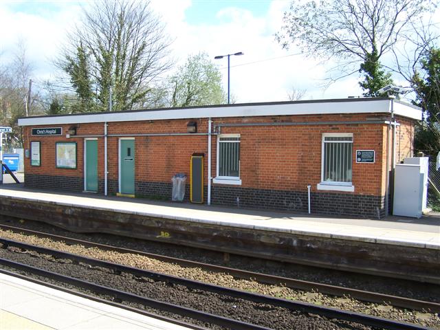
Christ's Hospital railway station
Christ's Hospital railway station is near Horsham in West Sussex, England. It is 40 miles 7 chains (64.5 km) down the line from London Bridge via Redhill...
Nearby Amenities
Located within 500m of 51.062553,-0.41163125Have you been to Hall Land Rough?
Leave your review of Hall Land Rough below (or comments, questions and feedback).