Crow Plantation

Wood, Forest in Lincolnshire South Kesteven

England

Crow Plantation

Old Hall Farmhouse A grade II listed building at the side of the Macmillan Way long distance path, which at this point runs along the road.

See <span class="nowrap"><a title="https://historicengland.org.uk/listing/the-list/list-entry/1062674" rel="nofollow ugc noopener" href="https://historicengland.org.uk/listing/the-list/list-entry/1062674">Link</a><img style="margin-left:2px;" alt="External link" title="External link - shift click to open in new window" src="https://s1.geograph.org.uk/img/external.png" width="10" height="10"/></span> for the house.
Old Hall Farmhouse Credit: Bob Harvey

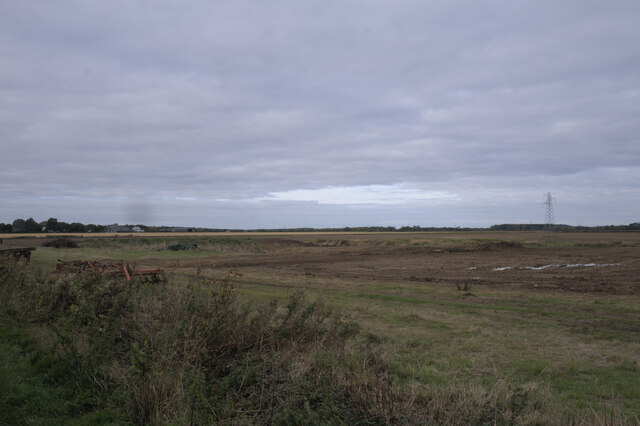
Crow Plantation is a woodland area located in the county of Lincolnshire, England. Nestled in the heart of the county, it spans across a vast area of approximately 200 acres. The plantation is characterized by its dense and diverse forest cover, which includes a variety of tree species such as oak, beech, birch, and pine.

The woodland is teeming with wildlife and serves as a crucial habitat for numerous species. It is a popular destination for nature enthusiasts and birdwatchers, who flock to the plantation to observe the rich avian population that calls it home. Common bird species found in the area include robins, woodpeckers, owls, and various types of finches.

The plantation offers an idyllic setting for leisurely walks and outdoor activities. There are several well-maintained trails that meander through the forest, providing visitors with the opportunity to explore the natural beauty of the woodland. The paths are often lined with carpets of wildflowers during the spring and summer months, adding a splash of vibrant colors to the already picturesque surroundings.

In addition to its recreational value, Crow Plantation also plays a crucial role in maintaining the ecological balance of the region. The dense forest cover helps in mitigating climate change by absorbing carbon dioxide and releasing oxygen, while also providing a natural barrier against soil erosion.

Overall, Crow Plantation in Lincolnshire is a precious natural asset that offers both ecological significance and recreational opportunities for locals and visitors alike.

If you have any feedback on the listing, please let us know in the comments section below.

Crow Plantation Images

Images are sourced within 2km of 52.718643/-0.36089615 or Grid Reference TF1014. Thanks to Geograph Open Source API. All images are credited.

Old Hall Farmhouse A grade II listed building at the side of the Macmillan Way long distance path, which at this point runs along the road.

See <span class="nowrap"><a title="https://historicengland.org.uk/listing/the-list/list-entry/1062674" rel="nofollow ugc noopener" href="https://historicengland.org.uk/listing/the-list/list-entry/1062674">Link</a><img style="margin-left:2px;" alt="External link" title="External link - shift click to open in new window" src="https://s1.geograph.org.uk/img/external.png" width="10" height="10"/></span> for the house.
Old Hall Farmhouse
A grade II listed building at the side of the Macmillan Way long distance path, which at this point runs along the road. See LinkExternal link for the house.
Former phone box No longer in use for a payphone, this now belongs to the parish council who have put a defibrillator inside.
Former phone box
No longer in use for a payphone, this now belongs to the parish council who have put a defibrillator inside.
Defibrillator in phone box Inside <a href="https://www.geograph.org.uk/photo/6998599">TF0913 : Former phone box</a>.
Defibrillator in phone box
The Defib box Inside <a href="https://www.geograph.org.uk/photo/6998599">TF0913 : Former phone box</a>.
The Defib box
Life saving advice I have photographed many of these public access defibrillators, but this is the first I have seen with advice about the whole treatment of the victim.  I love this country.  A few well-meaning individuals have sat down and thought about when this device may be used, and taken their own actions to help.  This is why local voluntary action works so well.
Life saving advice
I have photographed many of these public access defibrillators, but this is the first I have seen with advice about the whole treatment of the victim. I love this country. A few well-meaning individuals have sat down and thought about when this device may be used, and taken their own actions to help. This is why local voluntary action works so well.
This made me smile A postbox with a sense of humour.
This made me smile
A postbox with a sense of humour.
Hydrant and Marker In the road at Wilsthorpe, a fire hydrant cover.

See <a href="https://www.geograph.org.uk/photo/6998745">TF0913 : Wilsthorpe cottages</a> for the context
Hydrant and Marker
In the road at Wilsthorpe, a fire hydrant cover. See TF0913 : Wilsthorpe cottages for the context
Wilsthorpe cottages Late 19th century workers cottages, extended at either end in the middle 20th century until the range is twice as long.

The fire hydrant is seen in <a href="https://www.geograph.org.uk/photo/6998740">TF0913 : Hydrant and Marker</a>
Wilsthorpe cottages
Late 19th century workers cottages, extended at either end in the middle 20th century until the range is twice as long. The fire hydrant is seen in TF0913 : Hydrant and Marker
Fingerpost All the tiny fen-edge villages south of Thurlby
Fingerpost
All the tiny fen-edge villages south of Thurlby
Field at Wilsthorpe
Field at Wilsthorpe
Fieldwork A lot of excavation going on
Fieldwork
A lot of excavation going on
Rival machines A Caterpillar D5KLGP mini bulldozer, and a JCB JS130LC excavator.
Rival machines
A Caterpillar D5KLGP mini bulldozer, and a JCB JS130LC excavator.
St Faith, Wilsthorpe The 1715 rebuild was subjected to "cruel alterations" by James Fowler in 1862, "showing the C19 contempt for the C18, paralleled in the mid-C20 contempt for the C19". Fowler added the spire and changed all the windows. Grade II* listed.
St Faith, Wilsthorpe
The 1715 rebuild was subjected to "cruel alterations" by James Fowler in 1862, "showing the C19 contempt for the C18, paralleled in the mid-C20 contempt for the C19". Fowler added the spire and changed all the windows. Grade II* listed.
Country road near Obthorpe (1) Lined mostly with ash trees.
Country road near Obthorpe (1)
Lined mostly with ash trees.
Country road near Obthorpe (2) Most of the trees by the road are ashes.
Country road near Obthorpe (2)
Most of the trees by the road are ashes.
Country road near Wilsthorpe
Early Autumn  There is a real feel the summer is slipping away.
Early Autumn
There is a real feel the summer is slipping away.
Obthorpe Manor Farm There always seem to be more sky than land in the Fens
Obthorpe Manor Farm
There always seem to be more sky than land in the Fens
Show me another place!

Crow Plantation is located at Grid Ref: TF1014 (Lat: 52.718643, Lng: -0.36089615)

Administrative County: Lincolnshire

District: South Kesteven

Police Authority: Lincolnshire

What 3 Words

///punks.clarifies.feathers. Near Baston, Lincolnshire

Nearby Locations

Crow Plantation

Related Wikis

Kates Bridge

Kates Bridge is a landmark settlement on the A15 road, in the parish of Thurlby. It is approximately 3 miles (5 km) south from Bourne, Lincolnshire, England...

Thetford, Lincolnshire

Thetford is a hamlet and farm in the civil parish of Baston in the South Kesteven district of Lincolnshire, England. Although Thetford has shrunken to...
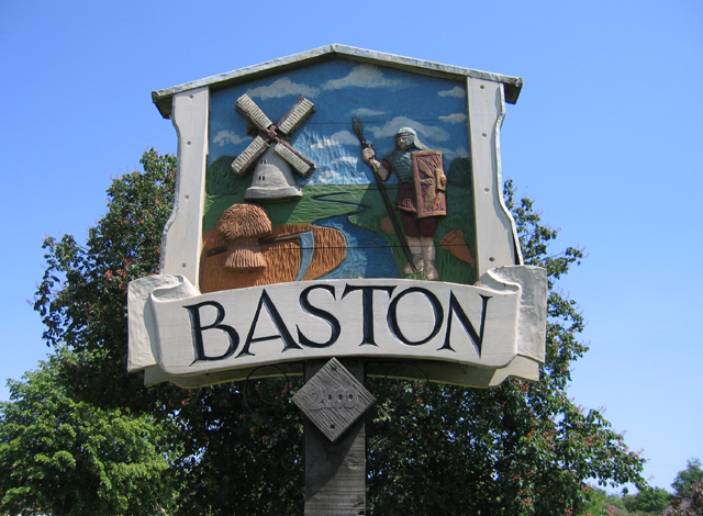
Baston

Baston is a village and parish on the edge of The Fens and in the administrative district of South Kesteven, Lincolnshire, England. The 2011 census reported...

Kirkstone House School

Kirkstone House School is an independent day school situated in the rural village of Baston in south Lincolnshire, England.The school provides education...

Obthorpe

Obthorpe is a hamlet in the civil parish of Thurlby, in the South Kesteven district of Lincolnshire, England. It lies 3 miles (5 km) south from Bourne...

Wilsthorpe, Lincolnshire

Wilsthorpe is a village in the district of South Kesteven in the county of Lincolnshire, England. It is situated approximately 6 miles (10 km) north-east...

Braceborough and Wilsthorpe

Braceborough and Wilsthorpe is a civil parish in the South Kesteven district of Lincolnshire, England. Braceborough and Wilsthorpe are less than 1 mile...

Wilsthorpe Crossing Halt railway station

Wilsthorpe Crossing Halt railway station was on the branch line between Bourne and Essendine, Lincolnshire, England. == History == The line of the Bourn...

Nearby Amenities

Located within 500m of 52.718643,-0.36089615
Bus Stop
Waterside Garden Centre
Bus: yes
Naptan AtcoCode: 270002701684
Naptan Bearing: NW
Naptan BusStopType: CUS
Naptan CommonName: Waterside Garden Centre
Naptan Indicator: adj
Naptan Landmark: Waterside Garden Centre
Naptan Street: A15
Naptan Verified: no
Public Transport: platform
Source: naptan_import
Lat/Long: 52.7187552/-0.362813
Bus Stop
Waterside Garden Centre
Bus: yes
Naptan AtcoCode: 270002701685
Naptan Bearing: SE
Naptan BusStopType: CUS
Naptan CommonName: Waterside Garden Centre
Naptan Indicator: opp
Naptan Landmark: Waterside Garden Centre
Naptan Street: A15
Naptan Verified: no
Public Transport: platform
Source: naptan_import
Lat/Long: 52.7187879/-0.3625749
Note: End of Public Highway
Lat/Long: 52.7160124/-0.3661792
Barrier: stile
Steps: 2
Stile: stepover
Lat/Long: 52.7205993/-0.3626655
Kates Bridge Poultry Farm
Landuse: farm
Note Retag: CS #48756035
Source: Bing
Lat/Long: 52.7169521/-0.3620251
Thetford
Place: isolated_dwelling
Source: Bing
Lat/Long: 52.7204546/-0.3561186
Fleetlore House
Place: isolated_dwelling
Source: Bing
Lat/Long: 52.7170824/-0.3656619
Horley House
Place: isolated_dwelling
Source: Bing
Lat/Long: 52.7169229/-0.3642981
Waterside Aquatics
Addr City: Baston
Addr Postcode: PE6 9NY
Addr Street: King Street
Pet: fish
Shop: pet
Lat/Long: 52.7178762/-0.3646864
Noexit: yes
Lat/Long: 52.717533/-0.3648272
Noexit: yes
Lat/Long: 52.717773/-0.3642606
Power: pole
Lat/Long: 52.7214615/-0.365556
King Street Butchery at Oasis Fine Foods
Addr City: Baston
Addr Housename: Waterside Nursery
Addr Postcode: PE6 9NY
Addr Street: King Street
Fhrs Authority: South Kesteven
Fhrs Id: 647419
Fhrs Local Authority Id: 85926
Shop: butcher
Lat/Long: 52.7178457/-0.3643804
Noexit: yes
Lat/Long: 52.7209863/-0.3638817
Parking
Access: permissive
Fee: no
Parking: layby
Surface: gravel
Lat/Long: 52.7211407/-0.3633139
Access: private
Barrier: stile
Foot: designated
Lat/Long: 52.7210484/-0.3636694
Power: pole
Lat/Long: 52.7204356/-0.3649681
Power: pole
Lat/Long: 52.7195457/-0.3643848
Entrance: yes
Lat/Long: 52.7178895/-0.3639518
Entrance: yes
Exit: yes
Lat/Long: 52.7182714/-0.3635589
The data included in this document is from www.openstreetmap.org. The data is made available under ODbL.

Have you been to Crow Plantation?

Leave your review of Crow Plantation below (or comments, questions and feedback).