Egerton Park

Settlement in Lancashire

England

Egerton Park

Bridgewater Canal At a narrowed section where the banks of the canal are enforced with metal piles
Bridgewater Canal Credit: Kevin Waterhouse

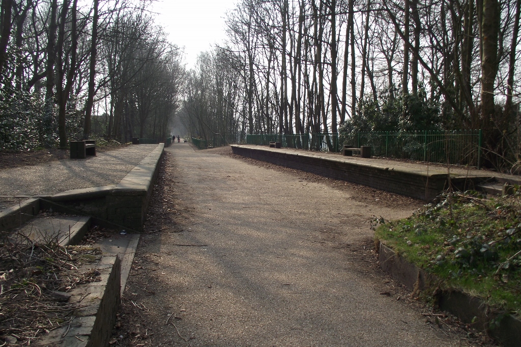
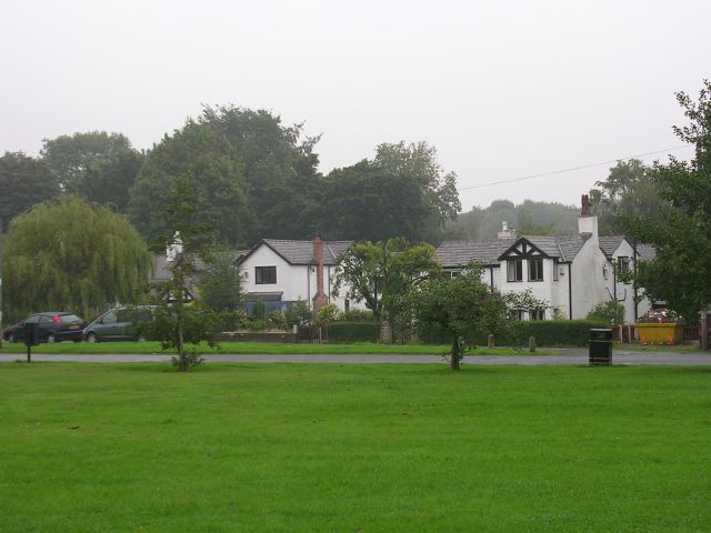
Egerton Park is a charming public park located in the town of Bury, Lancashire, England. Spanning an area of approximately 10 hectares, the park is a popular recreational spot for both locals and visitors alike.

The park boasts a picturesque landscape with well-maintained lawns, beautiful flowerbeds, and lush greenery. It offers a peaceful and serene environment, making it an ideal place for relaxation and leisurely strolls. Benches are scattered throughout the park, providing ample seating for visitors to enjoy the tranquil atmosphere.

Egerton Park offers a range of amenities and facilities to cater to the needs of its visitors. There is a children's play area where kids can enjoy various swings, slides, and climbing frames. For sports enthusiasts, the park features a bowling green, tennis courts, and a football field.

The park's centerpiece is a large lake, which adds to its natural beauty. Visitors can admire the calm waters and watch ducks and other waterfowl swimming gracefully. The lake also facilitates fishing activities, with permits available for anglers.

Throughout the year, Egerton Park hosts various events and activities, such as open-air concerts, fairs, and art exhibitions. These events attract people from all walks of life, adding vibrancy to the park's atmosphere.

In conclusion, Egerton Park in Lancashire is a delightful haven for nature lovers and those seeking a peaceful retreat. With its stunning landscape, recreational facilities, and a wide range of events, it offers something for everyone to enjoy.

If you have any feedback on the listing, please let us know in the comments section below.
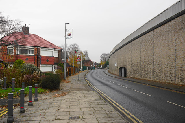
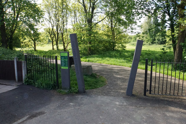
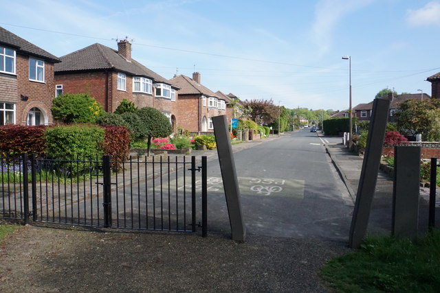
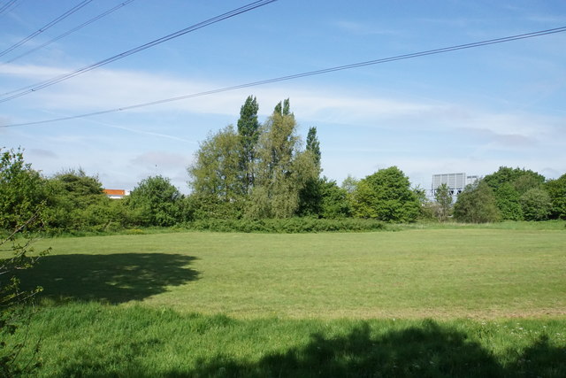
Egerton Park Images

Images are sourced within 2km of 53.506102/-2.368766 or Grid Reference SD7501. Thanks to Geograph Open Source API. All images are credited.

Bridgewater Canal At a narrowed section where the banks of the canal are enforced with metal piles
Bridgewater Canal
At a narrowed section where the banks of the canal are enforced with metal piles
Monton Bridge Over the Bridgewater Canal
Monton Bridge
Over the Bridgewater Canal
The Waterside The Waterside bar and restaurant alongside the Bridgewater Canal in Monton.
The Waterside
The Waterside bar and restaurant alongside the Bridgewater Canal in Monton.
Alder Forest Bridge Worsley Brook flows under the B5211. You hardly notice you are going over a bridge when driving along the road.
Alder Forest Bridge
Worsley Brook flows under the B5211. You hardly notice you are going over a bridge when driving along the road.
Grange Stores A corner shop on the corner of Grange Road and Worsley Road.
Grange Stores
A corner shop on the corner of Grange Road and Worsley Road.
Parrin Lane, Winton The large retaining wall on the right is supporting the M602 motorway. Although you can hear it, it doesn't have too much impact otherwise on life below.
Parrin Lane, Winton
The large retaining wall on the right is supporting the M602 motorway. Although you can hear it, it doesn't have too much impact otherwise on life below.
Eccles Timeline on the Magdalene Centre The Magdalene Centre belongs to the Anglican St Mary Magdalene's Church, Winton. It is interesting to see the top 5 influences on Eccles history on the timeline.
Eccles Timeline on the Magdalene Centre
The Magdalene Centre belongs to the Anglican St Mary Magdalene's Church, Winton. It is interesting to see the top 5 influences on Eccles history on the timeline.
Parrin Lane, Winton Monton Church is the striking feature in the distance.
Parrin Lane, Winton
Monton Church is the striking feature in the distance.
The Bridgewater Canal at Monton Looking down from Parrin Lane. The towpath is probably the most direct route from here to Worsley.
The Bridgewater Canal at Monton
Looking down from Parrin Lane. The towpath is probably the most direct route from here to Worsley.
Monton and Roe Green Loopline Heritage Trail A path making good use of a former railway.
Monton and Roe Green Loopline Heritage Trail
A path making good use of a former railway.
Monton Green The north eastern end of the green. Autumn is almost over, but the layer of leaves remains.
Monton Green
The north eastern end of the green. Autumn is almost over, but the layer of leaves remains.
Park Road, Monton A fairly leafy residential area.
Park Road, Monton
A fairly leafy residential area.
Tow path sculpture - Bridgewater Canal - Monton
Claude Street Off Parrin Lane.
Claude Street
Off Parrin Lane.
Port Salford Greenway A cycle route to Peel Green, here at the end of Edenfield Lane.
Port Salford Greenway
A cycle route to Peel Green, here at the end of Edenfield Lane.
Edenfield Lane A residential road not far from the centre of Worsley. This is on the route of the Port Salford Greenway.
Edenfield Lane
A residential road not far from the centre of Worsley. This is on the route of the Port Salford Greenway.
New Alder Park Green space on the edge of Worsley. Behind the barrier is the M60 motorway but it is quite well screened.
New Alder Park
Green space on the edge of Worsley. Behind the barrier is the M60 motorway but it is quite well screened.
Show me another place!

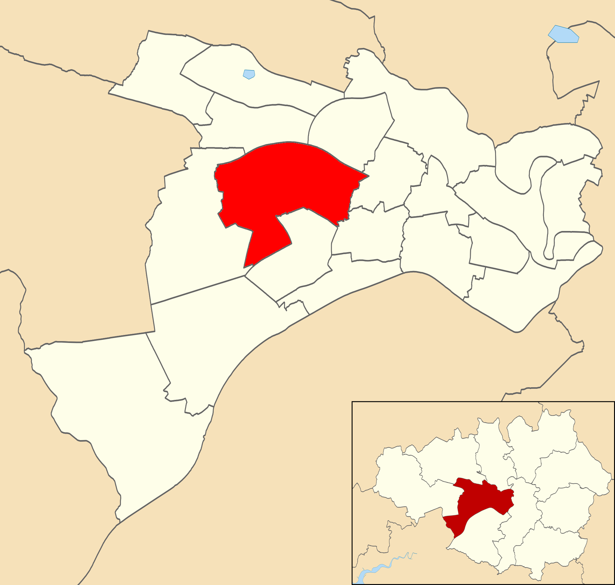
Egerton Park is located at Grid Ref: SD7501 (Lat: 53.506102, Lng: -2.368766)

Unitary Authority: Salford

Police Authority: Greater Manchester

What 3 Words

///bonds.cages.blues. Near Swinton, Manchester

Related Wikis

Bridgewater School

Bridgewater School is a British Independent school, located in Worsley in Greater Manchester. == History == The school was established in 1950 as a boys...

Worsley railway station

Worsley railway station was opened in 1864 to serve the town of Worsley in Greater Manchester. The Tyldesley Loopline closed in 1969 as a result of the...

Roe Green

Roe Green is a suburban area of Worsley, in the City of Salford, Greater Manchester, England. Historically in Lancashire, it was anciently a hamlet built...

Worsley (ward)

Worsley and Westwood Park (ward) is an electoral ward of Salford, England. It is represented in Westminster by Barbara Keeley MP for Worsley and Eccles...

Nearby Amenities

Located within 500m of 53.506102,-2.368766
Bus Stop
Greenleach Lane/Mabel Avenue
Bench: no
Bin: yes
Bus: yes
Naptan AtcoCode: 1800NF28191
Naptan Bearing: SE
Naptan CommonName: Greenleach Lane/Mabel Avenue
Naptan Indicator: O/s House 102
Naptan Landmark: HOUSE 98
Naptan NaptanCode: mangmajg
Naptan PlusbusZoneRef: MNCRPIC
Naptan ShortCommonName: Mabel Avenue
Naptan Street: GREENLEACH LANE
Naptan Verified: no
Network: TfGM
Public Transport: platform
Shelter: no
Source: naptan_import
Tactile Paving: no
Lat/Long: 53.5068667/-2.3724571
Bus Stop
Greenleach Lane/Mabel Avenue
Bench: no
Bin: no
Bus: yes
Naptan AtcoCode: 1800NF28201
Naptan Bearing: NW
Naptan CommonName: Greenleach Lane/Mabel Avenue
Naptan Indicator: Opp House 106
Naptan Landmark: Broadoak Park
Naptan NaptanCode: mangmajm
Naptan PlusbusZoneRef: MNCRPIC
Naptan ShortCommonName: Mabel Avenue
Naptan Street: GREENLEACH LANE
Naptan Verified: no
Network: TfGM
Public Transport: platform
Shelter: no
Source: naptan_import
Tactile Paving: no
Lat/Long: 53.506669/-2.3724252
Bus Stop
Greenleach Lane/Broadoak Road
Bench: no
Bin: yes
Bus: yes
Naptan AtcoCode: 1800NF28211
Naptan Bearing: NW
Naptan CommonName: Greenleach Lane/Broadoak Road
Naptan Indicator: Opp Hse 130
Naptan Landmark: HOUSE 130
Naptan NaptanCode: mangmajp
Naptan PlusbusZoneRef: MNCRPIC
Naptan ShortCommonName: Broadoak Road
Naptan Street: GREENLEACH LANE
Naptan Verified: no
Network: TfGM
Public Transport: platform
Shelter: no
Source: naptan_import
Tactile Paving: no
Lat/Long: 53.5047609/-2.3703428
Bus Stop
Greenleach Lane/Broadoak Lane
Bench: no
Bin: no
Bus: yes
Naptan AtcoCode: 1800NF28221
Naptan Bearing: SE
Naptan CommonName: Greenleach Lane/Broadoak Lane
Naptan Indicator: St Josephs Conv
Naptan Landmark: Convent
Naptan NaptanCode: mangmajt
Naptan PlusbusZoneRef: MNCRPIC
Naptan ShortCommonName: Broadoak Lane
Naptan Street: GREENLEACH LANE
Naptan Verified: no
Network: TfGM
Public Transport: platform
Shelter: no
Source: naptan_import
Tactile Paving: no
Lat/Long: 53.5040536/-2.3694471
Bus Stop
Worsley Road/Greenleach Lane
Bench: yes
Bin: no
Bus: yes
Naptan AtcoCode: 1800NF28321
Naptan Bearing: NE
Naptan CommonName: Worsley Road/Greenleach Lane
Naptan Indicator: House 46
Naptan Landmark: HOUSE 46
Naptan NaptanCode: mangmapa
Naptan PlusbusZoneRef: MNCRPIC
Naptan ShortCommonName: Greenleach Lane
Naptan Street: WORSLEY ROAD
Naptan Verified: no
Network: TfGM
Public Transport: platform
Shelter: yes
Source: naptan_import
Tactile Paving: no
Lat/Long: 53.5028563/-2.3671149
Bus Stop
Worsley Road/Welbeck Road
Bench: yes
Bin: yes
Bus: yes
Naptan AtcoCode: 1800NF28331
Naptan Bearing: SW
Naptan CommonName: Worsley Road/Welbeck Road
Naptan Indicator: O/s House 139
Naptan Landmark: HOUSE 139
Naptan NaptanCode: mangmapd
Naptan PlusbusZoneRef: MNCRPIC
Naptan ShortCommonName: Welbeck Road
Naptan Street: WORSLEY ROAD
Naptan Verified: no
Network: TfGM
Public Transport: platform
Shelter: yes
Source: naptan_import
Tactile Paving: no
Lat/Long: 53.5029294/-2.3667236
Bus Stop
Worsley Road/Garden Centre
Bus: yes
Naptan AtcoCode: 1800NF28341
Naptan Bearing: E
Naptan CommonName: Worsley Road/Garden Centre
Naptan Indicator: Op Gdn Centre
Naptan Landmark: HOUSE 78
Naptan NaptanCode: mangmapg
Naptan PlusbusZoneRef: MNCRPIC
Naptan ShortCommonName: Garden Centre
Naptan Street: WORSLEY ROAD
Naptan Verified: no
Network: TfGM
Public Transport: platform
Source: naptan_import
Lat/Long: 53.5038407/-2.3626456
Bus Stop
Greenleach Lane/Brentwood Avenue
Bench: no
Bin: yes
Bus: yes
Naptan AtcoCode: 1800NF00741
Naptan Bearing: NW
Naptan CommonName: Greenleach Lane/Brentwood Avenue
Naptan Indicator: Op House 60
Naptan Landmark: HOUSE 160
Naptan NaptanCode: mangjdtw
Naptan Notes: INDICATOR AMENDED
Naptan PlusbusZoneRef: MNCRPIC
Naptan ShortCommonName: Brentwood Avenue
Naptan Street: GREENLEACH LANE
Naptan Verified: no
Network: TfGM
Public Transport: platform
Shelter: no
Source: naptan_import
Tactile Paving: no
Lat/Long: 53.5027183/-2.3681389
Power: tower
Lat/Long: 53.5086851/-2.3673388
Power: tower
Lat/Long: 53.5030953/-2.3712927
Power: tower
Lat/Long: 53.5069431/-2.3702466
Phone
Emergency: phone
Lat/Long: 53.5089095/-2.3732088
Phone
Emergency: phone
Lat/Long: 53.508751/-2.3727954
Barrier: kissing_gate
Bicycle: yes
Foot: yes
Horse: yes
Motor Vehicle: private
Lat/Long: 53.502477/-2.372992
Barrier: bollard
Motor Vehicle: no
Lat/Long: 53.5059458/-2.3614493
Barrier: bollard
Bicycle: yes
Foot: yes
Motor Vehicle: no
Lat/Long: 53.505686/-2.3630079
Barrier: kissing_gate
Bicycle: yes
Foot: yes
Horse: yes
Motor Vehicle: no
Lat/Long: 53.5040151/-2.3725659
Worsley Woods Play area
Access: yes
Leisure: playground
Operator: Salford City Council
Playground Theme: playground
Surface: ground
Lat/Long: 53.5031885/-2.3718791
Waste Basket
Colour: red
Material: metal
Operator: Salford City Council
Lat/Long: 53.5031011/-2.3720887
The data included in this document is from www.openstreetmap.org. The data is made available under ODbL.

Have you been to Egerton Park?

Leave your review of Egerton Park below (or comments, questions and feedback).