Furze Field

Wood, Forest in Sussex Horsham

England

Furze Field

Downs Link, near Slinfold A view of the Downs Link path as it approaches Slinfold in West Sussex.  The path follows a dismantled railway line.  It also forms part of route 223 of the National Cycle Network.

Here, a public footpath crosses the Downs Link path.
Downs Link, near Slinfold Credit: Malc McDonald

Furze Field, located in Sussex, England, is a picturesque woodland area known for its abundant natural beauty and diverse ecosystem. Spanning over a vast area, the forest is characterized by its dense canopy of trees, primarily consisting of oak, beech, and birch species. The varying shades of green create a visually stunning landscape throughout the year.

The forest floor of Furze Field is covered with a lush carpet of ferns, mosses, and wildflowers, adding to its enchanting charm. The presence of these ground cover plants provides a habitat for numerous small animals and insects, contributing to the overall biodiversity of the area.

The woodland is home to an array of wildlife, including deer, foxes, badgers, and a variety of bird species. The tranquility of Furze Field is often interrupted by the melodic songs of birds, making it a haven for birdwatching enthusiasts.

A network of well-maintained footpaths meanders through the forest, allowing visitors to explore and appreciate the natural wonders of Furze Field. The paths lead to hidden clearings, babbling brooks, and secluded ponds, creating a sense of adventure and discovery.

Furze Field is not only a haven for wildlife and nature enthusiasts but also offers recreational activities such as hiking, picnicking, and photography. The peaceful ambiance and untouched beauty of the woodland make it a popular destination for those seeking an escape from the hustle and bustle of daily life.

Overall, Furze Field in Sussex is a captivating woodland that showcases the true splendor of nature. Its diverse flora and fauna, coupled with its tranquil atmosphere, make it a must-visit destination for anyone looking to immerse themselves in the wonders of the natural world.

If you have any feedback on the listing, please let us know in the comments section below.
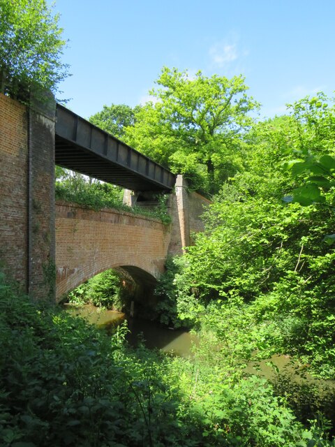
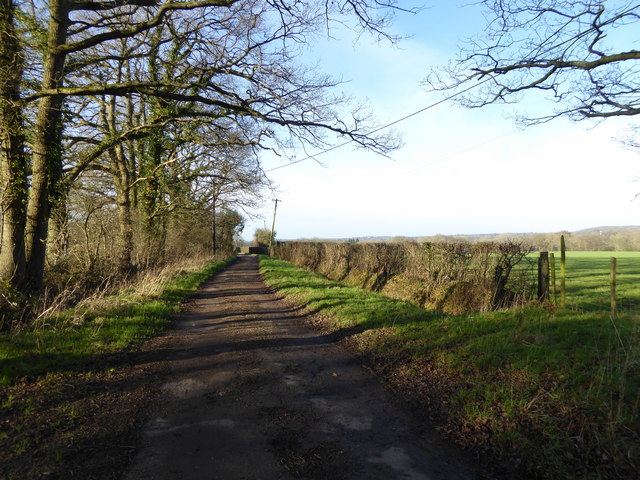
Furze Field Images

Images are sourced within 2km of 51.072778/-0.42098769 or Grid Reference TQ1031. Thanks to Geograph Open Source API. All images are credited.

Downs Link, near Slinfold A view of the Downs Link path as it approaches Slinfold in West Sussex.  The path follows a dismantled railway line.  It also forms part of route 223 of the National Cycle Network.

Here, a public footpath crosses the Downs Link path.
Downs Link, near Slinfold
A view of the Downs Link path as it approaches Slinfold in West Sussex. The path follows a dismantled railway line. It also forms part of route 223 of the National Cycle Network. Here, a public footpath crosses the Downs Link path.
Double bridge near Rudgwick, West Sussex The double bridge which crosses the River Arun near Rudgwick is unique in Britain, in having both a brick arch and an iron girder.

The brick arch was built to carry a railway line across the river.  However, on the far side of the river, the railway would then climb a steep gradient into Rudgwick station.  Inspectors from the government's Board of Trade refused permission for the railway to open, as they felt the gradient up to Rudgwick station was too steep.  The railway compamny therefore had to rebuild this section of the route with higher embankments, so that the gradient into Rudgwick was less steep.  As the railway had been raised to a higher level at this location, the iron girder bridge was installed to carry it across the river.  The brick arch has never been used for its intended purpose.

The railway opened in 1865 but closed a century later.  The railway route now forms part of the Downs Link long distance path, which itself forms part of route 223 of the National Cycle Network.
Double bridge near Rudgwick, West Sussex
The double bridge which crosses the River Arun near Rudgwick is unique in Britain, in having both a brick arch and an iron girder. The brick arch was built to carry a railway line across the river. However, on the far side of the river, the railway would then climb a steep gradient into Rudgwick station. Inspectors from the government's Board of Trade refused permission for the railway to open, as they felt the gradient up to Rudgwick station was too steep. The railway compamny therefore had to rebuild this section of the route with higher embankments, so that the gradient into Rudgwick was less steep. As the railway had been raised to a higher level at this location, the iron girder bridge was installed to carry it across the river. The brick arch has never been used for its intended purpose. The railway opened in 1865 but closed a century later. The railway route now forms part of the Downs Link long distance path, which itself forms part of route 223 of the National Cycle Network.
Wonky signpost
Wonky signpost
Footpath signpost, Riddens Farm
Electricity poles on Haven Road
Field by Haven Road
Field by Haven Road
Haven Road, The Haven
Looking along Naldretts Lane which is a public bridleway
Entrance to Naldrett House
Looking west on Pensfold Lane
Pensfold Lane looking west past Morelands The property Morelands is hidden by trees in the picture.
Pensfold Lane looking west past Morelands
The property Morelands is hidden by trees in the picture.
Gateway and buildings at Pensfold Farm
Dwellings at Pensfold Farm See also <a title="https://www.geograph.org.uk/photo/1984971" href="https://www.geograph.org.uk/photo/1984971">Link</a> from 2010.
Dwellings at Pensfold Farm
See also Link from 2010.
The drive at Park Farm
Path turns away from golf course to enter wood
Footbridge in Tittlesfold Copse (1)
Footbridge in Tittlesfold Copse (2) An almost identical picture from 2011 is at <a title="https://www.geograph.org.uk/photo/2425817" href="https://www.geograph.org.uk/photo/2425817">Link</a>.
Footbridge in Tittlesfold Copse (2)
An almost identical picture from 2011 is at Link.
Footpath leaves wood to follow field edge
Show me another place!

Furze Field is located at Grid Ref: TQ1031 (Lat: 51.072778, Lng: -0.42098769)

Administrative County: West Sussex

District: Horsham

Police Authority: Sussex

What 3 Words

///shook.hurray.stress. Near Slinfold, West Sussex

Nearby Locations

Rowadams Copse Furze Field

Related Wikis

Slinfold railway station

Slinfold railway station was on the Cranleigh Line and served the village of Slinfold in West Sussex. == History == The line had a single track and opened...

Slinfold

Slinfold is a village and civil parish in the Horsham District of West Sussex, England. == Geography == The village is almost 4 miles (6.4 km) west of...

Slinfold Stream and Quarry

Slinfold Stream and Quarry is a 2.3-hectare (5.7-acre) geological Site of Special Scientific Interest west of Horsham in West Sussex. It is a Geological...

Rudgwick railway station

Rudgwick railway station was on the Cranleigh Line. It served the village of Rudgwick in West Sussex until June, 1965. == History == Rudgwick station opened...

Rudgwick

Rudgwick is a village and civil parish in the Horsham District of West Sussex, England. The village is 6 miles (10 km) west from Horsham on the north...

Holy Trinity Church, Rudgwick

Holy Trinity Church is the Anglican parish church of Rudgwick, a village in the Horsham district of West Sussex, England. The oldest part of the church...

Five Oaks

Five Oaks is a large hamlet in the Horsham District of West Sussex, England. It lies about 1.7 miles (2.8 km) north of Billingshurst on the Roman road...

The Haven, West Sussex

The Haven is a rural hamlet in West Sussex, south east England located about 7 miles to the west of Horsham.The Haven is primarily an agricultural area...

Nearby Amenities

Located within 500m of 51.072778,-0.42098769
Bus Stop
Stane Street
Bus: yes
Naptan AtcoCode: 4400HR0024
Naptan Bearing: E
Naptan CommonName: Stane Street
Naptan Indicator: o/s 21
Naptan Landmark: Stane Street
Naptan NaptanCode: wsxatgat
Naptan Street: Park Street
Naptan Verified: no
Public Transport: platform
Source: naptan_import
Lat/Long: 51.0721279/-0.4144136
Bus Stop
Stane Street
Bus: yes
Naptan AtcoCode: 4400HR0025
Naptan Bearing: W
Naptan BusStopType: CUS
Naptan CommonName: Stane Street
Naptan Indicator: o/s Bakers End
Naptan Landmark: Stane Street
Naptan NaptanCode: wsxatgaw
Naptan Street: Park Street
Naptan Verified: no
Public Transport: platform
Source: naptan_import
Lat/Long: 51.0720141/-0.4143886
Bus Stop
A29 Stane Street
Bus: yes
Naptan AtcoCode: 4400HR1083
Naptan Bearing: NE
Naptan BusStopType: CUS
Naptan CommonName: A29 Stane Street
Naptan Indicator: HAR
Naptan Landmark: Hail & Ride
Naptan NaptanCode: wsxgdjgt
Naptan Street: A29 Stane Street
Naptan Verified: no
Public Transport: platform
Source: naptan_import
Lat/Long: 51.0720602/-0.4155085
Bus Stop
A29 Stane Street
Bus: yes
Naptan AtcoCode: 4400HR1084
Naptan Bearing: SW
Naptan BusStopType: CUS
Naptan CommonName: A29 Stane Street
Naptan Indicator: HAR
Naptan Landmark: Hail & Ride
Naptan NaptanCode: wsxgdjgw
Naptan Street: A29 Stane Street
Naptan Verified: no
Public Transport: platform
Source: naptan_import
Lat/Long: 51.0720571/-0.4152802
Bridge Farm
Place: farm
Lat/Long: 51.0710727/-0.4171947
The data included in this document is from www.openstreetmap.org. The data is made available under ODbL.

Have you been to Furze Field?

Leave your review of Furze Field below (or comments, questions and feedback).