Ash Plantation

Wood, Forest in Yorkshire

England

Ash Plantation

Pond at Kingswood, Hull Arguably the most north-westerly point of the city of Hull, a sliver of wetland between the River Hull and Kingswood housing estate
Pond at Kingswood, Hull Credit: Paul Harrop

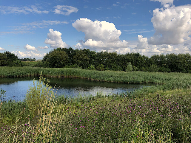
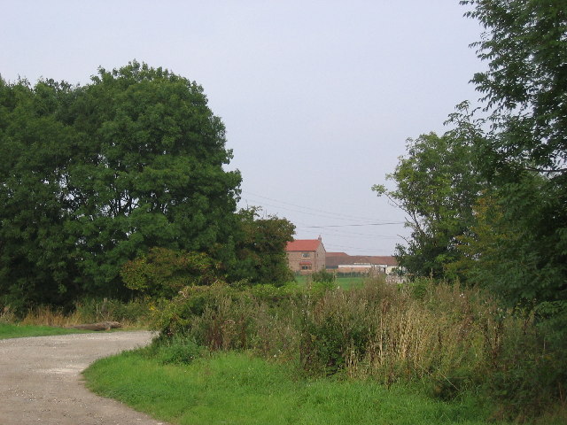
Ash Plantation is a picturesque woodland located in Yorkshire, England. Situated within the heart of the county, the plantation spans over a vast area, covering several hectares of land. This woodland is primarily made up of ash trees, which give it its name and contribute to its unique beauty.

The plantation boasts a diverse range of flora and fauna, creating a thriving ecosystem. Apart from the dominant ash trees, visitors can also find a variety of other tree species such as oak, beech, and birch. These trees provide a dense canopy, creating a shaded and tranquil environment.

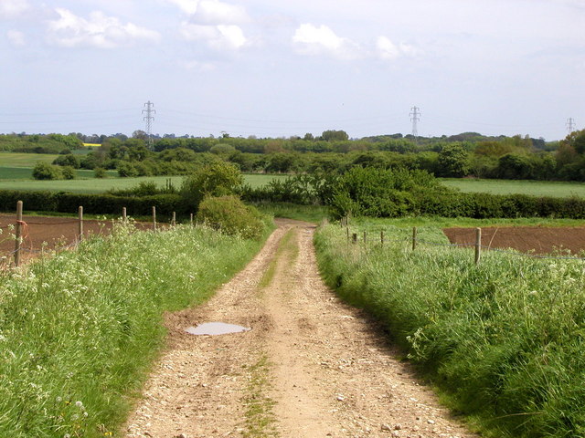
Ash Plantation is a popular destination for nature enthusiasts and hikers alike. The woodland is crisscrossed with well-maintained footpaths, allowing visitors to explore its beauty at their own pace. The paths wind through the plantation, offering stunning views of the surrounding countryside and glimpses of wildlife along the way.

The plantation is home to a rich array of wildlife, including numerous bird species, small mammals, and insects. Birdwatchers can spot an assortment of native and migratory birds, making it an ideal spot for birdwatching enthusiasts. The woodland also provides a habitat for creatures such as squirrels, badgers, and foxes, which can occasionally be spotted by lucky visitors.

Ash Plantation is a tranquil haven, offering a peaceful escape from the hustle and bustle of everyday life. Whether it's a leisurely stroll, a picnic amidst nature, or simply a moment of solitude, this woodland provides an opportunity to connect with the natural world and enjoy the beauty of Yorkshire's countryside.

If you have any feedback on the listing, please let us know in the comments section below.

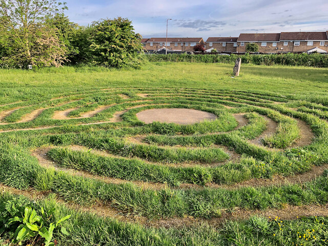
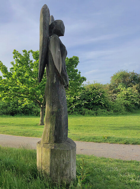
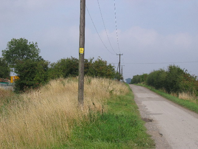
Ash Plantation Images

Images are sourced within 2km of 53.807745/-0.32741268 or Grid Reference TA1035. Thanks to Geograph Open Source API. All images are credited.

Pond at Kingswood, Hull Arguably the most north-westerly point of the city of Hull, a sliver of wetland between the River Hull and Kingswood housing estate
Pond at Kingswood, Hull
Arguably the most north-westerly point of the city of Hull, a sliver of wetland between the River Hull and Kingswood housing estate
Turf laying, Hull These men were doing a spot of landscaping at the junction of Wawne Road and Diversity Drive, at the eastern edge of Kingswood Parks housing development.
Turf laying, Hull
These men were doing a spot of landscaping at the junction of Wawne Road and Diversity Drive, at the eastern edge of Kingswood Parks housing development.
The long and winding path, Hull The path runs along the north-western edge of the huge Kingswood housing development to the east of the River Hull.
The long and winding path, Hull
The path runs along the north-western edge of the huge Kingswood housing development to the east of the River Hull.
Bransholme, Hull: aerial 2023 (1)
Bransholme, Hull: aerial 2023 (2)
Bransholme Fishing Lake, Hull Part of the Noddle Hill Nature Reserve <span class="nowrap"><a title="https://www.hcandl.co.uk/sport-and-leisure-and-parks/your-local-park/noddle-hill-nature-reserve" rel="nofollow ugc noopener" href="https://www.hcandl.co.uk/sport-and-leisure-and-parks/your-local-park/noddle-hill-nature-reserve">Link</a><img style="margin-left:2px;" alt="External link" title="External link - shift click to open in new window" src="https://s1.geograph.org.uk/img/external.png" width="10" height="10"/></span> on the north-eastern edge of the city. A couple of early morning anglers can be seen to the left of the picture.
Bransholme Fishing Lake, Hull
Part of the Noddle Hill Nature Reserve LinkExternal link on the north-eastern edge of the city. A couple of early morning anglers can be seen to the left of the picture.
Ducks on the fishing lake, Hull The eastern side of the lake which forms part of the Noddle Hill Nature Reserve <span class="nowrap"><a title="https://www.hcandl.co.uk/sport-and-leisure-and-parks/your-local-park/noddle-hill-nature-reserve" rel="nofollow ugc noopener" href="https://www.hcandl.co.uk/sport-and-leisure-and-parks/your-local-park/noddle-hill-nature-reserve">Link</a><img style="margin-left:2px;" alt="External link" title="External link - shift click to open in new window" src="https://s1.geograph.org.uk/img/external.png" width="10" height="10"/></span> on the north-eastern edge of the city.
Ducks on the fishing lake, Hull
The eastern side of the lake which forms part of the Noddle Hill Nature Reserve LinkExternal link on the north-eastern edge of the city.
Drain clearing, Bransholme, Hull Environment Agency workers clearing undergrowth and debris from one of the many land drains around this low-lying area on the north-eastern edge of the city. This drain runs along the western edge of the Noddle Hill nature reserve.
Drain clearing, Bransholme, Hull
Environment Agency workers clearing undergrowth and debris from one of the many land drains around this low-lying area on the north-eastern edge of the city. This drain runs along the western edge of the Noddle Hill nature reserve.
Foredyke Bridge, Hull In the Bransholme/Kingswood area, the bridge carries Wawne Road over the Foredyke Stream (or Wawne Drain, depending on which OS map resolution you are looking at).
Foredyke Bridge, Hull
In the Bransholme/Kingswood area, the bridge carries Wawne Road over the Foredyke Stream (or Wawne Drain, depending on which OS map resolution you are looking at).
Bransholme bunny, Hull The plentiful green areas and parks which thread among the streets and houses of Bransholme are home to numerous rabbits, this one close to Wawne Road and, like all the others, about to disappear into the undergrowth.
Bransholme bunny, Hull
The plentiful green areas and parks which thread among the streets and houses of Bransholme are home to numerous rabbits, this one close to Wawne Road and, like all the others, about to disappear into the undergrowth.
Labyrinth, Foredyke Green, Hull Created in 2017 as part of a regeneration of the Foredyke Green Nature area, this labyrinth is based on a medieval original which once existed in the east Hull village of Marfleet.
Labyrinth, Foredyke Green, Hull
Created in 2017 as part of a regeneration of the Foredyke Green Nature area, this labyrinth is based on a medieval original which once existed in the east Hull village of Marfleet.
Angel sculpture, Kingswood, Hull One of a number of carved wooden figures around the Kesteven Green nature area. They were introduced as part of a 2017 regeneration of the green space near Kesteven Way and Bude Road, led by the Kingswood Residents Association.
Angel sculpture, Kingswood, Hull
One of a number of carved wooden figures around the Kesteven Green nature area. They were introduced as part of a 2017 regeneration of the green space near Kesteven Way and Bude Road, led by the Kingswood Residents Association.
Kingswood High School Situated on the North Bransholme Housing Estate and is on the north edge of the grid square
Kingswood High School
Situated on the North Bransholme Housing Estate and is on the north edge of the grid square
High Bransholme Monk Dike and Holderness Drain converge at Wawne Drain in this grid square. This view looking NE towards Holderness Drain which this lane crosses. On the left in this photo is a council compound with the rest of the square being open countryside and farmland.
High Bransholme
Monk Dike and Holderness Drain converge at Wawne Drain in this grid square. This view looking NE towards Holderness Drain which this lane crosses. On the left in this photo is a council compound with the rest of the square being open countryside and farmland.
North Carr The Bransholme Housing Estate justs creeps into the bottom SW corner of the grid square. This view looking along the lane leading to Holderness Drain
North Carr
The Bransholme Housing Estate justs creeps into the bottom SW corner of the grid square. This view looking along the lane leading to Holderness Drain
Bransholme Housing Estate View of the road on the NE edge of the housing estate which fills most of this grid square.
Bransholme Housing Estate
View of the road on the NE edge of the housing estate which fills most of this grid square.
Carlam Hill Farm The Bransholme Housing Estate is in the bottom SW corner of the grid square with the remainder being farmland.
Carlam Hill Farm
The Bransholme Housing Estate is in the bottom SW corner of the grid square with the remainder being farmland.
Common Lane This is a 'green lane' near to the village of Wawne.  It was very muddy in places even in the middle of May!
Common Lane
This is a 'green lane' near to the village of Wawne. It was very muddy in places even in the middle of May!
Show me another place!

Ash Plantation is located at Grid Ref: TA1035 (Lat: 53.807745, Lng: -0.32741268)

Division: East Riding

Unitary Authority: Kingston upon Hull

Police Authority: Humberside

What 3 Words

///shapes.gets.joke. Near Dunswell, East Yorkshire

Nearby Locations

Ash Plantation Low Land

Related Wikis

Kingswood Academy, Hull

Kingswood Academy is a secondary school on the northern fringe of the Bransholme housing estate in Kingston upon Hull, England. The school opened in 2013...

Wawne

Wawne , also spelled Waghen, is a small village and civil parish in the East Riding of Yorkshire, England. The village is situated approximately 5.5 miles...

Kingswood, Kingston upon Hull

Kingswood, occasionally referred to as Kingswood Parks, is a modern housing estate on the northern fringe of Kingston upon Hull, England. Through much...

Lambwath Stream

Lambwath Stream (or Lambwath Drain), is a small beck in the Holderness area of the East Riding of Yorkshire, England. The stream is unusual in that despite...

Nearby Amenities

Located within 500m of 53.807745,-0.32741268
Crossing
Lat/Long: 53.8049544/-0.3271684
Pharmacy
Lloyds Pharmacy
Dispensing: yes
Toilets Wheelchair: no
Wheelchair: yes
Lat/Long: 53.8050051/-0.3284651
Post Box
Post Box Type: pillar
Lat/Long: 53.8054707/-0.328155
Bus Stop
Cumbrian Way Fairbourne Close
Naptan AtcoCode: 2290YHA00354
Naptan Bearing: W
Naptan CommonName: Cumbrian Way Fairbourne Close
Naptan PlusbusZoneRef: HULL
Naptan ShortCommonName: Fairbourne Close
Naptan Street: Cumbrian Way
Shelter: no
Source: naptan + survey
Lat/Long: 53.8115712/-0.3303787
Bus Stop
Cumbrian Way Kentmere Close
Naptan AtcoCode: 2290YHA00355
Naptan Bearing: W
Naptan CommonName: Cumbrian Way Kentmere Close
Naptan Crossing: Snowdon Way
Naptan Indicator: adj Carlam Lane
Naptan Landmark: South Field
Naptan PlusbusZoneRef: HULL
Naptan ShortCommonName: Kentmere Close
Naptan Street: Cumbrian Way
Note: Bearing should be E
Shelter: no
Source: naptan + survey
Lat/Long: 53.8117708/-0.3299373
Bus Stop
Cumbrian Way Snowdon Way
Naptan AtcoCode: 2290YHA00356
Naptan Bearing: W
Naptan CommonName: Cumbrian Way Snowdon Way
Naptan Crossing: Snowdon Way
Naptan Indicator: adj Carlam Lane
Naptan Landmark: South Field
Naptan PlusbusZoneRef: HULL
Naptan ShortCommonName: Snowdon Way
Naptan Street: Cumbrian Way
Shelter: no
Source: naptan + survey
Lat/Long: 53.8118647/-0.3262811
Bus Stop
Cumbrian Way Snowdon Way
Naptan AtcoCode: 2290YHA00357
Naptan Bearing: W
Naptan CommonName: Cumbrian Way Snowdon Way
Naptan Crossing: Carlam Road
Naptan Indicator: adj Carlamhill Bridge
Naptan Landmark: Carlamhill Bridge
Naptan PlusbusZoneRef: HULL
Naptan ShortCommonName: Snowdon Way
Naptan Street: Cumbrian Way
Note: Bearing should be E
Shelter: no
Source: naptan + survey
Lat/Long: 53.8120117/-0.3258652
Bus Stop
Aberdovey Close Cumbrian Way
Naptan AtcoCode: 2290YHA00358
Naptan Bearing: NW
Naptan CommonName: Aberdovey Close Cumbrian Way
Naptan Crossing: Aberdovey Close
Naptan Indicator: opp Old Main Drain
Naptan Landmark: Carlamhill Bridge
Naptan PlusbusZoneRef: HULL
Naptan ShortCommonName: Aberdovey Close
Naptan Street: Cumbrian Way
Shelter: no
Source: naptan + survey
Lat/Long: 53.8112322/-0.3234812
Bus Stop
Cumbrian Way Aberdovey Close
Naptan AtcoCode: 2290YHA00359
Naptan Bearing: S
Naptan CommonName: Cumbrian Way Aberdovey Close
Naptan Crossing: Aberdovey Close
Naptan Indicator: adj Old Main Drain
Naptan Landmark: Carlamhill Bridge
Naptan PlusbusZoneRef: HULL
Naptan ShortCommonName: Aberdovey Close
Naptan Street: Cumbrian Way
Shelter: no
Source: naptan + survey
Lat/Long: 53.8109617/-0.3231073
Bus Stop
Cumbrian Way Falkirk Close
Naptan AtcoCode: 2290YHA00360
Naptan Bearing: N
Naptan CommonName: Cumbrian Way Falkirk Close
Naptan Crossing: Lothian Way
Naptan Indicator: adj Furness Close
Naptan PlusbusZoneRef: HULL
Naptan ShortCommonName: Falkirk Close
Naptan Street: Cumbrian Way
Shelter: no
Source: naptan + survey
Lat/Long: 53.8087161/-0.3241891
Bus Stop
Cumbrian Way Leitholm Close
Naptan AtcoCode: 2290YHA00361
Naptan Bearing: S
Naptan CommonName: Cumbrian Way Leitholm Close
Naptan Crossing: Lothian Way
Naptan Indicator: adj Lothian Way
Naptan Landmark: Ash Plantation
Naptan PlusbusZoneRef: HULL
Naptan ShortCommonName: Leitholm Close
Naptan Street: Cumbrian Way
Shelter: yes
Source: naptan + survey
Lat/Long: 53.8079619/-0.3242496
Bus Stop
Cumbrian Way Snowhill Close
Naptan AtcoCode: 2290YHA00362
Naptan Bearing: N
Naptan CommonName: Cumbrian Way Snowhill Close
Naptan Crossing: Snowhill Close
Naptan Indicator: adj Snowhill Close
Naptan Landmark: Highlands Health Centre
Naptan PlusbusZoneRef: HULL
Naptan ShortCommonName: Snowhill Close
Naptan Street: Cumbrian Way
Shelter: no
Source: naptan + survey
Lat/Long: 53.8066125/-0.3241819
Bus Stop
Cumbrian Way Helvellyn Close
Naptan AtcoCode: 2290YHA00363
Naptan Bearing: N
Naptan CommonName: Cumbrian Way Helvellyn Close
Naptan Crossing: Helvellyn Close
Naptan Indicator: opp Highlands Primary School
Naptan Landmark: Highlands Primary School
Naptan PlusbusZoneRef: HULL
Naptan ShortCommonName: Helvellyn Close
Naptan Street: Cumbrian Way
Shelter: no
Source: naptan + survey
Lat/Long: 53.8046452/-0.3236377
Bus Stop
Grampian Way Appin Close
Naptan AtcoCode: 2290YHA00478
Naptan Bearing: E
Naptan CommonName: Grampian Way Appin Close
Naptan PlusbusZoneRef: HULL
Naptan ShortCommonName: Appin Close
Naptan Street: Grampian Way
Note: Bearing should be W
Shelter: no
Source: naptan + survey
Lat/Long: 53.805536/-0.3282038
Bus Stop
Pennine Way Grampian Way
Naptan AtcoCode: 2290YHA00479
Naptan Bearing: E
Naptan CommonName: Pennine Way Grampian Way
Naptan Crossing: Pennine Way
Naptan Indicator: adj Rannoch Close
Naptan Landmark: Community Centre
Naptan PlusbusZoneRef: HULL
Naptan ShortCommonName: Grampian Way
Naptan Street: Grampian Way
Shelter: no
Source: naptan + survey
Lat/Long: 53.8054555/-0.3304286
Bus Stop
Lothian Way Rangely Close
Naptan AtcoCode: 2290YHA00771
Naptan Bearing: S
Naptan CommonName: Lothian Way Rangely Close
Naptan Landmark: Whitehope Close
Naptan PlusbusZoneRef: HULL
Naptan ShortCommonName: Rangely Close
Naptan Street: Lothian Way
Shelter: no
Source: naptan + survey
Lat/Long: 53.8036371/-0.3267608
Bus Stop
Lothian Way Moorfoot Close
Naptan AtcoCode: 2290YHA00772
Naptan Bearing: N
Naptan CommonName: Lothian Way Moorfoot Close
Naptan Crossing: Grampian Way
Naptan Indicator: opp Rangely Close
Naptan Landmark: Highlands Primary School
Naptan PlusbusZoneRef: HULL
Naptan ShortCommonName: Moorfoot Close
Naptan Street: Lothian Way
Shelter: yes
Source: naptan + survey
Lat/Long: 53.8042118/-0.3270671
Bus Stop
Highlands Health Centre
Naptan AtcoCode: 2290YHA00773
Naptan Bearing: S
Naptan CommonName: Highlands Health Centre
Naptan Crossing: Grampian Way
Naptan PlusbusZoneRef: HULL
Naptan ShortCommonName: Highlands Primary School
Naptan Street: Lothian Way
Shelter: no
Source: naptan + survey
Lat/Long: 53.8055695/-0.3273824
Bus Stop
Pennine Way Grampian Way
Naptan AtcoCode: 2290YHA00888
Naptan Bearing: S
Naptan CommonName: Pennine Way Grampian Way
Naptan Crossing: Grampian Way
Naptan Indicator: opp Greygarth Close
Naptan Landmark: Community Centre
Naptan PlusbusZoneRef: HULL
Naptan ShortCommonName: The Pennine Rambler
Naptan Street: Pennine Way
Shelter: no
Source: naptan + survey
Lat/Long: 53.8050276/-0.3304261
Bus Stop
Pennine Way Trawden Close
Naptan AtcoCode: 2290YHA00895
Naptan Bearing: NW
Naptan CommonName: Pennine Way Trawden Close
Naptan Crossing: Trawden Close
Naptan Landmark: Pennine Centre
Naptan PlusbusZoneRef: HULL
Naptan ShortCommonName: Trawden Close
Naptan Street: Pennine Way
Shelter: no
Source: naptan + survey
Lat/Long: 53.8059186/-0.3313331
Bus Stop
Kettlewell Close
Naptan AtcoCode: 2290YHA00896
Naptan Bearing: W
Naptan CommonName: Kettlewell Close
Naptan Crossing: Kettlewell Cl
Naptan PlusbusZoneRef: HULL
Naptan ShortCommonName: Kettlewell Cl
Naptan Street: Pennine Way
Note: Bearing should be NW
Shelter: no
Source: naptan + survey
Lat/Long: 53.8072198/-0.3329209
Bus Stop
Pennine Way Wawne Lodge
Naptan AtcoCode: 2290YHA00897
Naptan Bearing: SE
Naptan CommonName: Pennine Way Wawne Lodge
Naptan Crossing: Kettlewell Close
Naptan PlusbusZoneRef: HULL
Naptan ShortCommonName: Dales Lodge
Naptan Street: Pennine Way
Shelter: no
Source: naptan + survey
Lat/Long: 53.8072962/-0.3325989
Telephone
Booth: K8
Colour: white
Covered: booth
Phone: +44 1482 821753
Lat/Long: 53.8038943/-0.3271768
Telephone
Booth: K8
Colour: white
Covered: booth
Phone: +44 1482 831907
Lat/Long: 53.8039719/-0.3234754
Barrier: bollard
Lat/Long: 53.8039842/-0.3252315
Telephone
Booth: KXPlus
Colour: white
Covered: booth
Phone: +44 1482 831614
Lat/Long: 53.8045807/-0.3304632
Telephone
Booth: KX300
Covered: booth
Phone: +44 1482 839585
Lat/Long: 53.8054724/-0.3276093
The data included in this document is from www.openstreetmap.org. The data is made available under ODbL.

Have you been to Ash Plantation?

Leave your review of Ash Plantation below (or comments, questions and feedback).