Chicksands Wood

Wood, Forest in Bedfordshire

England

Chicksands Wood

River Flit, Beadlow, Clophill, Beds a tributary of the River Ivel; view E towards Chicksands.
River Flit, Beadlow, Clophill, Beds Credit: Rodney Burton

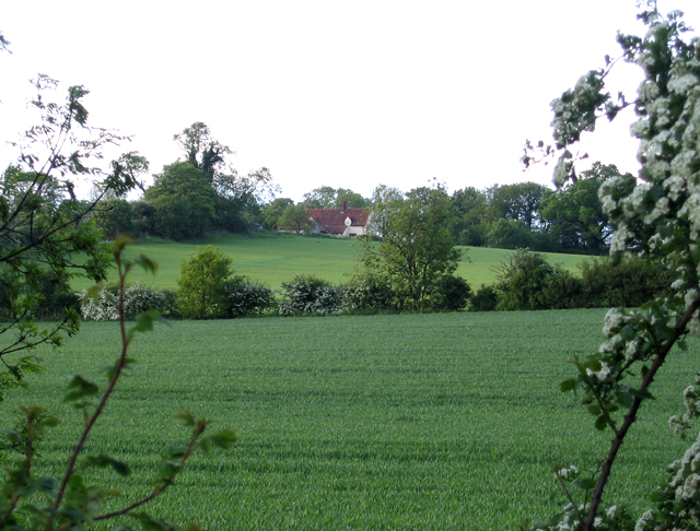
Chicksands Wood is a sprawling forest located in the county of Bedfordshire, England. Covering an area of approximately 200 acres, it is a popular destination for nature enthusiasts and outdoor enthusiasts alike. The wood is situated near the village of Chicksands, about 5 miles northeast of the town of Shefford.

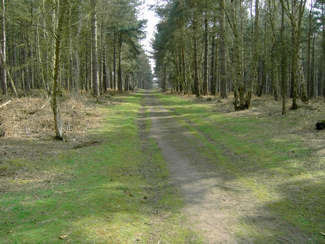
This ancient woodland is characterized by its diverse range of tree species, including oak, ash, and beech. The trees form a dense canopy, creating a tranquil and secluded atmosphere within the wood. Chicksands Wood is also home to a variety of wildlife, such as deer, foxes, and a wide array of bird species.

The wood features several well-maintained walking trails, allowing visitors to explore its natural beauty at their own pace. These trails wind through the forest, offering glimpses of the vibrant flora and fauna that inhabit the area. Additionally, the wood is crisscrossed by a network of streams and small ponds, adding to its charm.

Chicksands Wood has a rich history, with evidence of human activity dating back thousands of years. Archaeological finds, including Roman pottery and medieval earthworks, have been discovered within the wood, highlighting its significance as a historical site. The wood is also home to Chicksands Priory, a former medieval monastery that now serves as a private residence.

Overall, Chicksands Wood is a picturesque and ecologically diverse woodland that offers visitors a chance to connect with nature and explore its rich history.

If you have any feedback on the listing, please let us know in the comments section below.

Chicksands Wood Images

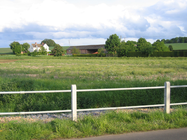
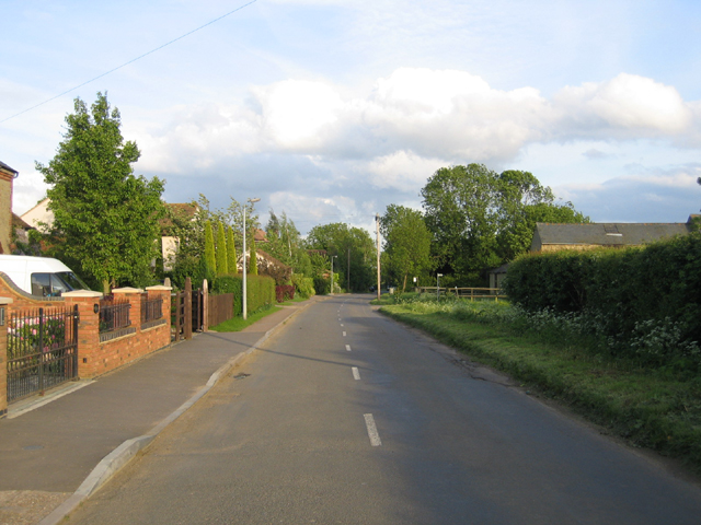
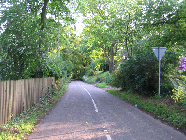
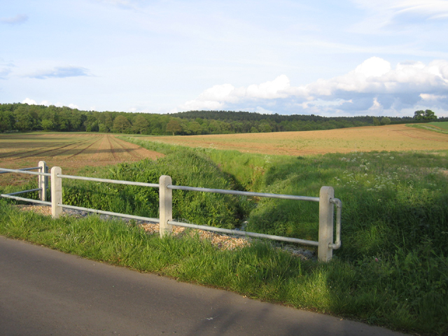
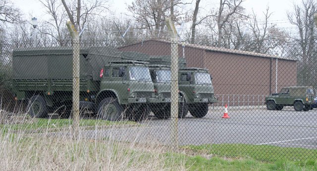
Images are sourced within 2km of 52.046697/-0.39485475 or Grid Reference TL1039. Thanks to Geograph Open Source API. All images are credited.

River Flit, Beadlow, Clophill, Beds a tributary of the River Ivel; view E towards Chicksands.
River Flit, Beadlow, Clophill, Beds
a tributary of the River Ivel; view E towards Chicksands.
Upper Alders, Flit valley, Chicksands, Beds View NNE from near the A507 Ampthill Road across set-aside land.
Upper Alders, Flit valley, Chicksands, Beds
View NNE from near the A507 Ampthill Road across set-aside land.
Wood Farm, Appley Corner, Haynes, Beds – view from the Standalone Warren road.
Wood Farm, Appley Corner, Haynes, Beds
– view from the Standalone Warren road.
Northwood End Road, Haynes, Beds
Standalone Warren lane, Haynes, Beds between the A600 and Appley Corner.
Standalone Warren lane, Haynes, Beds
between the A600 and Appley Corner.
Valley from Appley Corner towards Rowney Warren, Beds forming the Haynes–Chicksands parish boundary; view from the Standalone Warren road.
Valley from Appley Corner towards Rowney Warren, Beds
forming the Haynes–Chicksands parish boundary; view from the Standalone Warren road.
Farmland, Haynes, Beds – view N from the John Bunyan Way towards Northwood End Road.
Farmland, Haynes, Beds
– view N from the John Bunyan Way towards Northwood End Road.
Ministry of Defence facility MOD generator truck, tent and radio transmitter masts 84m above sea level.  To the right is a firing range.
Ministry of Defence facility
MOD generator truck, tent and radio transmitter masts 84m above sea level. To the right is a firing range.
Firing Range Keep out when red flag is flying.  You can just see the flag behind and you could hear the gunfire.
Firing Range
Keep out when red flag is flying. You can just see the flag behind and you could hear the gunfire.
Military facility Some kind of military facility in Chicksands
Military facility
Some kind of military facility in Chicksands
Footpath Sign Bedfordshire County Council Footpath sign
Footpath Sign
Bedfordshire County Council Footpath sign
Barn Conversions Barn conversions at Speedsdairy Farm.  Note the clay tiles on the main buildings and the black timber weatherboarding and pantiles on the subservient buildings.  No chimneys, not many windows and conservation rooflights - keep the planners content.
Barn Conversions
Barn conversions at Speedsdairy Farm. Note the clay tiles on the main buildings and the black timber weatherboarding and pantiles on the subservient buildings. No chimneys, not many windows and conservation rooflights - keep the planners content.
Military vehicles at Chicksands Bedford trucks parked at this military installation at Chicksands
Military vehicles at Chicksands
Bedford trucks parked at this military installation at Chicksands
Disused farmland
Disused farmland
Tracks Crossing in Rowney Warren Wood
Track Looking SSE in Rowney Warren Wood
Across The John Bunyan Trail Looking down to a river/irrigation canal from Rowney Warren Wood with the John Bunyan Trail in the foreground.
Across The John Bunyan Trail
Looking down to a river/irrigation canal from Rowney Warren Wood with the John Bunyan Trail in the foreground.
Obelisk In Chicksands Wood
Show me another place!

Chicksands Wood is located at Grid Ref: TL1039 (Lat: 52.046697, Lng: -0.39485475)

Unitary Authority: Central Bedfordshire

Police Authority: Bedfordshire

What 3 Words

///surfacing.guides.pasta. Near Chicksands, Bedfordshire

Nearby Locations

Chicksands Wood The Hill

Related Wikis

Woburn Sands Formation

The Woburn Sands Formation is a geological formation in England. Part of the Lower Greensand Group, it is the only unit of the group where it occurs, and...

St Mary's Church, Clophill

The present St Mary's Church is located in the centre of the small village of Clophill, between Bedford and Luton in the South Midlands of England. The...

Beadlow Priory

Beadlow Priory was a monastic foundation established between 1140 and 1146 by Robert D'Albini for a community of Benedictine monks. == History == Around...

Haynes, Bedfordshire

Haynes is a village and civil parish in Bedfordshire, England, about seven miles (11 km) south of Bedford. It includes the small hamlet of Haynes Church...

Nearby Amenities

Located within 500m of 52.046697,-0.39485475
The Hill
Place: locality
Lat/Long: 52.0441578/-0.3889996
Barrier: block
Material: concrete
Lat/Long: 52.0457625/-0.3891691
Barrier: block
Material: concrete
Lat/Long: 52.0457588/-0.3893186
Barrier: block
Material: concrete
Lat/Long: 52.0457472/-0.3894715
Barrier: block
Material: concrete
Lat/Long: 52.0457324/-0.3896264
Barrier: block
Material: concrete
Lat/Long: 52.0457126/-0.3897739
Barrier: block
Material: concrete
Lat/Long: 52.0456858/-0.3899208
Barrier: block
Material: concrete
Lat/Long: 52.0456499/-0.3900683
Barrier: block
Material: concrete
Lat/Long: 52.0456083/-0.3902084
Barrier: block
Material: concrete
Lat/Long: 52.045565/-0.3903439
Barrier: block
Material: concrete
Lat/Long: 52.0455146/-0.3904733
Barrier: block
Material: concrete
Lat/Long: 52.0454585/-0.3905994
Barrier: block
Material: concrete
Lat/Long: 52.0453996/-0.3907187
Barrier: block
Material: concrete
Lat/Long: 52.0453303/-0.390824
Barrier: block
Material: concrete
Lat/Long: 52.0452672/-0.3909326
Barrier: block
Material: concrete
Lat/Long: 52.045193/-0.3910285
Barrier: block
Material: concrete
Lat/Long: 52.0451146/-0.3911251
Barrier: block
Material: concrete
Lat/Long: 52.0450342/-0.3912116
Barrier: block
Material: concrete
Lat/Long: 52.0449476/-0.3912807
Barrier: block
Material: concrete
Lat/Long: 52.0448626/-0.391335
Barrier: block
Material: concrete
Lat/Long: 52.0447727/-0.391402
Barrier: block
Material: concrete
Lat/Long: 52.0446824/-0.3914476
Barrier: block
Material: concrete
Lat/Long: 52.0445896/-0.3914805
Barrier: block
Material: concrete
Lat/Long: 52.044496/-0.3915046
Barrier: block
Material: concrete
Lat/Long: 52.0443995/-0.3915187
Barrier: block
Material: concrete
Lat/Long: 52.0443063/-0.3915227
Barrier: block
Material: concrete
Lat/Long: 52.0442077/-0.3915281
Barrier: block
Material: concrete
Lat/Long: 52.0441141/-0.3915066
Barrier: block
Material: concrete
Lat/Long: 52.0440209/-0.3914825
Barrier: block
Material: concrete
Lat/Long: 52.043926/-0.3914463
Barrier: block
Material: concrete
Lat/Long: 52.0438315/-0.3913993
Barrier: block
Material: concrete
Lat/Long: 52.0437453/-0.3913437
Barrier: block
Material: concrete
Lat/Long: 52.0436592/-0.3912807
Barrier: block
Material: concrete
Lat/Long: 52.0435725/-0.3912015
Barrier: block
Material: concrete
Lat/Long: 52.0434995/-0.3911224
Barrier: block
Material: concrete
Lat/Long: 52.0434224/-0.3910305
Barrier: block
Material: concrete
Lat/Long: 52.0433416/-0.3909226
Barrier: block
Material: concrete
Lat/Long: 52.0432797/-0.3908321
Barrier: block
Material: concrete
Lat/Long: 52.0432129/-0.390714
Barrier: block
Material: concrete
Lat/Long: 52.0431502/-0.3905974
Barrier: block
Material: concrete
Lat/Long: 52.0455183/-0.3878501
Barrier: block
Material: concrete
Lat/Long: 52.045567/-0.3879802
Barrier: block
Material: concrete
Lat/Long: 52.0456116/-0.3881136
Barrier: block
Material: concrete
Lat/Long: 52.0456553/-0.3882585
Barrier: block
Material: concrete
Lat/Long: 52.045685/-0.3883979
Barrier: block
Material: concrete
Lat/Long: 52.0457126/-0.3885515
Barrier: block
Material: concrete
Lat/Long: 52.0457324/-0.388703
Barrier: block
Material: concrete
Lat/Long: 52.0457472/-0.3888533
Barrier: block
Material: concrete
Lat/Long: 52.0457596/-0.3890075
Barrier: block
Material: concrete
Lat/Long: 52.0457629/-0.3879775
Barrier: block
Material: concrete
Lat/Long: 52.0458528/-0.3883034
Barrier: block
Material: concrete
Lat/Long: 52.0458924/-0.3886373
Barrier: block
Material: concrete
Lat/Long: 52.0459279/-0.388986
Barrier: block
Material: concrete
Lat/Long: 52.045927/-0.3893307
Barrier: block
Material: concrete
Lat/Long: 52.0459081/-0.3896727
Barrier: block
Material: concrete
Lat/Long: 52.0458437/-0.3900053
Barrier: block
Material: concrete
Lat/Long: 52.0457679/-0.3903231
Barrier: block
Material: concrete
Lat/Long: 52.0456615/-0.3906396
Barrier: block
Material: concrete
Lat/Long: 52.0455278/-0.3909454
Barrier: block
Material: concrete
Lat/Long: 52.0453777/-0.391164
Barrier: block
Material: concrete
Lat/Long: 52.045207/-0.3913732
Barrier: block
Material: concrete
Lat/Long: 52.0450214/-0.3915502
Barrier: block
Material: concrete
Lat/Long: 52.0448234/-0.3916776
Barrier: block
Material: concrete
Lat/Long: 52.044609/-0.3917702
Barrier: block
Material: concrete
Lat/Long: 52.0444003/-0.3918144
Barrier: block
Material: concrete
Lat/Long: 52.0441842/-0.3918104
Barrier: block
Material: concrete
Lat/Long: 52.0439771/-0.3917675
Barrier: block
Material: concrete
Lat/Long: 52.0437594/-0.3916763
Barrier: block
Material: concrete
Lat/Long: 52.043568/-0.3915462
Barrier: block
Material: concrete
Lat/Long: 52.0433907/-0.3913759
Barrier: block
Material: concrete
Lat/Long: 52.0432075/-0.3911626
Barrier: block
Material: concrete
Lat/Long: 52.0430624/-0.3909092
The data included in this document is from www.openstreetmap.org. The data is made available under ODbL.

Have you been to Chicksands Wood?

Leave your review of Chicksands Wood below (or comments, questions and feedback).