Tanners Wood

Wood, Forest in Hertfordshire Three Rivers

England

Tanners Wood

Canal lock, Kings Langley Lock on Grand Union Canal, at the SE side of Kings Langley looking N from the road bridge at TL076021.
Canal lock, Kings Langley Credit: Rob Hinkley

Tanners Wood is a small woodland area located in the county of Hertfordshire, England. Situated near the village of Abbots Langley, it covers an area of approximately 70 acres. The wood is part of the larger Cassiobury Park and has a rich history dating back centuries.

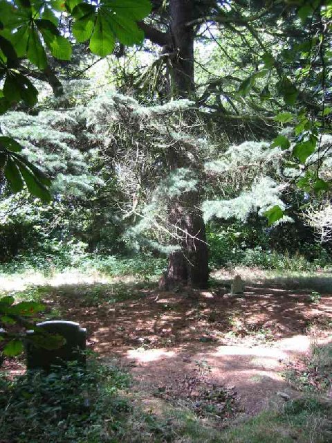
Tanners Wood is predominantly made up of oak and beech trees, providing a diverse and picturesque landscape. The woodland floor is covered with an array of wildflowers and ferns, creating a vibrant and enchanting atmosphere. The dense canopy of trees provides a haven for various bird species, making it a popular spot for birdwatchers.

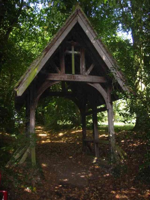
The wood is crisscrossed by a network of footpaths, allowing visitors to explore its natural beauty. These paths lead to scenic viewpoints and tranquil spots, making it a perfect destination for nature enthusiasts and walkers. The wood is also home to a variety of wildlife, including deer, squirrels, and rabbits.

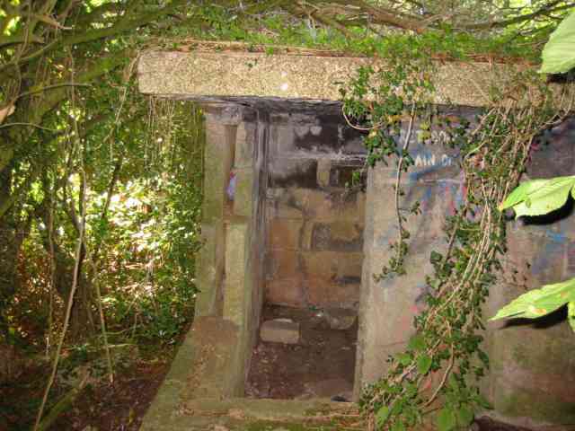
Tanners Wood has historical significance as well. It is believed that the wood was once used by tanners to soak animal hides, hence the name. Additionally, remnants of World War II pillboxes can be found in the area, serving as a reminder of its past.

Overall, Tanners Wood is a hidden gem in Hertfordshire, offering a peaceful retreat from the surrounding urban areas. Its natural beauty, diverse flora and fauna, and historical significance make it a must-visit destination for nature lovers and history enthusiasts alike.

If you have any feedback on the listing, please let us know in the comments section below.
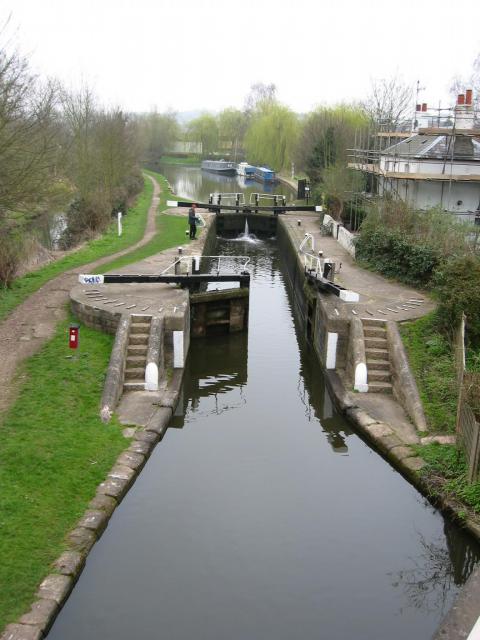
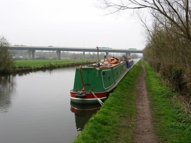
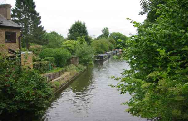
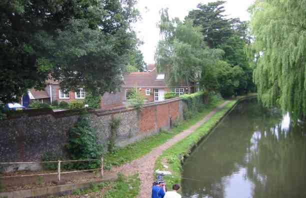
Tanners Wood Images

Images are sourced within 2km of 51.700424/-0.42127539 or Grid Reference TL0901. Thanks to Geograph Open Source API. All images are credited.

Canal lock, Kings Langley Lock on Grand Union Canal, at the SE side of Kings Langley looking N from the road bridge at TL076021.
Canal lock, Kings Langley
Lock on Grand Union Canal, at the SE side of Kings Langley looking N from the road bridge at TL076021.
Canal boats and motorway Looking South from the Grand Union Canal towpath at TL077019. The road is the M25, which crosses the canal in this grid square.
Canal boats and motorway
Looking South from the Grand Union Canal towpath at TL077019. The road is the M25, which crosses the canal in this grid square.
Grand Union Canal, Hunton Bridge The canal is wide enough to take boats wider than the standard "narrow" boat. Facing towards Watford.
Grand Union Canal, Hunton Bridge
The canal is wide enough to take boats wider than the standard "narrow" boat. Facing towards Watford.
Canal at Hunton Bridge This view is looking north. The building on the left used to be a school and is now office accommodation called "The Old Schoolhouse".
Canal at Hunton Bridge
This view is looking north. The building on the left used to be a school and is now office accommodation called "The Old Schoolhouse".
Railway Station at Kings Langley A simple fresh design in keeping with the Tilting trains zooming by overhead
Railway Station at Kings Langley
A simple fresh design in keeping with the Tilting trains zooming by overhead
Housing in the Ovaltine Factory, Kings Langley The factory has been gutted and is now being re-developed.
Housing in the Ovaltine Factory, Kings Langley
The factory has been gutted and is now being re-developed.
Generator at Kings Langley This wind turbine is powering the redeveloped Ovaltine Egg farm
Generator at Kings Langley
This wind turbine is powering the redeveloped Ovaltine Egg farm
RES  at Old Ovaltine Egg Farm Kings Langley All the original buildings have been redeveloped into offices and research rooms.
This is Beaufort Court and houses Renewable Energy Systems <span class="nowrap"><a title="http://www.beaufortcourt.com/" rel="nofollow ugc noopener" href="http://www.beaufortcourt.com/">Link</a><img style="margin-left:2px;" alt="External link" title="External link - shift click to open in new window" src="https://s1.geograph.org.uk/img/external.png" width="10" height="10"/></span>
RES at Old Ovaltine Egg Farm Kings Langley
All the original buildings have been redeveloped into offices and research rooms. This is Beaufort Court and houses Renewable Energy Systems LinkExternal link
Coles Farm Woodside Road    Waterdale This farm house appears to have been gentrified
Coles Farm Woodside Road Waterdale
This farm house appears to have been gentrified
Tombstones  amongst the trees in the Cemetery East Lane This cemetery was provided for the Asylum hospital nearby but has now been abandoned to nature.
Tombstones amongst the trees in the Cemetery East Lane
This cemetery was provided for the Asylum hospital nearby but has now been abandoned to nature.
Lych Gate entrance to the cemetery East Lane This structure is in good condition despite it being abandoned.
Lych Gate entrance to the cemetery East Lane
This structure is in good condition despite it being abandoned.
Machine gun post from 1939/45 war The pill box has been vandalised  but presumably has now been forgotten. Wonder what the guards were 
intending to defend.
Machine gun post from 1939/45 war
The pill box has been vandalised but presumably has now been forgotten. Wonder what the guards were intending to defend.
Leavesden Court, Woodside These buildings were the front face of the hospital
Leavesden Court, Woodside
These buildings were the front face of the hospital
The Hare Pub that was  Leavesden Green A comment on the pub sign reads Hare today gone tomorrow. Was this too big a pub to make a living?
The Hare Pub that was Leavesden Green
A comment on the pub sign reads Hare today gone tomorrow. Was this too big a pub to make a living?
The Boys Home Pub Abbots Langley A strange name for a pub but probably the original one.
The Boys Home Pub Abbots Langley
A strange name for a pub but probably the original one.
The Library at Abbots Langley This building has a very friendly air about it and floods of light inside from a top level rooflight
The Library at Abbots Langley
This building has a very friendly air about it and floods of light inside from a top level rooflight
R.C Church in Abbots Langley The huge bas relief panel over the entrance gives it prominence when seen from the High Street.
R.C Church in Abbots Langley
The huge bas relief panel over the entrance gives it prominence when seen from the High Street.
Tanners Wood Infants School, Abbots Langley I have difficulty imagining anyone driving at 5 mph
Tanners Wood Infants School, Abbots Langley
I have difficulty imagining anyone driving at 5 mph
Show me another place!

Tanners Wood is located at Grid Ref: TL0901 (Lat: 51.700424, Lng: -0.42127539)

Administrative County: Hertfordshire

District: Three Rivers

Police Authority: Hertfordshire

What 3 Words

///drain.torn.crest. Near Abbots Langley, Hertfordshire

Related Wikis

Abbots Langley

Abbots Langley () is a large village and civil parish in the English county of Hertfordshire. It is an old settlement and is mentioned (under the name...

Warner Bros. Studios, Leavesden

Warner Bros. Studios, Leavesden is an 80 ha (200-acre) studio complex in Leavesden in Watford, Hertfordshire, in the East of England. Formerly known as...

Warner Bros. Studio Tour London – The Making of Harry Potter

Warner Bros. Studio Tour London – The Making of Harry Potter is a walk-through exhibition and studio tour in Leavesden, Hertfordshire, England, owned by...

Hunton Park

Hunton Park is a large country house and estate in Abbots Langley, in south west Hertfordshire, in the United Kingdom. It was originally called Hazelwood...

Leavesden Hospital

Leavesden Mental Hospital was a mental health facility at Leavesden on the outskirts of Abbots Langley in Hertfordshire. == History == The facility was...

Hunton Bridge

Hunton Bridge is a small settlement near Abbots Langley, Hertfordshire, England, with a historic royal connection. Its population in the 1991 census was...

Kings Langley railway station

Kings Langley railway station is almost under the M25 motorway near Junction 20. It serves the village of Kings Langley, and the nearby villages of Abbots...

Leavesden, Hertfordshire

Leavesden is a residential and commercial area in the northern part of Watford, England. It lies within the M25 Motorway. On its eastern side it is bounded...

Nearby Amenities

Located within 500m of 51.700424,-0.42127539
Traffic Calming: table
Lat/Long: 51.7024823/-0.4211752
Traffic Calming: table
Lat/Long: 51.7019556/-0.4187706
Bus Stop
De Havilland Way
Bus: yes
Local Ref: NR
Naptan AtcoCode: 210021800467
Naptan Bearing: E
Naptan CommonName: De Havilland Way
Naptan Indicator: nr
Naptan Landmark: Unknown
Naptan NaptanCode: hrtajtda
Naptan PlusbusZoneRef: WATFDJ
Naptan ShortCommonName: NA
Naptan Street: Furtherfield
Naptan Verified: no
Public Transport: platform
Shelter: no
Source: naptan_import
Lat/Long: 51.7001406/-0.4173378
Bus Stop
The Fairway
Naptan AtcoCode: 210021800500
Naptan Bearing: E
Naptan CommonName: The Fairway
Naptan Indicator: opp
Naptan Landmark: Unknown
Naptan NaptanCode: hrtajtdw
Naptan PlusbusZoneRef: WATFDJ
Naptan ShortCommonName: NA
Naptan Street: Hazelwood Lane
Naptan Verified: no
Public Transport: platform
Source: naptan_import
Lat/Long: 51.6989578/-0.4266205
Bus Stop
Gallows Hill Lane
Naptan AtcoCode: 210021800520
Naptan Bearing: N
Naptan CommonName: Gallows Hill Lane
Naptan Indicator: nr
Naptan Landmark: Unknown
Naptan NaptanCode: hrtajptp
Naptan PlusbusZoneRef: WATFDJ
Naptan ShortCommonName: NA
Naptan Street: Hazelwood Lane
Naptan Verified: no
Public Transport: platform
Source: naptan_import
Lat/Long: 51.7019672/-0.4248037
Bus Stop
Pope's Road
Bench: no
Bin: no
Lit: yes
Naptan AtcoCode: 210021800540
Naptan Bearing: E
Naptan CommonName: Pope's Road
Naptan Crossing: Manor House Sports & Social Club
Naptan Indicator: opp
Naptan Landmark: Manor House Sports & Social Club
Naptan NaptanCode: hrtajptw
Naptan PlusbusZoneRef: WATFDJ
Naptan ShortCommonName: NA
Naptan Street: Gallows Hill Lane
Naptan Verified: no
Public Transport: platform
Shelter: no
Source: naptan_import
Tactile Paving: yes
Lat/Long: 51.7029178/-0.422426
Oak Green
Naptan AtcoCode: 210021806170
Naptan Bearing: SW
Naptan BusStopType: CUS
Naptan CommonName: Oak Green
Naptan Crossing: Greenways
Naptan Indicator: adj
Naptan Landmark: Greenways
Naptan NaptanCode: hrtagmjw
Naptan PlusbusZoneRef: WATFDJ
Naptan ShortCommonName: NA
Naptan Street: Trowley Rise
Naptan Verified: no
Source: naptan_import
Lat/Long: 51.7020245/-0.418343
Oak Green
Naptan AtcoCode: 210021806175
Naptan Bearing: NE
Naptan BusStopType: CUS
Naptan CommonName: Oak Green
Naptan Crossing: Pope's Road
Naptan Indicator: opp
Naptan Landmark: Pope's Road
Naptan NaptanCode: hrtagmpa
Naptan PlusbusZoneRef: WATFDJ
Naptan ShortCommonName: NA
Naptan Street: Trowley Rise
Naptan Verified: no
Source: naptan_import
Lat/Long: 51.7019684/-0.4188514
Bus Stop
Pope's Road
Bench: no
Bin: no
Lit: yes
Naptan AtcoCode: 210021806180
Naptan Bearing: W
Naptan CommonName: Pope's Road
Naptan Crossing: Breakepeare School
Naptan Indicator: nr
Naptan Landmark: Breakepeare School
Naptan NaptanCode: hrtagmpd
Naptan PlusbusZoneRef: WATFDJ
Naptan ShortCommonName: NA
Naptan Street: Gallows Hill Lane
Naptan Verified: no
Public Transport: platform
Shelter: no
Source: naptan_import
Tactile Paving: yes
Lat/Long: 51.7025433/-0.4236579
Bus Stop
Gallows Hill Lane
Naptan AtcoCode: 210021806200
Naptan Bearing: S
Naptan CommonName: Gallows Hill Lane
Naptan Indicator: adj
Naptan Landmark: Unknown
Naptan NaptanCode: hrtagmpg
Naptan PlusbusZoneRef: WATFDJ
Naptan ShortCommonName: NA
Naptan Street: Hazelwood Lane
Naptan Verified: no
Public Transport: platform
Source: naptan_import
Lat/Long: 51.7019865/-0.4246215
Bus Stop
Tanners Wood Lane
Naptan AtcoCode: 210021806220
Naptan Bearing: S
Naptan CommonName: Tanners Wood Lane
Naptan Crossing: Tanners Wood School
Naptan Indicator: nr
Naptan Landmark: Tanners Wood School
Naptan NaptanCode: hrtagmpj
Naptan PlusbusZoneRef: WATFDJ
Naptan ShortCommonName: NA
Naptan Street: Hazelwood Lane
Naptan Verified: no
Public Transport: platform
Source: naptan_import
Lat/Long: 51.6999704/-0.424021
Bus Stop
The Fairway
Naptan AtcoCode: 210021806240
Naptan Bearing: W
Naptan CommonName: The Fairway
Naptan Indicator: nr
Naptan Landmark: Unknown
Naptan NaptanCode: hrtagmpm
Naptan PlusbusZoneRef: WATFDJ
Naptan ShortCommonName: NA
Naptan Street: Hazelwood Lane
Naptan Verified: no
Public Transport: platform
Source: naptan_import
Lat/Long: 51.6988369/-0.4266492
Baby: yes
Playground: swing
Lat/Long: 51.6999286/-0.4234963
Waste Basket
Lat/Long: 51.6999198/-0.4210521
Bench
Lat/Long: 51.700369/-0.4240179
Street Lamp
Lat/Long: 51.7004379/-0.4234277
Waste Basket
Waste: dog_excrement
Lat/Long: 51.7014707/-0.4203401
Waste Basket
Waste: dog_excrement
Lat/Long: 51.6998531/-0.4239095
Waste Basket
Waste: dog_excrement
Lat/Long: 51.699924/-0.4210348
Traffic Calming: cushion
Lat/Long: 51.7018038/-0.4206794
Traffic Calming: cushion
Lat/Long: 51.7023317/-0.4173579
Traffic Calming: cushion
Lat/Long: 51.7026072/-0.4161957
Crossing
Lat/Long: 51.6991971/-0.4252055
Board Type: nature
Information: board
Lat/Long: 51.6999859/-0.4234765
Atm
Currency GBP: yes
Fee: no
Network: link
Operator: Bank Machine
Lat/Long: 51.6985976/-0.4254104
Post Box
Collection Times: Mo-Fr 16:00; Sa 10:30
Operator: Royal Mail
Post Box Type: pillar
Ref: WD5 273
Royal Cypher: EVIIIR
Royal Cypher Wikidata: Q33102195
Lat/Long: 51.6988204/-0.4254897
Waste Basket
Waste: dog_excrement
Lat/Long: 51.6986822/-0.4177019
BCF Maintenance
Fixme: locate
Note: Name on a sign down the road by the studios
Lat/Long: 51.6991214/-0.4187087
Simcross Welding Services Ltd.
Addr City: Abbots Langley
Addr Housename: Unit 2, The Maintenancen Depot
Addr Postcode: WD5 0PL
Fixme: locate
Note: Name on a sign down the road by the studios
Lat/Long: 51.6989844/-0.4191091
Window Wise
Addr City: Abbots Langley
Addr Housename: Units D - J
Addr Postcode: WD5 0PL
Addr Street: Furtherfield
Fixme: locate
Note: Name on a sign down the road by the studios
Website: https://www.window-wise.co.uk/
Lat/Long: 51.6990529/-0.4188652
Post Box
Collection Times: Mo-Fr 16:00; Sa 10:30
Operator: Royal Mail
Ref: WD5 101
Lat/Long: 51.7015235/-0.4246125
Information: board
Lat/Long: 51.6980745/-0.4248323
Fast Food
Domino's
Addr City: Abbots Langley
Addr Housenumber: 21
Addr Postcode: WD5 0LA
Addr Street: School Mead
Brand: Domino's
Brand Wikidata: Q839466
Brand Wikipedia: en:Domino's Pizza
Contact Phone: +44 1923 261261
Contact Website: https://www.dominos.co.uk/pizza-near-me/abbots-langley/21-school-mead
Cuisine: pizza
Level: 0
Opening Hours: Su-Sa 11:00-22:45
Takeaway: yes
Lat/Long: 51.6985489/-0.4254336
Spar
Addr City: Abbots Langley
Addr Housenumber: 28
Addr Postcode: WD5 0LA
Addr Street: School Mead
Brand: Spar
Brand Wikidata: Q610492
Brand Wikipedia: en:Spar (retailer)
Level: 0
Opening Hours: Mo-Su 07:00-23:00
Operator: SPAR
Phone: +44 1923 265693
Shop: convenience
Website: https://www.spar.co.uk/store-locator/afb10958-spar-abbots-langley/
Lat/Long: 51.6986374/-0.4254868
J & S Funeral Services
Addr City: Abbots Langley
Addr Housenumber: 17
Addr Postcode: WD5 0LA
Addr Street: School Mead
Level: 0
Shop: funeral_directors
Lat/Long: 51.6983692/-0.4253255
Fast Food
New Beijing
Addr City: Abbots Langley
Addr Housenumber: 19
Addr Postcode: WD5 0LA
Addr Street: School Mead
Cuisine: chinese
Level: 0
Lat/Long: 51.6984588/-0.4253794
Restaurant
Night of Bengal
Addr City: Abbots Langley
Addr Housenumber: 20
Addr Postcode: WD5 0LA
Addr Street: School Mead
Cuisine: indian
Level: 0
Lat/Long: 51.6985031/-0.425406
Fast Food
The Lighthouse
Addr City: Abbots Langley
Addr Housenumber: 18
Addr Postcode: WD5 0LA
Addr Street: School Mead
Cuisine: fish_and_chips
Level: 0
Opening Hours: Mo 16:00-23:00; Tu-We 11:30-14:30,15:30-23:00; Th-Sa 11:30-23:00; Su 16:00-22:30
Phone: +44 1923 260738;+44 1923 275213
Website: http://www.lighthousefishandchips.co.uk/
Lat/Long: 51.6984138/-0.4253523
Turning Circle
Lat/Long: 51.7017967/-0.4162066
Post Box
Collection Times: Mo-Fr 16:00; Sa 10:30
Lit: yes
Operator: Royal Mail
Post Box Type: lamp
Ref: WD5 46
Lat/Long: 51.7010848/-0.4181246
Entrance: yes
Lat/Long: 51.7010972/-0.4183843
Direction: 230
Generator Method: photovoltaic
Generator Output Electricity: yes
Generator Solar Modules: 16
Generator Source: solar
Generator Type: solar_photovoltaic_panel
Location: roof
Power: generator
Lat/Long: 51.7027846/-0.4262933
Direction: 190
Generator Method: photovoltaic
Generator Output Electricity: yes
Generator Solar Modules: 16
Generator Source: solar
Generator Type: solar_photovoltaic_panel
Location: roof
Power: generator
Lat/Long: 51.7029926/-0.4268661
Direction: 250
Generator Method: photovoltaic
Generator Output Electricity: yes
Generator Solar Modules: 10
Generator Source: solar
Generator Type: solar_photovoltaic_panel
Location: roof
Power: generator
Lat/Long: 51.6988452/-0.4260277
Direction: 165
Generator Method: photovoltaic
Generator Output Electricity: yes
Generator Solar Modules: 15
Generator Source: solar
Generator Type: solar_photovoltaic_panel
Location: roof
Power: generator
Lat/Long: 51.7009602/-0.4217618
Direction: 220
Generator Method: photovoltaic
Generator Output Electricity: yes
Generator Solar Modules: 4
Generator Source: solar
Generator Type: solar_photovoltaic_panel
Location: roof
Power: generator
Lat/Long: 51.6980325/-0.425547
Direction: 220
Generator Method: photovoltaic
Generator Output Electricity: yes
Generator Solar Modules: 4
Generator Source: solar
Generator Type: solar_photovoltaic_panel
Location: roof
Power: generator
Lat/Long: 51.6980128/-0.425501
Direction: 220
Generator Method: photovoltaic
Generator Output Electricity: yes
Generator Solar Modules: 4
Generator Source: solar
Generator Type: solar_photovoltaic_panel
Location: roof
Power: generator
Lat/Long: 51.6979918/-0.4254542
Direction: 220
Generator Method: photovoltaic
Generator Output Electricity: yes
Generator Solar Modules: 4
Generator Source: solar
Generator Type: solar_photovoltaic_panel
Location: roof
Power: generator
Lat/Long: 51.697972/-0.4254111
Direction: 220
Generator Method: photovoltaic
Generator Output Electricity: yes
Generator Solar Modules: 4
Generator Source: solar
Generator Type: solar_photovoltaic_panel
Location: roof
Power: generator
Lat/Long: 51.6979099/-0.4253443
Direction: 220
Generator Method: photovoltaic
Generator Output Electricity: yes
Generator Solar Modules: 4
Generator Source: solar
Generator Type: solar_photovoltaic_panel
Location: roof
Power: generator
Lat/Long: 51.6978896/-0.4253044
Direction: 220
Generator Method: photovoltaic
Generator Output Electricity: yes
Generator Solar Modules: 3
Generator Source: solar
Generator Type: solar_photovoltaic_panel
Location: roof
Power: generator
Lat/Long: 51.6978699/-0.4252567
Direction: 220
Generator Method: photovoltaic
Generator Output Electricity: yes
Generator Solar Modules: 3
Generator Source: solar
Generator Type: solar_photovoltaic_panel
Location: roof
Power: generator
Lat/Long: 51.6979225/-0.4253848
Direction: 220
Generator Method: photovoltaic
Generator Output Electricity: yes
Generator Solar Modules: 4
Generator Source: solar
Generator Type: solar_photovoltaic_panel
Location: roof
Power: generator
Lat/Long: 51.6978636/-0.4251713
Direction: 220
Generator Method: photovoltaic
Generator Output Electricity: yes
Generator Solar Modules: 4
Generator Source: solar
Generator Type: solar_photovoltaic_panel
Location: roof
Power: generator
Lat/Long: 51.6978463/-0.4251357
Direction: 220
Generator Method: photovoltaic
Generator Output Electricity: yes
Generator Solar Modules: 4
Generator Source: solar
Generator Type: solar_photovoltaic_panel
Location: roof
Power: generator
Lat/Long: 51.6978225/-0.4250799
Direction: 240
Generator Method: photovoltaic
Generator Output Electricity: yes
Generator Solar Modules: 13
Generator Source: solar
Generator Type: solar_photovoltaic_panel
Location: roof
Power: generator
Lat/Long: 51.6977302/-0.4245542
Direction: 170
Generator Method: photovoltaic
Generator Output Electricity: yes
Generator Solar Modules: 13
Generator Source: solar
Generator Type: solar_photovoltaic_panel
Location: roof
Power: generator
Lat/Long: 51.698746/-0.4216035
Direction: 215
Generator Method: photovoltaic
Generator Output Electricity: yes
Generator Solar Modules: 14
Generator Source: solar
Generator Type: solar_photovoltaic_panel
Location: roof
Power: generator
Lat/Long: 51.6974301/-0.426284
Direction: 170
Generator Method: photovoltaic
Generator Output Electricity: yes
Generator Solar Modules: 12
Generator Source: solar
Generator Type: solar_photovoltaic_panel
Location: roof
Power: generator
Lat/Long: 51.7013376/-0.4177194
Direction: 160
Fixme: survey for panel count
Generator Method: photovoltaic
Generator Output Electricity: yes
Generator Solar Modules: 8
Generator Source: solar
Generator Type: solar_photovoltaic_panel
Location: roof
Power: generator
Lat/Long: 51.7005166/-0.4166274
Direction: 165
Generator Method: photovoltaic
Generator Output Electricity: yes
Generator Solar Modules: 4
Generator Source: solar
Generator Type: solar_photovoltaic_panel
Location: roof
Power: generator
Lat/Long: 51.7002807/-0.4163227
Direction: 170
Generator Method: photovoltaic
Generator Output Electricity: yes
Generator Solar Modules: 13
Generator Source: solar
Generator Type: solar_photovoltaic_panel
Location: roof
Power: generator
Lat/Long: 51.7000099/-0.4167155
Traffic Calming: cushion
Lat/Long: 51.7017021/-0.4197446
Direction: backward
Traffic Calming: table
Lat/Long: 51.7028897/-0.4214138
Crossing
Crossing: unmarked
Lat/Long: 51.70022/-0.4276473
The data included in this document is from www.openstreetmap.org. The data is made available under ODbL.

Have you been to Tanners Wood?

Leave your review of Tanners Wood below (or comments, questions and feedback).