Rabbitfield Spring

Wood, Forest in Hertfordshire St. Albans

England

Rabbitfield Spring

Matrix gantry M1 northbound
Matrix gantry M1 northbound Credit: Dave Thompson

Rabbitfield Spring is a picturesque woodland located in Hertfordshire, England. Situated in the heart of the county, this enchanting forest is a haven for nature lovers and outdoor enthusiasts alike. The woodland covers an expansive area, boasting a diverse range of flora and fauna, making it a popular destination for wildlife enthusiasts and photographers.

Rabbitfield Spring is known for its breathtaking natural beauty, with tall, majestic trees providing a canopy of shade and tranquility. The forest floor is adorned with a carpet of vibrant wildflowers, creating a vibrant and colorful landscape. The air is filled with the sweet scent of pine, adding to the sensory experience of the woodland.

The forest is home to a variety of wildlife, including rabbits, squirrels, and a wide array of bird species. Birdwatchers flock to Rabbitfield Spring to catch a glimpse of rare and migratory birds that frequent the area. The peaceful surroundings and abundance of wildlife make it an ideal spot for nature walks, photography, and picnics.

Rabbitfield Spring has well-marked walking trails that wind through the woodland, providing visitors with the opportunity to explore and discover its hidden treasures. The forest is also home to a small stream that meanders through the trees, offering a tranquil setting for relaxation and reflection.

Overall, Rabbitfield Spring in Hertfordshire is a captivating woodland that offers a peaceful retreat from the hustle and bustle of everyday life. Its natural beauty, diverse wildlife, and well-maintained trails make it a must-visit destination for nature enthusiasts and those seeking a serene outdoor experience.

If you have any feedback on the listing, please let us know in the comments section below.

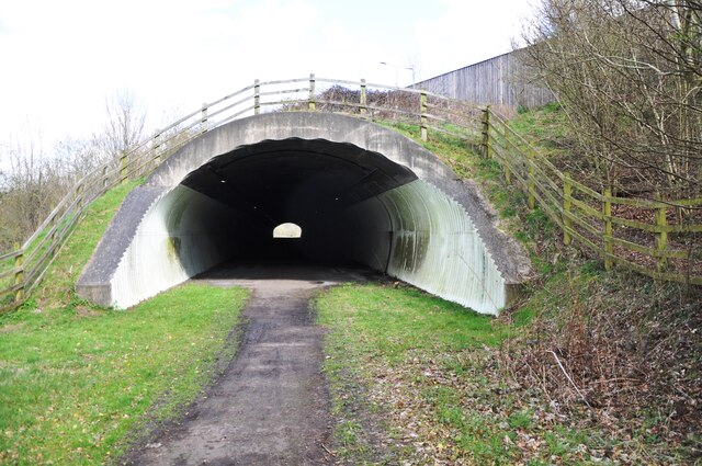
Rabbitfield Spring Images

Images are sourced within 2km of 51.802669/-0.41844613 or Grid Reference TL0912. Thanks to Geograph Open Source API. All images are credited.

Matrix gantry M1 northbound
Footbridge crossing M1 northbound
Matrix gantry M1 northbound
Conifers by Luton Lane, Redbourn
House on Luton Lane, Redbourn
Watling House on Dunstable Road, Redbourn Offices of Rolfe Construction Ltd. <span class="nowrap"><a title="https://rclservices.com/" rel="nofollow ugc noopener" href="https://rclservices.com/">Link</a><img style="margin-left:2px;" alt="External link" title="External link - shift click to open in new window" src="https://s1.geograph.org.uk/img/external.png" width="10" height="10"/></span>
Watling House on Dunstable Road, Redbourn
Offices of Rolfe Construction Ltd. LinkExternal link
Aubrey Park Hotel, Hemel Hempstead Road
Bridge over Redbourn High Street The disused railway bridge crossing Redbourn High Street, once the A5.  The single line ran from Harpenden to Hemel Hempstead and was built by the Midland Railway.  Passenger services ceased in 1947, but the full length of the line was not closed and removed until 1982.  Nowadays a large part of the line is used as a cycleway and footpath, known as the 'Nickey Line'.
Bridge over Redbourn High Street
The disused railway bridge crossing Redbourn High Street, once the A5. The single line ran from Harpenden to Hemel Hempstead and was built by the Midland Railway. Passenger services ceased in 1947, but the full length of the line was not closed and removed until 1982. Nowadays a large part of the line is used as a cycleway and footpath, known as the 'Nickey Line'.
Nickey Line M1 tunnel Since the widening of the M1, the Nickey Line path goes through this concrete tunnel, far less photogenic than the old 'original M1 style' bridge which is now encased beneath the roadway above.
Nickey Line M1 tunnel
Since the widening of the M1, the Nickey Line path goes through this concrete tunnel, far less photogenic than the old 'original M1 style' bridge which is now encased beneath the roadway above.
Nickey Line tunnel The south end of the new Nickey Line tunnel beneath the widened M1 motorway.  During the widening the old original railway bridge was lined and extended with this less elegant concrete tunnel.
Nickey Line tunnel
The south end of the new Nickey Line tunnel beneath the widened M1 motorway. During the widening the old original railway bridge was lined and extended with this less elegant concrete tunnel.
Southbound M1 near to Redbourn The M1 is a north–south motorway connecting London to Leeds, where it joins the A1(M) near Aberford. It was the first motorway to be completed in the United Kingdom.
The motorway is 193 miles long and was constructed in four phases. Most of the motorway was opened between 1959 and 1968 but the southern end was extended in 1977 and the northern end was extended in 1999.
Southbound M1 near to Redbourn
The M1 is a north–south motorway connecting London to Leeds, where it joins the A1(M) near Aberford. It was the first motorway to be completed in the United Kingdom. The motorway is 193 miles long and was constructed in four phases. Most of the motorway was opened between 1959 and 1968 but the southern end was extended in 1977 and the northern end was extended in 1999.
Greenacre Farm, Green Lane This farm displays an sign offering help with animal manipulation.  Horse whispering perhaps?
Greenacre Farm, Green Lane
This farm displays an sign offering help with animal manipulation. Horse whispering perhaps?
Clump of Trees in Gaddesden Lane. Thank goodness the farmer hasn't seen fit to chop down and fill the hollow to ease passage of the combine harvester
Clump of Trees in Gaddesden Lane.
Thank goodness the farmer hasn't seen fit to chop down and fill the hollow to ease passage of the combine harvester
House at entrance to Great Revell's Farm is this a Farmworkers cottage perhaps?
House at entrance to Great Revell's Farm
is this a Farmworkers cottage perhaps?
Bungalows at end of Gaddesden Lane When the road became a river these bungalows were flooded and had to be protected by sandbag barricades
Bungalows at end of Gaddesden Lane
When the road became a river these bungalows were flooded and had to be protected by sandbag barricades
Trowley Bottom  houses and  sculpture project The village was alive with people inspecting the exhibits based on sayings or happenings.
Trowley Bottom houses and sculpture project
The village was alive with people inspecting the exhibits based on sayings or happenings.
Show me another place!

Rabbitfield Spring is located at Grid Ref: TL0912 (Lat: 51.802669, Lng: -0.41844613)

Administrative County: Hertfordshire

District: St. Albans

Police Authority: Hertfordshire

What 3 Words

///ropes.jets.tolls. Near Redbourn, Hertfordshire

Nearby Locations

Rabbitfield Spring

Related Wikis

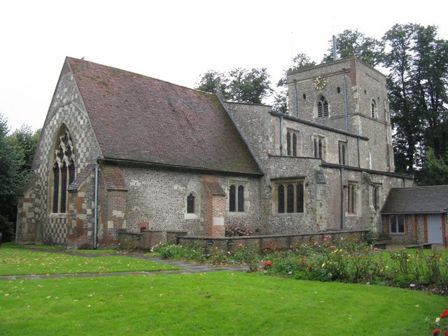
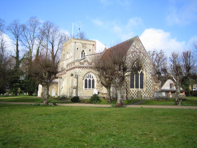
St Mary's Church, Redbourn

St Mary's Church is an active Grade I listed parish church in the Church of England in Redbourn, Hertfordshire, England. The building is Grade I listed...

Redbourn

Redbourn is a village and civil parish in Hertfordshire, England, lying on Watling Street, three miles (4.8 km) from Harpenden, four miles (6.4 km) from...

Beaumont's Halt railway station

Beaumont's Halt railway station was in Hertfordshire, England from 1905 to 1963 on the Nickey Line. == History == The station opened on 9 August 1905...
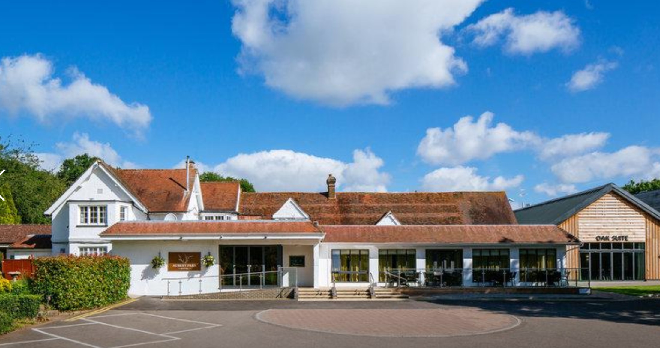
Aubrey Park Hotel

Aubrey Park, Redbourn in Hertfordshire is a building of historical significance and is listed on the English Heritage Register. Parts of the building date...

Redbourn railway station

Redbourn railway station served the village of Redbourn, Hertfordshire, England from 1887 to 1964 on the Nickey Line. == History == The station opened...

Flamstead

Flamstead is a village and civil parish in north-west Hertfordshire, England, close to the junction of the A5 and the M1 motorway at junction 9. The name...

Saunders Almshouses

The Saunders Almshouses are Grade II* listed almshouses in Flamstead, Hertfordshire, England. They date from 1669 and were built for Thomas Saunders of...

Harpenden Rural

Harpenden Rural is a civil parish in the City and District of St Albans in Hertfordshire, England, to the west of Harpenden parish. The local council is...

Nearby Amenities

Located within 500m of 51.802669,-0.41844613
Barrier: kissing_gate
Foot: yes
Lat/Long: 51.8019974/-0.4143431
Barrier: kissing_gate
Foot: yes
Lat/Long: 51.8017867/-0.4145556
Barrier: kissing_gate
Foot: yes
Lat/Long: 51.8016407/-0.4147361
Barrier: kissing_gate
Foot: yes
Lat/Long: 51.8030542/-0.4151878
Power: tower
Lat/Long: 51.8003978/-0.4124678
Power: tower
Lat/Long: 51.8045861/-0.4132774
Speed Camera
Maxspeed: 70 mph
Maxspeed Type: GB:motorway
Lat/Long: 51.7998141/-0.4130665
Street Lamp
Lamp Model: CU Phosco P860
Lamp Type: LED
Source: Survey of 2019-02-22
Lat/Long: 51.8062574/-0.4145347
Street Lamp
Lamp Model: CU Phosco P860
Lamp Type: LED
Source: Survey of 2019-02-22
Lat/Long: 51.8058573/-0.4144611
Street Lamp
Lamp Model: CU Phosco P860
Lamp Type: LED
Source: Survey of 2019-02-22
Lat/Long: 51.8054481/-0.4143553
Street Lamp
Lamp Model: CU Phosco P860
Lamp Type: LED
Source: Survey of 2019-02-22
Lat/Long: 51.8050553/-0.4142847
Street Lamp
Lamp Model: CU Phosco P860
Lamp Type: LED
Source: Survey of 2019-02-22
Lat/Long: 51.804637/-0.4141994
Street Lamp
Lamp Model: CU Phosco P860
Lamp Type: LED
Source: Survey of 2019-02-22
Lat/Long: 51.8042241/-0.4141141
Street Lamp
Lamp Model: CU Phosco P860
Lamp Type: LED
Source: Survey of 2019-02-22
Lat/Long: 51.8038131/-0.4140347
Street Lamp
Lamp Model: CU Phosco P860
Lamp Type: LED
Source: Survey of 2019-02-22
Lat/Long: 51.8033802/-0.4139435
Street Lamp
Lamp Model: CU Phosco P860
Lamp Type: LED
Source: Survey of 2019-02-22
Lat/Long: 51.8029692/-0.4138552
Street Lamp
Lamp Model: CU Phosco P860
Lamp Type: LED
Source: Survey of 2019-02-22
Lat/Long: 51.8025709/-0.4137758
Street Lamp
Lamp Model: CU Phosco P860
Lamp Type: LED
Source: Survey of 2019-02-22
Lat/Long: 51.8021216/-0.4136817
Street Lamp
Lamp Model: CU Phosco P860
Lamp Type: LED
Source: Survey of 2019-02-22
Lat/Long: 51.8017251/-0.4136082
Street Lamp
Lamp Model: CU Phosco P860
Lamp Type: LED
Source: Survey of 2019-02-22
Lat/Long: 51.8013086/-0.4135111
Street Lamp
Lamp Model: CU Phosco P860
Lamp Type: LED
Source: Survey of 2019-02-22
Lat/Long: 51.8008866/-0.4134258
Street Lamp
Lamp Model: CU Phosco P860
Lamp Type: LED
Source: Survey of 2019-02-22
Lat/Long: 51.8004828/-0.4133493
Street Lamp
Lamp Model: CU Phosco P860
Lamp Type: LED
Source: Survey of 2019-02-22
Lat/Long: 51.8000972/-0.413267
Street Lamp
Lamp Model: CU Phosco P860
Lamp Type: LED
Source: Survey of 2019-02-22
Lat/Long: 51.7997043/-0.4131787
Generator Method: wind_turbine
Generator Source: wind
Generator Type: horizontal_axis
Power: generator
Lat/Long: 51.8001854/-0.4151983
Marker: aerial
Utility: oil
Lat/Long: 51.8035631/-0.4127603
Power: pole
Lat/Long: 51.8018404/-0.4154845
Power: pole
Lat/Long: 51.8049658/-0.4158112
Power: pole
Lat/Long: 51.79901/-0.4170553
Power: pole
Lat/Long: 51.8029392/-0.4155696
Power: pole
Lat/Long: 51.8007455/-0.4160894
Power: pole
Lat/Long: 51.804043/-0.4157059
Power: pole
Lat/Long: 51.7996099/-0.4167224
The data included in this document is from www.openstreetmap.org. The data is made available under ODbL.

Have you been to Rabbitfield Spring?

Leave your review of Rabbitfield Spring below (or comments, questions and feedback).