Great Copse
Wood, Forest in Surrey Waverley
England
Great Copse

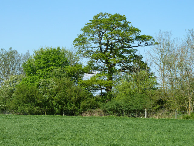
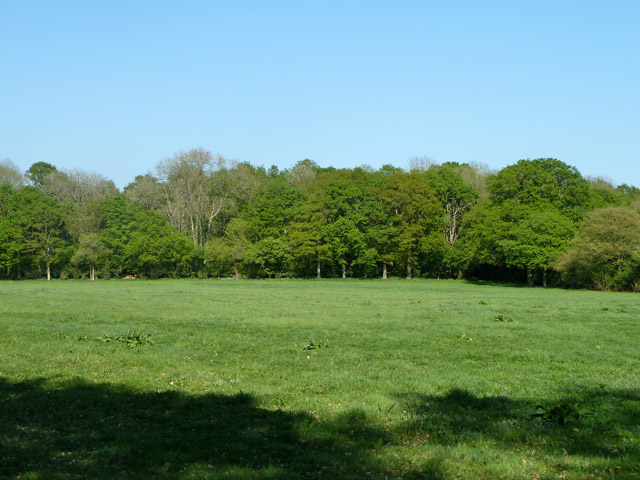
Great Copse is a picturesque woodland located in the county of Surrey, England. Covering an area of approximately 100 acres, it is renowned for its natural beauty and diverse ecosystem. Situated on the outskirts of the village of Surrey, Great Copse is easily accessible by foot or car.
The woodland is dominated by a variety of native tree species, including oak, beech, and birch. These majestic trees create a dense canopy, providing shelter for a wide range of wildlife. Visitors to Great Copse can expect to see an abundance of bird species, such as woodpeckers, thrushes, and owls, as well as small mammals like foxes, squirrels, and rabbits.
Tranquil walking trails wind their way through the woodland, offering visitors the opportunity to immerse themselves in nature. The paths are well-maintained, making them suitable for walkers of all ages and abilities. As visitors stroll through the woodland, they will encounter picturesque clearings, vibrant wildflower meadows, and babbling streams, enhancing the overall serenity of the surroundings.
Great Copse is also a popular spot for nature enthusiasts and photographers, who flock to capture the stunning landscapes and the ever-changing colors of the seasons. In the spring, the woodland comes alive with a carpet of bluebells, creating a breathtaking sight.
Overall, Great Copse in Surrey is a haven for nature lovers, offering a tranquil escape from the hustle and bustle of everyday life. Its natural beauty and diverse wildlife make it a must-visit destination for anyone seeking a peaceful retreat in the heart of nature.
If you have any feedback on the listing, please let us know in the comments section below.
Great Copse Images
Images are sourced within 2km of 51.135113/-0.447578 or Grid Reference TQ0838. Thanks to Geograph Open Source API. All images are credited.


Great Copse is located at Grid Ref: TQ0838 (Lat: 51.135113, Lng: -0.447578)
Administrative County: Surrey
District: Waverley
Police Authority: Surrey
What 3 Words
///jumpy.reliving.guitar. Near Ewhurst, Surrey
Nearby Locations
Related Wikis

Longhurst Lodge
Longhurst Lodge is a Grade II listed building in Cranleigh, Surrey, England. It is located on the former Baynards Park estate, about a quarter of a mile...

Baynards Park
Baynards Park is a 2,000 acres (810 ha) estate and site of a demolished country house with extant outbuildings, privately owned, in the south of the parishes...

Sayer's Croft LNR
Sayer's Croft is a 10.9-hectare (27-acre) Local Nature Reserve west of Ewhurst in Surrey. It is owned by the Sayer's Croft Environmental Education Trust...
Sayers Croft
Sayers Croft is a large outdoor 'learning camp' located in the village of Ewhurst, Surrey. It is one of the few remaining 'Camp schools' built by the National...
Cranleigh
Cranleigh is a village and civil parish, about 8 miles (13 km) southeast of Guildford in Surrey, England. It lies on a minor road east of the A281, which...

Ewhurst, Surrey
Ewhurst is a rural village and civil parish in the borough of Waverley in Surrey, England. It is located 8.3 miles (13.4 km) south-east of Guildford,...

Smokejack Clay Pit
Smokejack Clay Pit is a 56-hectare (140-acre) geological Site of Special Scientific Interest east of Cranleigh in Surrey. It is a Geological Conservation...
Glebelands School
Glebelands School is a county-funded and charity-supported secondary school in Cranleigh, Surrey, England. It is co-educational and takes students aged...
Nearby Amenities
Located within 500m of 51.135113,-0.447578Have you been to Great Copse?
Leave your review of Great Copse below (or comments, questions and feedback).