Great Gorse

Wood, Forest in Lincolnshire North Kesteven

England

Great Gorse

Church of St Andrew, Folkingham Listed Grade I; from the 12th century. The dedication, to St Andrew, is particularly common in this area (see very good information boards inside church).
Church of St Andrew, Folkingham Credit: Tim Heaton

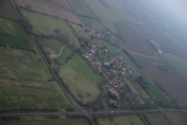
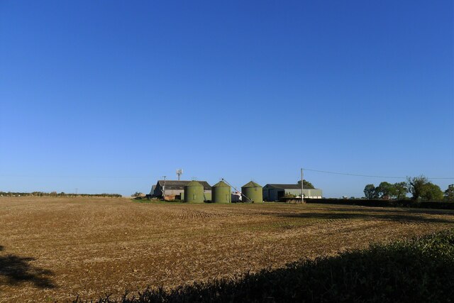
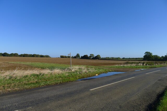
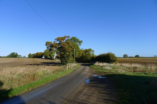
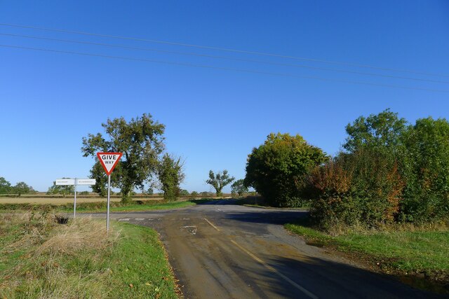
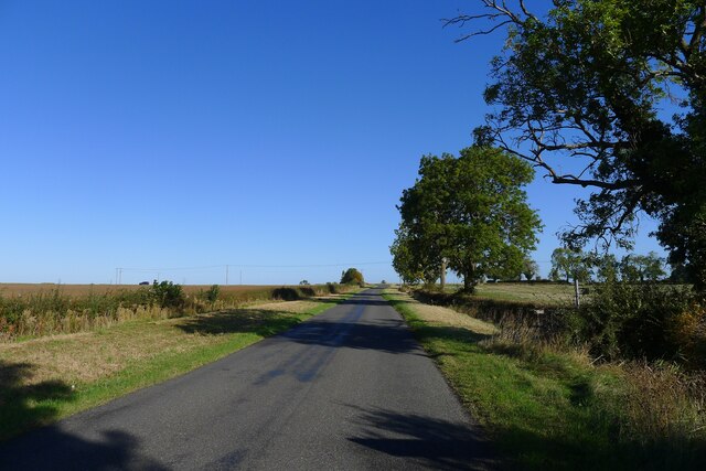
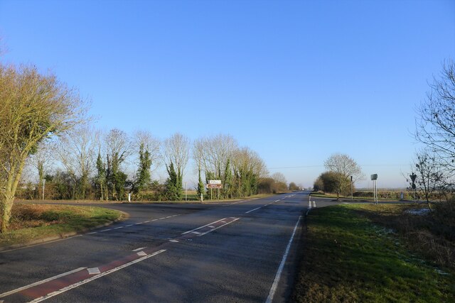
Great Gorse is a small woodland area located in the county of Lincolnshire, England. Situated near the village of Wood, it is known for its picturesque landscapes and rich biodiversity. With an area spanning approximately 50 acres, Great Gorse offers a tranquil and natural environment for visitors to explore.

The woodland is predominantly made up of dense thickets of gorse, a spiny evergreen shrub native to the area. These vibrant yellow flowers can be seen blooming throughout the year, adding a burst of color to the surroundings. In addition to gorse, the woodland also features a variety of other tree species, including oak, beech, and ash, which provide a diverse habitat for wildlife.

Great Gorse is home to an array of fauna, making it an ideal spot for nature enthusiasts. Birdwatchers may spot species such as woodpeckers, owls, and various songbirds. Small mammals, including rabbits and squirrels, can also be observed scurrying through the undergrowth. The woodland floor is adorned with wildflowers and ferns, creating a vibrant ecosystem for insects and other invertebrates.

For outdoor enthusiasts, Great Gorse offers several walking trails that meander through the woodland, allowing visitors to immerse themselves in the natural beauty of the area. The peaceful atmosphere and the abundance of flora and fauna make this woodland a popular destination for both locals and tourists looking to reconnect with nature.

If you have any feedback on the listing, please let us know in the comments section below.

Great Gorse Images

Images are sourced within 2km of 52.898826/-0.38562357 or Grid Reference TF0834. Thanks to Geograph Open Source API. All images are credited.

Church of St Andrew, Folkingham Listed Grade I; from the 12th century. The dedication, to St Andrew, is particularly common in this area (see very good information boards inside church).
Church of St Andrew, Folkingham
Listed Grade I; from the 12th century. The dedication, to St Andrew, is particularly common in this area (see very good information boards inside church).
Threekingham: aerial 2022 (1)
Threekingham: aerial 2022 (2)
Washdyke Farm from Billingborough Road A limited archaeological investigation was carried out at the farm prior to construction of a grain store, but nothing of note was found <span class="nowrap"><a title="https://archaeologydataservice.ac.uk/library/browse/issue.xhtml?recordId=1111651&recordType=GreyLitSeries" rel="nofollow ugc noopener" href="https://archaeologydataservice.ac.uk/library/browse/issue.xhtml?recordId=1111651&recordType=GreyLitSeries">Link</a><img style="margin-left:2px;" alt="External link" title="External link - shift click to open in new window" src="https://s1.geograph.org.uk/img/external.png" width="10" height="10"/></span> .
Washdyke Farm from Billingborough Road
A limited archaeological investigation was carried out at the farm prior to construction of a grain store, but nothing of note was found LinkExternal link .
Footpath off Billingborough Road The footpath leads to Folkingham
Footpath off Billingborough Road
The footpath leads to Folkingham
Mareham Lane crossing Ouse Mere Lode The modern Mareham Lane runs from near Graby, Lincolnshire, due north for about 10.5 miles to Sleaford. Much of its length follows the route of a Roman road, Margary number 260, which ran for about 16 miles from Bourne to Sleaford (Margary, I.D., 1955. Roman roads in Britain, volume 1)
Mareham Lane crossing Ouse Mere Lode
The modern Mareham Lane runs from near Graby, Lincolnshire, due north for about 10.5 miles to Sleaford. Much of its length follows the route of a Roman road, Margary number 260, which ran for about 16 miles from Bourne to Sleaford (Margary, I.D., 1955. Roman roads in Britain, volume 1)
Mareham Lane crossing the Folkingham to Billingborough road The modern Mareham Lane runs from near Graby, Lincolnshire, due north for about 10.5 miles to Sleaford. Much of its length follows the route of a Roman road, Margary number 260, which ran for about 16 miles from Bourne to Sleaford (Margary, I.D., 1955. Roman roads in Britain, volume 1)
Mareham Lane crossing the Folkingham to Billingborough road
The modern Mareham Lane runs from near Graby, Lincolnshire, due north for about 10.5 miles to Sleaford. Much of its length follows the route of a Roman road, Margary number 260, which ran for about 16 miles from Bourne to Sleaford (Margary, I.D., 1955. Roman roads in Britain, volume 1)
Mareham Lane crossing into the district of North Kesteven The modern Mareham Lane runs from near Graby, Lincolnshire, due north for about 10.5 miles to Sleaford. Much of its length follows the route of a Roman road, Margary number 260, which ran for about 16 miles from Bourne to Sleaford (Margary, I.D., 1955. Roman roads in Britain, volume 1)
Mareham Lane crossing into the district of North Kesteven
The modern Mareham Lane runs from near Graby, Lincolnshire, due north for about 10.5 miles to Sleaford. Much of its length follows the route of a Roman road, Margary number 260, which ran for about 16 miles from Bourne to Sleaford (Margary, I.D., 1955. Roman roads in Britain, volume 1)
Mareham Lane approaching Threekingham The flat landscape on softer Jurassic mudstones
Mareham Lane approaching Threekingham
The flat landscape on softer Jurassic mudstones
Church of St Peter ad Vincula, Threekingham Listed Grade I, 12th to 14th century, restored 19th century <span class="nowrap"><a title="https://historicengland.org.uk/listing/the-list/list-entry/1306911?section=official-list-entry" rel="nofollow ugc noopener" href="https://historicengland.org.uk/listing/the-list/list-entry/1306911?section=official-list-entry">Link</a><img style="margin-left:2px;" alt="External link" title="External link - shift click to open in new window" src="https://s1.geograph.org.uk/img/external.png" width="10" height="10"/></span> . 12th century Romanesque windows are seen in the east wall of the chancel
Church of St Peter ad Vincula, Threekingham
Listed Grade I, 12th to 14th century, restored 19th century LinkExternal link . 12th century Romanesque windows are seen in the east wall of the chancel
Acre Lane leaving Threekingham
Saltersway entering Threekingham The original route of the A52 through the village before the bypass was built, and presumably on the line of the Salt Way Roman road.
(Note that the street sign says 'Salters Way', but 'Saltersway' appears to be the preferred spelling)
Saltersway entering Threekingham
The original route of the A52 through the village before the bypass was built, and presumably on the line of the Salt Way Roman road. (Note that the street sign says 'Salters Way', but 'Saltersway' appears to be the preferred spelling)
Three Kings Inn, Saltersway, Threekingham Listed Grade II, early 18th century <span class="nowrap"><a title="https://historicengland.org.uk/listing/the-list/list-entry/1061736?section=official-list-entry" rel="nofollow ugc noopener" href="https://historicengland.org.uk/listing/the-list/list-entry/1061736?section=official-list-entry">Link</a><img style="margin-left:2px;" alt="External link" title="External link - shift click to open in new window" src="https://s1.geograph.org.uk/img/external.png" width="10" height="10"/></span> .
The following from the Threekingham parish website:
"The Three Kings Inn: Reputedly, a hostelry has been on the site of The Three Kings Inn for centuries. An ailing King John stayed at the Inn during October 1216 when he was en route from Swineshead Abbey to Newark Castle where he died. Three centuries later, on the 8th August 1554, King Henry VIII passed through the village on his way to York and returned a few weeks later. In the 18th Century the Inn was known as the Harvest Home and then the Barley Mow. In about 1737, Dick Turpin's mother-in-law, Mrs Berrys, ran the Inn, and he frequently visited her to feed his horse before he set out to rob travellers on Salters Way." <span class="nowrap"><a title="http://www.threekingham.org.uk/about_3kh.html" rel="nofollow ugc noopener" href="http://www.threekingham.org.uk/about_3kh.html">Link</a><img style="margin-left:2px;" alt="External link" title="External link - shift click to open in new window" src="https://s1.geograph.org.uk/img/external.png" width="10" height="10"/></span>
Three Kings Inn, Saltersway, Threekingham
Listed Grade II, early 18th century LinkExternal link . The following from the Threekingham parish website: "The Three Kings Inn: Reputedly, a hostelry has been on the site of The Three Kings Inn for centuries. An ailing King John stayed at the Inn during October 1216 when he was en route from Swineshead Abbey to Newark Castle where he died. Three centuries later, on the 8th August 1554, King Henry VIII passed through the village on his way to York and returned a few weeks later. In the 18th Century the Inn was known as the Harvest Home and then the Barley Mow. In about 1737, Dick Turpin's mother-in-law, Mrs Berrys, ran the Inn, and he frequently visited her to feed his horse before he set out to rob travellers on Salters Way." LinkExternal link
Mareham Lane crossing the A52 Much of the A52 is believed to follow the Salt Way, which would make this location close to the crossing of two Roman roads.
Mareham Lane crossing the A52
Much of the A52 is believed to follow the Salt Way, which would make this location close to the crossing of two Roman roads.
Site of gallows by the Sleaford-Bourne road (A15) "The gallows apparently stood by the roadside where the Threekingham-Newton footpath crossed the Sleaford-Bourne road (the modern A15). The area around this site was known as Galley (from Gallows) Hill. During the early 20th century, some large stones were uncovered at this site which were interpreted as the remains of the holdfasts of the wooden gallows." <span class="nowrap"><a title="https://heritage-explorer.lincolnshire.gov.uk/Monument/MLI90643" rel="nofollow ugc noopener" href="https://heritage-explorer.lincolnshire.gov.uk/Monument/MLI90643">Link</a><img style="margin-left:2px;" alt="External link" title="External link - shift click to open in new window" src="https://s1.geograph.org.uk/img/external.png" width="10" height="10"/></span>
The site, on a road and parish boundary, was typical for gallows. The mentioned footpath, crossing the road and following the track to the right, is clearly shown on pre-1950s OS maps, but is absent on the current map.
Site of gallows by the Sleaford-Bourne road (A15)
"The gallows apparently stood by the roadside where the Threekingham-Newton footpath crossed the Sleaford-Bourne road (the modern A15). The area around this site was known as Galley (from Gallows) Hill. During the early 20th century, some large stones were uncovered at this site which were interpreted as the remains of the holdfasts of the wooden gallows." LinkExternal link The site, on a road and parish boundary, was typical for gallows. The mentioned footpath, crossing the road and following the track to the right, is clearly shown on pre-1950s OS maps, but is absent on the current map.
Walcot Bar, Sleaford Road (A15) The name suggests that there used to be a toll gate (barrier) on this former turnpike road?
Walcot Bar, Sleaford Road (A15)
The name suggests that there used to be a toll gate (barrier) on this former turnpike road?
The A15 north of Folkingham The A15 is the main north-south road in Lincolnshire, running the entire length of the county for almost 100 miles between Hessle, near Kingston upon Hull, and Peterborough via Lincoln, Sleaford and Bourne. It is also the road that crosses the Humber Bridge.
The A15 north of Folkingham
The A15 is the main north-south road in Lincolnshire, running the entire length of the county for almost 100 miles between Hessle, near Kingston upon Hull, and Peterborough via Lincoln, Sleaford and Bourne. It is also the road that crosses the Humber Bridge.
Roman crossroads?, Threekingham Mareham Lane (Roman Road 260) crossing the A52 (possible route of the Salt Way, Roman Road 58b)
Roman crossroads?, Threekingham
Mareham Lane (Roman Road 260) crossing the A52 (possible route of the Salt Way, Roman Road 58b)
Show me another place!

Great Gorse is located at Grid Ref: TF0834 (Lat: 52.898826, Lng: -0.38562357)

Administrative County: Lincolnshire

District: North Kesteven

Police Authority: Lincolnshire

What 3 Words

///adopts.grounding.aimless. Near Billingborough, Lincolnshire

Nearby Locations

Great Gorse

Related Wikis

Stow Fair, Lincolnshire

Stow Fair was an English medieval fair inaugurated in 1233 and held at Stow Green Hill in Lincolnshire.The Prior of Sempringham was granted permission...

St Peter's Church, Threekingham

St Peter's Church is a church in Threekingham, Lincolnshire. It is dedicated to St. Peter ad Vincula (St Peter in chains). It became a Grade I listed building...

Folkingham Castle

Folkingham Castle is located near the village of Folkingham, Lincolnshire, England. The castle was the caput baroniae of the barony of Folkingham. A motte...

Threekingham

Threekingham (sometimes Threckingham or Tricengham) is a village in the North Kesteven district of Lincolnshire, England. The population of the civil parish...

Have you been to Great Gorse?

Leave your review of Great Gorse below (or comments, questions and feedback).