Beech Wood

Wood, Forest in Yorkshire

England

Beech Wood

Works by the River Hull Looking from the eastern embankment of the river, towards the Croda factory on the western side, still illuminated in the winter early morning. The light on the slope to the left comes from one of the depots on Stockholm Road.
Works by the River Hull Credit: Paul Harrop

Beech Wood is a picturesque forest located in the county of Yorkshire, England. Spanning over a vast area of land, it is known for its dense and abundant beech trees, from which it derives its name. The wood is situated in a rural setting, surrounded by rolling hills and meadows, creating a serene and tranquil atmosphere.

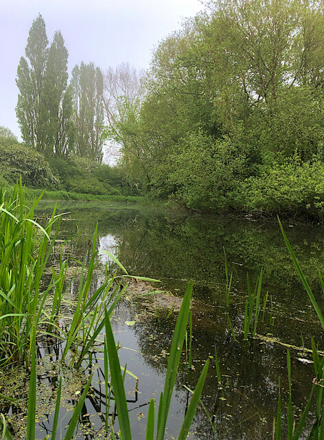
The beech trees in Beech Wood are a prominent feature, towering majestically over the landscape. These trees are known for their distinctive smooth silver-gray bark and vibrant green leaves, which turn a beautiful golden color during the autumn season. The forest floor is covered in a thick carpet of fallen beech leaves, creating a stunning natural palette of colors.

The wood offers a diverse range of flora and fauna. Apart from the beech trees, other tree species such as oak, birch, and ash can also be found. The forest floor is carpeted with a variety of wildflowers, including bluebells and primroses, adding bursts of color to the woodland.

Beech Wood is a haven for wildlife enthusiasts, as it is home to a wide array of animal species. Visitors may catch a glimpse of deer, foxes, and badgers roaming freely through the forest. The avian population is equally impressive, with numerous species of birds such as woodpeckers, owls, and thrushes inhabiting the wood.

The wood is a popular destination for nature lovers and hikers, offering a network of well-maintained trails that wind through the forest. These paths provide an opportunity to explore the wood's beauty up close, allowing visitors to immerse themselves in the peaceful ambiance and appreciate the diverse ecosystem that thrives within Beech Wood.

If you have any feedback on the listing, please let us know in the comments section below.
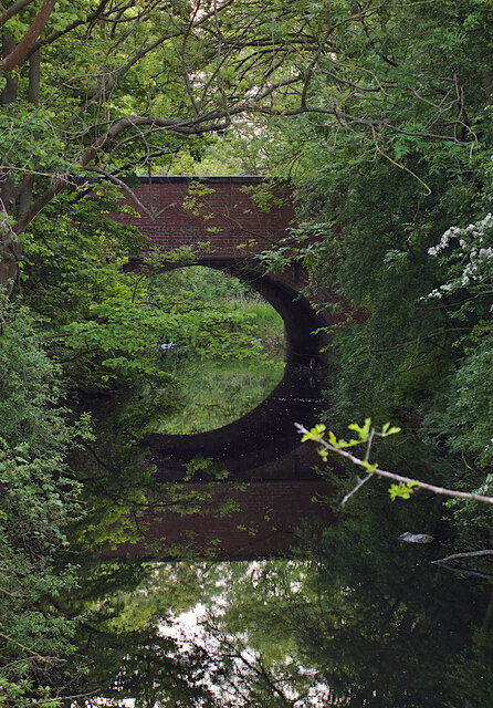
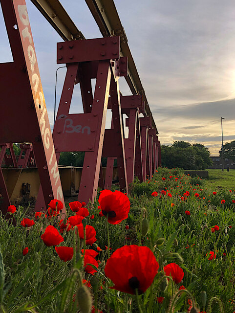
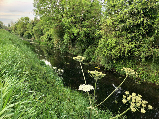
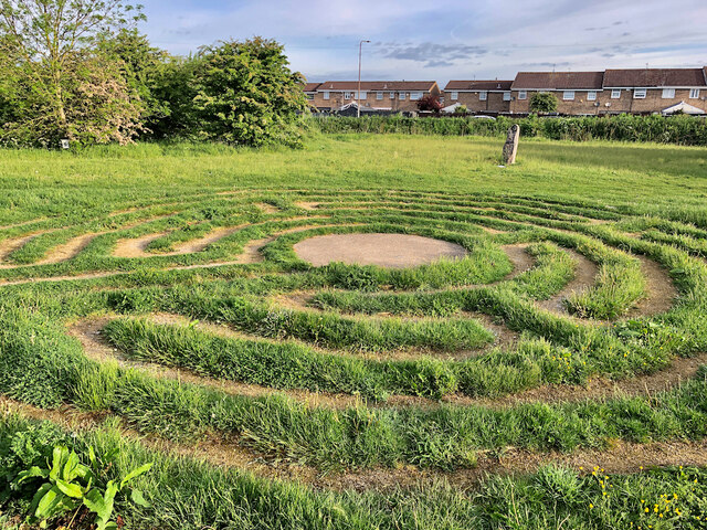
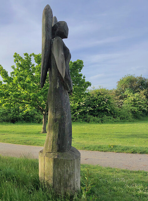
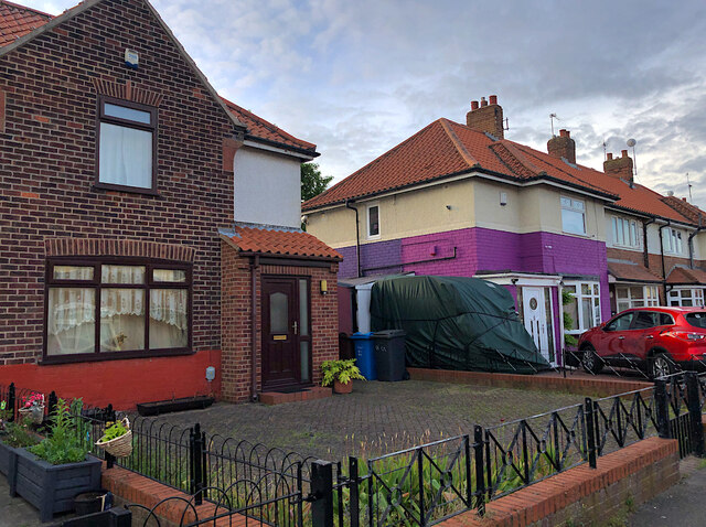
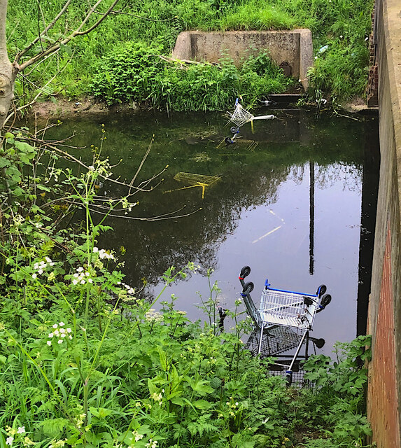
Beech Wood Images

Images are sourced within 2km of 53.787476/-0.35214262 or Grid Reference TA0833. Thanks to Geograph Open Source API. All images are credited.

Works by the River Hull Looking from the eastern embankment of the river, towards the Croda factory on the western side, still illuminated in the winter early morning. The light on the slope to the left comes from one of the depots on Stockholm Road.
Works by the River Hull
Looking from the eastern embankment of the river, towards the Croda factory on the western side, still illuminated in the winter early morning. The light on the slope to the left comes from one of the depots on Stockholm Road.
Ings Bridge, Beverley Road, Hull - 1979 The bus is on an enthusiast tour commemorating the end of operation of the AEC Renown type of bus by the East Yorkshire company.

This is one of a series of views featuring buses in the 60s, 70s, and 80s. <a title="https://www.geograph.org.uk/search.php?i=137652761" href="https://www.geograph.org.uk/search.php?i=137652761">Link</a> 

The bridge as seen here has completely disappeared with the development of the road as a dual carriageway and with the 'angle' of the bend eased into a longer gradual curve. The bridge also marks the location of the boundary of the City of Kingston upon Hull.
Ings Bridge, Beverley Road, Hull - 1979
The bus is on an enthusiast tour commemorating the end of operation of the AEC Renown type of bus by the East Yorkshire company. This is one of a series of views featuring buses in the 60s, 70s, and 80s. Link The bridge as seen here has completely disappeared with the development of the road as a dual carriageway and with the 'angle' of the bend eased into a longer gradual curve. The bridge also marks the location of the boundary of the City of Kingston upon Hull.
Foredyke Bridge, Hull In the Bransholme/Kingswood area, the bridge carries Wawne Road over the Foredyke Stream (or Wawne Drain, depending on which OS map resolution you are looking at).
Foredyke Bridge, Hull
In the Bransholme/Kingswood area, the bridge carries Wawne Road over the Foredyke Stream (or Wawne Drain, depending on which OS map resolution you are looking at).
Bransholme bunny, Hull The plentiful green areas and parks which thread among the streets and houses of Bransholme are home to numerous rabbits, this one close to Wawne Road and, like all the others, about to disappear into the undergrowth.
Bransholme bunny, Hull
The plentiful green areas and parks which thread among the streets and houses of Bransholme are home to numerous rabbits, this one close to Wawne Road and, like all the others, about to disappear into the undergrowth.
Poppies by the old bridge, Bransholme Only the iron superstructure remains of what was once a bridge carrying Bude Road over, presumably, a land drain, which has long since been filled in or culverted.
Poppies by the old bridge, Bransholme
Only the iron superstructure remains of what was once a bridge carrying Bude Road over, presumably, a land drain, which has long since been filled in or culverted.
Beverley and Barmston Drain, Hull Section between Greenwood Avenue and Endike Lane of this major land drain which here runs south-east towards its outfall into the River Hull.
Beverley and Barmston Drain, Hull
Section between Greenwood Avenue and Endike Lane of this major land drain which here runs south-east towards its outfall into the River Hull.
Labyrinth, Foredyke Green, Hull Created in 2017 as part of a regeneration of the Foredyke Green Nature area, this labyrinth is based on a medieval original which once existed in the east Hull village of Marfleet.
Labyrinth, Foredyke Green, Hull
Created in 2017 as part of a regeneration of the Foredyke Green Nature area, this labyrinth is based on a medieval original which once existed in the east Hull village of Marfleet.
Angel sculpture, Kingswood, Hull One of a number of carved wooden figures around the Kesteven Green nature area. They were introduced as part of a 2017 regeneration of the green space near Kesteven Way and Bude Road, led by the Kingswood Residents Association.
Angel sculpture, Kingswood, Hull
One of a number of carved wooden figures around the Kesteven Green nature area. They were introduced as part of a 2017 regeneration of the green space near Kesteven Way and Bude Road, led by the Kingswood Residents Association.
All the twos, Hull The eastern side of 22nd Avenue, taken on 22/5/22. The house on the left is number 22.
All the twos, Hull
The eastern side of 22nd Avenue, taken on 22/5/22. The house on the left is number 22.
Paddock near Dunswell Home to several horses to the west of Beverley High Road, south of the Dunswell roundabout.
Paddock near Dunswell
Home to several horses to the west of Beverley High Road, south of the Dunswell roundabout.
Linn Park, Hull
Linn Park, Hull
Trolley drowning, Hull If the nearby Tesco store ever wonders where some of their trolleys disappear to, there are at least six of them either underwater, or partially submerged here, in the Beverley and Barmston Drain by the Beckside Close bridge, where dumping them appears to be something of a local sport.
Trolley drowning, Hull
If the nearby Tesco store ever wonders where some of their trolleys disappear to, there are at least six of them either underwater, or partially submerged here, in the Beverley and Barmston Drain by the Beckside Close bridge, where dumping them appears to be something of a local sport.
Beverley & Barmston Drain, Hull A short section of the generally dead straight drain which meanders between Hall Road and Greenwood Avenue
Beverley & Barmston Drain, Hull
A short section of the generally dead straight drain which meanders between Hall Road and Greenwood Avenue
Wildlife-themed shelter, Hull Hull City Council provided 19 new bus shelters in March 2023, along Hedon Road and Hall Road, to replace old ones in poor condition. These all included 'wildflower roofs', planted to attract bees and other pollinators. Some, like this one, were also painted by a local artist working with students from the city's schools. This example in Hall Road reflects the project's ecological aspect.

Other examples of similar painted shelters include: <a href="https://www.geograph.org.uk/photo/7483495">TA1329 : Painted bus shelter, Hedon Road, Hull</a> <a href="https://www.geograph.org.uk/photo/7483496">TA0633 : Hall Road painted shelter, Hull</a> and <a href="https://www.geograph.org.uk/photo/7483498">TA0632 : Painted bus shelter, Hall Road, Hull</a>
Wildlife-themed shelter, Hull
Hull City Council provided 19 new bus shelters in March 2023, along Hedon Road and Hall Road, to replace old ones in poor condition. These all included 'wildflower roofs', planted to attract bees and other pollinators. Some, like this one, were also painted by a local artist working with students from the city's schools. This example in Hall Road reflects the project's ecological aspect. Other examples of similar painted shelters include: TA1329 : Painted bus shelter, Hedon Road, Hull TA0633 : Hall Road painted shelter, Hull and TA0632 : Painted bus shelter, Hall Road, Hull
Damaged turbine removal, Hull A wind turbine which was destroyed by fire on 3 August 2022 is being dismantled nearly a year after the incident. It powered the former Croda - now Cargill - chemicals site on Oak Road (see <a href="https://www.geograph.org.uk/photo/1049825">TA0931 : Croda's Wind  Turbine</a> for a pre-fire view). BBC news report of the fire: <span class="nowrap"><a title="https://www.bbc.co.uk/news/uk-england-humber-62405231" rel="nofollow ugc noopener" href="https://www.bbc.co.uk/news/uk-england-humber-62405231">Link</a><img style="margin-left:2px;" alt="External link" title="External link - shift click to open in new window" src="https://s1.geograph.org.uk/img/external.png" width="10" height="10"/></span> . Close-up of the damage: <a href="https://www.geograph.org.uk/photo/7534206">TA0932 : Damaged turbine close-up, Hull</a>
Damaged turbine removal, Hull
A wind turbine which was destroyed by fire on 3 August 2022 is being dismantled nearly a year after the incident. It powered the former Croda - now Cargill - chemicals site on Oak Road (see TA0931 : Croda's Wind Turbine for a pre-fire view). BBC news report of the fire: LinkExternal link . Close-up of the damage: TA0932 : Damaged turbine close-up, Hull
Damaged turbine close-up, Hull A closer view of the damage to the wind turbine which was destroyed by fire on 3 August 2022. It is being dismantled nearly a year after the incident. It powered the former Croda - now Cargill - chemicals site on Oak Road (see <a href="https://www.geograph.org.uk/photo/1049825">TA0931 : Croda's Wind  Turbine</a> for a pre-fire view). BBC news report of the fire: <span class="nowrap"><a title="https://www.bbc.co.uk/news/uk-england-humber-62405231" rel="nofollow ugc noopener" href="https://www.bbc.co.uk/news/uk-england-humber-62405231">Link</a><img style="margin-left:2px;" alt="External link" title="External link - shift click to open in new window" src="https://s1.geograph.org.uk/img/external.png" width="10" height="10"/></span>
Damaged turbine close-up, Hull
A closer view of the damage to the wind turbine which was destroyed by fire on 3 August 2022. It is being dismantled nearly a year after the incident. It powered the former Croda - now Cargill - chemicals site on Oak Road (see TA0931 : Croda's Wind Turbine for a pre-fire view). BBC news report of the fire: LinkExternal link
Housing site development, Hull Groundworks and drainage in progress on one of the final parcels of land on Kingswood, this one being developed by Beal Homes as 'King's Fold' to the east of Barnes Way.
Housing site development, Hull
Groundworks and drainage in progress on one of the final parcels of land on Kingswood, this one being developed by Beal Homes as 'King's Fold' to the east of Barnes Way.
Swan and cygnets on the lagoon, Hull Some of the avian residents of the surface water storage lagoon at the Bransholme water works. It serves the Bransholme and Kingswood areas of Hull where surface water is discharged into the adjacent River Hull. This intermediate storage lagoon stores water when river levels are high.

It has been designated a Site of Nature Conservation Interest (SNCI). Surveys have recorded water vole, smooth newts and grass snakes in an adjacent wetland nature reserve, and a wide variety of bird species at the lagoon. Other species  have included eels and non-native terrapins .
Swan and cygnets on the lagoon, Hull
Some of the avian residents of the surface water storage lagoon at the Bransholme water works. It serves the Bransholme and Kingswood areas of Hull where surface water is discharged into the adjacent River Hull. This intermediate storage lagoon stores water when river levels are high. It has been designated a Site of Nature Conservation Interest (SNCI). Surveys have recorded water vole, smooth newts and grass snakes in an adjacent wetland nature reserve, and a wide variety of bird species at the lagoon. Other species have included eels and non-native terrapins .
Show me another place!

Beech Wood is located at Grid Ref: TA0833 (Lat: 53.787476, Lng: -0.35214262)

Division: East Riding

Unitary Authority: Kingston upon Hull

Police Authority: Humberside

What 3 Words

///tinsel.learns.skinny. Near Dunswell, East Yorkshire

Related Wikis

Bransholme water works

Bransholme water works is a surface water storage and pumping station serving the Bransholme and Kingswood estates in Kingston upon Hull, England. The...

Sirius Academy North

Sirius Academy North (formerly Thomas Ferens Academy) is a mixed secondary school located in the North Hull Estate of Kingston upon Hull in the East Riding...

North Hull Estate

The North Hull Estate is a residential area in the north of Kingston upon Hull, west of the River Hull, built by Hull Corporation in the interwar period...

Hull United A.F.C.

Hull United Association Football Club is a football club in Hull, East Riding of Yorkshire, England. They were members of Division One of the Northern...

Nearby Amenities

Located within 500m of 53.787476,-0.35214262
Mini Roundabout
Lat/Long: 53.789998/-0.3496487
Bus Stop
Anchor Road
Bus: yes
Naptan AtcoCode: 2290YHA00315
Naptan Bearing: SE
Naptan CommonName: Anchor Road
Naptan PlusbusZoneRef: HULL
Naptan Street: Compass Road
Public Transport: platform
Shelter: no
Source: naptan + survey
Lat/Long: 53.7903141/-0.3579119
Bus Stop
Larard Avenue
Bench: no
Bin: no
Check Date Shelter: 2021-10-27
Naptan AtcoCode: 2290YHA00316
Naptan Bearing: S
Naptan CommonName: Larard Avenue
Naptan PlusbusZoneRef: HULL
Naptan Street: Compass Road
Shelter: no
Source: naptan + survey
Tactile Paving: yes
Lat/Long: 53.7883196/-0.3560315
Bus Stop
Kingswood Leisure Centre
Bus: yes
Naptan AtcoCode: 2290YHA01283
Naptan Bearing: S
Naptan CommonName: Kingswood Leisure Centre
Naptan Crossing: Gibraltar Way
Naptan Indicator: adj Cinema
Naptan Landmark: Roe Bank
Naptan PlusbusZoneRef: HULL
Naptan ShortCommonName: UGC Cinema
Naptan Street: Raich Carter Way
Public Transport: platform
Shelter: no
Source: naptan + survey
Lat/Long: 53.7914073/-0.3551752
Power: tower
Lat/Long: 53.7879295/-0.3469692
Power: tower
Lat/Long: 53.7918442/-0.3513811
The data included in this document is from www.openstreetmap.org. The data is made available under ODbL.

Have you been to Beech Wood?

Leave your review of Beech Wood below (or comments, questions and feedback).