Couzens Hanger
Wood, Forest in Sussex Horsham
England
Couzens Hanger

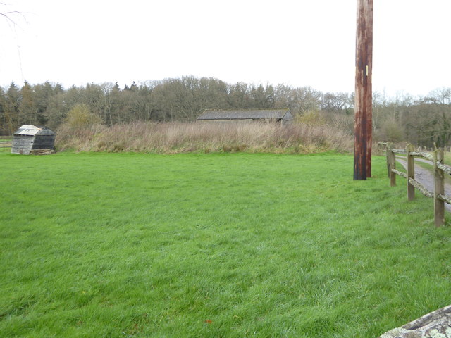
Couzens Hanger is a picturesque woodland area located in Sussex, England. Covering an expansive area, it is a popular destination for nature enthusiasts and hikers alike. The hanger is characterized by its dense forest, which is primarily composed of oak and beech trees, creating a stunning canopy of foliage.
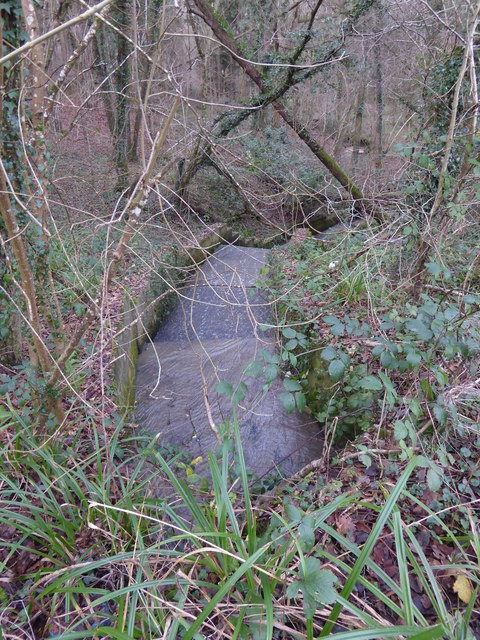
The woodland is known for its diverse flora and fauna, providing a habitat for various species of birds, mammals, and insects. Visitors often catch glimpses of deer, squirrels, and a multitude of bird species as they explore the area. The serene atmosphere and tranquil surroundings make it an ideal spot for birdwatching and nature photography.
Couzens Hanger offers a well-maintained network of trails, providing visitors with the opportunity to explore the woodland at their own pace. These trails wind through the forest, offering breathtaking views of the surrounding countryside and allowing visitors to immerse themselves in the natural beauty of the area.
In addition to its natural charm, Couzens Hanger also boasts a rich history. It is believed to have been used as a hunting ground by local nobility in the Middle Ages. Today, remnants of this history can still be seen in the form of ancient earthworks and boundary markers.
Overall, Couzens Hanger is a haven for those seeking solace in nature. With its lush forest, diverse wildlife, and captivating views, it offers a truly unforgettable experience for all who visit.
If you have any feedback on the listing, please let us know in the comments section below.
Couzens Hanger Images
Images are sourced within 2km of 51.068895/-0.46228322 or Grid Reference TQ0731. Thanks to Geograph Open Source API. All images are credited.


Couzens Hanger is located at Grid Ref: TQ0731 (Lat: 51.068895, Lng: -0.46228322)
Administrative County: West Sussex
District: Horsham
Police Authority: Sussex
What 3 Words
///investors.boasted.stutter. Near Rudgwick, West Sussex
Nearby Locations
Related Wikis

Tisman's Common
Tisman's Common is a hamlet in the Horsham District of West Sussex, England. It stands in the parish of Rudgwick, on the Rudgwick to Loxwood road, 6.4...

The Haven, West Sussex
The Haven is a rural hamlet in West Sussex, south east England located about 7 miles to the west of Horsham.The Haven is primarily an agricultural area...

Rudgwick railway station
Rudgwick railway station was on the Cranleigh Line. It served the village of Rudgwick in West Sussex until June, 1965. == History == Rudgwick station opened...
Rudgwick
Rudgwick is a village and civil parish in the Horsham District of West Sussex, England. The village is 6 miles (10 km) west from Horsham on the north...

Five Oaks
Five Oaks is a large hamlet in the Horsham District of West Sussex, England. It lies about 1.7 miles (2.8 km) north of Billingshurst on the Roman road...

Rikkyo School in England
Rikkyo School in England (立教英国学院, Rikkyō Eikoku Gakuin) is a Japanese boarding primary and secondary school in Rudgwick, Horsham District, West Sussex...

Coppedhall Hanger
Coppedhall Hanger is a 0.6-hectare (1.5-acre) geological Site of Special Scientific Interest north of Billingshurst in West Sussex. It is a Geological...

Holy Trinity Church, Rudgwick
Holy Trinity Church is the Anglican parish church of Rudgwick, a village in the Horsham district of West Sussex, England. The oldest part of the church...
Nearby Amenities
Located within 500m of 51.068895,-0.46228322Have you been to Couzens Hanger?
Leave your review of Couzens Hanger below (or comments, questions and feedback).