An t-Aodann Ban

Settlement in Inverness-shire

Scotland

An t-Aodann Ban

Loch Greshornish
Loch Greshornish Credit: thejackrustles

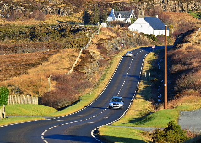
An t-Aodann Ban, also known as White Point, is a beautiful and picturesque location situated in Inverness-shire, Scotland. This coastal area is renowned for its stunning views of the surrounding landscapes, including the Scottish Highlands and the Moray Firth.

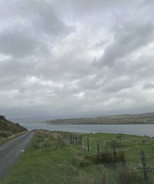
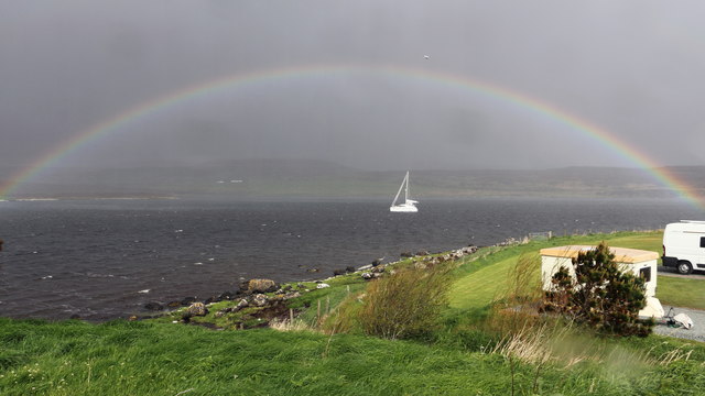
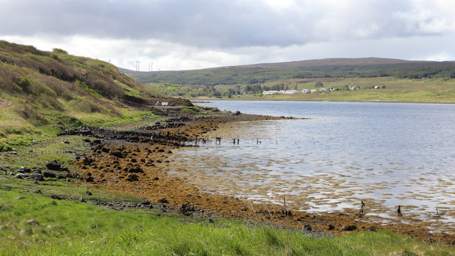
Located in the northern part of Inverness-shire, An t-Aodann Ban is a popular destination for tourists and nature enthusiasts. The area offers a diverse range of outdoor activities, including hiking, birdwatching, and photography. Visitors can explore the rugged coastline, with its rocky cliffs and hidden coves, providing a haven for various bird species, including puffins, guillemots, and gannets.

The landscape of An t-Aodann Ban is characterized by its dramatic scenery and tranquil atmosphere. The rugged cliffs provide a perfect vantage point to observe the breathtaking views of the sea and the distant mountains. The area is also home to an abundance of flora and fauna, including heather, wildflowers, and sea thrift.

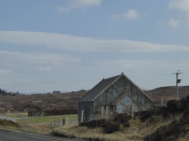
In addition to its natural beauty, An t-Aodann Ban has a rich history. The remains of an Iron Age fort can be found in the vicinity, adding an air of mystery to the area. Exploring these ancient ruins provides visitors with a glimpse into the past and a chance to appreciate the area's cultural heritage.

Overall, An t-Aodann Ban in Inverness-shire offers a unique and unforgettable experience for nature lovers and history enthusiasts alike. Its combination of stunning landscapes, diverse wildlife, and rich history makes it a must-visit destination in Scotland.

If you have any feedback on the listing, please let us know in the comments section below.

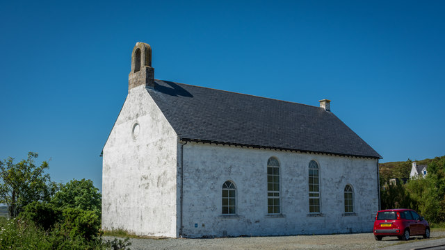
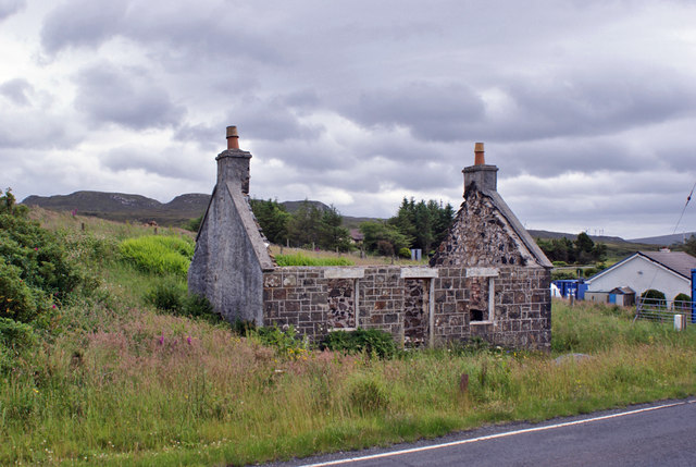
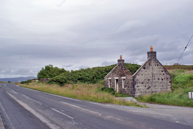
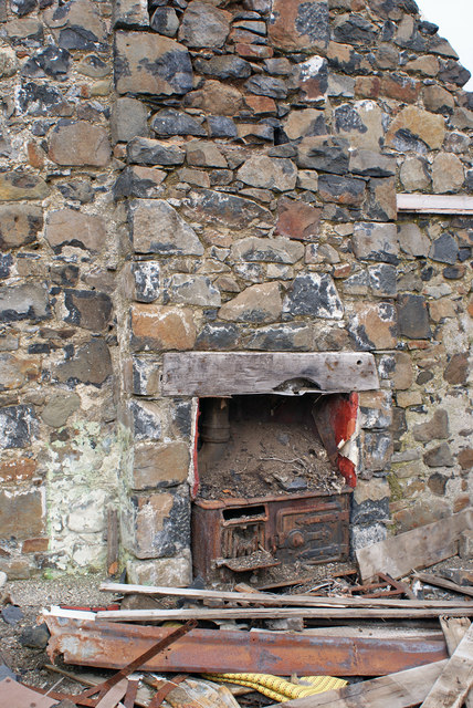
An t-Aodann Ban Images

Images are sourced within 2km of 57.474898/-6.4261615 or Grid Reference NG3451. Thanks to Geograph Open Source API. All images are credited.

Loch Greshornish
Loch Greshornish
Old Morris car in Edinbane Parked in the centre of the village, I think this is a Morris Ten. Built at Cowley in Oxford, the  model was first introduced in 1932 and this one was registered in the West Riding of Yorkshire the following year.
Old Morris car in Edinbane
Parked in the centre of the village, I think this is a Morris Ten. Built at Cowley in Oxford, the model was first introduced in 1932 and this one was registered in the West Riding of Yorkshire the following year.
Abhainn Choisleadar Edinbane's river takes its name (Choisleadar or Coshletter) from cois leitir or leth-tir "the foot of a hillside or half-land". Rising on the slopes of Ben Sca ("mount of fear or shadow"), it descends rapidly to its outflow at the head of Loch Greshornish just below the village.
Abhainn Choisleadar
Edinbane's river takes its name (Choisleadar or Coshletter) from cois leitir or leth-tir "the foot of a hillside or half-land". Rising on the slopes of Ben Sca ("mount of fear or shadow"), it descends rapidly to its outflow at the head of Loch Greshornish just below the village.
Ruins at Lowerglen The footings of a building which appear to be the remains of a relatively recent open-fronted shed see ‘Skye, Lowerglen | Canmore’. 2023. Canmore.org.uk <<span class="nowrap"><a title="https://canmore.org.uk/site/71227/skye-lowerglen" rel="nofollow ugc noopener" href="https://canmore.org.uk/site/71227/skye-lowerglen">Link</a><img style="margin-left:2px;" alt="External link" title="External link - shift click to open in new window" src="https://s1.geograph.org.uk/img/external.png" width="10" height="10"/></span> > [accessed 16 July 2023]
Ruins at Lowerglen
The footings of a building which appear to be the remains of a relatively recent open-fronted shed see ‘Skye, Lowerglen | Canmore’. 2023. Canmore.org.uk <LinkExternal link > [accessed 16 July 2023]
Rainbow over Loch Greshornish  
The photograph was taken from the shore of the Loch from a caravan and camping site at Borve.

See also this rainbow photograph by Norrie Adamson:- &lt;a href=&quot;https://www.geograph.org.uk/photo/109341&quot;&gt;NG3452 : Loch Greshornish, Skye&lt;/a&gt;.
Rainbow over Loch Greshornish
  The photograph was taken from the shore of the Loch from a caravan and camping site at Borve. See also this rainbow photograph by Norrie Adamson:- NG3452 : Loch Greshornish, Skye.
Old walls and fence at Loch Greshornish  
The photograph was taken from the eastern shore of the loch on the southern edge of a caravan and camping site at Borve.

The hamlet in the distance is Coishletter and the summit above the trees beyond is Mullach Ben Sca.

The wind turbines are part of Edinbane Wind Farm.
Old walls and fence at Loch Greshornish
  The photograph was taken from the eastern shore of the loch on the southern edge of a caravan and camping site at Borve. The hamlet in the distance is Coishletter and the summit above the trees beyond is Mullach Ben Sca. The wind turbines are part of Edinbane Wind Farm.
Former Gesto Hospital, Edinbane
A850 near Coishletter, Isle of Skye
A850 at Edinbane, Isle of Skye
Mission Church at Borve, Arnisort When I lived at the nearby Borve Cottage in the early 1990s, this tin clad meeting house was in regular use.    It now appears to be disused and in disrepair.
Mission Church at Borve, Arnisort
When I lived at the nearby Borve Cottage in the early 1990s, this tin clad meeting house was in regular use. It now appears to be disused and in disrepair.
Arnisort Kirk
Arnisort Kirk
Forestry track improvement The track leading into the forest from the main A850 just west of Edinbane has recently been scraped, and the track-side ditches dug out. I suspect this is in preparation for some timber felling operations in the near future.
Forestry track improvement
The track leading into the forest from the main A850 just west of Edinbane has recently been scraped, and the track-side ditches dug out. I suspect this is in preparation for some timber felling operations in the near future.
Edinbane Lodge The Lodge Hotel is under new management, and has been significantly refurbished and re-opened as a fine-dining restaurant named Edinbane Lodge. It is planned that the Lodge will also offer accommodation in the near future.
Edinbane Lodge
The Lodge Hotel is under new management, and has been significantly refurbished and re-opened as a fine-dining restaurant named Edinbane Lodge. It is planned that the Lodge will also offer accommodation in the near future.
Derelict cottage in Flashader Until recently, this long-uninhabited roadside cottage was roofed and had windows and door. When builders turned up, I had thought that restoration was underway, but it now looks like the cottage is to be left derelict.
Other views: &lt;a href=&quot;https://www.geograph.org.uk/photo/6199938&quot;&gt;NG3553 : Derelict cottage, Flashader&lt;/a&gt;, &lt;a href=&quot;https://www.geograph.org.uk/photo/6199944&quot;&gt;NG3553 : Cooking range in derelict cottage&lt;/a&gt;.
Derelict cottage in Flashader
Until recently, this long-uninhabited roadside cottage was roofed and had windows and door. When builders turned up, I had thought that restoration was underway, but it now looks like the cottage is to be left derelict. Other views: NG3553 : Derelict cottage, Flashader, NG3553 : Cooking range in derelict cottage.
Derelict cottage, Flashader Another view of the small and now roofless cottage in Flashader.
The road is the A850.
See also: &lt;a href=&quot;https://www.geograph.org.uk/photo/6199935&quot;&gt;NG3553 : Derelict cottage in Flashader&lt;/a&gt; and &lt;a href=&quot;https://www.geograph.org.uk/photo/6199944&quot;&gt;NG3553 : Cooking range in derelict cottage&lt;/a&gt;.
Derelict cottage, Flashader
Another view of the small and now roofless cottage in Flashader. The road is the A850. See also: NG3553 : Derelict cottage in Flashader and NG3553 : Cooking range in derelict cottage.
Cooking range in derelict cottage Detail of the interior of a derelict cottage in Flashader (see also &lt;a href=&quot;https://www.geograph.org.uk/photo/6199935&quot;&gt;NG3553 : Derelict cottage in Flashader&lt;/a&gt;). 
The tiny cottage had two fireplaces - this one housing a cast iron range.
Cooking range in derelict cottage
Detail of the interior of a derelict cottage in Flashader (see also NG3553 : Derelict cottage in Flashader). The tiny cottage had two fireplaces - this one housing a cast iron range.
Cottages in Lowerglen The minor road ends at Greshornish - behind the photographer.
Cottages in Lowerglen
The minor road ends at Greshornish - behind the photographer.
Old petrol pump at Edinbane The decrepit pump still stands forlornly outside &lt;a href=&quot;https://www.geograph.org.uk/photo/2141425&quot;&gt;NG3451 : The Edinbane Shop&lt;/a&gt; twelve years after the business closed. The notice at the right warns drivers that they will be charged double the price shown on the dial for fuel - this was a commonplace workaround after prices reached one pound per litre, as the maximum setting on many of the older pumps was 99 (or 99.9) pence.
Old petrol pump at Edinbane
The decrepit pump still stands forlornly outside NG3451 : The Edinbane Shop twelve years after the business closed. The notice at the right warns drivers that they will be charged double the price shown on the dial for fuel - this was a commonplace workaround after prices reached one pound per litre, as the maximum setting on many of the older pumps was 99 (or 99.9) pence.
Show me another place!

An t-Aodann Ban is located at Grid Ref: NG3451 (Lat: 57.474898, Lng: -6.4261615)

Unitary Authority: Highland

Police Authority: Highlands and Islands

Also known as: Edinbane

What 3 Words

///pricier.sleeps.mountains. Near Dunvegan, Highland

Related Wikis

A850 road

The A850 road is a road in the Scottish Isles, off the west coast of mainland Scotland. == Road function == It is one of the principal roads of the Isle...

Edinbane

Edinbane (Scottish Gaelic: An t-Aodann Bàn the fair hill-face) is a small village on the island of Skye, Scotland. == Location == Edinbane lies on the...

Flashader

Flashader (Scottish Gaelic: Flaiseader) is a small crofting township close to the east coast of the sea loch Loch Greshornish on the Isle of Skye. It is...

Suladale

Suladale or Suledale (Scottish Gaelic: Sùladal) is a small mixed crofting hamlet of fewer than a dozen houses, located near Edinbane, on the north of...

Nearby Amenities

Located within 500m of 57.474898,-6.4261615
Created By: dmgroom_coastlines
Source: PGS
Lat/Long: 57.47588/-6.43259
Source: PGS
Lat/Long: 57.4755258/-6.4317347
Created By: dmgroom_coastlines
Source: PGS
Lat/Long: 57.47254/-6.43187
Created By: dmgroom_coastlines
Source: PGS
Lat/Long: 57.47267/-6.43234
Created By: dmgroom_coastlines
Source: PGS
Lat/Long: 57.47268/-6.43281
Bus Stop
Upper Edinbane
Naptan AtcoCode: 6700713376
Naptan Bearing: NW
Naptan CommonName: Upper Edinbane
Naptan Indicator: at Houses
Naptan Landmark: Houses
Naptan NaptanCode: 45328676
Naptan Street: off A850
Naptan Verified: no
Source: naptan_import
Lat/Long: 57.4714079/-6.4226742
Edinbane
Name En: Edinbane
Name Ga: An t-Aodann Bán
Name Gd: An t-Aodann Bàn
Place: village
Wikidata: Q2982302
Wikipedia: en:Edinbane
Lat/Long: 57.4710792/-6.4291983
Post Box
Ref: IV51 12
Source: survey
Lat/Long: 57.4711742/-6.4302009
Telephone
Booth: K6
Covered: booth
Source: survey
Lat/Long: 57.4751523/-6.4262354
Power: pole
Lat/Long: 57.4792786/-6.4273345
Power: pole
Lat/Long: 57.4784495/-6.4267981
Power: pole
Lat/Long: 57.4780385/-6.4265513
Power: pole
Lat/Long: 57.4774103/-6.4261932
Power: pole
Lat/Long: 57.4767623/-6.4258137
Power: pole
Lat/Long: 57.4761797/-6.4254516
Power: pole
Lat/Long: 57.4756937/-6.4251485
Power: pole
Lat/Long: 57.4752409/-6.4248723
Power: pole
Lat/Long: 57.4744809/-6.4242876
Power: pole
Lat/Long: 57.4738564/-6.4237914
Power: pole
Lat/Long: 57.4734613/-6.4234936
Power: pole
Lat/Long: 57.4729925/-6.423094
Power: pole
Lat/Long: 57.4714941/-6.4218226
Power: pole
Lat/Long: 57.4723147/-6.4225106
Power: pole
Lat/Long: 57.4718409/-6.4248146
Power: pole
Lat/Long: 57.4716195/-6.4258754
Power: pole
Lat/Long: 57.4714003/-6.4269416
Power: pole
Lat/Long: 57.4711493/-6.4280762
Power: pole
Lat/Long: 57.4708984/-6.42931
Power: pole
Lat/Long: 57.4764925/-6.4302453
Power: pole
Lat/Long: 57.4767696/-6.4290275
Power: pole
Lat/Long: 57.4769925/-6.428019
Power: pole
Lat/Long: 57.4771343/-6.4274191
Recycling
Recycling Clothes: yes
Recycling Type: container
Lat/Long: 57.4714844/-6.4303313
Recycling
Recycling Glass Bottles: yes
Recycling Type: container
Lat/Long: 57.4715266/-6.4303488
The data included in this document is from www.openstreetmap.org. The data is made available under ODbL.

Have you been to An t-Aodann Ban?

Leave your review of An t-Aodann Ban below (or comments, questions and feedback).