Collins Copse

Wood, Forest in Surrey Waverley

England

Collins Copse

Cox Green Road, near Rudgwick Cox Green Road near Rudgwick, on the borders of Surrey and West Sussex.  Here, a bridge carries the road over the course of a dismantled railway.

Much of the dismantled railway forms the route of the Downs Link path and route 223 of the National Cycle Network.  A short distance south of this location, however, the railway passed through a tunnel.  The tunnel is closed, therefore the path and cycle route climb up to the road, crossing the bridge then passing through woodland before rejoining the railway route.
Cox Green Road, near Rudgwick Credit: Malc McDonald

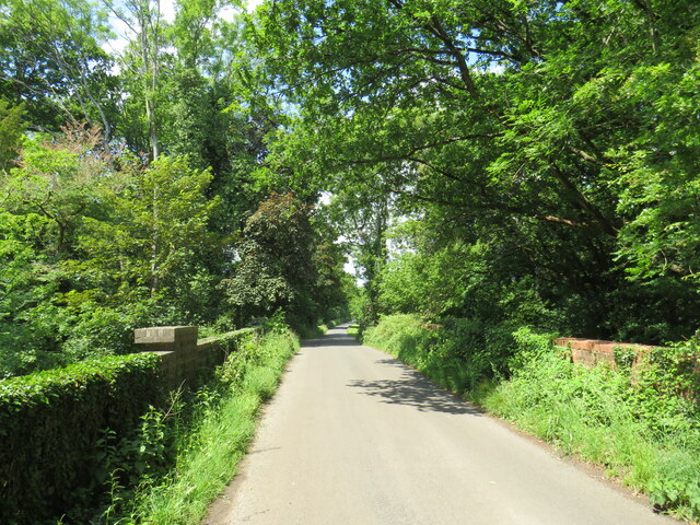
Collins Copse is a picturesque woodland located in Surrey, England. Situated on the outskirts of the village of Surrey Hills, the copse spans over 50 acres of land, providing a tranquil retreat for nature enthusiasts and hikers alike.

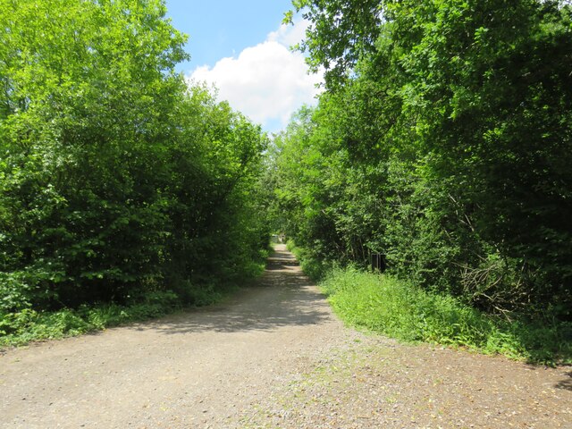
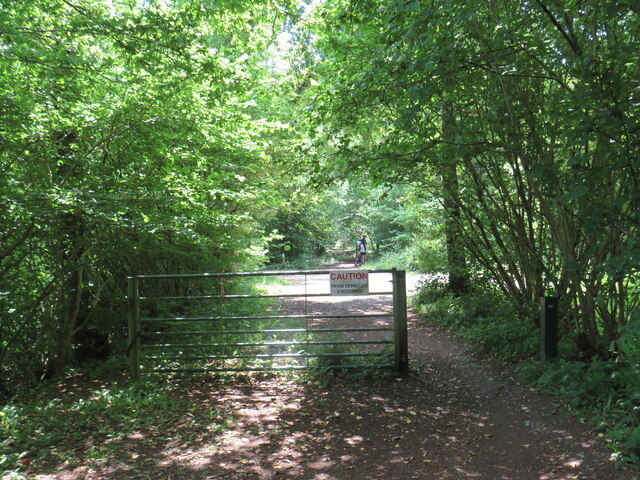
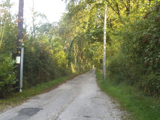
The copse is predominantly composed of a diverse range of deciduous trees, including oak, ash, beech, and birch. These trees create a dense canopy, which not only adds to the copse's beauty but also provides a habitat for a variety of wildlife species.

The forest floor is covered in a thick carpet of moss, ferns, and wildflowers, creating a vibrant and colorful display throughout the year. In the spring, bluebells blanket the ground, creating a breathtaking sight. In the autumn months, the copse is transformed into a golden paradise as the leaves change color.

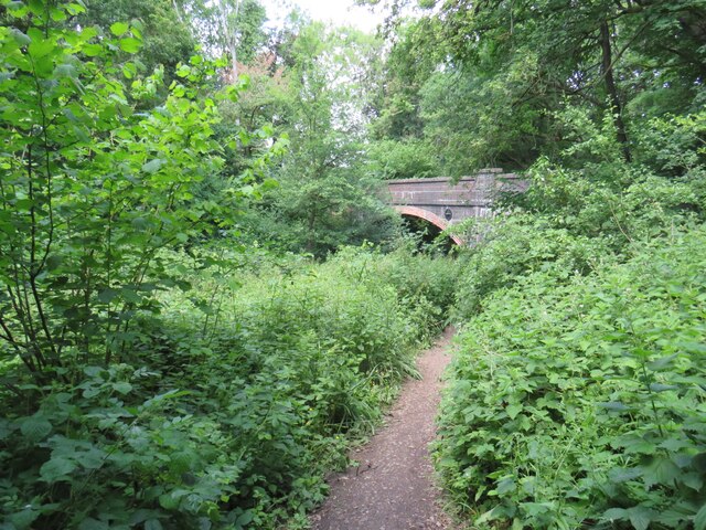
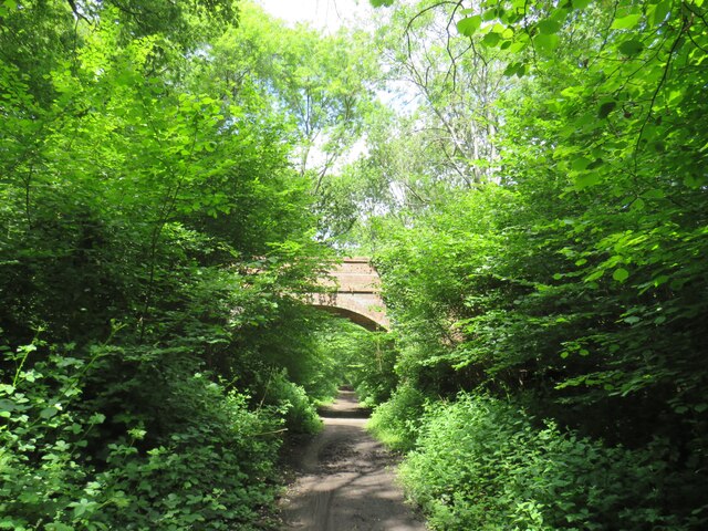
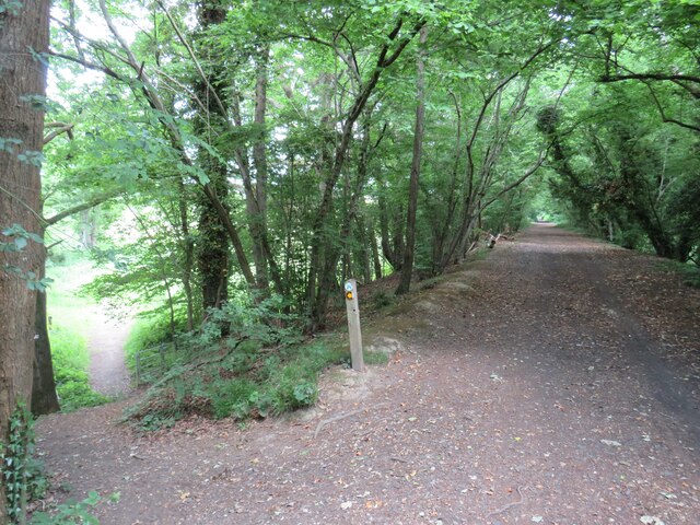
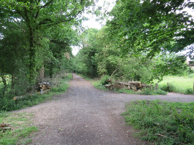
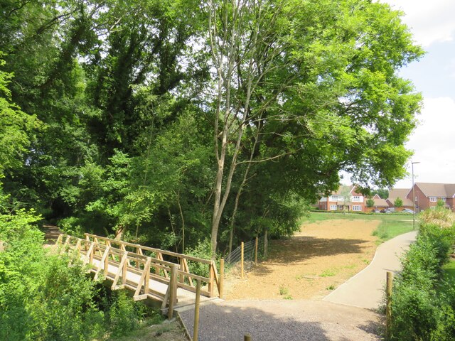
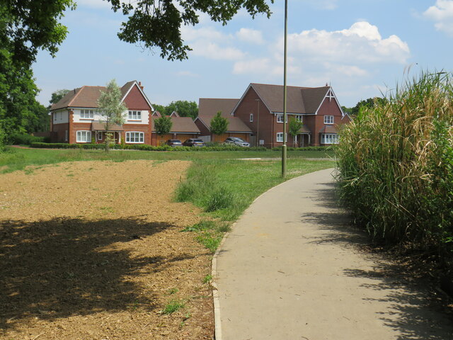
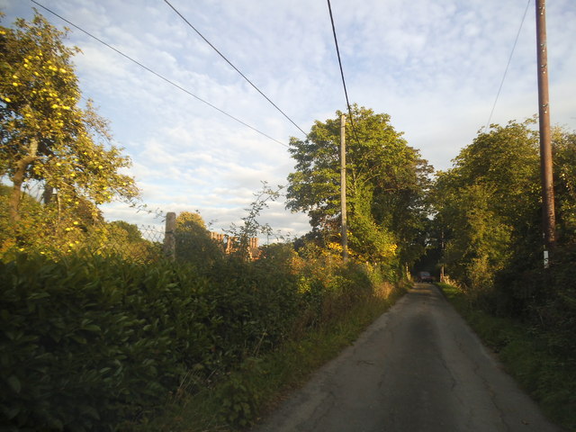
Collins Copse is crisscrossed by a network of well-maintained footpaths, allowing visitors to explore the woodland at their own pace. These paths lead to picturesque viewpoints, tranquil ponds, and babbling brooks, enhancing the copse's natural beauty.

The copse is also home to a wide array of wildlife, including deer, foxes, badgers, and various bird species. Nature lovers can often spot these creatures in their natural habitat, making Collins Copse a popular destination for birdwatchers and wildlife photographers.

Overall, Collins Copse is a captivating woodland that offers a peaceful and enchanting escape from the hustle and bustle of everyday life. Its natural beauty, diverse flora and fauna, and well-maintained trails make it a must-visit destination for those seeking a connection with nature.

If you have any feedback on the listing, please let us know in the comments section below.

Collins Copse Images

Images are sourced within 2km of 51.116154/-0.47200221 or Grid Reference TQ0736. Thanks to Geograph Open Source API. All images are credited.

Cox Green Road, near Rudgwick Cox Green Road near Rudgwick, on the borders of Surrey and West Sussex.  Here, a bridge carries the road over the course of a dismantled railway.

Much of the dismantled railway forms the route of the Downs Link path and route 223 of the National Cycle Network.  A short distance south of this location, however, the railway passed through a tunnel.  The tunnel is closed, therefore the path and cycle route climb up to the road, crossing the bridge then passing through woodland before rejoining the railway route.
Cox Green Road, near Rudgwick
Cox Green Road near Rudgwick, on the borders of Surrey and West Sussex. Here, a bridge carries the road over the course of a dismantled railway. Much of the dismantled railway forms the route of the Downs Link path and route 223 of the National Cycle Network. A short distance south of this location, however, the railway passed through a tunnel. The tunnel is closed, therefore the path and cycle route climb up to the road, crossing the bridge then passing through woodland before rejoining the railway route.
Downs Link near Rudgwick The Downs Link path descending into a railway cutting where it will pass beneath the bridge visible ahead.  The path also forms part of route 223 of the National Cycle Network.

Much of the Downs Link path follows the course of a dismantled railway.  The tunnel is closed, therefore the path and cycle route climb through woodland to avoid the tunnel before rejoining the railway route.
Downs Link near Rudgwick
The Downs Link path descending into a railway cutting where it will pass beneath the bridge visible ahead. The path also forms part of route 223 of the National Cycle Network. Much of the Downs Link path follows the course of a dismantled railway. The tunnel is closed, therefore the path and cycle route climb through woodland to avoid the tunnel before rejoining the railway route.
Baynards station building, near Horsham Baynards station was situated in Surrey countryside close to the Sussex border.  The station closed in 1965, along with the railway which passed through it.  The building survives, however, and is used as a private house.

The driveway past the station forms part of the route of the Downs Link path, which itself forms part of route 223 of the National Cycle Network.

For more information about Baynards station, including photographs taken when it was still operating as a station, see the Disused Stations website: <span class="nowrap"><a title="http://www.disused-stations.org.uk/b/baynards/index.shtml" rel="nofollow ugc noopener" href="http://www.disused-stations.org.uk/b/baynards/index.shtml">Link</a><img style="margin-left:2px;" alt="External link" title="External link - shift click to open in new window" src="https://s1.geograph.org.uk/img/external.png" width="10" height="10"/></span>
Baynards station building, near Horsham
Baynards station was situated in Surrey countryside close to the Sussex border. The station closed in 1965, along with the railway which passed through it. The building survives, however, and is used as a private house. The driveway past the station forms part of the route of the Downs Link path, which itself forms part of route 223 of the National Cycle Network. For more information about Baynards station, including photographs taken when it was still operating as a station, see the Disused Stations website: LinkExternal link
Downs Link near Cranleigh The Downs Link path follows a dismantled railway line for most of its length.  It also forms part of route 223 of the National Cycle Network.
Downs Link near Cranleigh
The Downs Link path follows a dismantled railway line for most of its length. It also forms part of route 223 of the National Cycle Network.
Farm track near Cranleigh A track leading to a farm in the Surrey countryside near Cranleigh.
Farm track near Cranleigh
A track leading to a farm in the Surrey countryside near Cranleigh.
Downs Link near Cranleigh The Downs Link path follows a dismantled railway line for most of its length.  It also forms part of route 223 of the National Cycle Network.
Downs Link near Cranleigh
The Downs Link path follows a dismantled railway line for most of its length. It also forms part of route 223 of the National Cycle Network.
Downs Link near Cranleigh The Downs Link path follows a dismantled railway line for most of its length.  It also forms part of route 223 of the National Cycle Network.  Here, the former railway line ran along an embankment.  A footpath descends to the left.
Downs Link near Cranleigh
The Downs Link path follows a dismantled railway line for most of its length. It also forms part of route 223 of the National Cycle Network. Here, the former railway line ran along an embankment. A footpath descends to the left.
Downs Link near Cranleigh The Downs Link path follows a dismantled railway line for most of its length.  It also forms part of route 223 of the National Cycle Network.
Downs Link near Cranleigh
The Downs Link path follows a dismantled railway line for most of its length. It also forms part of route 223 of the National Cycle Network.
Path to Dapples Lane, Cranleigh A path leading into a new housing development in Cranleigh, in Surrey.  The wooden bridge to the left takes another path across a stream.
Path to Dapples Lane, Cranleigh
A path leading into a new housing development in Cranleigh, in Surrey. The wooden bridge to the left takes another path across a stream.
Bridge over a stream, Cranleigh The bridge was built to carry a railway line across a stream on the outskirts of Cranleigh.  The railway closed in 1965 and was dismantled, but the Downs Link path now follows the railway alignment, crossing the bridge.  Downs Link also forms part of route 223 of the National Cycle Network.
Bridge over a stream, Cranleigh
The bridge was built to carry a railway line across a stream on the outskirts of Cranleigh. The railway closed in 1965 and was dismantled, but the Downs Link path now follows the railway alignment, crossing the bridge. Downs Link also forms part of route 223 of the National Cycle Network.
Footpath to Dapples Lane, Cranleigh A path leading into a new housing development on the outskirts of Cranleigh, in Surrey.
Footpath to Dapples Lane, Cranleigh
A path leading into a new housing development on the outskirts of Cranleigh, in Surrey.
Lawns Road at the junction of Cox Green Road
Lawns Road, Baynards
House with chimneys on Cox Green Road I have another picture of the one next door with a lot more than this.
House with chimneys on Cox Green Road
I have another picture of the one next door with a lot more than this.
Multiple chimneys on Cox Green Road I'm sure they don't need most of them but the architect went wild with the pseudo period design.
Multiple chimneys on Cox Green Road
I'm sure they don't need most of them but the architect went wild with the pseudo period design.
Bungalow on Lawns Road, Baynards This appears to be a holiday chalet and has a sports field next to it.
Bungalow on Lawns Road, Baynards
This appears to be a holiday chalet and has a sports field next to it.
Lawns Road, Baynards
Cox Green Road, Baynards
Show me another place!

Collins Copse is located at Grid Ref: TQ0736 (Lat: 51.116154, Lng: -0.47200221)

Administrative County: Surrey

District: Waverley

Police Authority: Surrey

What 3 Words

///developer.stop.airfields. Near Cranleigh, Surrey

Nearby Locations

Collins Copse

Related Wikis

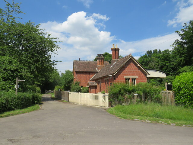
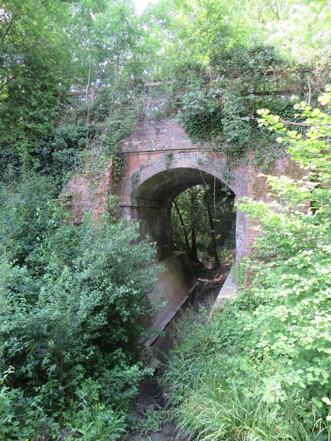
Baynards railway station

Baynards was a railway station on the Cranleigh Line, between Guildford, Surrey, and Horsham, West Sussex, England. The station opened with the line on...

Baynards Park

Baynards Park is a 2,000 acres (810 ha) estate and site of a demolished country house with extant outbuildings, privately owned, in the south of the parishes...

Longhurst Lodge

Longhurst Lodge is a Grade II listed building in Cranleigh, Surrey, England. It is located on the former Baynards Park estate, about a quarter of a mile...

Cranleigh

Cranleigh is a village and civil parish, about 8 miles (13 km) southeast of Guildford in Surrey, England. It lies on a minor road east of the A281, which...

Rikkyo School in England

Rikkyo School in England (立教英国学院, Rikkyō Eikoku Gakuin) is a Japanese boarding primary and secondary school in Rudgwick, Horsham District, West Sussex...

Holy Trinity Church, Rudgwick

Holy Trinity Church is the Anglican parish church of Rudgwick, a village in the Horsham district of West Sussex, England. The oldest part of the church...

Cranleigh railway station

Cranleigh was a railway station on the Cranleigh Line between Guildford and Horsham. It served the village of Cranleigh, Surrey in southern England....

Rudgwick

Rudgwick is a village and civil parish in the Horsham District of West Sussex, England. The village is 6 miles (10 km) west from Horsham on the north...

Nearby Amenities

Located within 500m of 51.116154,-0.47200221
Collins Farm
Note Retag: CS #48756035
Place: farm
Source: npe
Lat/Long: 51.1153675/-0.4675111
Moat
Historic: archaeological_site
Source: npe
Lat/Long: 51.1201717/-0.4750909
The data included in this document is from www.openstreetmap.org. The data is made available under ODbL.

Have you been to Collins Copse?

Leave your review of Collins Copse below (or comments, questions and feedback).