Battlers Wells Wood
Wood, Forest in Middlesex
England
Battlers Wells Wood

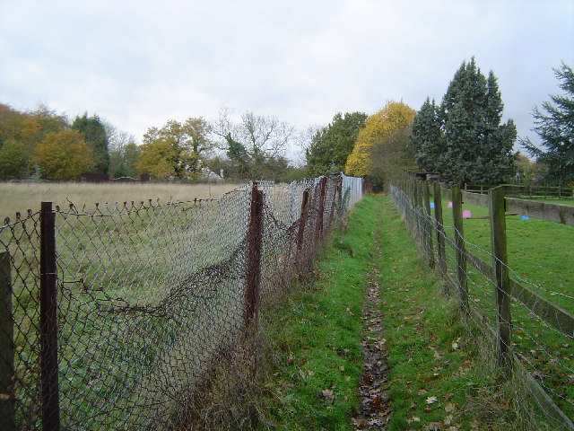
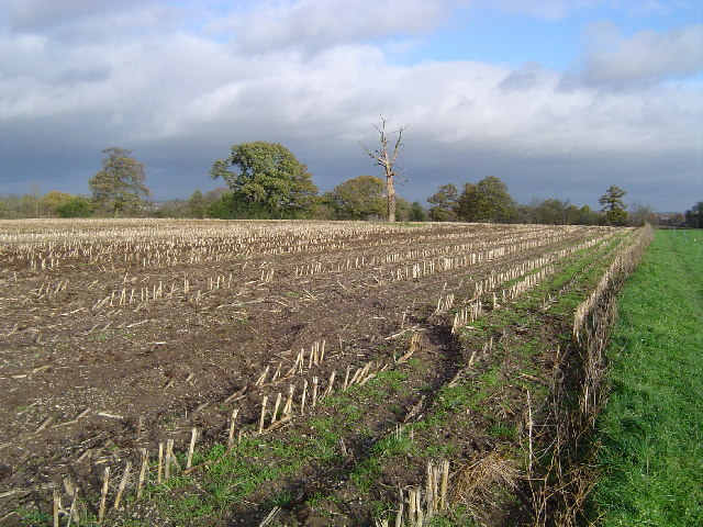
Battlers Wells Wood, Middlesex, also known as Wood or Forest, is a picturesque natural area located in the county of Middlesex, England. Spanning approximately 200 acres, the wood is a haven for nature enthusiasts and those seeking a peaceful retreat from the bustling city life.
The wood is characterized by its diverse range of flora and fauna, with an array of tree species including oak, beech, and birch. The dense foliage provides a habitat for various woodland creatures such as squirrels, foxes, and a variety of bird species, making it a popular spot for birdwatchers and wildlife photographers.
Battlers Wells Wood offers a network of walking trails, allowing visitors to explore the beauty of the wood at their own pace. These paths wind through the enchanting forest, offering glimpses of babbling brooks, wildflowers, and moss-covered rocks. The wood's peaceful ambiance makes it an ideal spot for nature walks, picnics, and meditation.
In addition to its natural beauty, Battlers Wells Wood holds historical significance. The wood has been well-preserved over the years, with evidence of human activity dating back to the Roman era. Archaeological discoveries suggest that the wood was once used as a hunting ground for the Roman elite.
Overall, Battlers Wells Wood, Middlesex, is a captivating destination that offers a blend of natural splendor and historical significance. Whether visitors seek tranquility, a chance to connect with nature, or a glimpse into the past, this wood has something to offer for everyone.
If you have any feedback on the listing, please let us know in the comments section below.
Battlers Wells Wood Images
Images are sourced within 2km of 51.610398/-0.45588456 or Grid Reference TQ0791. Thanks to Geograph Open Source API. All images are credited.


Battlers Wells Wood is located at Grid Ref: TQ0791 (Lat: 51.610398, Lng: -0.45588456)
Unitary Authority: Hillingdon
Police Authority: Metropolitan
What 3 Words
///honest.only.small. Near Harefield, London
Nearby Locations
Related Wikis
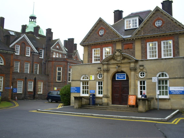
Mount Vernon Hospital
Mount Vernon Hospital is located in Northwood, an area of north-west Greater London. It is one of two hospitals run by The Hillingdon Hospitals NHS Foundation...

Denville Hall
Denville Hall is a historic building in Northwood, a town in the London Borough of Hillingdon, England, which is used as a retirement home for professional...

1948 Northwood mid-air collision
The 1948 Northwood mid-air collision took place on 4 July at 15:03 when a Douglas DC-6 of Scandinavian Airlines System (SAS) and an Avro York C.1 of the...

Ruislip, Northwood and Pinner (UK Parliament constituency)
Ruislip, Northwood and Pinner is a constituency in Greater London represented in the House of Commons of the UK Parliament since 2019 by David Simmonds...

Harefield Academy
Harefield Academy is a secondary school and sixth form in Uxbridge, London. Located on the site of the former community school, John Penrose School, which...
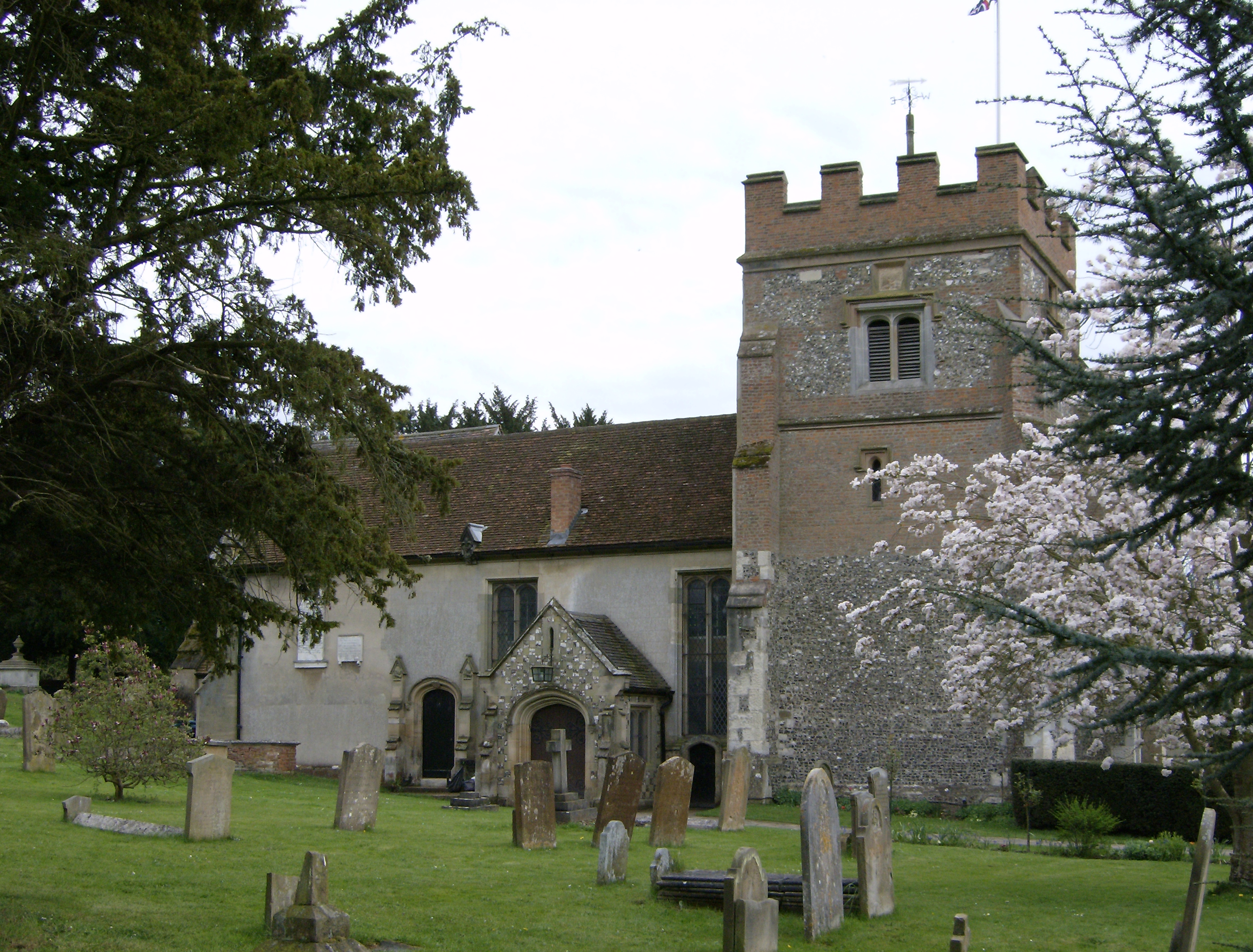
Harefield
Harefield is a village in the London Borough of Hillingdon, England, 17 miles (27 km) northwest of Charing Cross near Greater London's boundary with Buckinghamshire...
London School of Theology
The London School of Theology (LST), formerly London Bible College, is a British interdenominational evangelical theological college based in Northwood...
Harefield United F.C.
Harefield United Football Club are an English football club based in Harefield in the London Borough of Hillingdon. The club is the oldest in Middlesex...
Nearby Amenities
Located within 500m of 51.610398,-0.45588456Have you been to Battlers Wells Wood?
Leave your review of Battlers Wells Wood below (or comments, questions and feedback).