Blackets Wood

Wood, Forest in Hertfordshire Three Rivers

England

Blackets Wood

Grand Union Canal: Lock Number 77: Iron Bridge Lock Lock Number 77 viewed looking north.
Grand Union Canal: Lock Number 77: Iron Bridge Lock Credit: Nigel Cox

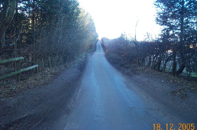
Blackets Wood is a picturesque woodland located in Hertfordshire, England. Covering an area of approximately 56 hectares, it is nestled in the heart of the county and is a popular destination for nature enthusiasts and walkers alike.

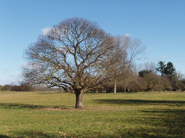
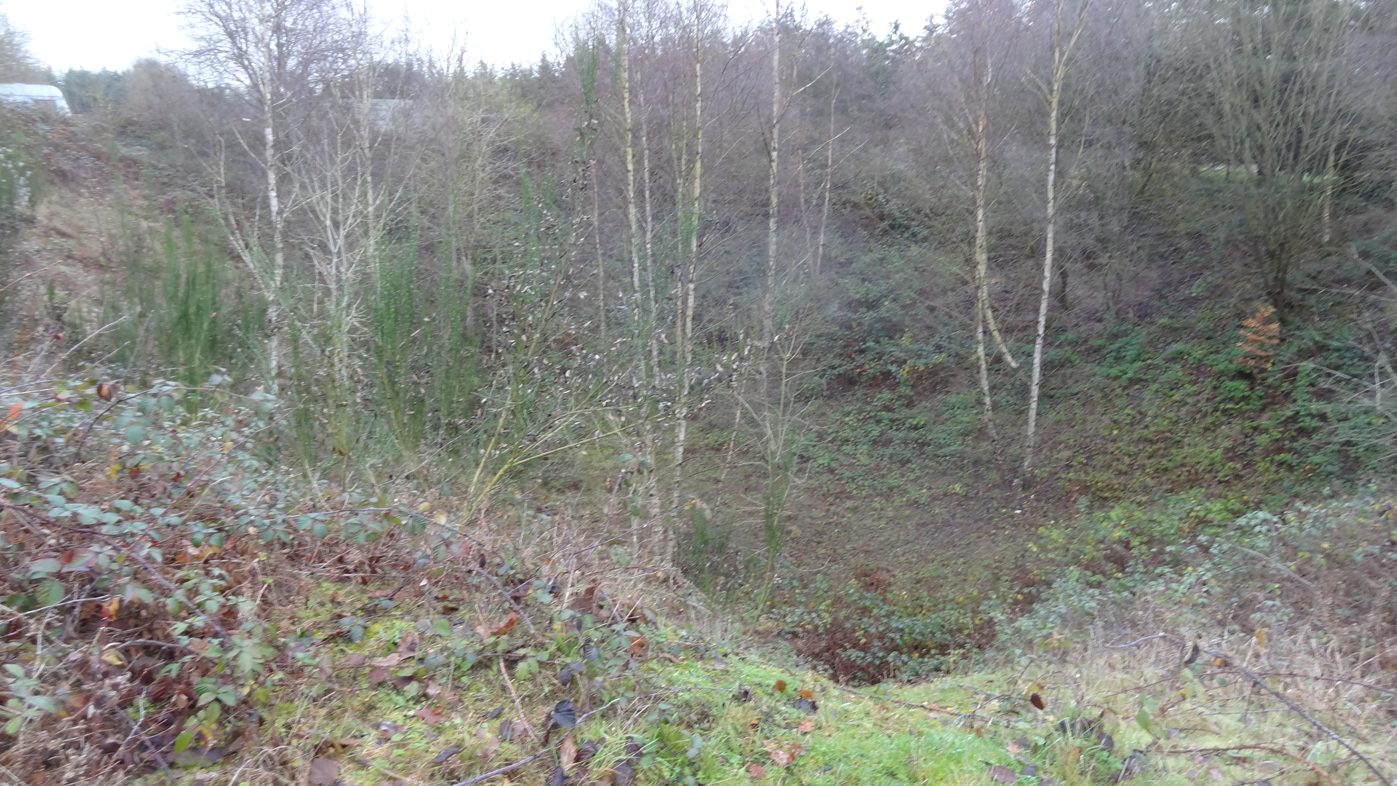
The wood is characterized by its diverse and rich flora and fauna. It boasts a variety of tree species, including oak, birch, and beech, which create a beautiful and vibrant canopy. The forest floor is adorned with bluebells during the spring, creating a stunning carpet of color. Additionally, the wood is home to a plethora of wildlife, such as squirrels, deer, and numerous bird species.

The woodland offers a network of well-maintained walking trails, allowing visitors to explore its natural beauty at their leisure. These paths wind through the forest, leading to open meadows, tranquil ponds, and hidden clearings. The wood also features a picnic area, providing a perfect spot for visitors to enjoy a packed lunch amidst nature.

Blackets Wood is managed by the Woodland Trust, a conservation charity dedicated to preserving and protecting woodland areas across the UK. The trust ensures that the wood remains a haven for wildlife and a peaceful escape for visitors.

Overall, Blackets Wood is a serene and enchanting woodland, offering a tranquil retreat from the hustle and bustle of everyday life. Its natural beauty, diverse wildlife, and well-maintained trails make it a must-visit destination for nature lovers and those seeking a peaceful respite.

If you have any feedback on the listing, please let us know in the comments section below.

Blackets Wood Images

Images are sourced within 2km of 51.670554/-0.45450518 or Grid Reference TQ0697. Thanks to Geograph Open Source API. All images are credited.

Grand Union Canal: Lock Number 77: Iron Bridge Lock Lock Number 77 viewed looking north.
Grand Union Canal: Lock Number 77: Iron Bridge Lock
Lock Number 77 viewed looking north.
Grand Union Canal: Lock Number 77: Iron Bridge Lock Lock Number 77 viewed looking south.
Grand Union Canal: Lock Number 77: Iron Bridge Lock
Lock Number 77 viewed looking south.
Croxley Green: Lone tree near Dell Wood Viewed looking south across rolling arable farmland from the public footpath from Rousebarn Lane, with the houses in Croxley Green just visible on the horizon. This point is about 28 kilometres, or about 17 miles, as the crow flies, from Charing Cross railway station in central London!
Croxley Green: Lone tree near Dell Wood
Viewed looking south across rolling arable farmland from the public footpath from Rousebarn Lane, with the houses in Croxley Green just visible on the horizon. This point is about 28 kilometres, or about 17 miles, as the crow flies, from Charing Cross railway station in central London!
Croxley Green: Baldwins Lane The parade of community shops at the western end of Croxley Green.
Croxley Green: Baldwins Lane
The parade of community shops at the western end of Croxley Green.
Croxley Green The Green viewed looking northwards. The road to Sarratt goes straight ahead. The name Croxley is reputedly derived from Croc's Lea in Saxon times, and the Green has been owned at various times by the Church, the Crown, and Gonville and Caius College, Cambridge. In 1945 it was sold by the College to Rickmansworth Urban District Council, and is now owned and maintained by their successors, Three Rivers District Council.
Croxley Green
The Green viewed looking northwards. The road to Sarratt goes straight ahead. The name Croxley is reputedly derived from Croc's Lea in Saxon times, and the Green has been owned at various times by the Church, the Crown, and Gonville and Caius College, Cambridge. In 1945 it was sold by the College to Rickmansworth Urban District Council, and is now owned and maintained by their successors, Three Rivers District Council.
Watford: Whippendell Wood Possibly the most boring photograph ever to be uploaded onto the site! Footpath, field, trees, sky. Whippendell Wood viewed looking eastwards, Rousebarn Lane runs behind the hedge at the bottom of the field.
Watford: Whippendell Wood
Possibly the most boring photograph ever to be uploaded onto the site! Footpath, field, trees, sky. Whippendell Wood viewed looking eastwards, Rousebarn Lane runs behind the hedge at the bottom of the field.
Grand Union Canal: near Grove Mill Lane bridge, Watford Viewed looking northwards from the Grove Mill Lane bridge, the canal makes a right angled turn here, hence the need for a wide channel to enable long narrow boats to make the turn.
Grand Union Canal: near Grove Mill Lane bridge, Watford
Viewed looking northwards from the Grove Mill Lane bridge, the canal makes a right angled turn here, hence the need for a wide channel to enable long narrow boats to make the turn.
Watford: The Grove Mill The former mill building in Grove Mill Lane now converted into residential use.
Watford: The Grove Mill
The former mill building in Grove Mill Lane now converted into residential use.
Sarratt: Buckshill Bottom valley A dry valley viewed looking eastwards from a footpath to Newhall Farm near Sarratt.
Sarratt: Buckshill Bottom valley
A dry valley viewed looking eastwards from a footpath to Newhall Farm near Sarratt.
Sarratt: Great Wood, Micklefield Green Sylvan tranquility in this mixed deciduous and coniferous woodland. The only problem is that it is less than 300 metres away from the M25 Motorway...
Sarratt: Great Wood, Micklefield Green
Sylvan tranquility in this mixed deciduous and coniferous woodland. The only problem is that it is less than 300 metres away from the M25 Motorway...
Chandler's Cross: Fir Tree Hill Fir Tree Hill is the name of the road, viewed looking westwards towards Chandler's Cross.
Chandler's Cross: Fir Tree Hill
Fir Tree Hill is the name of the road, viewed looking westwards towards Chandler's Cross.
M25 Motorway Link Road, Chandler's Cross This is the spur road leading to Junction 19 of the M25 Motorway from the Hunton Bridge roundabout, viewed looking westwards from the Langleybury Lane overbridge. Traffic is usually stationary westbound on this stretch during the weekday morning rush hour, but the road is virtually deserted on a Sunday morning. This particular road existed as the A405 trunk road, by-passing Watford, for many years prior to the M25 being built, and the route of the A405 was also incorporated into the motorway from Junction 19 to Junction 17 at Maple Cross. The distant dark triangular shaped structure is the gantry holding a conveyor belt crossing the road, associated with the numerous gravel pit workings in the vicinity.
M25 Motorway Link Road, Chandler's Cross
This is the spur road leading to Junction 19 of the M25 Motorway from the Hunton Bridge roundabout, viewed looking westwards from the Langleybury Lane overbridge. Traffic is usually stationary westbound on this stretch during the weekday morning rush hour, but the road is virtually deserted on a Sunday morning. This particular road existed as the A405 trunk road, by-passing Watford, for many years prior to the M25 being built, and the route of the A405 was also incorporated into the motorway from Junction 19 to Junction 17 at Maple Cross. The distant dark triangular shaped structure is the gantry holding a conveyor belt crossing the road, associated with the numerous gravel pit workings in the vicinity.
Chandler's Cross: Oldhouse Lane Viewed looking westwards up Juniper Hill from Beechen Bottom.
Chandler's Cross: Oldhouse Lane
Viewed looking westwards up Juniper Hill from Beechen Bottom.
M25 Motorway, Chandler's Cross Viewed looking south westwards from the Chandler's Lane overbridge.
M25 Motorway, Chandler's Cross
Viewed looking south westwards from the Chandler's Lane overbridge.
Loudwater: Welling Grove wood Viewed looking westwards from Sarratt Road.
Loudwater: Welling Grove wood
Viewed looking westwards from Sarratt Road.
Redhall farm, Chandler's Cross View north-east near the junction of Sarrat Road and Redhall Lane
Redhall farm, Chandler's Cross
View north-east near the junction of Sarrat Road and Redhall Lane
Grand Union Canal, near Watford Looking north from Lady Capel's Lock. The M25 bridge is just beyond this stretch.
Grand Union Canal, near Watford
Looking north from Lady Capel's Lock. The M25 bridge is just beyond this stretch.
The Grove Bridge, Grand Union Canal The Earl of Clarendon insisted on an elegant bridge when the canal was routed across his land. The bridge was restored in 1987 by the Railway Heritage Trust, British Waterways Board, and British Rail Property Board.
The Grove Bridge, Grand Union Canal
The Earl of Clarendon insisted on an elegant bridge when the canal was routed across his land. The bridge was restored in 1987 by the Railway Heritage Trust, British Waterways Board, and British Rail Property Board.
Show me another place!

Blackets Wood is located at Grid Ref: TQ0697 (Lat: 51.670554, Lng: -0.45450518)

Administrative County: Hertfordshire

District: Three Rivers

Police Authority: Hertfordshire

What 3 Words

///maybe.spot.prom. Near Rickmansworth, Hertfordshire

Related Wikis

Whippendell Wood

Whippendell Wood (or Whippendell Woods) is an ancient woodland on the edges of Watford, England, covering an area of 165.3 acres (66.9 ha). It is owned...

Westwood Quarry

Westwood Quarry is a 0.07 hectares (0.17 acres) geological site of Special Scientific Interest west of Watford in Hertfordshire. It was notified in 1987...

The Grove, Watford

The Grove is a large hotel in Hertfordshire, England, with a 300–acre (1.2 km2) private park next to the River Gade and the Grand Union Canal. It touches...

Sun Sports Watford F.C.

Sun Sports Watford Football Club are a football club based in Watford, Hertfordshire, England. They were established in 1901 and joined the Herts Senior...

Watford Miniature Railway

The Watford Miniature Railway is a 10+1⁄4 in (260 mm) gauge railway in Cassiobury Park, Watford, Hertfordshire. == History == The railway was opened at...

Langleybury

Langleybury is a country house and estate in Abbots Langley, Hertfordshire, England, about 3 miles (5 km) northwest of the centre of the town of Watford...

Loudwater, Hertfordshire

Loudwater is a private housing estate in the parish of Chorleywood, separated from the latter by the River Chess, north of Rickmansworth, Hertfordshire...

Croxley Danes School

Croxley Danes School is a co-educational Secondary School and sixth form currently located in Rickmansworth, Hertfordshire. == Admissions == Croxley Danes...

Nearby Amenities

Located within 500m of 51.670554,-0.45450518
Bus Stop
Clarendon Arms PH
Bus: yes
Naptan AtcoCode: 210021805420
Naptan Bearing: W
Naptan CommonName: Clarendon Arms PH
Naptan Indicator: adj
Naptan Landmark: Unknown
Naptan NaptanCode: hrtagptp
Naptan ShortCommonName: NA
Naptan Street: Redhall Lane
Naptan Verified: no
Public Transport: platform
Source: naptan_import
Lat/Long: 51.6728573/-0.4605632
Post Box
Fixme: verify exact location
Mapillary: 163509792929207
Post Box Mounting: concrete_post
Post Box Type: lamp
Source: Survey
Survey Date: 2022-06-01
Lat/Long: 51.67276/-0.4601221
Chandler's Cross
Place: hamlet
Lat/Long: 51.6728326/-0.4594091
Answer: P
Marker: post
Orienteering: marker
Ref: 5
Sport: orienteering
Lat/Long: 51.667946/-0.4497679
Bench
Backrest: yes
Lat/Long: 51.6697558/-0.4598391
Direction: 215
Generator Method: photovoltaic
Generator Output Electricity: yes
Generator Solar Modules: 11
Generator Source: solar
Generator Type: solar_photovoltaic_panel
Location: roof
Power: generator
Lat/Long: 51.6724477/-0.4600904
Direction: 125
Generator Method: photovoltaic
Generator Output Electricity: yes
Generator Solar Modules: 5
Generator Source: solar
Generator Type: solar_photovoltaic_panel
Location: roof
Power: generator
Lat/Long: 51.6724241/-0.4601934
The data included in this document is from www.openstreetmap.org. The data is made available under ODbL.

Have you been to Blackets Wood?

Leave your review of Blackets Wood below (or comments, questions and feedback).