Diamond Jubilee Plantation

Wood, Forest in Northamptonshire

England

Diamond Jubilee Plantation

A47(T) & field, west of Wansford Looking west.
A47(T) & field, west of Wansford Credit: Julian Dowse

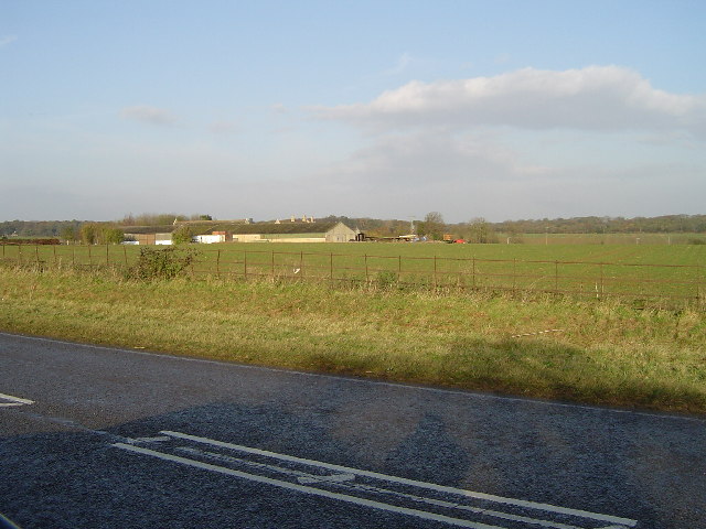
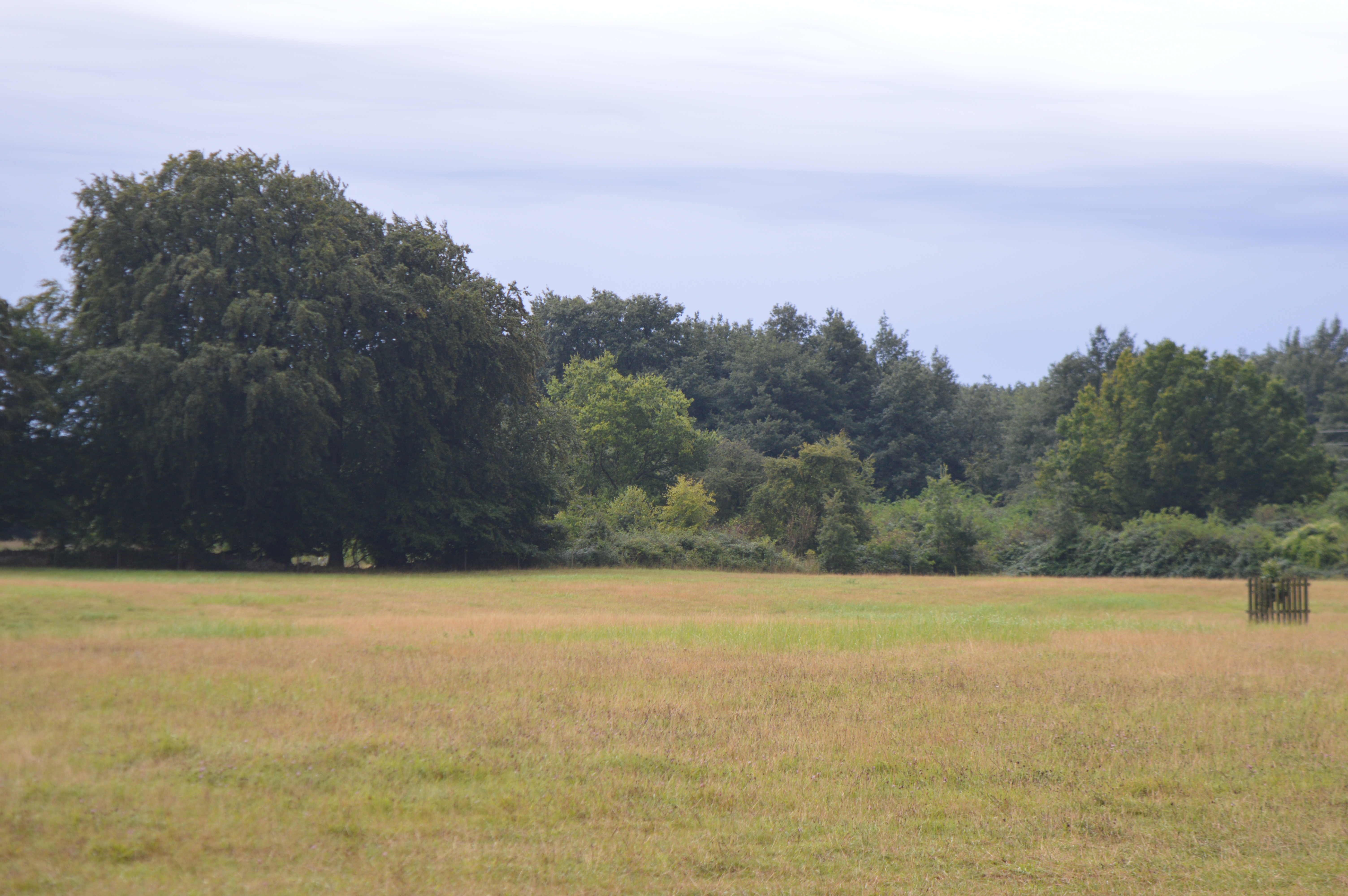
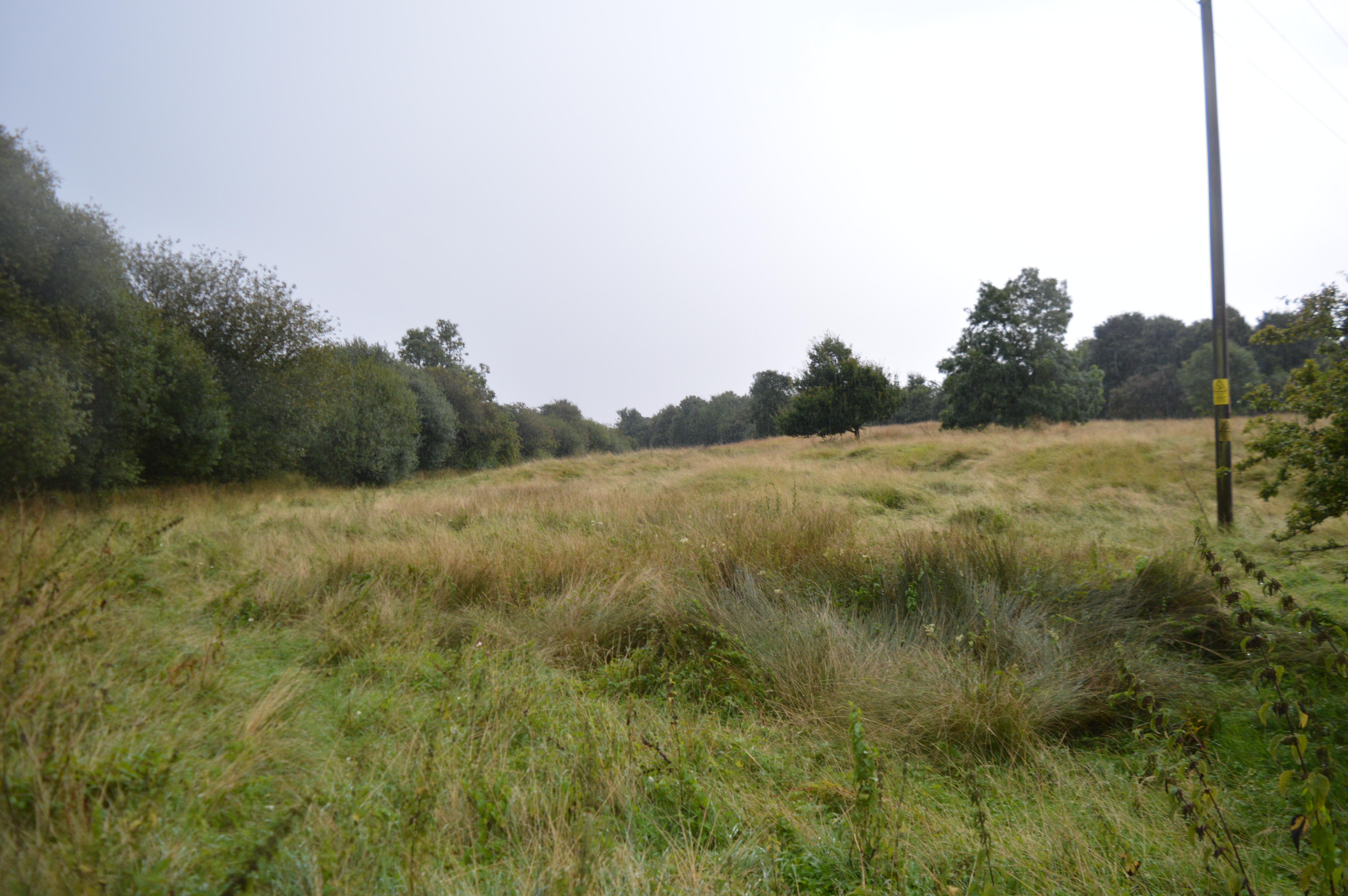
Diamond Jubilee Plantation is a picturesque woodland located in Northamptonshire, England. Covering a vast area, the plantation is a popular destination for nature enthusiasts and hikers alike. The woodland is named in honor of Queen Elizabeth II's Diamond Jubilee, which commemorated her 60 years on the throne.

The plantation boasts a diverse range of tree species, including oak, beech, and birch, creating a stunning and vibrant landscape throughout the year. The woodland is maintained by the local forestry commission, ensuring its preservation and sustainability.

Visitors to Diamond Jubilee Plantation can explore a network of well-marked trails, offering both short and long walks suitable for all fitness levels. The trails wind through the woodland, providing breathtaking views of the surrounding countryside and opportunities to spot local wildlife such as deer, squirrels, and a variety of bird species.

The plantation also offers picnic areas and benches strategically placed along the trails, allowing visitors to take a break and appreciate the tranquil surroundings. Additionally, there are designated camping spots for those who wish to experience the woodland overnight.

Diamond Jubilee Plantation is easily accessible, with ample parking facilities available. It provides a peaceful and serene escape from the hustle and bustle of city life, making it a perfect destination for families, couples, and individuals seeking a connection with nature.

Overall, Diamond Jubilee Plantation in Northamptonshire offers a delightful woodland experience with its beautiful scenery, well-maintained trails, and abundant wildlife, making it a must-visit destination for nature lovers in the region.

If you have any feedback on the listing, please let us know in the comments section below.

Diamond Jubilee Plantation Images

Images are sourced within 2km of 52.601368/-0.43055919 or Grid Reference TF0601. Thanks to Geograph Open Source API. All images are credited.

A47(T) & field, west of Wansford Looking west.
A47(T) & field, west of Wansford
Looking west.
Sibberton Lodge, west of Wansford From the A47(T), looking north to Sibberton Lodge.
Sibberton Lodge, west of Wansford
From the A47(T), looking north to Sibberton Lodge.
Near Oaks Cottage & Thornhaugh Hall Outside Oaks Cottage looking east towards Thornhaugh Hall. The Hall lies out of sight behind a stone wall.
Near Oaks Cottage & Thornhaugh Hall
Outside Oaks Cottage looking east towards Thornhaugh Hall. The Hall lies out of sight behind a stone wall.
West of Thornhaugh Looking east towards Thornhaugh.
West of Thornhaugh
Looking east towards Thornhaugh.
Parish Church of St Andrew, Thornhaugh From the road looking north.
Parish Church of St Andrew, Thornhaugh
From the road looking north.
A1, near Thornhaugh The A1 dominates this grid square. This was taken looking north, towards Wittering and Stamford.
A1, near Thornhaugh
The A1 dominates this grid square. This was taken looking north, towards Wittering and Stamford.
Water Tower RAF Wittering
Abbot's Wood The wood is surrounded by a deer fence to prevent the animals from entering to devour tender young shoots.
Abbot's Wood
The wood is surrounded by a deer fence to prevent the animals from entering to devour tender young shoots.
Open Country From a footpath which curves round to run past the west side of West Wood.
Open Country
From a footpath which curves round to run past the west side of West Wood.
Green Willow Lound Wood is on the left, behind the weeping willows, and West Wood is to the right of the stream.
Green Willow
Lound Wood is on the left, behind the weeping willows, and West Wood is to the right of the stream.
Over the Fields to Mill Farm Pheasant looking on
Over the Fields to Mill Farm
Pheasant looking on
Hereward Way running down unto Southorpe
Farmland near Wittering Taken from the road that skirts the RAF airfield.
Farmland near Wittering
Taken from the road that skirts the RAF airfield.
Farmland at Bonemills Farm The horses, centre right, belong to the Wittering Grange Equestrian Centre. The buildings in the distance, to the left are RAF housing in Wittering. The A1 is just over the horizon and the woodland on the far right is Diamond Jubilee Plantation.
Farmland at Bonemills Farm
The horses, centre right, belong to the Wittering Grange Equestrian Centre. The buildings in the distance, to the left are RAF housing in Wittering. The A1 is just over the horizon and the woodland on the far right is Diamond Jubilee Plantation.
The home of the Harrier RAF Wittering, with the guard room & reception behind the display Harrier.
The home of the Harrier
RAF Wittering, with the guard room & reception behind the display Harrier.
A1, Southbound At the turning for the research station and Sacrewell Lodge Farm.
A1, Southbound
At the turning for the research station and Sacrewell Lodge Farm.
Approaching the Research Centre From the road outside (which was previously part of the A1) by the visitor's car park.
Approaching the Research Centre
From the road outside (which was previously part of the A1) by the visitor's car park.
Lay by on a wet A1 South near RAF Wittering
Show me another place!

Diamond Jubilee Plantation is located at Grid Ref: TF0601 (Lat: 52.601368, Lng: -0.43055919)

Division: Soke of Peterborough

Unitary Authority: Peterborough

Police Authority: Cambridgeshire

What 3 Words

///rescue.stale.comply. Near Wittering, Cambridgeshire

Related Wikis

West, Abbot's and Lound Woods

West, Abbot's and Lound Woods is a 50.4-hectare (125-acre) biological Site of Special Scientific Interest south of Wittering in Cambridgeshire.The site...

Thornhaugh

Thornhaugh is a civil parish and village in the city of Peterborough unitary authority, Cambridgeshire in the United Kingdom. For electoral purposes the...

Wittering, Cambridgeshire

Wittering is a village and civil parish in the City of Peterborough unitary authority area in the ceremonial county of Cambridgeshire, England. The village...

Southorpe Roughs

Southorpe Roughs is a 9.8-hectare (24-acre) Site of Special Scientific Interest west of Southorpe in Cambridgeshire.This is a disused quarry which has...

Southorpe Paddock

Southorpe Paddock is a 1.6-hectare (4.0-acre) Site of Special Scientific Interest south of Southorpe in Cambridgeshire. It is managed by the Wildlife Trust...

Southorpe

Southorpe is a settlement and civil parish in the Peterborough district, in the ceremonial county of Cambridgeshire, England. For electoral purposes it...

Wansford Pasture

Wansford Pasture is a 3.1-hectare (7.7-acre) biological Site of Special Scientific Interest in Wansford in Cambridgeshire. It is part of the 7.3 hectare...

Wansford, Cambridgeshire

Wansford is a village straddling the City of Peterborough and Huntingdonshire districts in the ceremonial county of Cambridgeshire, England. It had a population...

Nearby Amenities

Located within 500m of 52.601368,-0.43055919
Phone
Check Date: 2021-08-24
Emergency: phone
Lat/Long: 52.6042813/-0.4282406
Parking
Access: yes
Description: Layby
Ele: 54.6802979
Fee: no
Parking: street_side
Lat/Long: 52.6043873/-0.4282791
Barrier: kissing_gate
Wheelchair: no
Lat/Long: 52.5997214/-0.4302277
Colour: red and white
Marker: aerial
Material: plastic
Utility: gas
Lat/Long: 52.6043941/-0.4283839
Colour: red and white
Marker: aerial
Material: plastic
Utility: gas
Lat/Long: 52.6045734/-0.428027
Noexit: yes
Lat/Long: 52.6053896/-0.4319428
Addr City: Wittering
Addr Housenumber: 110
Addr Postcode: PE8 6EQ
Addr Street: St Mary's Avenue
Lat/Long: 52.605266/-0.4329464
The data included in this document is from www.openstreetmap.org. The data is made available under ODbL.

Have you been to Diamond Jubilee Plantation?

Leave your review of Diamond Jubilee Plantation below (or comments, questions and feedback).