Watts Common

Wood, Forest in Middlesex

England

Watts Common

Langley Farm
Langley Farm Credit: N Chadwick

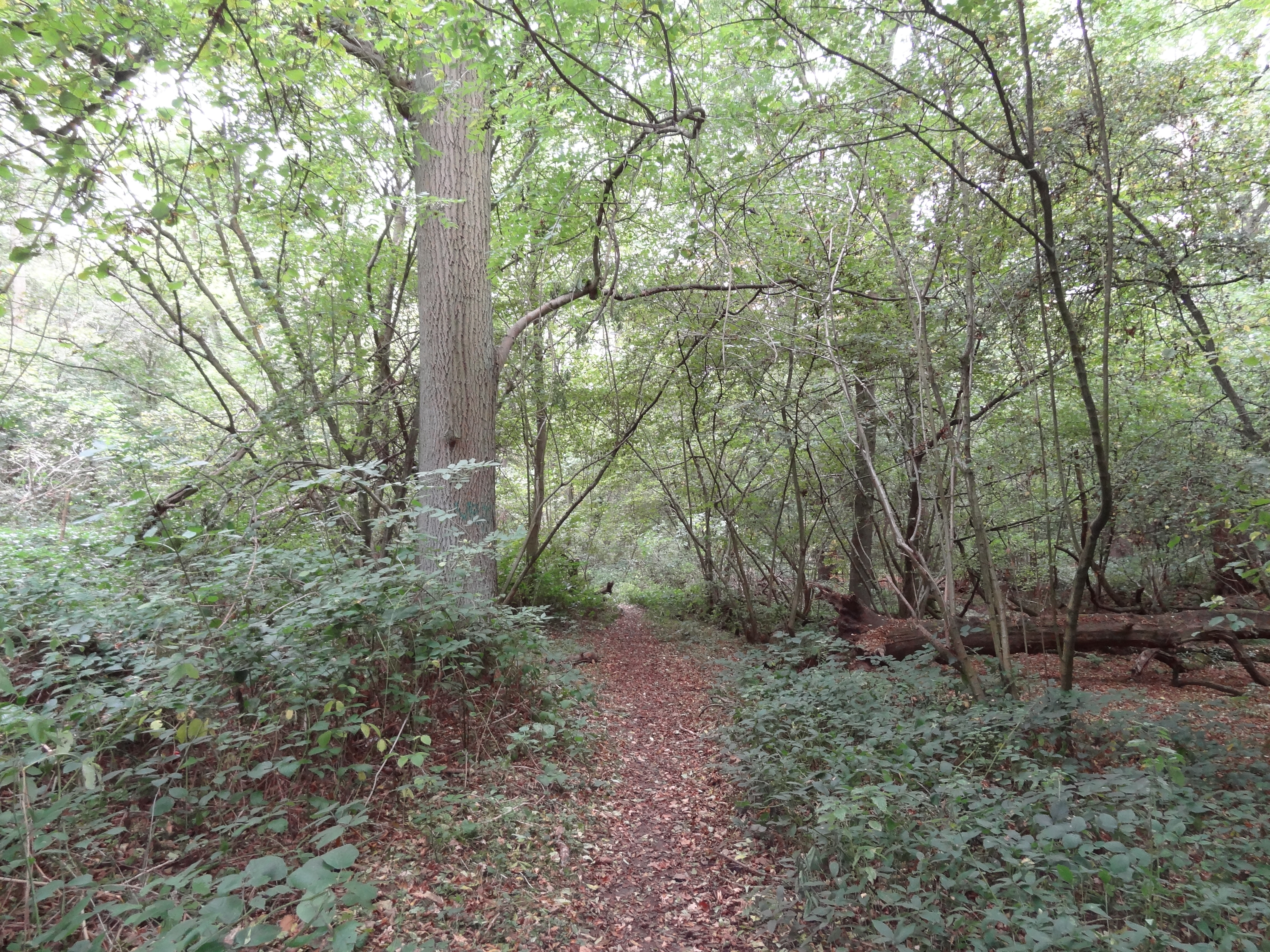
Watts Common, located in Middlesex, England, is a picturesque woodland area that spans over several acres. Nestled amidst the bustling town of Wood, the forest offers a tranquil and serene escape from the urban environment. With its rich biodiversity and natural beauty, Watts Common is a beloved destination for nature enthusiasts and locals alike.

The common is characterized by its dense canopy of trees, predominantly consisting of oak, beech, and birch. This lush vegetation creates a cool and shaded atmosphere, perfect for leisurely strolls or picnics. The forest floor is adorned with an array of wildflowers, ferns, and moss, adding to its enchanting ambiance.

Watts Common is home to a variety of wildlife, including squirrels, foxes, and a diverse range of bird species. The tranquil setting and abundant food sources attract these creatures, making it an ideal spot for birdwatching and animal spotting. Visitors may also come across small ponds and streams that meander through the forest, providing a refreshing habitat for amphibians and insects.

The common is well-maintained and features a network of well-marked trails, making it accessible to walkers and hikers of all levels. These trails allow visitors to explore the forest's different areas, from its towering trees to its secluded clearings. Additionally, there are picnic areas and benches scattered throughout the common, providing ample opportunities for relaxation and enjoying the natural surroundings.

Overall, Watts Common in Middlesex offers a serene and captivating natural haven, where visitors can immerse themselves in the beauty of the woodland, observe wildlife, and enjoy peaceful walks amidst nature's tranquility.

If you have any feedback on the listing, please let us know in the comments section below.
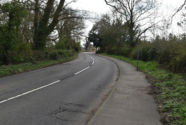
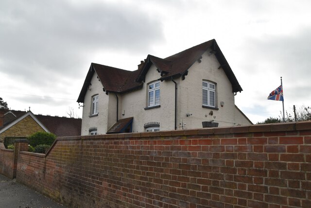
Watts Common Images

Images are sourced within 2km of 51.612107/-0.47938274 or Grid Reference TQ0591. Thanks to Geograph Open Source API. All images are credited.

Langley Farm
Langley Farm
Brakspear Road North
Breakspear Road North
Hammond Lodge
Hammond Lodge
Hammond Lodge
Hammond Lodge
Breakspear Stable Cottage
Breakspear Road North
Field edge footpath
Field edge footpath
Joining The Hillingdon Trail This 20 mile long route spans the London Borough of Hillingdon from Cranford Park in the south to Springwell Lock on the Grand Union Canal in the north. The Celandine Route (12 miles) along the River Pinn from Pinner provides another link to the Grand Union Canal Walk at the junction of the Slough Arm.
Joining The Hillingdon Trail
This 20 mile long route spans the London Borough of Hillingdon from Cranford Park in the south to Springwell Lock on the Grand Union Canal in the north. The Celandine Route (12 miles) along the River Pinn from Pinner provides another link to the Grand Union Canal Walk at the junction of the Slough Arm.
Single tree
Single tree
Hillingdon Trail This 20 mile long route spans the London Borough of Hillingdon from Cranford Park in the south to Springwell Lock on the Grand Union Canal in the north. The Celandine Route (12 miles) along the River Pinn from Pinner provides another link to the Grand Union Canal Walk at the junction of the Slough Arm.
Hillingdon Trail
This 20 mile long route spans the London Borough of Hillingdon from Cranford Park in the south to Springwell Lock on the Grand Union Canal in the north. The Celandine Route (12 miles) along the River Pinn from Pinner provides another link to the Grand Union Canal Walk at the junction of the Slough Arm.
Woodland
Woodland
A eutrophic pond Eutrophication is an enrichment of a water body by minerals and nutrients that lead to a reduction in water quality, especially a reduction in oxygen content. Although it can be a natural process most modern eutrophication is caused by human activity, especially the use of nitrates and phosphates. A eutrophic water body is characterised by a surface green algal bloom.
Wikipedia: <span class="nowrap"><a title="https://en.wikipedia.org/wiki/Eutrophication" rel="nofollow ugc noopener" href="https://en.wikipedia.org/wiki/Eutrophication">Link</a><img style="margin-left:2px;" alt="External link" title="External link - shift click to open in new window" src="https://s1.geograph.org.uk/img/external.png" width="10" height="10"/></span>
A eutrophic pond
Eutrophication is an enrichment of a water body by minerals and nutrients that lead to a reduction in water quality, especially a reduction in oxygen content. Although it can be a natural process most modern eutrophication is caused by human activity, especially the use of nitrates and phosphates. A eutrophic water body is characterised by a surface green algal bloom. Wikipedia: LinkExternal link
Hillingdon Trail
Hillingdon Trail
Graveyard, St Mary's Church A Grade I listed church dating back to the 12th century. The graveyard contains many ANZAC graves.
A full history can be read at <span class="nowrap"><a title="https://www.british-history.ac.uk/vch/middx/vol3/pp252-256" rel="nofollow ugc noopener" href="https://www.british-history.ac.uk/vch/middx/vol3/pp252-256">Link</a><img style="margin-left:2px;" alt="External link" title="External link - shift click to open in new window" src="https://s1.geograph.org.uk/img/external.png" width="10" height="10"/></span>
Graveyard, St Mary's Church
A Grade I listed church dating back to the 12th century. The graveyard contains many ANZAC graves. A full history can be read at LinkExternal link
Church of St Mary A Grade I listed church dating back to the 12th century. The graveyard contains many ANZAC graves.
A full history can be read at <span class="nowrap"><a title="https://www.british-history.ac.uk/vch/middx/vol3/pp252-256" rel="nofollow ugc noopener" href="https://www.british-history.ac.uk/vch/middx/vol3/pp252-256">Link</a><img style="margin-left:2px;" alt="External link" title="External link - shift click to open in new window" src="https://s1.geograph.org.uk/img/external.png" width="10" height="10"/></span>
Church of St Mary
A Grade I listed church dating back to the 12th century. The graveyard contains many ANZAC graves. A full history can be read at LinkExternal link
Show me another place!

Watts Common is located at Grid Ref: TQ0591 (Lat: 51.612107, Lng: -0.47938274)

Unitary Authority: Hillingdon

Police Authority: Metropolitan

What 3 Words

///sports.boil.quiet. Near Harefield, London

Related Wikis

Old Park Wood

Old Park Wood is a 16.7-hectare (41-acre) Site of Special Scientific Interest in Harefield in the London Borough of Hillingdon. The south-east part is...

Uxbridge power station

Uxbridge power station supplied electricity to the District of Uxbridge and the surrounding area from 1902 to 1962. The power station was built by the...
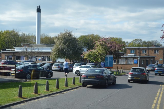
Harefield Hospital

Harefield Hospital is a health institution in Harefield, London Borough of Hillingdon, England. It is managed by the Guy's and St Thomas' NHS Foundation...

Harefield Academy

Harefield School is a secondary school in Uxbridge, London. Located on the site of the former community school, John Penrose School, which closed on 31...

Nearby Amenities

Located within 500m of 51.612107,-0.47938274
Barrier: stile
Lat/Long: 51.6139799/-0.4838858
Barrier: stile
Lat/Long: 51.6162177/-0.4816787
Barrier: stile
Lat/Long: 51.6162557/-0.4816426
Post Box
Check Date: 2023-03-27
Collection Times: Mo-Fr 09:00; Sa 07:00; Su off
Post Box Type: lamp
Ref: UB9 84D
Royal Cypher: EIIR
Royal Cypher Wikidata: Q33102113
Source: survey_2016-08-29
Lat/Long: 51.6130627/-0.4846267
Waste Basket
Check Date: 2023-03-27
Waste: dog_excrement
Lat/Long: 51.6121902/-0.4839643
Direction: 175
Generator Method: photovoltaic
Generator Output Electricity: yes
Generator Solar Modules: 44
Generator Source: solar
Generator Type: solar_photovoltaic_panel
Location: roof
Power: generator
Lat/Long: 51.6129241/-0.4855904
Direction: 85
Generator Method: photovoltaic
Generator Output Electricity: yes
Generator Solar Modules: 44
Generator Source: solar
Generator Type: solar_photovoltaic_panel
Location: roof
Power: generator
Lat/Long: 51.6130881/-0.4857632
Direction: 265
Generator Method: photovoltaic
Generator Output Electricity: yes
Generator Solar Modules: 22
Generator Source: solar
Generator Type: solar_photovoltaic_panel
Location: roof
Power: generator
Lat/Long: 51.6130827/-0.4858804
Cafe
Mitchell's Village Kitchen
Addr Housenumber: 4
Addr Street: Plough Lane
Alt Name: Mitchell's Garden Tea Shop
Fhrs Id: no
Lat/Long: 51.6139775/-0.4841296
The data included in this document is from www.openstreetmap.org. The data is made available under ODbL.

Have you been to Watts Common?

Leave your review of Watts Common below (or comments, questions and feedback).