Keisby Wood
Wood, Forest in Lincolnshire South Kesteven
England
Keisby Wood
Keisby Wood is a small woodland located in Lincolnshire, England. Covering an area of approximately 20 hectares, it is situated near the village of Keisby, between Grantham and Bourne. The wood is primarily composed of deciduous trees, including oak, beech, and ash, with some coniferous species such as Scots pine.
Keisby Wood is a designated Site of Special Scientific Interest (SSSI) due to its high ecological value. The woodland provides a diverse habitat for various wildlife species, including several rare and protected bird species like the lesser spotted woodpecker and the tawny owl. It is also home to mammals such as badgers, foxes, and deer.
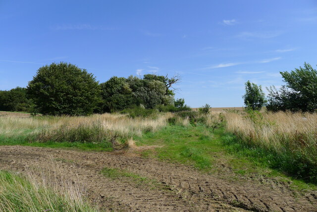
The wood features a network of walking trails, allowing visitors to explore its beauty and tranquility. The paths wind through the trees, providing opportunities for nature enthusiasts to observe the flora and fauna. Keisby Wood is particularly stunning in the spring when the forest floor is carpeted with bluebells, creating a vibrant display of color.
The management of Keisby Wood is overseen by a local conservation group, which ensures that the woodland is maintained and protected for future generations to enjoy. The group organizes regular events and activities, including guided walks and educational programs, to raise awareness about the importance of preserving this natural habitat.
Overall, Keisby Wood is a cherished natural gem in Lincolnshire, offering a peaceful retreat for both locals and visitors, while also playing a vital role in the conservation of the region's biodiversity.
If you have any feedback on the listing, please let us know in the comments section below.
Keisby Wood Images
Images are sourced within 2km of 52.853693/-0.43792845 or Grid Reference TF0529. Thanks to Geograph Open Source API. All images are credited.


Keisby Wood is located at Grid Ref: TF0529 (Lat: 52.853693, Lng: -0.43792845)
Administrative County: Lincolnshire
District: South Kesteven
Police Authority: Lincolnshire
What 3 Words
///intruded.reunion.winning. Near Corby Glen, Lincolnshire
Nearby Locations
Related Wikis
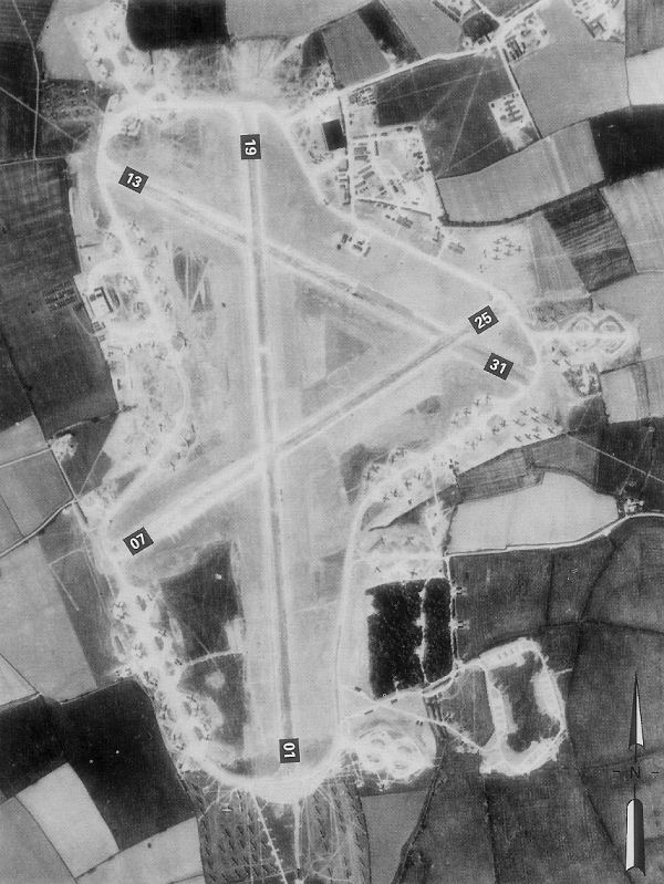
RAF Folkingham
Royal Air Force Folkingham or RAF Folkingham is a former Royal Air Force station located south west of Folkingham, Lincolnshire and about 29 miles (47...

Aveland
Aveland was a Wapentake of Kesteven from the time of the Danelaw until the Local Government Act 1888. Its meeting place was The Aveland at grid reference...

Keisby
Keisby is a hamlet in the civil parish of Lenton, Keisby and Osgodby, in the South Kesteven district, in Lincolnshire, England. It is situated 6 miles...

Aslackby and Laughton
Aslackby and Laughton is a civil parish in the South Kesteven district of Lincolnshire, England. According to the 2001 census the parish had a population...
Nearby Amenities
Located within 500m of 52.853693,-0.43792845Have you been to Keisby Wood?
Leave your review of Keisby Wood below (or comments, questions and feedback).