Edenthorpe

Settlement in Yorkshire

England

Edenthorpe

A small part of Sandall Park, Doncaster Looking north-eastward.
A small part of Sandall Park, Doncaster Credit: Peter Wood

Edenthorpe is a quaint village located in the metropolitan borough of Doncaster, South Yorkshire, England. Situated just three miles north-east of Doncaster town center, it is a thriving community with a population of around 8,000 residents.

Known for its peaceful and scenic surroundings, Edenthorpe is nestled in the heart of the Yorkshire countryside, offering a tranquil escape from the hustle and bustle of city life. The village is surrounded by beautiful green fields and rolling hills, providing ample opportunities for outdoor activities such as hiking, cycling, and horse riding.

Despite its rural charm, Edenthorpe is conveniently located close to a range of amenities and services. The village boasts a variety of local shops, including a supermarket, post office, and several small businesses. There are also several pubs and restaurants, offering a selection of dining options for residents and visitors alike.

Education is well-catered for in Edenthorpe, with two primary schools serving the local community. In addition, there are excellent transport links, including regular bus services to Doncaster and the surrounding areas.

Edenthorpe also benefits from its proximity to a range of attractions and landmarks. Yorkshire Wildlife Park, a popular wildlife conservation park, is just a short drive away. Doncaster Racecourse, famous for its horse racing events, is also within easy reach, providing entertainment for locals and tourists alike.

Overall, Edenthorpe offers a perfect blend of rural charm, convenience, and community spirit, making it a highly desirable place to live or visit in Yorkshire.

If you have any feedback on the listing, please let us know in the comments section below.
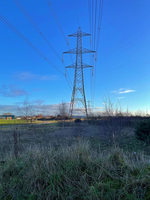
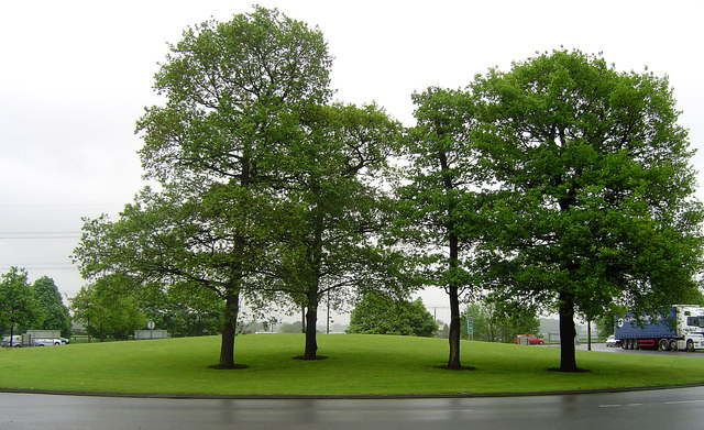
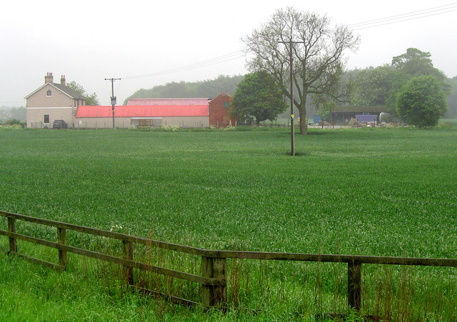
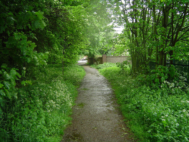
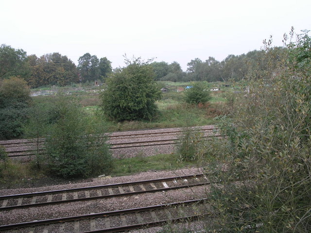
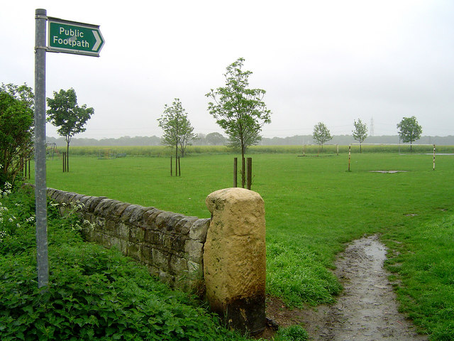
Edenthorpe Images

Images are sourced within 2km of 53.553547/-1.065834 or Grid Reference SE6106. Thanks to Geograph Open Source API. All images are credited.

A small part of Sandall Park, Doncaster Looking north-eastward.
A small part of Sandall Park, Doncaster
Looking north-eastward.
Electricity pylons Marching across fields to the east of Kirk Sandall.
Electricity pylons
Marching across fields to the east of Kirk Sandall.
Hatfield Lane Approaching the roundabout junction with the A630.
Hatfield Lane
Approaching the roundabout junction with the A630.
Electricity pylon off Hatfield Lane
The lake in Sandall Park
Church of Our Lady of Sorrows and St Francis Opened in 1959 to serve the growing population in Armthorpe
Church of Our Lady of Sorrows and St Francis
Opened in 1959 to serve the growing population in Armthorpe
The church of St Leonard & St Mary Grade II listed parish church dating from the 11th century.
The church of St Leonard & St Mary
Grade II listed parish church dating from the 11th century.
Path in Hag Wood
Path in Hag Wood
Fence under construction The posts are formed from old telegraph poles so the fence should be very robust when it's finished.
Fence under construction
The posts are formed from old telegraph poles so the fence should be very robust when it's finished.
Armthorpe Typical housing in Armthorpe, Doncaster.
Armthorpe
Typical housing in Armthorpe, Doncaster.
Hatfield Lane Roundabout
Grange Farm Grange Farm near Armthorpe - the birth place of Kevin Keegan!
Grange Farm
Grange Farm near Armthorpe - the birth place of Kevin Keegan!
Edenthorpe Playing Field The history of Edenthorpe can be found following the link.
<span class="nowrap"><a title="http://www.edenthorpe.com/history.htm" rel="nofollow ugc noopener" href="http://www.edenthorpe.com/history.htm">Link</a><img style="margin-left:2px;" alt="External link" title="External link - shift click to open in new window" src="https://s1.geograph.org.uk/img/external.png" width="10" height="10"/></span>
Edenthorpe Playing Field
The history of Edenthorpe can be found following the link. LinkExternal link
Edenthorpe Lanes The history of Edenthorpe can be found following the link.
<span class="nowrap"><a title="http://www.edenthorpe.com/history.htm" rel="nofollow ugc noopener" href="http://www.edenthorpe.com/history.htm">Link</a><img style="margin-left:2px;" alt="External link" title="External link - shift click to open in new window" src="https://s1.geograph.org.uk/img/external.png" width="10" height="10"/></span>
Edenthorpe Lanes
The history of Edenthorpe can be found following the link. LinkExternal link
Bridleway in Edenthorpe The history of Edenthorpe can be found following the link.
<span class="nowrap"><a title="http://www.edenthorpe.com/history.htm" rel="nofollow ugc noopener" href="http://www.edenthorpe.com/history.htm">Link</a><img style="margin-left:2px;" alt="External link" title="External link - shift click to open in new window" src="https://s1.geograph.org.uk/img/external.png" width="10" height="10"/></span>
Bridleway in Edenthorpe
The history of Edenthorpe can be found following the link. LinkExternal link
St.Mary & St.Leonard's church, Armthorpe A Norman nave, chancel arch and south door, the rest largely of 1885, including the pretty bell turret.
St.Mary & St.Leonard's church, Armthorpe
A Norman nave, chancel arch and south door, the rest largely of 1885, including the pretty bell turret.
Railway and Allotments The four railway tracks pass by these allotments on the edge of Barnby Dun.
Railway and Allotments
The four railway tracks pass by these allotments on the edge of Barnby Dun.
Path Through the Woods This footpath passes through more trees than it did on the 1940s OS map, a few more houses too.
Path Through the Woods
This footpath passes through more trees than it did on the 1940s OS map, a few more houses too.
Show me another place!

Edenthorpe is located at Grid Ref: SE6106 (Lat: 53.553547, Lng: -1.065834)

Division: West Riding

Unitary Authority: Doncaster

Police Authority: South Yorkshire

What 3 Words

///applauded.plump.passing. Near Kirk Sandall, South Yorkshire

Nearby Locations

Sunnyside Edenthorpe

Related Wikis

Nearby Amenities

Located within 500m of 53.553547,-1.065834
Edenthorpe
Place: village
Lat/Long: 53.5529148/-1.0659478
Traffic Signals
Lat/Long: 53.5543978/-1.0608247
Bus Stop
Church Balk/Athelstane Crescent
Naptan AtcoCode: 370040460
Naptan Bearing: N
Naptan CommonName: Church Balk/Athelstane Crescent
Naptan Indicator: 40460
Naptan Landmark: OPPOSITE HOUSE NUMBER 9
Naptan PlusbusZoneRef: ROTHCEN
Naptan Street: Church Balk
Naptan Verified: no
Source: naptan_import
Lat/Long: 53.5542253/-1.0670229
Bus Stop
Church Balk/Milton Grove
Alt Name: Church Balk/Milton Grove
Naptan AltCommonName: Church Balk/Milton Grove
Naptan AtcoCode: 370040461
Naptan Bearing: N
Naptan CommonName: Church Balk/Milton Grove
Naptan Indicator: 40461
Naptan Landmark: 40461
Naptan PlusbusZoneRef: ROTHCEN
Naptan Street: Church Balk
Naptan Verified: no
Source: naptan_import
Lat/Long: 53.5556257/-1.0702377
Bus Stop
Edenfield Road/Thorne Road
Alt Name: Edenfield Road/Thorne Road
Naptan AltCommonName: Edenfield Road/Thorne Road
Naptan AtcoCode: 370041138
Naptan Bearing: N
Naptan CommonName: Edenfield Road/Thorne Road
Naptan Indicator: 41138
Naptan Landmark: Outside Tesco
Naptan PlusbusZoneRef: ROTHCEN
Naptan Street: Edenfield Road
Naptan Verified: no
Source: naptan_import
Lat/Long: 53.5553735/-1.0609744
Bus Stop
Edenfield Road/Longfield Road
Alt Name: Edenfield Road/Longfield Road
Naptan AltCommonName: Edenfield Road/Longfield Road
Naptan AtcoCode: 370041139
Naptan Bearing: N
Naptan CommonName: Edenfield Road/Longfield Road
Naptan Indicator: 41139
Naptan Landmark: THE EDEN ARMS PUB/OPPOSITE TES
Naptan PlusbusZoneRef: ROTHCEN
Naptan Street: Edenfield Road
Naptan Verified: no
Source: naptan_import
Lat/Long: 53.5561263/-1.060686
Bus Stop
Church Balk/St Oswalds Drive
Alt Name: Church Balk/St Oswalds Drive
Naptan AltCommonName: Church Balk/St Oswalds Drive
Naptan AtcoCode: 370045350
Naptan Bearing: NW
Naptan CommonName: Church Balk/St Oswalds Drive
Naptan Indicator: 45350
Naptan Landmark: EDENTHORPE C.E.SCHOOL/CHURCH/P
Naptan PlusbusZoneRef: ROTHCEN
Naptan Street: Church Balk
Naptan Verified: no
Source: naptan_import
Lat/Long: 53.5561779/-1.0719012
Bus Stop
Thorne Road/Clovelly Road
Naptan AtcoCode: 370045351
Naptan Bearing: NE
Naptan CommonName: Thorne Road/Clovelly Road
Naptan Indicator: 45351
Naptan Landmark: THE RIDGEWOOD PUB
Naptan PlusbusZoneRef: ROTHCEN
Naptan Street: Thorne Road
Naptan Verified: no
Source: naptan_import
Lat/Long: 53.5525949/-1.0682559
Bus Stop
Church Balk/Locksley Avenue
Alt Name: Church Balk/Locksley Avenue
Naptan AltCommonName: Church Balk/Locksley Avenue
Naptan AtcoCode: 370045352
Naptan Bearing: N
Naptan CommonName: Church Balk/Locksley Avenue
Naptan Indicator: 45352
Naptan Landmark: OPPOSITE NO. 36
Naptan PlusbusZoneRef: ROTHCEN
Naptan Street: Church Balk
Naptan Verified: no
Source: naptan_import
Lat/Long: 53.5548788/-1.068986
Bus Stop
Thorne Road/Cedric Road
Alt Name: Thorne Road/Cedric Road
Naptan AltCommonName: Thorne Road/Cedric Road
Naptan AtcoCode: 370045353
Naptan Bearing: SW
Naptan CommonName: Thorne Road/Cedric Road
Naptan Indicator: 45353
Naptan Landmark: 45353
Naptan PlusbusZoneRef: ROTHCEN
Naptan Street: Thorne Road
Naptan Verified: no
Source: naptan_import
Lat/Long: 53.5531956/-1.0663813
Church Balk/Athelstane Crescent
Naptan AtcoCode: 370045876
Naptan Bearing: N
Naptan BusStopType: CUS
Naptan CommonName: Church Balk/Athelstane Crescent
Naptan Indicator: 45876
Naptan Landmark: OPPOSITE HOUSE NUMBER 9
Naptan PlusbusZoneRef: ROTHCEN
Naptan Street: Thorne Road
Naptan Verified: no
Source: naptan_import
Lat/Long: 53.554065/-1.0671899
Bus Stop
Thorne Road/Eden Field Road
Naptan AtcoCode: 370045019
Naptan Bearing: W
Naptan CommonName: Thorne Road/Eden Field Road
Naptan Indicator: 45019
Naptan Landmark: TESCO SUPERMARKET
Naptan PlusbusZoneRef: ROTHCEN
Naptan Street: Thorne Road
Naptan Verified: no
Source: naptan_import
Lat/Long: 53.5542019/-1.0628721
Bus Stop
Thorne Road/Eden Field Road
Naptan AtcoCode: 370045020
Naptan Bearing: E
Naptan CommonName: Thorne Road/Eden Field Road
Naptan Indicator: 45020
Naptan Landmark: TESCO SUPERMARKET
Naptan PlusbusZoneRef: ROTHCEN
Naptan Street: Thorne Road
Naptan Verified: no
Source: naptan_import
Lat/Long: 53.5543796/-1.0619366
The Beverley Inn
Addr City: Doncaster
Addr Housename: The Beverley Inn
Addr Housenumber: 117
Addr Postcode: DN3 2JE
Addr Street: Thorne Road
Tourism: hotel
Lat/Long: 53.5528511/-1.0680802
Pub
Eden arms
Brand: Ember Inns
Brand Wikidata: Q116272278
Contact Website: https://www.emberinns.co.uk/nationalsearch/yorkshireandthehumber/the-eden-arms-edenthorpe
Operator: Ember Inns
Lat/Long: 53.555971/-1.061042
Crossing
Lat/Long: 53.554597/-1.0608464
Bus Stop
Lat/Long: 53.5551618/-1.0608739
Bench
Lat/Long: 53.5527751/-1.0673468
Bench
Lat/Long: 53.5527576/-1.0673871
Crossing
Crossing: traffic_signals
Crossing Ref: pelican
Lat/Long: 53.5530235/-1.0670214
Pharmacy
Weldricks Pharmacy
Dispensing: yes
Lat/Long: 53.5527225/-1.0669472
Generator Method: photovoltaic
Generator Output Electricity: yes
Generator Source: solar
Generator Type: solar_photovoltaic_panel
Location: roof
Power: generator
Lat/Long: 53.5531126/-1.0617256
Generator Method: photovoltaic
Generator Output Electricity: yes
Generator Source: solar
Generator Type: solar_photovoltaic_panel
Location: roof
Power: generator
Lat/Long: 53.5531429/-1.0617176
Generator Method: photovoltaic
Generator Output Electricity: yes
Generator Source: solar
Generator Type: solar_photovoltaic_panel
Location: roof
Power: generator
Lat/Long: 53.5526234/-1.0618034
Generator Method: photovoltaic
Generator Output Electricity: yes
Generator Source: solar
Generator Type: solar_photovoltaic_panel
Location: roof
Power: generator
Lat/Long: 53.5538743/-1.0632062
Generator Method: photovoltaic
Generator Output Electricity: yes
Generator Source: solar
Generator Type: solar_photovoltaic_panel
Location: roof
Power: generator
Lat/Long: 53.5533277/-1.0692385
Generator Method: photovoltaic
Generator Output Electricity: yes
Generator Source: solar
Generator Type: solar_photovoltaic_panel
Location: roof
Power: generator
Lat/Long: 53.5533596/-1.0693914
Generator Method: photovoltaic
Generator Output Electricity: yes
Generator Source: solar
Generator Type: solar_photovoltaic_panel
Location: roof
Power: generator
Lat/Long: 53.5530043/-1.0692707
Generator Method: photovoltaic
Generator Output Electricity: yes
Generator Source: solar
Generator Type: solar_photovoltaic_panel
Location: roof
Power: generator
Lat/Long: 53.5530457/-1.0693538
Generator Method: photovoltaic
Generator Output Electricity: yes
Generator Source: solar
Generator Type: solar_photovoltaic_panel
Location: roof
Power: generator
Lat/Long: 53.5526935/-1.0716257
Generator Method: photovoltaic
Generator Output Electricity: yes
Generator Source: solar
Generator Type: solar_photovoltaic_panel
Location: roof
Power: generator
Lat/Long: 53.5526218/-1.0714352
Generator Method: photovoltaic
Generator Output Electricity: yes
Generator Source: solar
Generator Type: solar_photovoltaic_panel
Location: roof
Power: generator
Lat/Long: 53.5524115/-1.0707754
Generator Method: photovoltaic
Generator Output Electricity: yes
Generator Source: solar
Generator Type: solar_photovoltaic_panel
Location: roof
Power: generator
Lat/Long: 53.5515431/-1.0684097
Generator Method: photovoltaic
Generator Output Electricity: yes
Generator Source: solar
Generator Type: solar_photovoltaic_panel
Location: roof
Power: generator
Lat/Long: 53.5515016/-1.0683507
Generator Method: photovoltaic
Generator Output Electricity: yes
Generator Source: solar
Generator Type: solar_photovoltaic_panel
Location: roof
Power: generator
Lat/Long: 53.5519542/-1.0683909
Generator Method: photovoltaic
Generator Output Electricity: yes
Generator Source: solar
Generator Type: solar_photovoltaic_panel
Location: roof
Power: generator
Lat/Long: 53.5519988/-1.0683668
Generator Method: photovoltaic
Generator Output Electricity: yes
Generator Source: solar
Generator Type: solar_photovoltaic_panel
Location: roof
Power: generator
Lat/Long: 53.5516116/-1.067538
Generator Method: photovoltaic
Generator Output Electricity: yes
Generator Source: solar
Generator Type: solar_photovoltaic_panel
Location: roof
Power: generator
Lat/Long: 53.5510554/-1.0631499
Generator Method: photovoltaic
Generator Output Electricity: yes
Generator Source: solar
Generator Type: solar_photovoltaic_panel
Location: roof
Power: generator
Lat/Long: 53.5510698/-1.063115
Generator Method: photovoltaic
Generator Output Electricity: yes
Generator Source: solar
Generator Type: solar_photovoltaic_panel
Location: roof
Power: generator
Lat/Long: 53.551763/-1.0649952
Generator Method: photovoltaic
Generator Output Electricity: yes
Generator Source: solar
Generator Type: solar_photovoltaic_panel
Location: roof
Power: generator
Lat/Long: 53.5504642/-1.0642764
Generator Method: photovoltaic
Generator Output Electricity: yes
Generator Source: solar
Generator Type: solar_photovoltaic_panel
Location: roof
Power: generator
Lat/Long: 53.5512068/-1.0654029
Generator Method: photovoltaic
Generator Output Electricity: yes
Generator Source: solar
Generator Type: solar_photovoltaic_panel
Location: roof
Power: generator
Lat/Long: 53.5511925/-1.0655344
Generator Method: photovoltaic
Generator Output Electricity: yes
Generator Source: solar
Generator Type: solar_photovoltaic_panel
Location: roof
Power: generator
Lat/Long: 53.5508196/-1.0694557
Generator Method: photovoltaic
Generator Output Electricity: yes
Generator Source: solar
Generator Type: solar_photovoltaic_panel
Location: roof
Power: generator
Lat/Long: 53.5508068/-1.0695389
Generator Method: photovoltaic
Generator Output Electricity: yes
Generator Source: solar
Generator Type: solar_photovoltaic_panel
Location: roof
Power: generator
Lat/Long: 53.5497296/-1.0633054
Generator Method: photovoltaic
Generator Output Electricity: yes
Generator Source: solar
Generator Type: solar_photovoltaic_panel
Location: roof
Power: generator
Lat/Long: 53.5494603/-1.0652125
Generator Method: photovoltaic
Generator Output Electricity: yes
Generator Source: solar
Generator Type: solar_photovoltaic_panel
Location: roof
Power: generator
Lat/Long: 53.5499431/-1.0691607
Generator Method: photovoltaic
Generator Output Electricity: yes
Generator Source: solar
Generator Type: solar_photovoltaic_panel
Location: roof
Power: generator
Lat/Long: 53.5494396/-1.0681173
Generator Method: photovoltaic
Generator Output Electricity: yes
Generator Source: solar
Generator Type: solar_photovoltaic_panel
Location: roof
Power: generator
Lat/Long: 53.5494587/-1.0682488
Generator Method: photovoltaic
Generator Output Electricity: yes
Generator Source: solar
Generator Type: solar_photovoltaic_panel
Location: roof
Power: generator
Lat/Long: 53.5493806/-1.0678679
Generator Method: photovoltaic
Generator Output Electricity: yes
Generator Source: solar
Generator Type: solar_photovoltaic_panel
Location: roof
Power: generator
Lat/Long: 53.5491607/-1.0669398
Generator Method: photovoltaic
Generator Output Electricity: yes
Generator Source: solar
Generator Type: solar_photovoltaic_panel
Location: roof
Power: generator
Lat/Long: 53.5491623/-1.066846
Post Box
Collection Times: Mo-Fr 09:00; Sa 07:00
Operator: Royal Mail
Operator Wikidata: Q638098
Post Box Design: type_b
Post Box Type: pillar
Ref: DN3 119
Lat/Long: 53.5501825/-1.0664819
The data included in this document is from www.openstreetmap.org. The data is made available under ODbL.

Have you been to Edenthorpe?

Leave your review of Edenthorpe below (or comments, questions and feedback).