Skiff Copse

Wood, Forest in Sussex Chichester

England

Skiff Copse

Churchyard gates, Wisborough Green
Churchyard gates, Wisborough Green Credit: Robin Webster

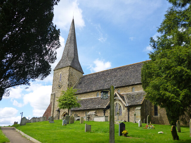
Skiff Copse, located in Sussex, England, is a picturesque woodland that spans across a vast area. Known for its natural beauty and diverse flora and fauna, it is a popular destination for nature enthusiasts and hikers alike.

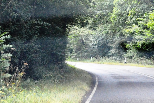
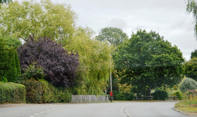
The copse is characterized by its dense canopy of trees, primarily consisting of oak, beech, and ash. These majestic trees provide a sheltered habitat for a wide range of wildlife, including various species of birds, mammals, and insects. The forest floor is adorned with an assortment of wildflowers, ferns, and mosses, creating a vibrant and enchanting atmosphere.

Traversing through Skiff Copse, one can discover a network of well-maintained walking trails that wind their way through the forest. These trails offer visitors the opportunity to immerse themselves in the tranquility of nature, while also providing educational signage that highlights the copse's ecological importance.

In addition to its natural beauty, Skiff Copse also boasts a rich history. The area has been inhabited for centuries, and remnants of ancient settlements and burial mounds can still be found within the woodland. Such historical significance adds an extra layer of intrigue to the copse, making it an enticing destination for history enthusiasts and archaeologists.

Skiff Copse is not only a haven for wildlife and history buffs but also a peaceful retreat for those seeking solace in nature. With its breathtaking scenery, diverse ecosystem, and cultural significance, it continues to captivate visitors from near and far.

If you have any feedback on the listing, please let us know in the comments section below.

Skiff Copse Images

Images are sourced within 2km of 51.027593/-0.51669842 or Grid Reference TQ0426. Thanks to Geograph Open Source API. All images are credited.

Churchyard gates, Wisborough Green
Wisborough Green church The Church of St Peter ad Vincula is a grade I listed building, late 11th century onwards.
Wisborough Green church
The Church of St Peter ad Vincula is a grade I listed building, late 11th century onwards.
Petworth Road, Wisborough Green
House on Petworth Road, Wisborough Green
Petworth Road, Wisborough Green
Looking westwards on the B2133
Dovecote at Fishers Farm Park Also seen at <a title="https://www.geograph.org.uk/photo/3348264" href="https://www.geograph.org.uk/photo/3348264">Link</a>.
Dovecote at Fishers Farm Park
Also seen at Link.
Weathervane at Fishers Farm Park
Looking northwards across Newpound Lane at bridleway junction
Weatheranimals at Fishers Farm Park
A272, eastbound The A272 is a very rural A road, which follows an east to west route from near Heathfield to Winchester, passing through the Sussex countryside. It runs 86 miles from Sutton Scotney to Five Ashes <a href="https://www.geograph.org.uk/photo/6669405">TQ5523 : A267, A272 junction</a>.
<span class="nowrap"><a title="http://www.sabre-roads.org.uk/wiki/index.php?title=A272" rel="nofollow ugc noopener" href="http://www.sabre-roads.org.uk/wiki/index.php?title=A272">Link</a><img style="margin-left:2px;" alt="External link" title="External link - shift click to open in new window" src="https://s1.geograph.org.uk/img/external.png" width="10" height="10"/></span> 
Wikipedia: <span class="nowrap"><a title="http://en.wikipedia.org/wiki/A272_road" rel="nofollow ugc noopener" href="http://en.wikipedia.org/wiki/A272_road">Link</a><img style="margin-left:2px;" alt="External link" title="External link - shift click to open in new window" src="https://s1.geograph.org.uk/img/external.png" width="10" height="10"/></span>
A272, eastbound
The A272 is a very rural A road, which follows an east to west route from near Heathfield to Winchester, passing through the Sussex countryside. It runs 86 miles from Sutton Scotney to Five Ashes TQ5523 : A267, A272 junction. LinkExternal link Wikipedia: LinkExternal link
Bend, A272 The A272 is a very rural A road, which follows an east to west route from near Heathfield to Winchester, passing through the Sussex countryside. It runs 86 miles from Sutton Scotney to Five Ashes <a href="https://www.geograph.org.uk/photo/6669405">TQ5523 : A267, A272 junction</a>.
<span class="nowrap"><a title="http://www.sabre-roads.org.uk/wiki/index.php?title=A272" rel="nofollow ugc noopener" href="http://www.sabre-roads.org.uk/wiki/index.php?title=A272">Link</a><img style="margin-left:2px;" alt="External link" title="External link - shift click to open in new window" src="https://s1.geograph.org.uk/img/external.png" width="10" height="10"/></span> 
Wikipedia: <span class="nowrap"><a title="http://en.wikipedia.org/wiki/A272_road" rel="nofollow ugc noopener" href="http://en.wikipedia.org/wiki/A272_road">Link</a><img style="margin-left:2px;" alt="External link" title="External link - shift click to open in new window" src="https://s1.geograph.org.uk/img/external.png" width="10" height="10"/></span>
Bend, A272
The A272 is a very rural A road, which follows an east to west route from near Heathfield to Winchester, passing through the Sussex countryside. It runs 86 miles from Sutton Scotney to Five Ashes TQ5523 : A267, A272 junction. LinkExternal link Wikipedia: LinkExternal link
Entering Wisborough Green, A272 The A272 is a very rural A road, which follows an east to west route from near Heathfield to Winchester, passing through the Sussex countryside. It runs 86 miles from Sutton Scotney to Five Ashes <a href="https://www.geograph.org.uk/photo/6669405">TQ5523 : A267, A272 junction</a>.
<span class="nowrap"><a title="http://www.sabre-roads.org.uk/wiki/index.php?title=A272" rel="nofollow ugc noopener" href="http://www.sabre-roads.org.uk/wiki/index.php?title=A272">Link</a><img style="margin-left:2px;" alt="External link" title="External link - shift click to open in new window" src="https://s1.geograph.org.uk/img/external.png" width="10" height="10"/></span> 
Wikipedia: <span class="nowrap"><a title="http://en.wikipedia.org/wiki/A272_road" rel="nofollow ugc noopener" href="http://en.wikipedia.org/wiki/A272_road">Link</a><img style="margin-left:2px;" alt="External link" title="External link - shift click to open in new window" src="https://s1.geograph.org.uk/img/external.png" width="10" height="10"/></span>
Entering Wisborough Green, A272
The A272 is a very rural A road, which follows an east to west route from near Heathfield to Winchester, passing through the Sussex countryside. It runs 86 miles from Sutton Scotney to Five Ashes TQ5523 : A267, A272 junction. LinkExternal link Wikipedia: LinkExternal link
A272 The A272 is a very rural A road, which follows an east to west route from near Heathfield to Winchester, passing through the Sussex countryside. It runs 86 miles from Sutton Scotney to Five Ashes <a href="https://www.geograph.org.uk/photo/6669405">TQ5523 : A267, A272 junction</a>.
<span class="nowrap"><a title="http://www.sabre-roads.org.uk/wiki/index.php?title=A272" rel="nofollow ugc noopener" href="http://www.sabre-roads.org.uk/wiki/index.php?title=A272">Link</a><img style="margin-left:2px;" alt="External link" title="External link - shift click to open in new window" src="https://s1.geograph.org.uk/img/external.png" width="10" height="10"/></span> 
Wikipedia: <span class="nowrap"><a title="http://en.wikipedia.org/wiki/A272_road" rel="nofollow ugc noopener" href="http://en.wikipedia.org/wiki/A272_road">Link</a><img style="margin-left:2px;" alt="External link" title="External link - shift click to open in new window" src="https://s1.geograph.org.uk/img/external.png" width="10" height="10"/></span>
A272
The A272 is a very rural A road, which follows an east to west route from near Heathfield to Winchester, passing through the Sussex countryside. It runs 86 miles from Sutton Scotney to Five Ashes TQ5523 : A267, A272 junction. LinkExternal link Wikipedia: LinkExternal link
A272, Wisborough Green The A272 is a very rural A road, which follows an east to west route from near Heathfield to Winchester, passing through the Sussex countryside. It runs 86 miles from Sutton Scotney to Five Ashes <a href="https://www.geograph.org.uk/photo/6669405">TQ5523 : A267, A272 junction</a>.
<span class="nowrap"><a title="http://www.sabre-roads.org.uk/wiki/index.php?title=A272" rel="nofollow ugc noopener" href="http://www.sabre-roads.org.uk/wiki/index.php?title=A272">Link</a><img style="margin-left:2px;" alt="External link" title="External link - shift click to open in new window" src="https://s1.geograph.org.uk/img/external.png" width="10" height="10"/></span> 
Wikipedia: <span class="nowrap"><a title="http://en.wikipedia.org/wiki/A272_road" rel="nofollow ugc noopener" href="http://en.wikipedia.org/wiki/A272_road">Link</a><img style="margin-left:2px;" alt="External link" title="External link - shift click to open in new window" src="https://s1.geograph.org.uk/img/external.png" width="10" height="10"/></span>
A272, Wisborough Green
The A272 is a very rural A road, which follows an east to west route from near Heathfield to Winchester, passing through the Sussex countryside. It runs 86 miles from Sutton Scotney to Five Ashes TQ5523 : A267, A272 junction. LinkExternal link Wikipedia: LinkExternal link
Wisborough Green War Memorial
Cottages overlooking the village green at Wisborough Green
Show me another place!

Skiff Copse is located at Grid Ref: TQ0426 (Lat: 51.027593, Lng: -0.51669842)

Administrative County: West Sussex

District: Chichester

Police Authority: Sussex

What 3 Words

///mastering.selects.elections. Near Billingshurst, West Sussex

Related Wikis

Wisborough Green

Wisborough Green is a village and civil parish in the north of the Chichester district of West Sussex, England, 2 miles (3.2 km) west of Billingshurst...

River Kird

The River Kird is a river located in the Chichester District of West Sussex, England that is a tributary to the River Arun. It is located in South Downs...

Kirdford

Kirdford is a village and civil parish in the Chichester District of West Sussex, England. Its nearest town is Petworth, located 6.5 miles (10.5 km) southwest...

St Ronan's School

Saint Ronan's School is an independent co-educational preparatory school for boys and girls from 3 to 13 years located in Hawkhurst in Kent, England. It...

The Mens

The Mens is a 205.2-hectare (507-acre) biological Site of Special Scientific Interest west of Billingshurst in West Sussex. It is a Nature Conservation...

Loxwood F.C.

Loxwood Football Club is a football club based in Loxwood, West Sussex, England. Nicknamed "The Magpies" and affiliated to the Surrey County FA, they are...

Coppedhall Hanger

Coppedhall Hanger is a 0.6-hectare (1.5-acre) geological Site of Special Scientific Interest north of Billingshurst in West Sussex. It is a Geological...

Billingshurst F.C.

Billingshurst Football Club is a football club based in Billingshurst, West Sussex, England. They are currently members of the Southern Combination Division...

Nearby Amenities

Located within 500m of 51.027593,-0.51669842
Montague Farm
Naptan AtcoCode: 4400HR0937
Naptan Bearing: SE
Naptan BusStopType: CUS
Naptan CommonName: Montague Farm
Naptan Indicator: HAR
Naptan Landmark: Hail & Ride
Naptan NaptanCode: wsxgajpj
Naptan Street: Unnamed Road
Naptan Verified: no
Source: naptan_import
Lat/Long: 51.0295847/-0.5125796
Montague Farm
Naptan AtcoCode: 4400HR0938
Naptan Bearing: NW
Naptan BusStopType: CUS
Naptan CommonName: Montague Farm
Naptan Indicator: HAR
Naptan Landmark: Hail & Ride
Naptan NaptanCode: wsxgajpm
Naptan Street: Unnamed Road
Naptan Verified: no
Source: naptan_import
Lat/Long: 51.0295321/-0.5126811
Power: tower
Lat/Long: 51.0273112/-0.5235053
Power: tower
Lat/Long: 51.030738/-0.514547
Power: tower
Source: bing
Lat/Long: 51.0289093/-0.5191785
The data included in this document is from www.openstreetmap.org. The data is made available under ODbL.

Have you been to Skiff Copse?

Leave your review of Skiff Copse below (or comments, questions and feedback).