Edburton

Settlement in Sussex Horsham

England

Edburton

Fulking - from the South Downs This is a cross-grid shot. The camera was in the square to the south.
Fulking - from the South Downs Credit: Ian Cunliffe

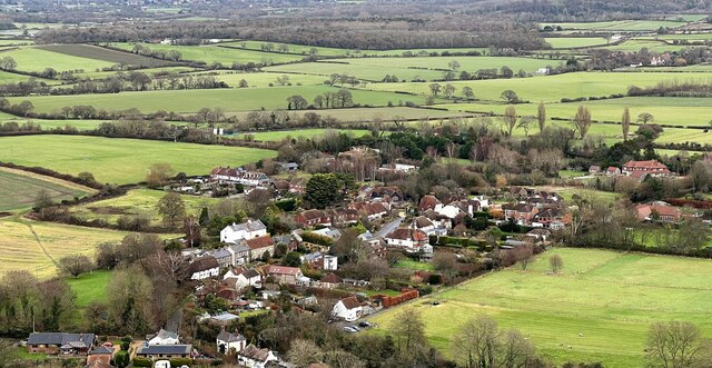
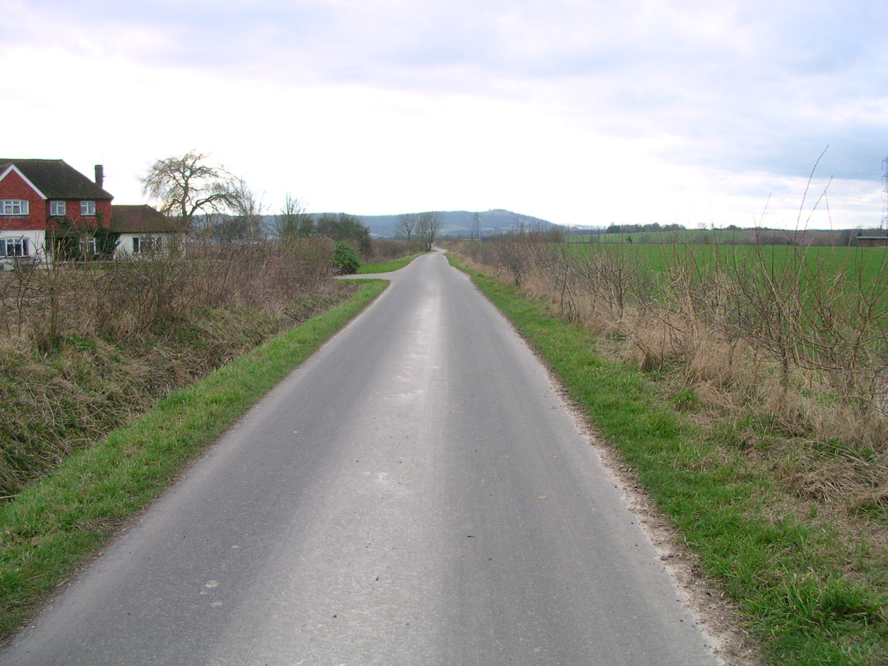
Edburton is a small village located in the county of Sussex, in the southeast region of England. Situated within the South Downs National Park, it is surrounded by picturesque rolling hills and breathtaking landscapes. The village is part of the Mid Sussex district and falls under the administrative authority of West Sussex County Council.

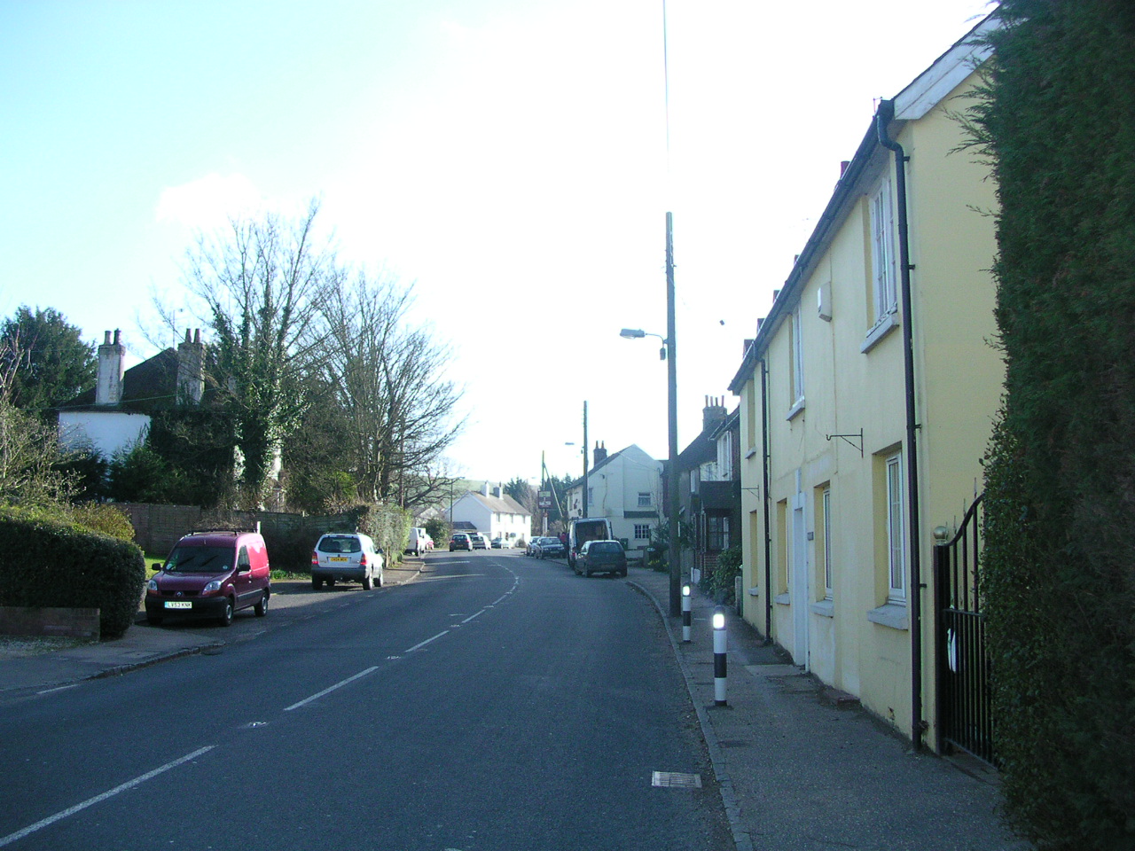
With a population of around 300 residents, Edburton retains a charming and close-knit community feel. The village is predominantly residential, consisting of traditional cottages and houses that blend seamlessly with the rural surroundings. Many of these properties date back several centuries and exhibit the architectural character of the region, adding to the village's historical appeal.

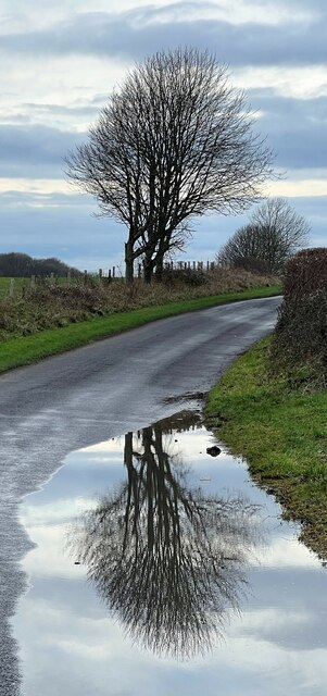
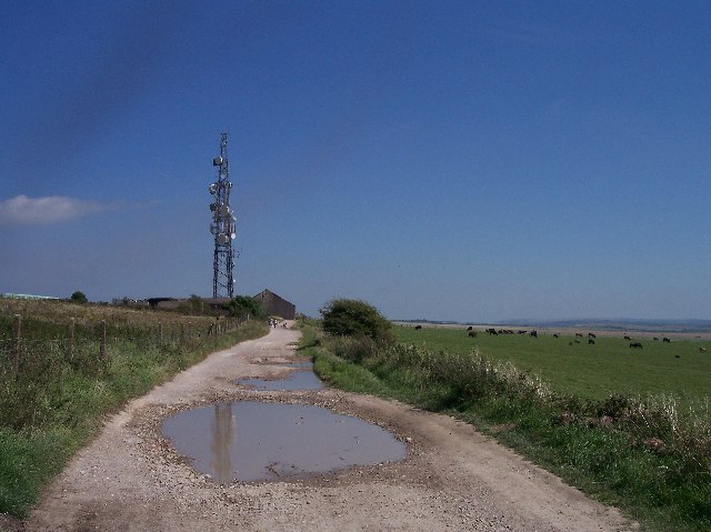
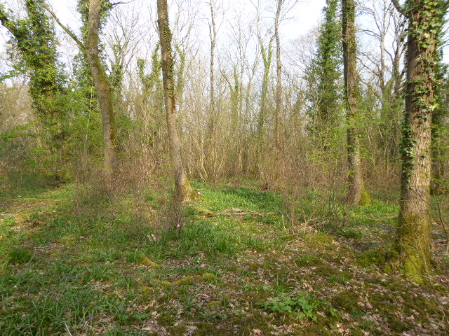
Edburton offers a peaceful and idyllic countryside setting, attracting visitors seeking tranquility and natural beauty. The village is well-known for its scenic walks and hiking trails, which allow visitors to explore the stunning South Downs landscape. Additionally, the nearby Devil's Dyke, a deep V-shaped valley, is a popular spot for outdoor activities such as paragliding, picnicking, and enjoying panoramic views of the surrounding countryside.

Although Edburton is a small village, it benefits from its proximity to larger towns and cities. The nearby town of Henfield provides essential amenities such as shops, schools, and healthcare facilities. The village is also conveniently located within easy reach of Brighton and Hove, offering a wider range of services, cultural attractions, and entertainment options.

In conclusion, Edburton is a charming and serene village nestled within the rolling hills of Sussex. With its rich history, picturesque landscapes, and close community, it offers a delightful retreat for those seeking a tranquil and traditional English countryside experience.

If you have any feedback on the listing, please let us know in the comments section below.

Edburton Images

Images are sourced within 2km of 50.890176/-0.24547 or Grid Reference TQ2311. Thanks to Geograph Open Source API. All images are credited.

Fulking - from the South Downs This is a cross-grid shot. The camera was in the square to the south.
Fulking - from the South Downs
This is a cross-grid shot. The camera was in the square to the south.
Tree and reflection A collection of photographs taken around midday by Geographers from all over Britain and Ireland. 
See all the images on the map: <a title="https://www.geograph.org.uk/stuff/xmas.php?year=2022" href="https://www.geograph.org.uk/stuff/xmas.php?year=2022">Link</a>
Tree and reflection
A collection of photographs taken around midday by Geographers from all over Britain and Ireland. See all the images on the map: Link
Inscription by the spring
Approach to Paythorne Barn The area by the trees, had about 50 years ago, the ruins of Summersdeane Farm and Paythorne Barn. Summersdeane Farm is now west of Truleigh Hill which can be seen on the horizon.
The path itself has seen changes, Once it was a full byway from Mile Oak to Edburton Hill and Truleigh Hill but is now only a restricted byway apart from the short section shown in the photo which is just a bridleway.
Approach to Paythorne Barn
The area by the trees, had about 50 years ago, the ruins of Summersdeane Farm and Paythorne Barn. Summersdeane Farm is now west of Truleigh Hill which can be seen on the horizon. The path itself has seen changes, Once it was a full byway from Mile Oak to Edburton Hill and Truleigh Hill but is now only a restricted byway apart from the short section shown in the photo which is just a bridleway.
Site of Summersdeane Farm (1) The trees are the only surviving entity of the former farm that was used by the Canadian Army for target practice. Directly opposite were the former outbuildings whilst to the south (see <a href="https://www.geograph.org.uk/photo/5861648">TQ2309 : Site of Summersdeane Farm (2)</a>) was a pair of cottages erected in the late Victorian period. The farm was rebuilt on Truleigh Hill after the war.
Site of Summersdeane Farm (1)
The trees are the only surviving entity of the former farm that was used by the Canadian Army for target practice. Directly opposite were the former outbuildings whilst to the south (see TQ2309 : Site of Summersdeane Farm (2)) was a pair of cottages erected in the late Victorian period. The farm was rebuilt on Truleigh Hill after the war.
Site of Summersdeane Farm (2) The dip on the right once contained a pair of late Victorian cottages which was located to the south of the farm buildings, see <a href="https://www.geograph.org.uk/photo/5861646">TQ2309 : Site of Summersdeane Farm (1)</a>. They were all used for target practice by the Canadian Army during the Second World War and the farm rebuilt on Truleigh Hill after.
Site of Summersdeane Farm (2)
The dip on the right once contained a pair of late Victorian cottages which was located to the south of the farm buildings, see TQ2309 : Site of Summersdeane Farm (1). They were all used for target practice by the Canadian Army during the Second World War and the farm rebuilt on Truleigh Hill after.
Site of Paythorne Barn Located on the right though the dip may be the site of an old dew pond. The outline can be seen better on the map where the footpath from Edburton Hill once went round the barn's perimeter. Like many farm buildings on the Downs, it was used by the Canadian Army for target practice during the Second World War. By the trees is <a href="https://www.geograph.org.uk/photo/5861646">TQ2309 : Site of Summersdeane Farm (1)</a> whilst beyond is Truleigh Hill and its radio masts.
Site of Paythorne Barn
Located on the right though the dip may be the site of an old dew pond. The outline can be seen better on the map where the footpath from Edburton Hill once went round the barn's perimeter. Like many farm buildings on the Downs, it was used by the Canadian Army for target practice during the Second World War. By the trees is TQ2309 : Site of Summersdeane Farm (1) whilst beyond is Truleigh Hill and its radio masts.
Permissive Bridleway Linking Restricted Byway 2756 at the northern end of Summers Deane with Footpath 13F which originally ended at Perchinghill Barn. The combe runs between Edburton Hill and Tenant Hill.
Permissive Bridleway
Linking Restricted Byway 2756 at the northern end of Summers Deane with Footpath 13F which originally ended at Perchinghill Barn. The combe runs between Edburton Hill and Tenant Hill.
Summer pastimes on the South Downs On fine summer Saturdays the hang-gliders and para-gliders gather to catch the rising thermals. This location, above Devil's Dyke in the South Downs, is managed by the National Trust and offers stunning views. Here you can see right across to the North Downs.
Summer pastimes on the South Downs
On fine summer Saturdays the hang-gliders and para-gliders gather to catch the rising thermals. This location, above Devil's Dyke in the South Downs, is managed by the National Trust and offers stunning views. Here you can see right across to the North Downs.
Fulking The village of Fulking is a classic spring line settlement.  It is viewed here from the South Downs Way which runs along the top of the South Downs escarpment.
Fulking
The village of Fulking is a classic spring line settlement. It is viewed here from the South Downs Way which runs along the top of the South Downs escarpment.
Edburton The tiny village of Edburton is one of the spring line settlements at the foot of the northern edge of the South Downs.
Edburton
The tiny village of Edburton is one of the spring line settlements at the foot of the northern edge of the South Downs.
Dip slope of the South Downs escarpment This view is taken looking south from the South Downs Way and shows the undulating nature of the dip slope of the escarpment.
Dip slope of the South Downs escarpment
This view is taken looking south from the South Downs Way and shows the undulating nature of the dip slope of the escarpment.
ascending Truleigh Hill - view to the west The buildings in the middle distance are Tottington Manor Farm and Hotel.
ascending Truleigh Hill - view to the west
The buildings in the middle distance are Tottington Manor Farm and Hotel.
Truleigh Hill, radio masts. Three of the four main masts viewed from the South Downs Way. Once the site of a chain home replacement radar it still boasts an underground bunker.
Truleigh Hill, radio masts.
Three of the four main masts viewed from the South Downs Way. Once the site of a chain home replacement radar it still boasts an underground bunker.
Truleigh Hill, Youth Hostel Located at Tottington Barn on the South Downs Way.
Truleigh Hill, Youth Hostel
Located at Tottington Barn on the South Downs Way.
Truleigh Hill, radio mast Looking east along the South Downs Way.
One of the four main radio masts on this hill.
Truleigh Hill, radio mast
Looking east along the South Downs Way. One of the four main radio masts on this hill.
Tumulus, Edburton Hill, Sussex Close to the South Downs Way, probably an ancient routeway. The tumulus is not in an obvious position where its outline would stand out on the skyline. Looking West towards the radio masts on Truleigh Hill.
Tumulus, Edburton Hill, Sussex
Close to the South Downs Way, probably an ancient routeway. The tumulus is not in an obvious position where its outline would stand out on the skyline. Looking West towards the radio masts on Truleigh Hill.
Show me another place!

Edburton is located at Grid Ref: TQ2311 (Lat: 50.890176, Lng: -0.24547)

Administrative County: West Sussex

District: Horsham

Police Authority: Sussex

What 3 Words

///dries.precluded.prepared. Near Henfield, West Sussex

Nearby Locations

Edburton

Related Wikis

Edburton

Edburton is a small village and former civil parish, now in the parish of Upper Beeding, in the Horsham district, in the county of West Sussex, England...

Edburton Castle Ring

Edburton Castle Ring (or Castle Rings) is an archaeological site in West Sussex, England, on the peak of Edburton Hill on the South Downs, near the villages...

Fulking

Fulking is a village and civil parish in the Mid Sussex District of West Sussex, England. The parish lies wholly with the South Downs National Park. The...

Beeding Hill to Newtimber Hill

Beeding Hill to Newtimber Hill is a 321 ha (790-acre) biological and geological Downland Site of Special Scientific Interest (SSSI) north of Shoreham-by...

Tottington Wood

Tottington Wood is a 5.1-hectare (13-acre) Local Nature Reserve in Small Dole in West Sussex. It is owned by Hopegar Properties and managed by The Tottington...

Horton Clay Pit

Horton Clay Pit is a 0.4-hectare (0.99-acre) geological Site of Special Scientific Interest in Small Dole in West Sussex. It is a Geological Conservation...

Small Dole

Small Dole is a village in the Horsham District of West Sussex, in England. It lies on the A2037 road two miles (3.2 km) south of Henfield. In the late...

Sussex Greensand Way

The Sussex Greensand Way is a Roman road that runs east-west linking the London to Lewes Way at Barcombe Mills to Stane Street at Hardham. The road, which...

Nearby Amenities

Located within 500m of 50.890176,-0.24547
St Andrews Church
Naptan AtcoCode: 4400HR0346
Naptan Bearing: E
Naptan BusStopType: CUS
Naptan CommonName: St Andrews Church
Naptan Indicator: o/s Church
Naptan Landmark: St Andrews Church
Naptan NaptanCode: wsxawdpa
Naptan Street: Clappers Lane
Naptan Verified: no
Source: naptan_import
Lat/Long: 50.889058/-0.2478833
Post Box
Collection Times: Mo-Fr 16:00; Sa 09:30
Post Box Type: wall
Ref: BN5 1359
Royal Cypher: VR
Royal Cypher Wikidata: Q33102356
Lat/Long: 50.8889007/-0.2467419
Edburton
Place: hamlet
Source: OS OpenData StreetView
Wikidata: Q5335741
Lat/Long: 50.8887825/-0.2484373
St Andrews Church
Naptan AtcoCode: 4400HR0347
Naptan Bearing: W
Naptan BusStopType: CUS
Naptan CommonName: St Andrews Church
Naptan Indicator: opp Clappers Lane
Naptan Landmark: St Andrews Church
Naptan NaptanCode: wsxawdpd
Naptan Street: Clappers Lane
Naptan Verified: no
Source: naptan_import
Lat/Long: 50.8887816/-0.2466598
Bench
Lat/Long: 50.8891148/-0.2478058
Barrier: stile
Lat/Long: 50.8881267/-0.2508597
The data included in this document is from www.openstreetmap.org. The data is made available under ODbL.

Have you been to Edburton?

Leave your review of Edburton below (or comments, questions and feedback).