Hookhurst Square Copse

Wood, Forest in Sussex Chichester

England

Hookhurst Square Copse

Churchyard gates, Wisborough Green
Churchyard gates, Wisborough Green Credit: Robin Webster

Hookhurst Square Copse is a picturesque woodland located in the county of Sussex, England. This dense forest covers an area of approximately 50 acres and is renowned for its natural beauty and diverse ecosystem. The copse is situated near the village of Hookhurst, surrounded by rolling hills and quaint countryside.

The woodland is primarily composed of native broadleaf species, including oak, beech, and ash trees, which dominate the landscape and create a lush and vibrant canopy. The age of these trees varies, with some dating back several centuries, adding a sense of history and grandeur to the copse.

Hookhurst Square Copse is home to a wide range of wildlife, providing a vital habitat for numerous species. Visitors may catch a glimpse of deer, foxes, and squirrels, as well as a variety of bird species, such as woodpeckers, owls, and thrushes. The copse also supports a diverse undergrowth of ferns, bluebells, and wildflowers, adding bursts of color throughout the seasons.

The copse is intersected by a network of well-maintained footpaths, allowing visitors to explore and enjoy the natural surroundings. These paths wind through the woodland, leading to secluded clearings and tranquil spots, ideal for picnics or simply taking in the peaceful atmosphere.

Hookhurst Square Copse is a popular destination for nature enthusiasts, walkers, and photographers, offering a peaceful retreat from the hustle and bustle of everyday life. Its natural beauty and biodiversity make it a valuable asset to the local community and an important conservation area for the wider Sussex region.

If you have any feedback on the listing, please let us know in the comments section below.

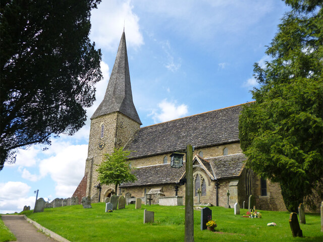
Hookhurst Square Copse Images

Images are sourced within 2km of 51.036623/-0.51820727 or Grid Reference TQ0327. Thanks to Geograph Open Source API. All images are credited.

Churchyard gates, Wisborough Green
Wisborough Green church The Church of St Peter ad Vincula is a grade I listed building, late 11th century onwards.
Wisborough Green church
The Church of St Peter ad Vincula is a grade I listed building, late 11th century onwards.
Petworth Road, Wisborough Green
House on Petworth Road, Wisborough Green
Petworth Road, Wisborough Green
Field edge bridleway by Smale Hanger
Bridleway enters Smale Copse
Bridleway leaves Smale Copse
Manger by field gate seen from bridleway
Looking along the B2133 from the entrance to Smale Farm
Looking westwards on the B2133
Dovecote at Fishers Farm Park Also seen at <a title="https://www.geograph.org.uk/photo/3348264" href="https://www.geograph.org.uk/photo/3348264">Link</a>.
Dovecote at Fishers Farm Park
Also seen at Link.
Weathervane at Fishers Farm Park
Looking northwards across Newpound Lane at bridleway junction
Weatheranimals at Fishers Farm Park
A272 The A272 is a very rural A road, which follows an east to west route from near Heathfield to Winchester, passing through the Sussex countryside. It runs 86 miles from Sutton Scotney to Five Ashes <a href="https://www.geograph.org.uk/photo/6669405">TQ5523 : A267, A272 junction</a>.
<span class="nowrap"><a title="http://www.sabre-roads.org.uk/wiki/index.php?title=A272" rel="nofollow ugc noopener" href="http://www.sabre-roads.org.uk/wiki/index.php?title=A272">Link</a><img style="margin-left:2px;" alt="External link" title="External link - shift click to open in new window" src="https://s1.geograph.org.uk/img/external.png" width="10" height="10"/></span> 
Wikipedia: <span class="nowrap"><a title="http://en.wikipedia.org/wiki/A272_road" rel="nofollow ugc noopener" href="http://en.wikipedia.org/wiki/A272_road">Link</a><img style="margin-left:2px;" alt="External link" title="External link - shift click to open in new window" src="https://s1.geograph.org.uk/img/external.png" width="10" height="10"/></span>
A272
The A272 is a very rural A road, which follows an east to west route from near Heathfield to Winchester, passing through the Sussex countryside. It runs 86 miles from Sutton Scotney to Five Ashes TQ5523 : A267, A272 junction. LinkExternal link Wikipedia: LinkExternal link
A272, Wisborough Green The A272 is a very rural A road, which follows an east to west route from near Heathfield to Winchester, passing through the Sussex countryside. It runs 86 miles from Sutton Scotney to Five Ashes <a href="https://www.geograph.org.uk/photo/6669405">TQ5523 : A267, A272 junction</a>.
<span class="nowrap"><a title="http://www.sabre-roads.org.uk/wiki/index.php?title=A272" rel="nofollow ugc noopener" href="http://www.sabre-roads.org.uk/wiki/index.php?title=A272">Link</a><img style="margin-left:2px;" alt="External link" title="External link - shift click to open in new window" src="https://s1.geograph.org.uk/img/external.png" width="10" height="10"/></span> 
Wikipedia: <span class="nowrap"><a title="http://en.wikipedia.org/wiki/A272_road" rel="nofollow ugc noopener" href="http://en.wikipedia.org/wiki/A272_road">Link</a><img style="margin-left:2px;" alt="External link" title="External link - shift click to open in new window" src="https://s1.geograph.org.uk/img/external.png" width="10" height="10"/></span>
A272, Wisborough Green
The A272 is a very rural A road, which follows an east to west route from near Heathfield to Winchester, passing through the Sussex countryside. It runs 86 miles from Sutton Scotney to Five Ashes TQ5523 : A267, A272 junction. LinkExternal link Wikipedia: LinkExternal link
Wisborough Green War Memorial
Show me another place!

Hookhurst Square Copse is located at Grid Ref: TQ0327 (Lat: 51.036623, Lng: -0.51820727)

Administrative County: West Sussex

District: Chichester

Police Authority: Sussex

What 3 Words

///icebergs.amphibian.pimples. Near Billingshurst, West Sussex

Related Wikis

Wisborough Green

Wisborough Green is a village and civil parish in the north of the Chichester district of West Sussex, England, 2 miles (3.2 km) west of Billingshurst...

St Ronan's School

Saint Ronan's School is an independent co-educational preparatory school for boys and girls from 3 to 13 years located in Hawkhurst in Kent, England. It...

Kirdford

Kirdford is a village and civil parish in the Chichester District of West Sussex, England. Its nearest town is Petworth, located 6.5 miles (10.5 km) southwest...

Loxwood F.C.

Loxwood Football Club is a football club based in Loxwood, West Sussex, England. Nicknamed "The Magpies" and affiliated to the Surrey County FA, they are...

River Kird

The River Kird is a river located in the Chichester District of West Sussex, England that is a tributary to the River Arun. It is located in South Downs...

Coppedhall Hanger

Coppedhall Hanger is a 0.6-hectare (1.5-acre) geological Site of Special Scientific Interest north of Billingshurst in West Sussex. It is a Geological...

Ifold

Ifold is a hamlet in West Sussex and part of the civil Parish of Plaistow, of which it is the largest settlement. Ifold is classified as a hamlet, because...

Loxwood

Loxwood is a small village and civil parish with several outlying settlements, in the Chichester district of West Sussex, England, within the Low Weald...

Nearby Amenities

Located within 500m of 51.036623,-0.51820727
Barrier: stile
Foot: yes
Lat/Long: 51.0326669/-0.5154149
Post Box
Collection Plate: CP7
Collection Times: Mo-Fr 16:45; Sa 09:15
Last Checked: 2020-03-06
Note: This postbox is of a brand new EIIR lamp design.
Operator: Royal Mail
Post Box Type: lamp
Ref: RH14 109
Royal Cypher: EIIR
Royal Cypher Wikidata: Q33102113
Lat/Long: 51.0326681/-0.5180368
Skiff Common
Naptan AtcoCode: 4400HR0935
Naptan Bearing: E
Naptan BusStopType: CUS
Naptan CommonName: Skiff Common
Naptan Indicator: HAR
Naptan Landmark: Hail & Ride
Naptan NaptanCode: wsxgajpd
Naptan Street: Unnamed Road
Naptan Verified: no
Source: naptan_import
Lat/Long: 51.0324867/-0.5187335
Skiff Common
Naptan AtcoCode: 4400HR0936
Naptan Bearing: W
Naptan BusStopType: CUS
Naptan CommonName: Skiff Common
Naptan Indicator: HAR
Naptan Landmark: Hail & Ride
Naptan NaptanCode: wsxgajpg
Naptan Street: Unnamed Road
Naptan Verified: no
Source: naptan_import
Lat/Long: 51.0324234/-0.518707
Power: pole
Source: Bing
Lat/Long: 51.0364658/-0.5168894
Power: pole
Source: Bing
Lat/Long: 51.0370359/-0.5151835
Power: pole
Source: Bing
Lat/Long: 51.0375959/-0.5134078
Power: pole
Source: Bing
Lat/Long: 51.0346913/-0.5223442
Power: pole
Source: Bing
Lat/Long: 51.0353256/-0.5203923
Power: pole
Source: Bing
Lat/Long: 51.0359495/-0.5184603
Sparr Farm Airstrip
Aeroway: aerodrome
Operator: Puddleduck Plane Partners
Source: http://www.ukairfieldguide.net/airfields/Sparr-Farm
Lat/Long: 51.036199/-0.5114311
The data included in this document is from www.openstreetmap.org. The data is made available under ODbL.

Have you been to Hookhurst Square Copse?

Leave your review of Hookhurst Square Copse below (or comments, questions and feedback).