Ecton

Settlement in Staffordshire Staffordshire Moorlands

England

Ecton

Wetton Mill Tearoom The tea room Wetton Mill is alongside the river Manifold and is a hive of activity every sunny weekend and Bank Holiday.
Wetton Mill Tearoom Credit: Dennis Thorley

Ecton is a small village located in the county of Staffordshire, England. Situated approximately four miles east of the town of Newcastle-under-Lyme, Ecton is nestled in the picturesque countryside of North Staffordshire.

The village is known for its historical significance, as it was the birthplace of the renowned engineer and inventor, Thomas Newcomen, who is credited with developing the atmospheric steam engine in the early 18th century. A plaque commemorating Newcomen can be found at the site of his former residence, which is now a private dwelling.

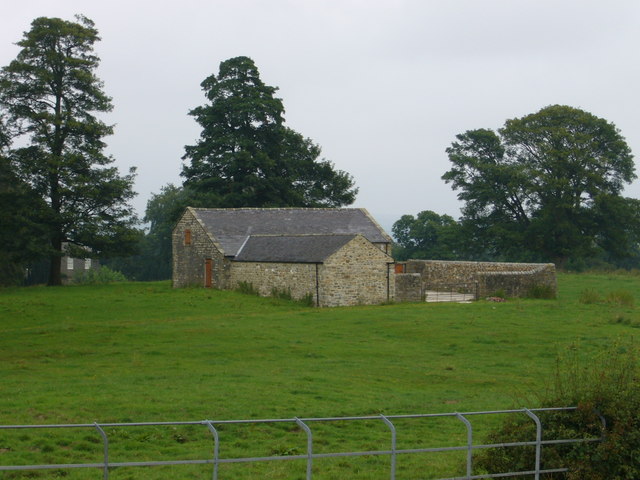
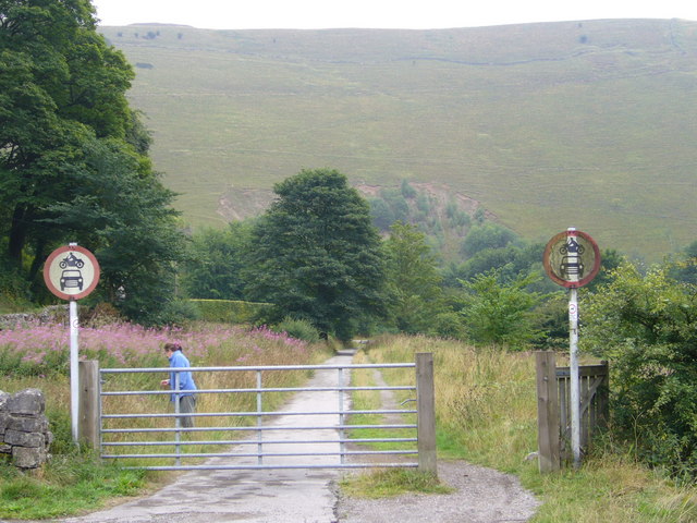
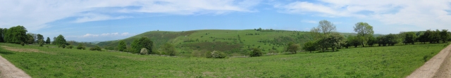
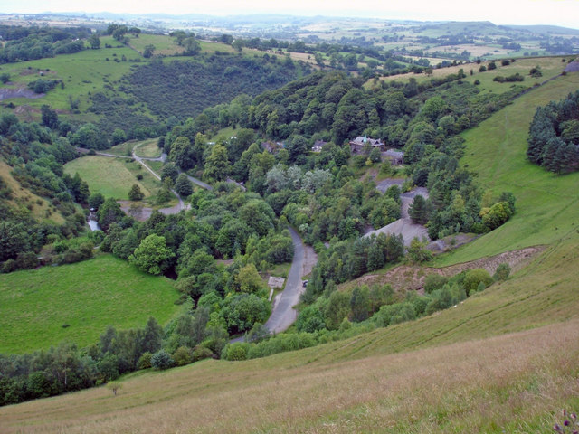
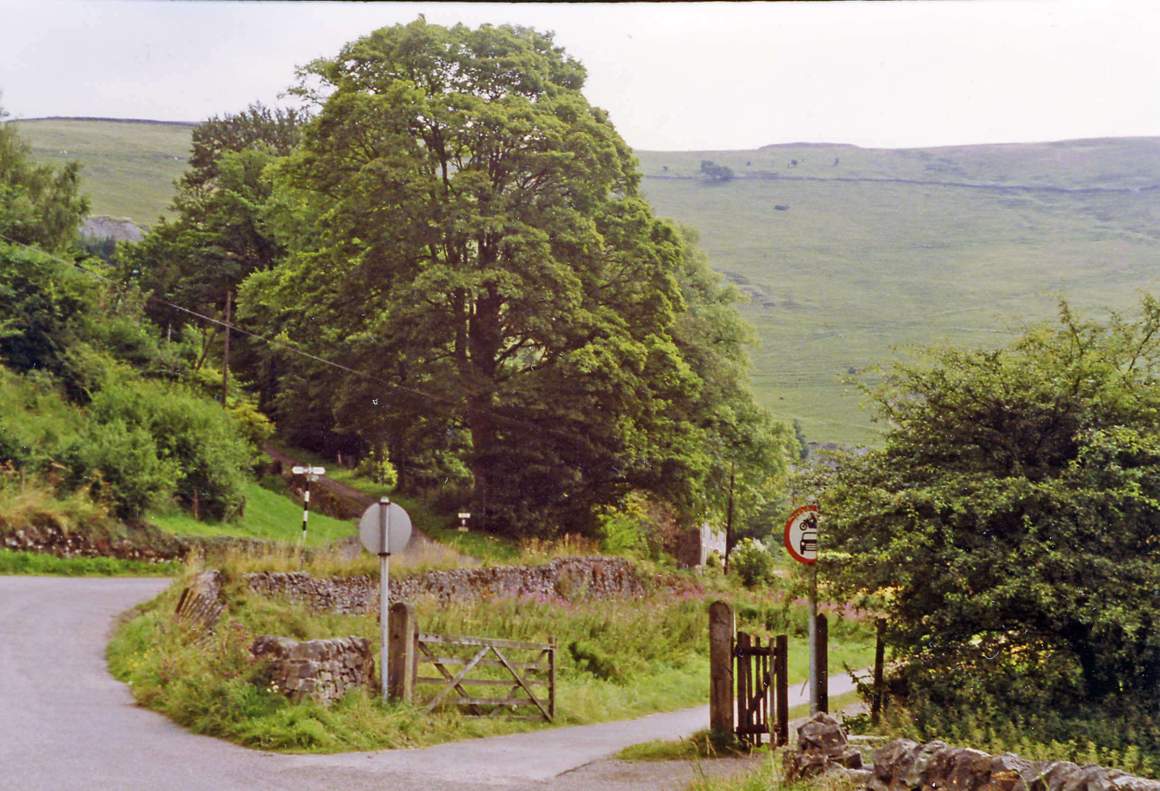
Ecton boasts a charming rural setting, with its rolling hills, meandering streams, and lush green landscapes. The village is surrounded by agricultural land, predominantly used for grazing dairy cattle and sheep. The countryside provides ample opportunities for outdoor activities such as walking, cycling, and horse riding.

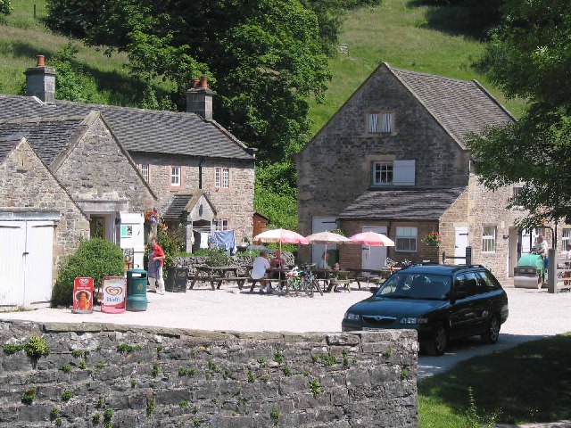
In terms of amenities, Ecton offers a limited range of facilities. There is a village hall, which serves as a community hub for various social gatherings and events. The nearest shops and services can be found in nearby towns such as Newcastle-under-Lyme or Stoke-on-Trent.

Ecton is a close-knit community with a population of around 500 residents. The village maintains a strong sense of community spirit, evident through local initiatives and annual events, including a summer fete and a Christmas market. The village also has a primary school, providing education for local children.

Overall, Ecton offers a tranquil and idyllic setting for those seeking a peaceful rural lifestyle, while still being within easy reach of larger towns and cities in Staffordshire.

If you have any feedback on the listing, please let us know in the comments section below.

Ecton Images

Images are sourced within 2km of 53.12249/-1.856514 or Grid Reference SK0958. Thanks to Geograph Open Source API. All images are credited.

Wetton Mill Tearoom The tea room Wetton Mill is alongside the river Manifold and is a hive of activity every sunny weekend and Bank Holiday.
Wetton Mill Tearoom
The tea room Wetton Mill is alongside the river Manifold and is a hive of activity every sunny weekend and Bank Holiday.
Caves at Wetton Mill Caves behind the cafe at Wetton Mill on the river Manifold
Caves at Wetton Mill
Caves behind the cafe at Wetton Mill on the river Manifold
Old railway tunnel - new road tunnel This old railway tunnel is now used as a road/footpath in the Manifold Valley.
Old railway tunnel - new road tunnel
This old railway tunnel is now used as a road/footpath in the Manifold Valley.
Near Warslow Hall part of Warslow Hall can be seen on the left. Not quite sure what this building is. It has a yard with a very substantial wall, over two metres high, on the two sides which are not buildings. Possibly stables?
Near Warslow Hall
part of Warslow Hall can be seen on the left. Not quite sure what this building is. It has a yard with a very substantial wall, over two metres high, on the two sides which are not buildings. Possibly stables?
K6 Kiosk in Quarter Lane near Leek Road, Warslow, Staffordshire. The sign above the kiosk reads "Telephone. Telegrams may be telephoned".
K6 Kiosk
in Quarter Lane near Leek Road, Warslow, Staffordshire. The sign above the kiosk reads "Telephone. Telegrams may be telephoned".
Dead railway off The Dale, Ecton near Warslow, Staffordshire. The trackbed of the former railway through the Manifold Valley is now a footpath. A kilometre beyond here the route goes through <a href="https://www.geograph.org.uk/photo/55883">SK0957 : Old railway tunnel - new road tunnel</a>.
Dead railway
off The Dale, Ecton near Warslow, Staffordshire. The trackbed of the former railway through the Manifold Valley is now a footpath. A kilometre beyond here the route goes through SK0957 : Old railway tunnel - new road tunnel.
The Greyhound Inn Leek Road, Warslow, Staffordshire
The Greyhound Inn
Leek Road, Warslow, Staffordshire
Ex rail - new road tunnel Similar view to previous photograph, but showing more of the surrounding terrain.
Ex rail - new road tunnel
Similar view to previous photograph, but showing more of the surrounding terrain.
Entrance to Ecton Copper Mine Derbyshire is usually associated with lead mining. However, the area around Ecton has been mined for copper since the Bronze age. Information on this mine can be read on the plaque to the right of the entrance  <a href="https://www.geograph.org.uk/photo/326511">SK0958 : Ecton Copper Mine information plaque</a>.
Entrance to Ecton Copper Mine
Derbyshire is usually associated with lead mining. However, the area around Ecton has been mined for copper since the Bronze age. Information on this mine can be read on the plaque to the right of the entrance SK0958 : Ecton Copper Mine information plaque.
Ecton Copper Mine information plaque <a href="https://www.geograph.org.uk/photo/326509">SK0958 : Entrance to Ecton Copper Mine</a>
Ecton Copper Mine information plaque
Warslow Hall feeder reservoir Feeder pond for the ornamental fishpond at Warslow Hall
Warslow Hall feeder reservoir
Feeder pond for the ornamental fishpond at Warslow Hall
Clayton House Clayton House, almost hidden among the trees
Clayton House
Clayton House, almost hidden among the trees
Kirksteads Farm Kirksteads Farm, with Ecton Hill in the background (on the other side of the Manifold Valley)
Kirksteads Farm
Kirksteads Farm, with Ecton Hill in the background (on the other side of the Manifold Valley)
Ivy House Ivy House viewed from the public footpath which passes through its garden
Ivy House
Ivy House viewed from the public footpath which passes through its garden
Ecton Hill panorama Ecton Hill viewed from the track south of Clayton House (trees around Clayton House at left edge of photo)
Ecton Hill panorama
Ecton Hill viewed from the track south of Clayton House (trees around Clayton House at left edge of photo)
Old farm building above Kirksteads Farm
The Warslow Brook valley looking across to Warslow
Derelict barn near Clough Head, Warslow
Show me another place!

Ecton is located at Grid Ref: SK0958 (Lat: 53.12249, Lng: -1.856514)

Administrative County: Staffordshire

District: Staffordshire Moorlands

Police Authority: Staffordshire

What 3 Words

///dragon.jump.earpiece. Near Newhaven, Derbyshire

Nearby Locations

Ecton

Related Wikis

Ecton, Staffordshire

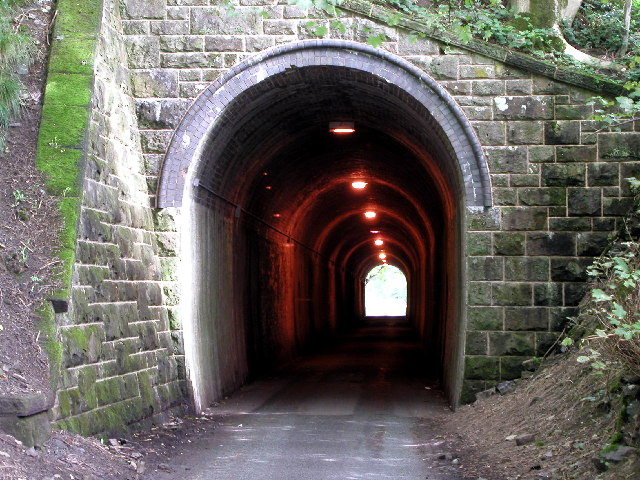
Ecton is a hamlet in the Staffordshire Peak District (grid reference SK096584). It is on the Manifold Way, an 8-mile (13 km) walk and cycle path that follows...
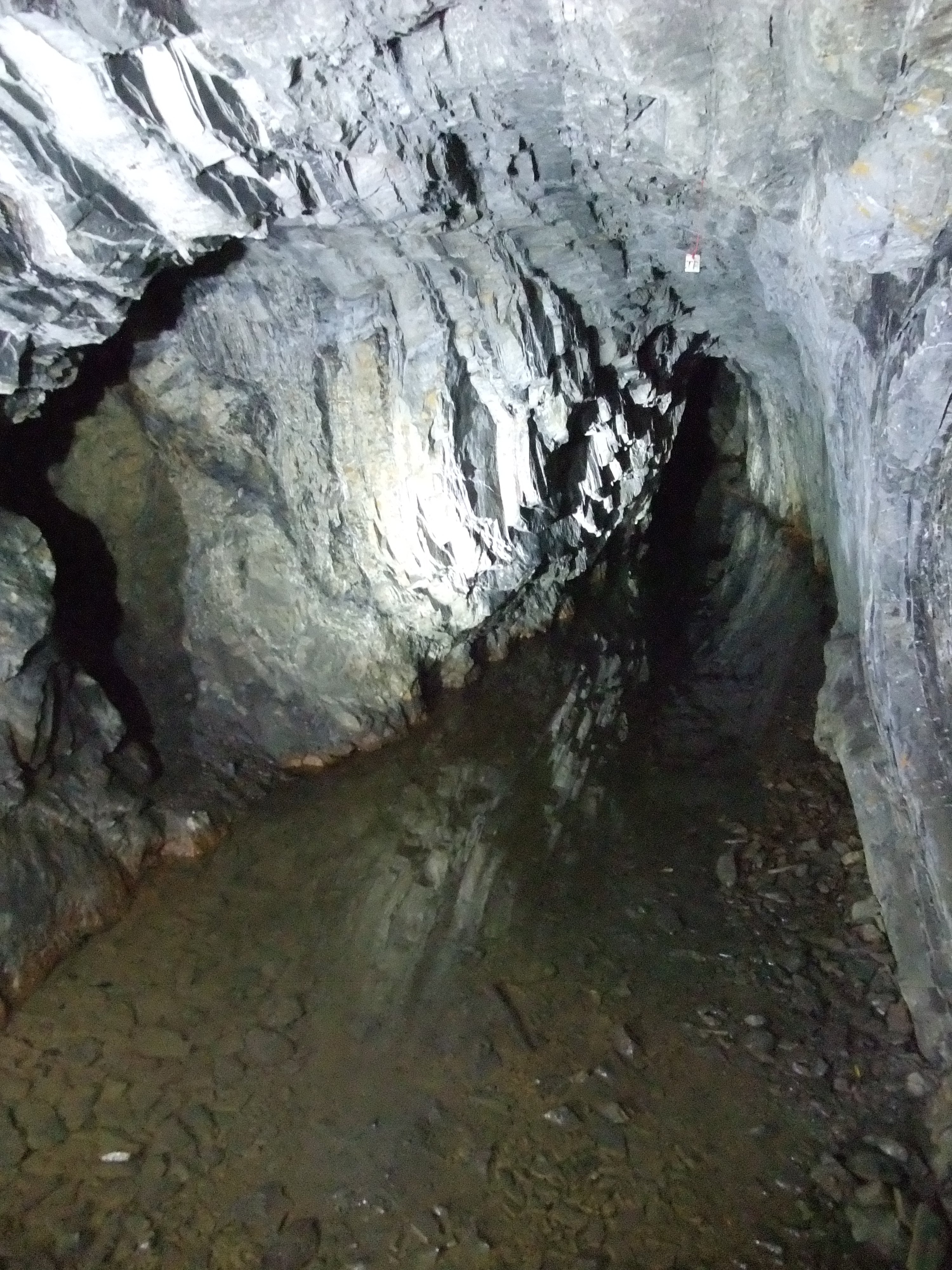
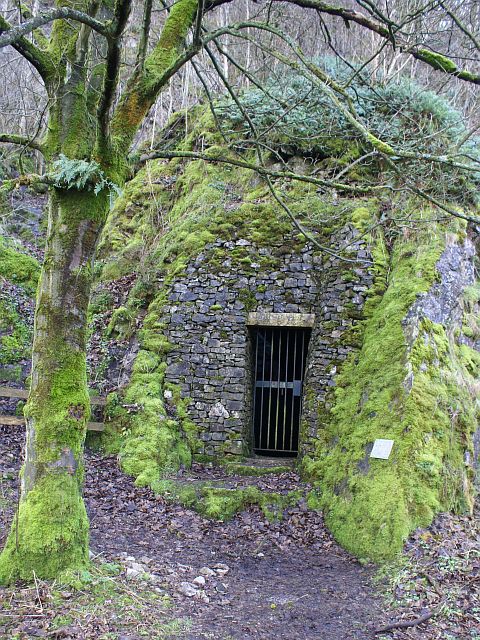
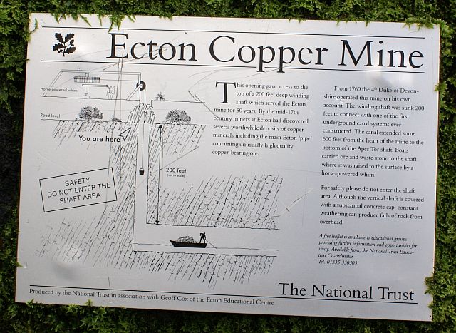
Ecton Mines

A group of mines on Ecton Hill, Staffordshire, are unusual for the Peak District in producing predominantly copper rather than lead and zinc. The most...

Ecton railway station

Ecton railway station was a station on the Leek and Manifold Light Railway. It served the hamlet of Ecton, Staffordshire. Today, the site is now part of...

Butterton railway station

Butterton railway station was a station on the Leek and Manifold Light Railway. It served the village of Butterton in Staffordshire. The site is now part...

Nearby Amenities

Located within 500m of 53.12249,-1.856514
Ecton
Place: hamlet
Wikidata: Q4530708
Lat/Long: 53.1222278/-1.8564039
Bench
Backrest: yes
Ele: 214.9788818
Lat/Long: 53.1216424/-1.8580178
Crossing
Crossing: unmarked
Crossing Island: no
Crossing Markings: no
Tactile Paving: no
Lat/Long: 53.1228736/-1.8589557
Parking
Ele: 202.7221680
Lat/Long: 53.1198984/-1.8609335
Parking
Ele: 199.8382568
Lat/Long: 53.1196103/-1.8588253
Parking
Ele: 202.7221680
Lat/Long: 53.1201785/-1.8571731
Parking
Ele: 203.2027588
Lat/Long: 53.1204828/-1.8569636
Ele: 251.0000000
Lat/Long: 53.1237401/-1.8629786
Ele: 242.0000000
Lat/Long: 53.1236003/-1.8624352
Ele: 231.0000000
Lat/Long: 53.1232899/-1.8612561
Ele: 217.0000000
Lat/Long: 53.1231094/-1.8602933
Ele: 224.0000000
Lat/Long: 53.1231972/-1.8608329
Access: no
Danger: yes
Man Made: mineshaft
Lat/Long: 53.1213299/-1.8528561
Access: no
Danger: yes
Man Made: mineshaft
Lat/Long: 53.1221114/-1.8531939
Ecton Hill
Ele: 369
Man Made: survey_point
Natural: peak
Lat/Long: 53.1190914/-1.852328
Ecton Copper Mine
Access: no
Historic: yes
Man Made: adit
Operator: National Trust
Lat/Long: 53.124737/-1.8533066
Access: no
Danger: yes
Man Made: mineshaft
Lat/Long: 53.1217413/-1.8530983
Ele: 200.0000000
Lat/Long: 53.121126/-1.8569877
Barrier: stile
Material: stone
Source: survey
Stile: squeezer
Lat/Long: 53.1207286/-1.8520467
Barrier: stile
Material: stone
Source: survey;gps
Stile: squeezer
Lat/Long: 53.122351/-1.8533576
Barrier: stile
Material: wood
Source: survey;gps
Stile: stepover
Lat/Long: 53.1261811/-1.8569328
Barrier: stile
Material: stone
Source: survey;gps
Stile: stepover
Lat/Long: 53.1215813/-1.8560208
Barrier: stile
Material: wood
Source: survey;gps
Stile: stepover
Lat/Long: 53.1246425/-1.8521252
Ecton Mine Powder House
Building: yes
Lat/Long: 53.1231833/-1.8567291
Ecton Copper Mine
Board Type: history
Check Date: 2021-10-03
Information: board
Tourism: information
Lat/Long: 53.1224995/-1.853875
Access: no
Danger: yes
Man Made: mineshaft
Lat/Long: 53.1183481/-1.8539323
Fixme: fence needs survey
Lat/Long: 53.1206161/-1.8518932
Ecton
Historic Railway: station
Railway: site
Wikidata: Q97357991
Wikipedia: en:Ecton railway station
Lat/Long: 53.1225642/-1.8587453
Clayton Mine
Direction: 90
Man Made: adit
Operator: Ecton Mines Educational Trust
Lat/Long: 53.1198222/-1.8580935
The data included in this document is from www.openstreetmap.org. The data is made available under ODbL.

Have you been to Ecton?

Leave your review of Ecton below (or comments, questions and feedback).