Decoy Wood
Wood, Forest in Yorkshire
England
Decoy Wood

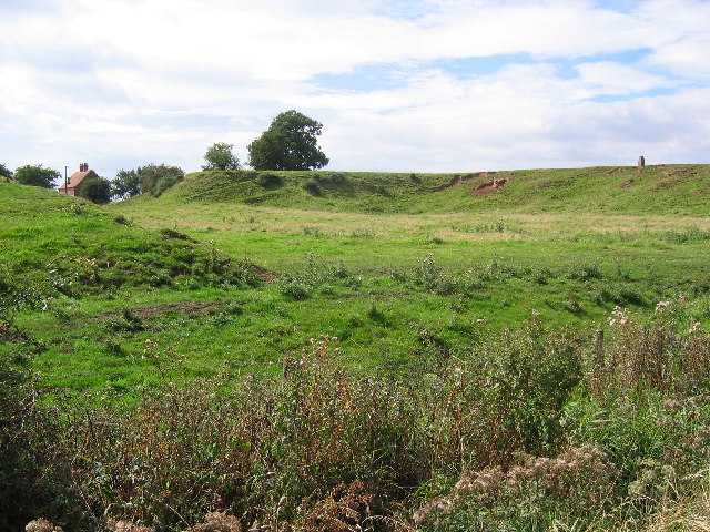
Decoy Wood, located in Yorkshire, England, is a picturesque forest that offers an enchanting escape into nature. Spanning over a vast area, this woodland is a popular destination for outdoor enthusiasts and nature lovers alike.
The forest is characterized by its diverse ecosystem, comprising a wide variety of tree species, including oak, beech, and birch. The dense foliage creates a lush and vibrant environment, providing a sanctuary for numerous wildlife species, such as deer, foxes, and a multitude of bird species. The wood is also home to a variety of plant life, including ferns, bluebells, and wild garlic, adding to its natural beauty.
Decoy Wood offers a range of activities for visitors to enjoy. A network of well-maintained trails provides opportunities for hiking and walking, allowing visitors to immerse themselves in the tranquil surroundings. The forest also features designated picnic areas where visitors can relax and enjoy a meal amidst the peaceful ambiance.
For those seeking a more adventurous experience, Decoy Wood offers opportunities for wildlife spotting and photography. The diverse range of animals and plants present in the forest makes it an ideal location for capturing stunning photographs of nature's wonders.
Overall, Decoy Wood in Yorkshire is a captivating destination for those seeking a serene and immersive nature experience. Its lush forest, abundant wildlife, and recreational activities make it an ideal getaway for individuals and families looking to connect with the natural world.
If you have any feedback on the listing, please let us know in the comments section below.
Decoy Wood Images
Images are sourced within 2km of 53.898479/-0.42640428 or Grid Reference TA0345. Thanks to Geograph Open Source API. All images are credited.


Decoy Wood is located at Grid Ref: TA0345 (Lat: 53.898479, Lng: -0.42640428)
Division: East Riding
Unitary Authority: East Riding of Yorkshire
Police Authority: Humberside
What 3 Words
///lease.beginning.unzipped. Near Leconfield, East Yorkshire
Nearby Locations
Related Wikis
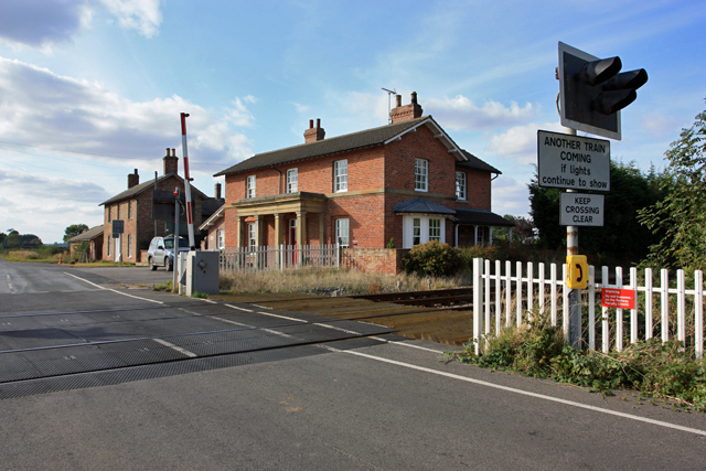
Lockington railway station
Lockington railway station was a minor station serving the village of Lockington, East Riding of Yorkshire, England. It was on the Hull to Scarborough...

Lockington rail crash
In Lockington, England on 26 July 1986, the 09:33 passenger train from Bridlington to Kingston upon Hull on the Hull to Scarborough Line struck a passenger...

Aike
Aike ( ) is a hamlet and former civil parish, now in the parish of Lockington, in the East Riding of Yorkshire, England. The hamlet is centred around a...
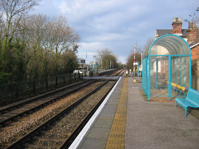
Arram railway station
Arram railway station serves the small village of Arram in the East Riding of Yorkshire, England. It is located on the Yorkshire Coast Line and is operated...
Have you been to Decoy Wood?
Leave your review of Decoy Wood below (or comments, questions and feedback).