Wood Walk

Wood, Forest in Hertfordshire Three Rivers

England

Wood Walk

Railway station at Chorleywood This station entrance needs to be given an uplift
Railway station at Chorleywood Credit: Jack Hill

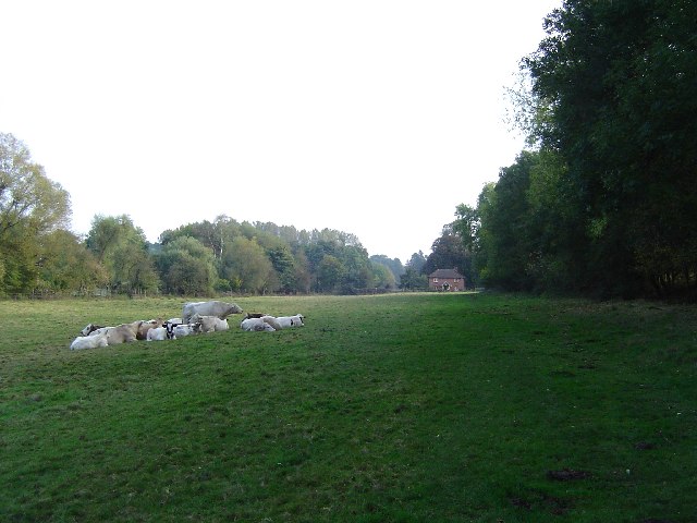
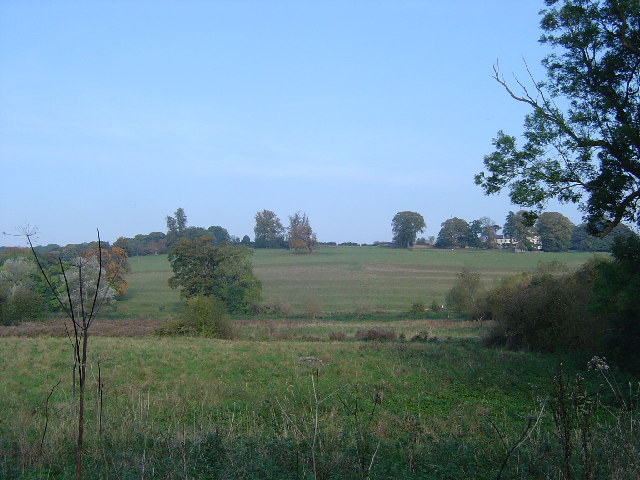
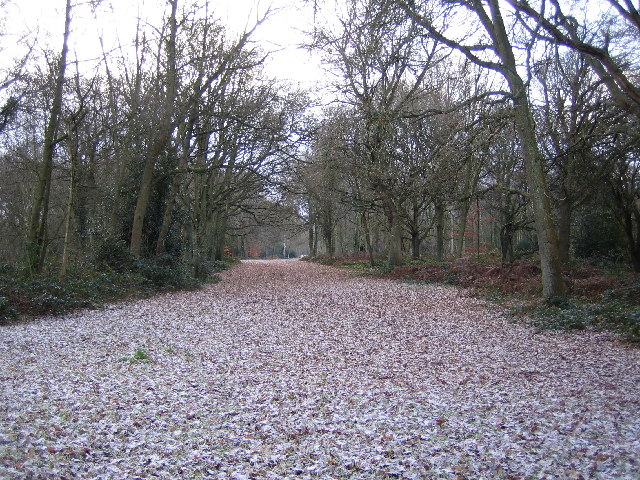
Wood Walk is a picturesque woodland located in Hertfordshire, England. Covering an area of approximately 100 acres, it is a popular destination for outdoor enthusiasts and nature lovers alike. The woodland is characterized by its dense canopy of trees, which includes a variety of species such as oak, beech, and silver birch.

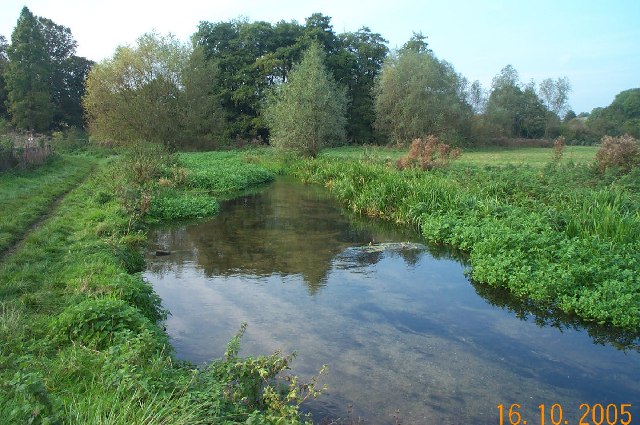
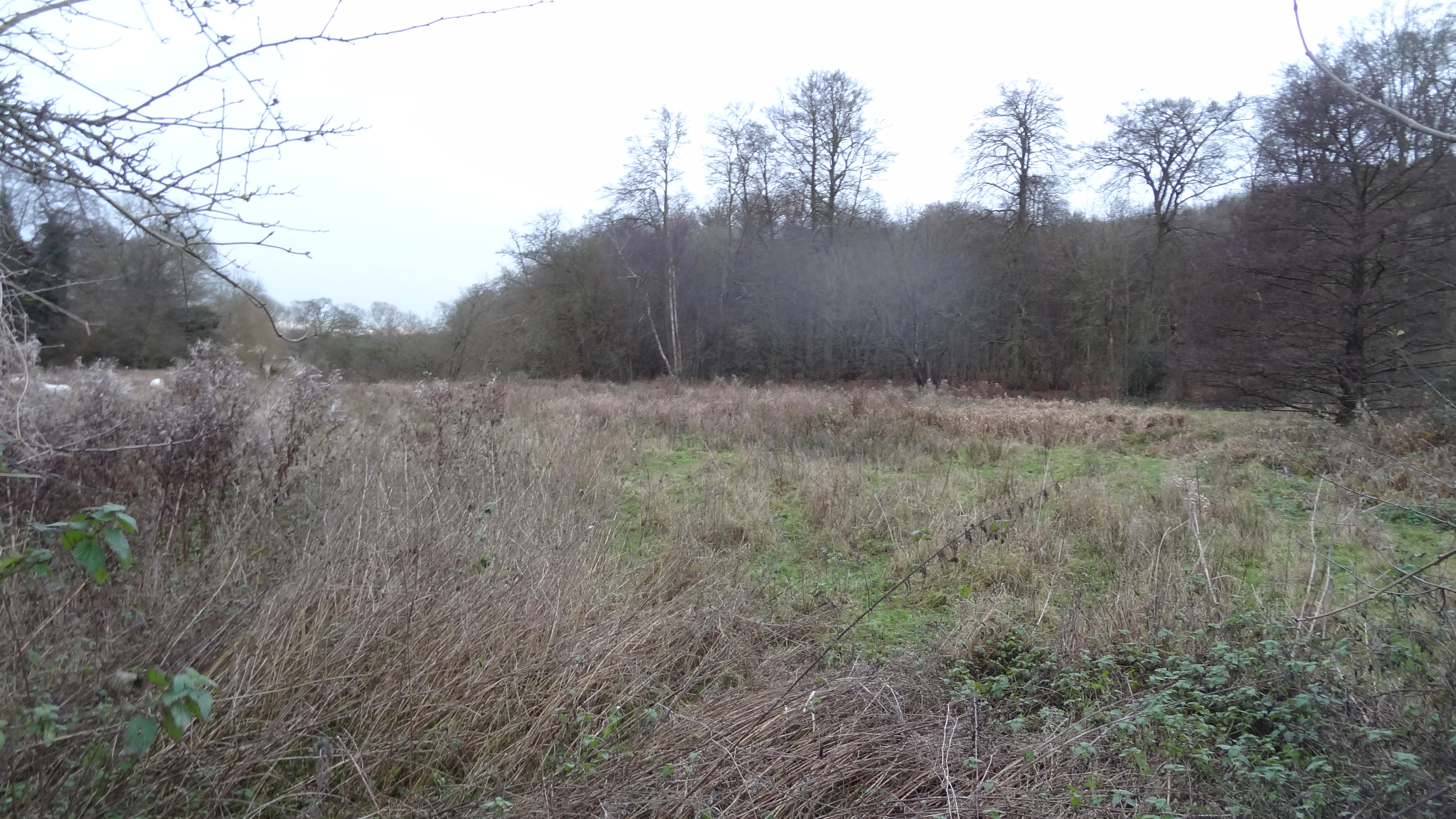
The forest floor is covered with a lush carpet of moss, ferns, and wildflowers, creating a vibrant and enchanting atmosphere. Numerous walking trails wind their way through the woodland, offering visitors the opportunity to explore its natural beauty at their own pace. These paths are well-maintained and clearly signposted, making it easy for visitors to navigate their way around.

Wood Walk is home to a diverse range of wildlife, providing nature enthusiasts with ample opportunities for birdwatching and animal spotting. The woodland is particularly known for its populations of deer, squirrels, and a variety of bird species, including woodpeckers and songbirds.

The tranquil setting of Wood Walk makes it an ideal place for relaxation and meditation. The peaceful ambiance, combined with the fresh scent of pine and the gentle rustling of leaves, creates a serene environment that encourages visitors to unwind and connect with nature.

With its natural beauty, diverse wildlife, and peaceful atmosphere, Wood Walk in Hertfordshire is a haven for nature enthusiasts and those seeking a respite from the hustle and bustle of everyday life. Whether it's a leisurely stroll, birdwatching, or simply enjoying the tranquility, Wood Walk offers a truly immersive and memorable experience.

If you have any feedback on the listing, please let us know in the comments section below.

Wood Walk Images

Images are sourced within 2km of 51.665022/-0.5050273 or Grid Reference TQ0397. Thanks to Geograph Open Source API. All images are credited.

Railway station at Chorleywood This station entrance needs to be given an uplift
Railway station at Chorleywood
This station entrance needs to be given an uplift
The Old Shepherd Pub Chorleywood This is adjoining the railway but has a small green 
outside
The Old Shepherd Pub Chorleywood
This is adjoining the railway but has a small green outside
The Chapel at Chenies A simple workman-like building Notice the balcony
 balustrade visible through the top windows.
The Chapel at Chenies
A simple workman-like building Notice the balcony balustrade visible through the top windows.
Red Lion at Chenies. This section of road needs to be widened to allow 
safer passage of vehicles.A metre would be enough.
Red Lion at Chenies.
This section of road needs to be widened to allow safer passage of vehicles.A metre would be enough.
Sarratt Bottom The houses at the bottom end of Moor Lane viewed looking eastwards from Holloway Lane and the valley of the River Chess. Holloway Lane is on the Chess Valley Walk.
Sarratt Bottom
The houses at the bottom end of Moor Lane viewed looking eastwards from Holloway Lane and the valley of the River Chess. Holloway Lane is on the Chess Valley Walk.
M25 Motorway from the Solesbridge Lane overbridge Viewed looking north at the stretch where a fourth lane has recently been constructed on an uphill section.
M25 Motorway from the Solesbridge Lane overbridge
Viewed looking north at the stretch where a fourth lane has recently been constructed on an uphill section.
River Chess watercress beds From the Chess Valley Walk official guide: "The clean warm waters of the Chess create ideal growing conditions for watercress, once a common crop along the river but now grown only here at Sarratt. Water from the Chess is diverted into a series of growing compartments - 'beds'. The cress takes root in the shallow beds, taking minerals from the calcium rich water. The flow is added to by spring water from deep in the aquifer which is at a constant temperature - about 10ºC. In years when the air temperature remains high enough the warm water allows cultivation right through the winter."
River Chess watercress beds
From the Chess Valley Walk official guide: "The clean warm waters of the Chess create ideal growing conditions for watercress, once a common crop along the river but now grown only here at Sarratt. Water from the Chess is diverted into a series of growing compartments - 'beds'. The cress takes root in the shallow beds, taking minerals from the calcium rich water. The flow is added to by spring water from deep in the aquifer which is at a constant temperature - about 10ºC. In years when the air temperature remains high enough the warm water allows cultivation right through the winter."
Mount Wood, Chenies View looking southwards along the footpath in Mount Wood running parallel to the River Chess.
Mount Wood, Chenies
View looking southwards along the footpath in Mount Wood running parallel to the River Chess.
A Pastoral Scene Looking south east towards North Hill, Chorleywood, this idyllic picture of rural tranquillity was marred by the constant roar of the traffic on the M25 motorway, about a kilometre away to the south east.
A Pastoral Scene
Looking south east towards North Hill, Chorleywood, this idyllic picture of rural tranquillity was marred by the constant roar of the traffic on the M25 motorway, about a kilometre away to the south east.
Strip lynchets, River Chess valley From the Chess Valley Walk Guide: "The terraced field rising up the valley side is thought to date from the 9th century.The characteristic steps, or ‘strip lynchets’, formed by the action of ploughing along the slope, may have been the site of mediaeval vineyards."
Strip lynchets, River Chess valley
From the Chess Valley Walk Guide: "The terraced field rising up the valley side is thought to date from the 9th century.The characteristic steps, or ‘strip lynchets’, formed by the action of ploughing along the slope, may have been the site of mediaeval vineyards."
River Chess, near Sarratt Bottom Viewed looking upstream and northwards, the river here appears to be in an artificial cut, as it does not flow in the lowest part of the valley, which is to the left of the photo.
River Chess, near Sarratt Bottom
Viewed looking upstream and northwards, the river here appears to be in an artificial cut, as it does not flow in the lowest part of the valley, which is to the left of the photo.
River Chess, near Sarrattmill Bridge Viewed looking upstream and northwards from opposite the Water Works.
River Chess, near Sarrattmill Bridge
Viewed looking upstream and northwards from opposite the Water Works.
River Chess, near Valley Farm Viewed looking downstream and eastwards from the footbridge by the Holloway Lane ford, the commercial watercress beds are beyond the shed, with the trees on the slope of Mount Wood visible to the right.
River Chess, near Valley Farm
Viewed looking downstream and eastwards from the footbridge by the Holloway Lane ford, the commercial watercress beds are beyond the shed, with the trees on the slope of Mount Wood visible to the right.
Sarratt: Scrubbs Farm, Micklefield Green Barns of indeterminate age, almost entirely surrounded by arable farmland. Curiously this group of buildings is called "New Model Farm" on my 1979 version of the OS 1:25,000 scale map.
Sarratt: Scrubbs Farm, Micklefield Green
Barns of indeterminate age, almost entirely surrounded by arable farmland. Curiously this group of buildings is called "New Model Farm" on my 1979 version of the OS 1:25,000 scale map.
Sarratt: Almshouses, Church End Opposite the church in Church Lane, Sarratt, and built in 1821 by a local benefactor.
Sarratt: Almshouses, Church End
Opposite the church in Church Lane, Sarratt, and built in 1821 by a local benefactor.
Mobile telephone mast and farm track bridge over the M25 Viewed looking northwards over the motorway, near Micklefield Green, Sarratt.
Mobile telephone mast and farm track bridge over the M25
Viewed looking northwards over the motorway, near Micklefield Green, Sarratt.
Chorleywood Common Viewed looking south eastwards along one of the wide rides through the wood.
Chorleywood Common
Viewed looking south eastwards along one of the wide rides through the wood.
M25 Motorway viaduct & Metropolitan Line railway & Berry Lane Three for the price of one here. The underside of the M25 Motorway viaduct between Junctions 17 and 18, viewed looking southwards, and at the far end of the viaduct a southbound Metropolitan Line train on the track between Chorleywood and Rickmansworth stations. Berry Lane road runs east-west under the viaduct between the earth banks in the middle.
M25 Motorway viaduct & Metropolitan Line railway & Berry Lane
Three for the price of one here. The underside of the M25 Motorway viaduct between Junctions 17 and 18, viewed looking southwards, and at the far end of the viaduct a southbound Metropolitan Line train on the track between Chorleywood and Rickmansworth stations. Berry Lane road runs east-west under the viaduct between the earth banks in the middle.
Show me another place!

Wood Walk is located at Grid Ref: TQ0397 (Lat: 51.665022, Lng: -0.5050273)

Administrative County: Hertfordshire

District: Three Rivers

Police Authority: Hertfordshire

What 3 Words

///smooth.garden.choice. Near Chorleywood, Hertfordshire

Related Wikis

Chorleywood House Estate

Chorleywood House Estate is a 64.3 hectare Local Nature Reserve in Chorleywood in Hertfordshire. It is owned and managed by Three Rivers District Council...

Chorleywood Common

Chorleywood Common is a 75.6 hectare Local Nature Reserve in Chorleywood in Hertfordshire. It is owned and managed by Chorleywood Parish Council, and the...

St Clement Danes School

St Clement Danes School is a mixed academy school in Chorleywood, Hertfordshire. == Admissions == St Clement Danes is a partially selective school, providing...
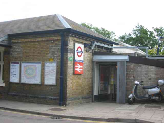
Chorleywood station

Chorleywood is a London Underground and National Rail station in Travelcard Zone 7 (previously zone B) on the Metropolitan line. The village of Chorleywood...

Sarratt Bottom nature reserve

Sarratt Bottom nature Reserve in Hertfordshire is a 3.2-hectare (7.9-acre) biological Site of Special Scientific Interest. The site is a meadow beside...
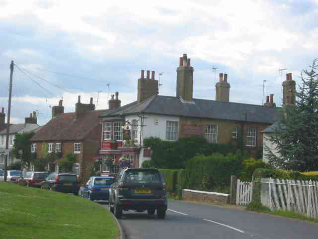
Chorleywood

Chorleywood is both a village and a civil parish in the Three Rivers District, Hertfordshire, on the border with Buckinghamshire, approximately 20 miles...

Loudwater, Hertfordshire

Loudwater is a private housing estate in the parish of Chorleywood, separated from the latter by the River Chess, north of Rickmansworth, Hertfordshire...

Frogmore Meadows

Frogmore Meadows is a 4.6-hectare (11-acre) biological Site of Special Scientific Interest in Hertfordshire and Buckinghamshire, north of the village of...

Nearby Amenities

Located within 500m of 51.665022,-0.5050273
Waste Basket
Waste: dog_excrement
Lat/Long: 51.6605863/-0.5059032
Bicycle Parking
Bicycle Parking: stands
Capacity: 6
Lat/Long: 51.6606587/-0.5060899
Entrance: yes
Lat/Long: 51.6643582/-0.5107356
North Hill Farm
Addr City: Rickmansworth
Addr Housename: North Hill Farm
Addr Postcode: WD3 6HA
Addr Street: North Hill
Addr Suburb: Chorleywood
Fhrs Id: 323836
Tourism: guest_house
Website: https://www.northhillfarm.co.uk/bedandbreakfast
Lat/Long: 51.6643057/-0.5106765
Toilets
Access: customers
Lat/Long: 51.6653974/-0.5105293
Shower
Access: customers
Lat/Long: 51.6653839/-0.5105027
Shower
Access: customers
Lat/Long: 51.6646724/-0.5104733
Toilets
Access: customers
Lat/Long: 51.664643/-0.5104727
Waste Disposal
Waste: trash
Lat/Long: 51.6648206/-0.5115335
Bench
Backrest: yes
Lat/Long: 51.6691459/-0.5034024
Bench
Backrest: yes
Inscription: Pinner & District Walking Club 1970-2012 Pam Manning remembered with affection
Material: wood
Lat/Long: 51.6677485/-0.5010249
Bench
Backrest: yes
Check Date: 2023-08-07
Material: wood
Lat/Long: 51.667463/-0.5004942
Waste Basket
Check Date: 2023-08-07
Waste: dog_excrement
Lat/Long: 51.6655651/-0.4980936
Waste Basket
Check Date: 2023-08-07
Waste: trash
Lat/Long: 51.6655888/-0.4981358
Chorleywood House Estate
Check Date: 2023-08-07
Hiking: yes
Information: map
Map Size: site
Map Type: scheme
Tourism: information
Lat/Long: 51.665506/-0.4983417
Bench
Backrest: yes
Lat/Long: 51.6646738/-0.5010822
Bench
Backrest: yes
Lat/Long: 51.6654711/-0.5051176
Access: no
Barrier: kissing_gate
Foot: permissive
Lat/Long: 51.6685767/-0.503706
Access: no
Barrier: kissing_gate
Foot: permissive
Lat/Long: 51.6654525/-0.4986933
Barrier: kissing_gate
Lat/Long: 51.6672428/-0.505942
Access: no
Barrier: kissing_gate
Foot: permissive
Lat/Long: 51.6673167/-0.5015689
Access: no
Barrier: kissing_gate
Foot: permissive
Lat/Long: 51.6661299/-0.5032645
Bench
Lat/Long: 51.6668254/-0.5058048
Chorleywood Lawn Tennis Club
Addr City: Rickmansworth
Addr Housename: Walled Garden
Addr Postcode: WD3 5SL
Addr Street: Chorleywood House Drive
Addr Suburb: Chorleywood
Club: sport
Phone: +44 1923 284199
Website: https://www.chorleywoodtennis.com/
Lat/Long: 51.6622695/-0.5098966
Bullscroft Farm Pick Your Own
Addr City: Rickmansworth
Addr Postcode: WD3 6EW
Addr Street: Chenies Road
Addr Suburb: Chorleywood
Shop: agrarian
Lat/Long: 51.6651597/-0.5121931
Waste Basket
Waste: dog_excrement
Lat/Long: 51.6625585/-0.5057207
Bench
Lat/Long: 51.6624581/-0.5062799
Bench
Lat/Long: 51.6624269/-0.5080712
Bench
Lat/Long: 51.6609873/-0.5021802
Bench
Lat/Long: 51.6631528/-0.5003799
Bench
Backrest: yes
Inscription: In Loving Memory of Ian Broadbent 3/2/52 to 4/5/21. Ian Loved Walking in the Chess Valley
Material: wood
Lat/Long: 51.6659741/-0.5034668
Bench
Lat/Long: 51.6656178/-0.5072074
Bench
Backrest: yes
Inscription: In loving memory of Jean Walker who loved this place
Material: wood
Lat/Long: 51.6621389/-0.5060568
The data included in this document is from www.openstreetmap.org. The data is made available under ODbL.

Have you been to Wood Walk?

Leave your review of Wood Walk below (or comments, questions and feedback).