Haceby Little Wood

Wood, Forest in Lincolnshire North Kesteven

England

Haceby Little Wood

Haceby: aerial 2021 (1)
Haceby: aerial 2021 (1) Credit: Chris

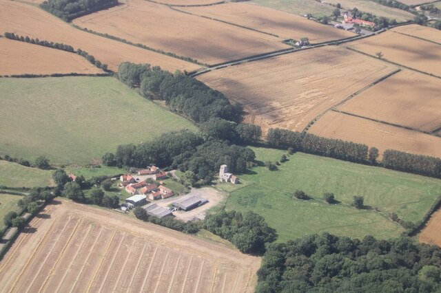
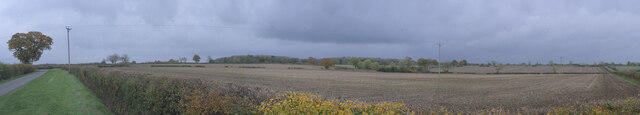
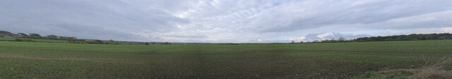
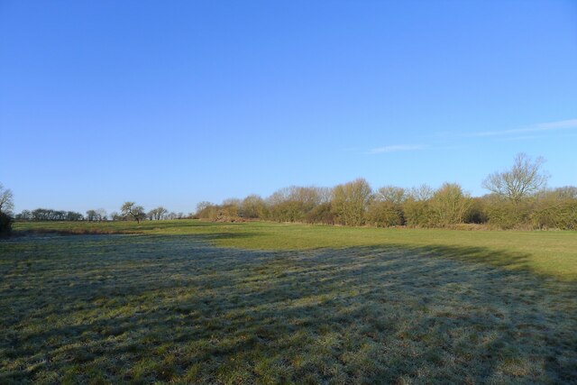
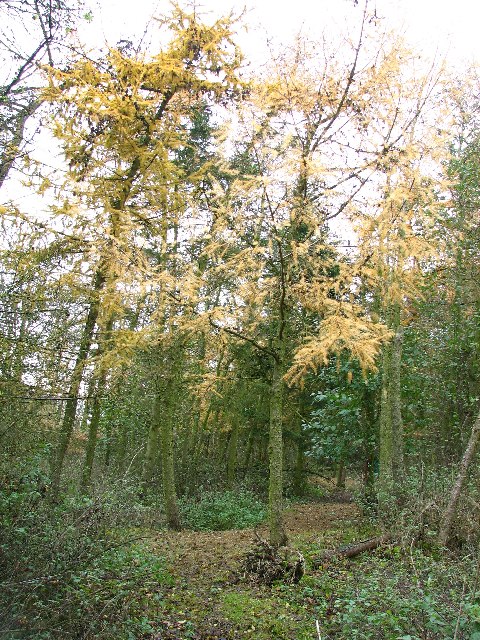
Haceby Little Wood is a small woodland area located in the county of Lincolnshire, England. Nestled in the picturesque countryside, this woodland covers an area of approximately 20 acres and is known for its natural beauty and diverse ecosystem.

The wood is predominantly composed of mixed deciduous trees, including oak, ash, birch, and beech, offering a stunning display of colors throughout the year. It is a haven for wildlife, providing a habitat for various species of birds, mammals, and insects. Nature enthusiasts and birdwatchers are often drawn to the wood to observe the rich birdlife, including woodpeckers, owls, and songbirds.

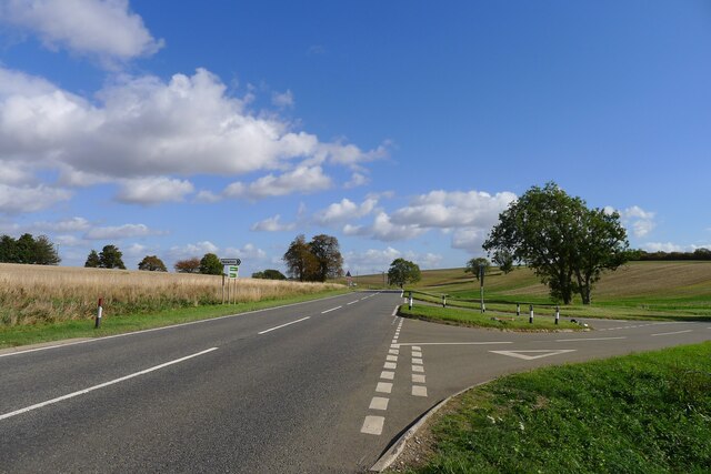
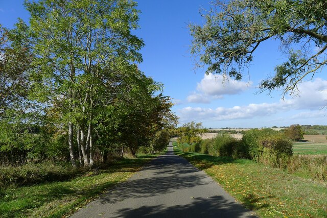
Haceby Little Wood is a popular destination for outdoor activities such as walking, hiking, and nature trails. The wood is crisscrossed by well-maintained footpaths, allowing visitors to explore its enchanting surroundings. The peaceful atmosphere and tranquil setting make it an ideal spot for relaxation and immersing oneself in nature.

Managed by local authorities and conservation organizations, efforts are made to preserve and protect the woodland's natural heritage. The management includes regular maintenance and conservation activities to ensure the continued health and vitality of the ecosystem.

The wood is situated in close proximity to the village of Haceby, offering visitors easy access to amenities such as parking facilities, picnic areas, and nearby attractions. Haceby Little Wood is a true gem for nature lovers and provides a delightful escape into the beauty of Lincolnshire's countryside.

If you have any feedback on the listing, please let us know in the comments section below.

Haceby Little Wood Images

Images are sourced within 2km of 52.911431/-0.46500002 or Grid Reference TF0335. Thanks to Geograph Open Source API. All images are credited.

Haceby: aerial 2021 (1)
Haceby: aerial 2021 (2)
Fields north-west of Pickworth
Church of St Margaret, Braceby A grade II* listed church with origins in the 13th Century - see <span class="nowrap"><a title="https://historicengland.org.uk/listing/the-list/list-entry/1360324" rel="nofollow ugc noopener" href="https://historicengland.org.uk/listing/the-list/list-entry/1360324">Link</a><img style="margin-left:2px;" alt="External link" title="External link - shift click to open in new window" src="https://s1.geograph.org.uk/img/external.png" width="10" height="10"/></span> .
Church of St Margaret, Braceby
A grade II* listed church with origins in the 13th Century - see LinkExternal link .
Church of St Margaret: the door Wood door within the porch of the church.
Church of St Margaret: the door
Wood door within the porch of the church.
Church of St Margaret: Covid notice On the door seen in <a href="https://www.geograph.org.uk/photo/7018303">TF0135 : Church of St Margaret: the door</a> is the Test&trace checkin QR code and this welcoming notice, very different from so many other churches where precautions start with locking the door.
Church of St Margaret: Covid notice
On the door seen in TF0135 : Church of St Margaret: the door is the Test&trace checkin QR code and this welcoming notice, very different from so many other churches where precautions start with locking the door.
Field near Moor Lane A 90 degree panorama of the field south of Moor Lane
Field near Moor Lane
A 90 degree panorama of the field south of Moor Lane
Field between Braceby and Stibbington
Newton Bar, A52 Location of one of the turnpikes (barrier gates) when the A52 was maintained as a toll road <span class="nowrap"><a title="https://www.sabre-roads.org.uk/wiki/index.php?title=Lincolnshire_Turnpikes" rel="nofollow ugc noopener" href="https://www.sabre-roads.org.uk/wiki/index.php?title=Lincolnshire_Turnpikes">Link</a><img style="margin-left:2px;" alt="External link" title="External link - shift click to open in new window" src="https://s1.geograph.org.uk/img/external.png" width="10" height="10"/></span>
Newton Bar, A52
Location of one of the turnpikes (barrier gates) when the A52 was maintained as a toll road LinkExternal link
Road from Newton down to Newton Bar (A52) Running down to one of the shallow valleys formed by tributaries to the South Forty Drain Catchment
Road from Newton down to Newton Bar (A52)
Running down to one of the shallow valleys formed by tributaries to the South Forty Drain Catchment
Village Cross, The Green, Newton Listed Grade II 'buildings': a 19th century cross and, behind, the late 18th century Laundry Cottage <span class="nowrap"><a title="https://historicengland.org.uk/listing/the-list/map-search?clearresults=true?clearresults=True#?search=TF04723626" rel="nofollow ugc noopener" href="https://historicengland.org.uk/listing/the-list/map-search?clearresults=true?clearresults=True#?search=TF04723626">Link</a><img style="margin-left:2px;" alt="External link" title="External link - shift click to open in new window" src="https://s1.geograph.org.uk/img/external.png" width="10" height="10"/></span>
Village Cross, The Green, Newton
Listed Grade II 'buildings': a 19th century cross and, behind, the late 18th century Laundry Cottage LinkExternal link
Church of St Botolph, Newton Listed Grade I. Built 13th to 15th, and restored 19th century <span class="nowrap"><a title="https://historicengland.org.uk/listing/the-list/list-entry/1061795?section=official-list-entry" rel="nofollow ugc noopener" href="https://historicengland.org.uk/listing/the-list/list-entry/1061795?section=official-list-entry">Link</a><img style="margin-left:2px;" alt="External link" title="External link - shift click to open in new window" src="https://s1.geograph.org.uk/img/external.png" width="10" height="10"/></span>
Church of St Botolph, Newton
Listed Grade I. Built 13th to 15th, and restored 19th century LinkExternal link
Site of a Roman villa by the A52 near Haceby There is little to be seen now. But earlier excavation revealed a large villa, probably of a courtyard plan consisting of eight rooms including a bath house, and artefacts including coins dating from the period 76 to 364 AD. 
<span class="nowrap"><a title="https://heritage-explorer.lincolnshire.gov.uk/Monument/MLI60730" rel="nofollow ugc noopener" href="https://heritage-explorer.lincolnshire.gov.uk/Monument/MLI60730">Link</a><img style="margin-left:2px;" alt="External link" title="External link - shift click to open in new window" src="https://s1.geograph.org.uk/img/external.png" width="10" height="10"/></span>
The site, a scheduled Ancient Monument, lies next to the A52 (beyond the hedge on right), which follows the route of a Roman road (the Salt Way).
Site of a Roman villa by the A52 near Haceby
There is little to be seen now. But earlier excavation revealed a large villa, probably of a courtyard plan consisting of eight rooms including a bath house, and artefacts including coins dating from the period 76 to 364 AD. LinkExternal link The site, a scheduled Ancient Monument, lies next to the A52 (beyond the hedge on right), which follows the route of a Roman road (the Salt Way).
Saint Botolphs Church, Newton by Folkingham.
Haceby Little Wood
Haceby Little Wood
Haceby Church, Dedicated To The Saints Margaret & Barbara First time I have come across a church dedicated to Saint Barbara. Albeit shared with Saint Margaret.
Haceby Church, Dedicated To The Saints Margaret & Barbara
First time I have come across a church dedicated to Saint Barbara. Albeit shared with Saint Margaret.
Braceby Woodland New woodland planted between Haceby & Braceby.
Braceby Woodland
New woodland planted between Haceby & Braceby.
Saint Margaret's Church, Braceby
Show me another place!

Haceby Little Wood is located at Grid Ref: TF0335 (Lat: 52.911431, Lng: -0.46500002)

Administrative County: Lincolnshire

District: North Kesteven

Police Authority: Lincolnshire

What 3 Words

///crest.buying.headboard. Near Billingborough, Lincolnshire

Related Wikis

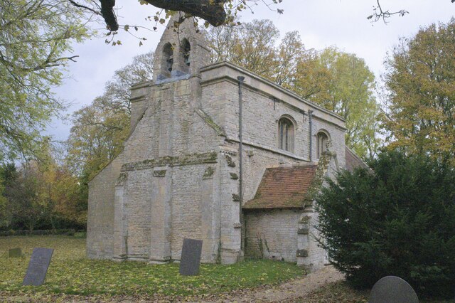
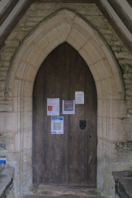
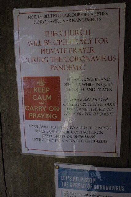
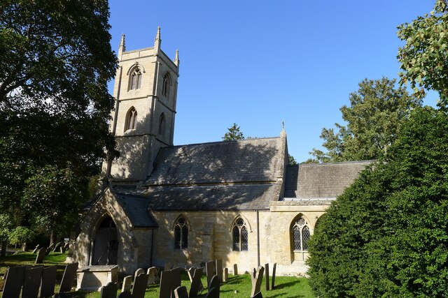
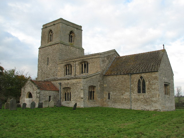
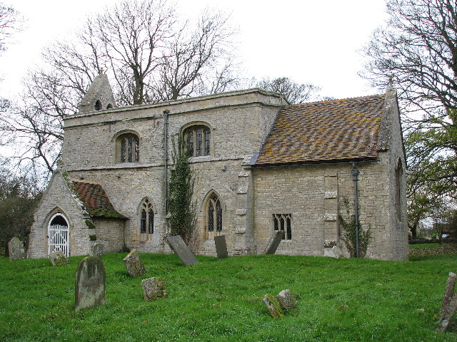
St Barbara's Church, Haceby

St Barbara's Church is a redundant Anglican church in the village of Haceby, Lincolnshire, England. It is recorded in the National Heritage List for England...
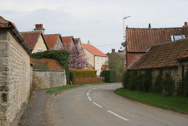
Haceby

Haceby is a hamlet in the civil parish of Newton and Haceby in the district of North Kesteven, Lincolnshire, England. It is 8 miles (13 km) east from...

Newton and Haceby

Newton and Haceby is a civil parish in North Kesteven, Lincolnshire, England. It includes the separate hamlets of Newton and Haceby. The population of...

Newton, Lincolnshire

Newton is a hamlet in the North Kesteven district of Lincolnshire, England. The hamlet is situated approximately 8 miles (13 km) east from the town of...

Braceby

Braceby is a small English village in the South Kesteven district of Lincolnshire. Its population is included in the civil parish of Pickworth. The village...

Braceby and Sapperton

Braceby and Sapperton is a civil parish in the South Kesteven district of Lincolnshire, England. According to the 2001 census it had a population of 47...

Ropsley and Humby

Ropsley and Humby is a civil parish in the South Kesteven district of Lincolnshire, England. According to the 2001 Census it had a population of 808, increasing...

Sapperton, Lincolnshire

Sapperton is a village in the South Kesteven district of Lincolnshire, England. The nearest town is Grantham, 6 miles (9.7 km) to the west. Adjacent villages...

Nearby Amenities

Located within 500m of 52.911431,-0.46500002
Haceby
Is In: Lincolnshire, England, UK
Place: hamlet
Wikidata: Q15059021
Wikipedia: en:Haceby
Lat/Long: 52.9116464/-0.4700634
Moat Farm
Place: farm
Source: Bing
Lat/Long: 52.9112831/-0.4689367
The data included in this document is from www.openstreetmap.org. The data is made available under ODbL.

Have you been to Haceby Little Wood?

Leave your review of Haceby Little Wood below (or comments, questions and feedback).