Eccleshall

Settlement in Staffordshire Stafford

England

Eccleshall

Fire station at Eccleshall Eccleshall's fire station on the west side of Newport Road, the A519. The 'public space' or garden over which it's viewed has trimmed bushes, perhaps of laurel.
Fire station at Eccleshall Credit: Trevor Littlewood

Eccleshall is a small market town located in the county of Staffordshire, England. It is situated approximately 8 miles to the north-west of Stafford, the county town. The town is located on the A519 road, making it easily accessible from nearby cities such as Stoke-on-Trent and Wolverhampton.

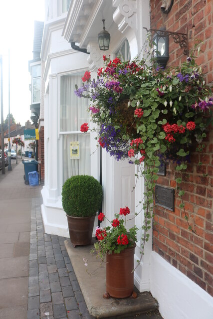
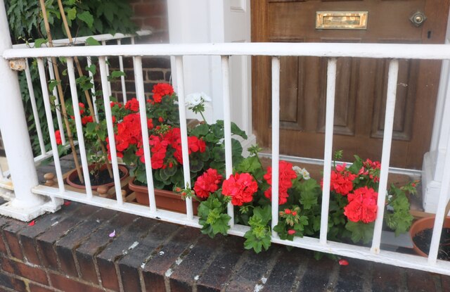
Eccleshall has a rich historical background and is known for its picturesque streets and traditional architecture. The town is dominated by the stunning Eccleshall Castle, which dates back to the 13th century. The castle, though privately owned and not open to the public, adds to the town's charm and character.

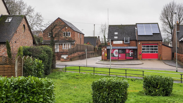
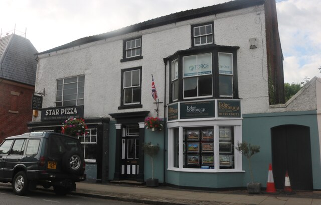
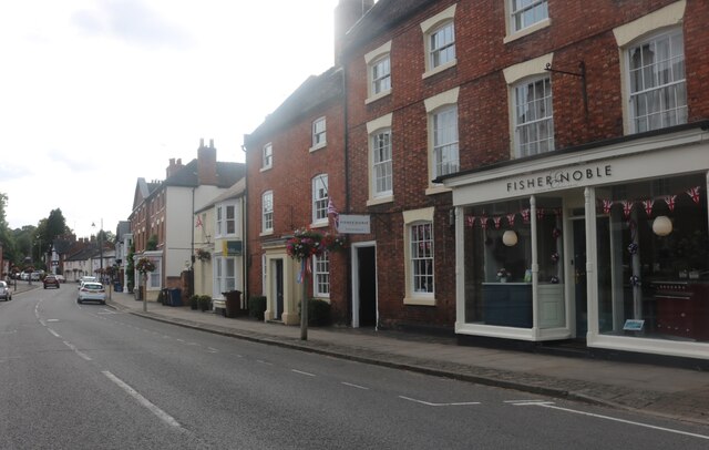
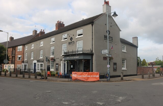
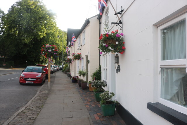
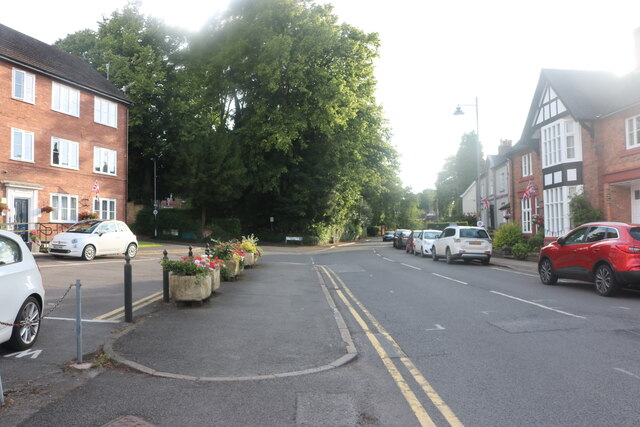
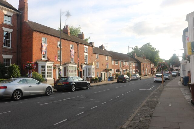
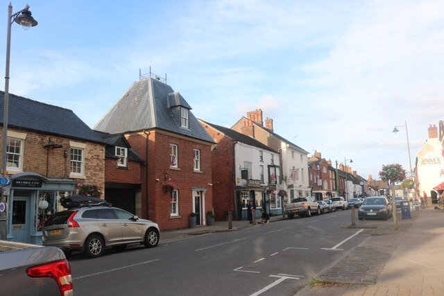
The High Street in Eccleshall is lined with a variety of independent shops, cafes, and restaurants, offering visitors a chance to explore local produce and unique gifts. The town also hosts a weekly market where fresh produce, clothing, and other items can be purchased.

Eccleshall is surrounded by beautiful countryside, making it a popular destination for walkers, cyclists, and nature lovers. The nearby Shropshire Union Canal offers scenic walks and boat trips.

The town has a strong sense of community and hosts various events throughout the year, including a summer carnival and a Christmas market. Eccleshall also has several sports clubs and facilities, including a golf club and a cricket club.

Overall, Eccleshall is a charming and historic town that offers both residents and visitors a peaceful and welcoming atmosphere, along with a range of amenities and attractions to enjoy.

If you have any feedback on the listing, please let us know in the comments section below.
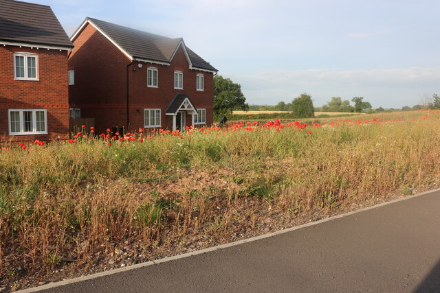
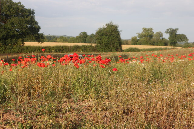
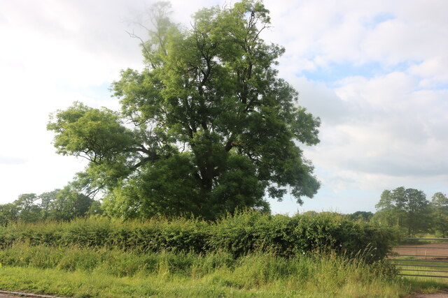
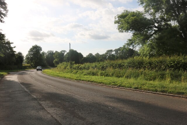
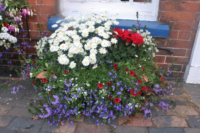
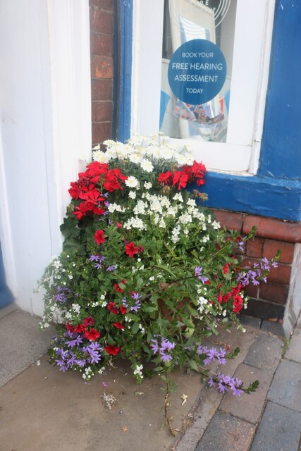
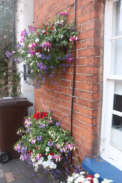
Eccleshall Images

Images are sourced within 2km of 52.859613/-2.2531299 or Grid Reference SJ8329. Thanks to Geograph Open Source API. All images are credited.

Fire station at Eccleshall Eccleshall's fire station on the west side of Newport Road, the A519. The 'public space' or garden over which it's viewed has trimmed bushes, perhaps of laurel.
Fire station at Eccleshall
Eccleshall's fire station on the west side of Newport Road, the A519. The 'public space' or garden over which it's viewed has trimmed bushes, perhaps of laurel.
Edge and Goodrich estate agents on High Street, Eccleshall
High Street, Eccleshall
The Little George, Eccleshall
The last house in Eccleshall No doubt in a few years the next field along may become residential, as so many are.
The last house in Eccleshall
No doubt in a few years the next field along may become residential, as so many are.
Poppies by Stafford Road, Eccleshall
Tree by Chester Road, Pershall
Chester Road, Pershall
Eccleshall in bloom Eccleshall in bloom provides flowers for the town every summer including over 60 hanging baskets. <span class="nowrap"><a title="http://eccleshallguide.org/inbloom.html" rel="nofollow ugc noopener" href="http://eccleshallguide.org/inbloom.html">Link</a><img style="margin-left:2px;" alt="External link" title="External link - shift click to open in new window" src="https://s1.geograph.org.uk/img/external.png" width="10" height="10"/></span>
Eccleshall in bloom
Eccleshall in bloom provides flowers for the town every summer including over 60 hanging baskets. LinkExternal link
Eccleshall in bloom Flower displays are provided every summer by the local group.
Eccleshall in bloom
Flower displays are provided every summer by the local group.
Eccleshall in bloom Over 60 hanging baskets and other arrangements are provided locally every summer.
Eccleshall in bloom
Over 60 hanging baskets and other arrangements are provided locally every summer.
High Street, Eccleshall The flowers are provided every summer by Eccleshall in Bloom. <span class="nowrap"><a title="http://eccleshallguide.org/inbloom.html" rel="nofollow ugc noopener" href="http://eccleshallguide.org/inbloom.html">Link</a><img style="margin-left:2px;" alt="External link" title="External link - shift click to open in new window" src="https://s1.geograph.org.uk/img/external.png" width="10" height="10"/></span>
High Street, Eccleshall
The flowers are provided every summer by Eccleshall in Bloom. LinkExternal link
High Street, Eccleshall
Passageway off High Street, Eccleshall
Eccleshall in bloom
Eccleshall in bloom
Geraniums on High Street, Eccleshall I've been told to call them pelargoniums but who would recognise them?
Geraniums on High Street, Eccleshall
I've been told to call them pelargoniums but who would recognise them?
High Street, Eccleshall
Show me another place!

Eccleshall is located at Grid Ref: SJ8329 (Lat: 52.859613, Lng: -2.2531299)

Administrative County: Staffordshire

District: Stafford

Police Authority: Staffordshire

What 3 Words

///necklace.points.stiffly. Near Eccleshall, Staffordshire

Nearby Locations

Eccleshall

Related Wikis

Eccleshall

Eccleshall () is a town and civil parish in the Stafford district, in the county of Staffordshire, England. It is located seven miles northwest of Stafford...

Holy Trinity Church, Eccleshall

Holy Trinity Church in Eccleshall, Staffordshire, England, is a Grade I listed Anglican church. The building dates mostly from the 13th century, and there...

Eccleshall Castle

Eccleshall Castle is located in Eccleshall, Staffordshire, England (grid reference SJ827295). It was originally built in the 13th century. It is a Scheduled...

Eagle House, Eccleshall

Eagle House is a Grade II listed building in the Staffordshire town of Eccleshall, England, which is currently an award winning bed and breakfast. ��2...

Eccleshall F.C.

Eccleshall Football Club is a football club based in Eccleshall, Staffordshire, England. They are currently members of the North West Counties League Division...

Walton Hall Academy

Walton Hall Academy (formerly Walton Hall Community Special School) is a mixed special school of approximately 150 pupils. The school is based in Eccleshall...

HM Prison Drake Hall

HMP Prison Drake Hall is a women's closed prison, located near the town of Eccleshall in Staffordshire, England. The prison is operated by His Majesty...

A519 road

The A519 is a road in the Midlands, United Kingdom. == Route == It that runs between Newcastle-under-Lyme, Staffordshire and Newport, Shropshire. At Newport...

Nearby Amenities

Located within 500m of 52.859613,-2.2531299
Mini Roundabout
Direction: clockwise
Lat/Long: 52.8597724/-2.2515059
Mini Roundabout
Direction: clockwise
Lat/Long: 52.8587572/-2.2514025
Eccleshall
Place: town
Wikidata: Q2123282
Lat/Long: 52.858059/-2.2511202
Bus Stop
Stone Road
Bus: yes
Naptan AtcoCode: 3800C702900
Naptan Bearing: S
Naptan CommonName: Stone Road
Naptan Indicator: Adj
Naptan Landmark: Stone Rd
Naptan Street: Castle Street
Naptan Verified: no
Public Transport: platform
Source: naptan_import
Lat/Long: 52.860322/-2.2515047
Bus Stop
Post Office
Bus: yes
Naptan AtcoCode: 3800C703100
Naptan Bearing: N
Naptan CommonName: Post Office
Naptan Indicator: Adj
Naptan Landmark: Post Office
Naptan Street: Stafford Street
Naptan Verified: no
Public Transport: platform
Source: naptan_import
Lat/Long: 52.8594342/-2.2515588
Bus Stop
Post Office
Bus: yes
Naptan AtcoCode: 3800C703101
Naptan Bearing: S
Naptan CommonName: Post Office
Naptan Indicator: Opp
Naptan Landmark: Post Office
Naptan Street: Stafford Street
Naptan Verified: no
Public Transport: platform
Source: naptan_import
Lat/Long: 52.8593694/-2.2513655
Bus Stop
Cherry Tree Close
Bus: yes
Naptan AtcoCode: 3800C707500
Naptan Bearing: E
Naptan CommonName: Cherry Tree Close
Naptan Indicator: Adj
Naptan Landmark: Cherry Tree Close
Naptan Street: Stone Road
Naptan Verified: no
Public Transport: platform
Source: naptan_import
Lat/Long: 52.8598833/-2.2506555
Bus Stop
Stafford Road
Bus: yes
Naptan AtcoCode: 3800C707501
Naptan Bearing: W
Naptan CommonName: Stafford Road
Naptan Indicator: Adj
Naptan Landmark: Stafford Rd
Naptan Street: Stone Rd
Naptan Verified: no
Public Transport: platform
Source: naptan_import
Lat/Long: 52.8597841/-2.250772
Bus Stop
Newcastle Road
Bus: yes
Naptan AtcoCode: 3800C795401
Naptan Bearing: N
Naptan CommonName: Newcastle Road
Naptan Indicator: Adj
Naptan Landmark: Newcastle Rd
Naptan Street: Castle St
Naptan Verified: no
Public Transport: platform
Source: naptan_import
Lat/Long: 52.8613181/-2.2523422
Post Box
Post Box Type: lamp
Ref: ST21 76
Lat/Long: 52.8591527/-2.257639
Telephone
Booth: K6
Covered: booth
Listed Status: Grade II
Operator: BT
Phone: +44 1785 850317
Lat/Long: 52.8591816/-2.2576352
Eccleshall Primary
Power: substation
Ref: 96/235
Voltage: 11000
Lat/Long: 52.8570323/-2.2531455
Post Box
Brand: Royal Mail
Brand Wikidata: Q638098
Mapillary: 728293565384452
Operator: Royal Mail
Operator Wikidata: Q638098
Post Box Type: pillar
Ref: ST21 426
Survey Date: 2022-09-08
Lat/Long: 52.8558655/-2.2530639
Removed Amenity: telephone
Lat/Long: 52.859703/-2.2513394
Pub
Kings Arms Hotel
Addr Housenumber: 17
Addr Postcode: ST21 6BL
Addr Street: Stafford Street
Fhrs Id: 1195912
Source Addr: FHRS Open Data
Website: https://www.kingsarmseccleshall.com/
Lat/Long: 52.8590465/-2.2513844
Eccleshall X Rds
Power: substation
Ref: 967612
Lat/Long: 52.8599475/-2.2505788
Post Office
Eccleshall Post Office
Addr City: Stafford
Addr Country: GB
Addr Housenumber: 4
Addr Postcode: ST21 6BH
Addr Street: Stafford Street
Opening Hours: Mo-We 08:00-18:00; Th 09:00-17:30; Fr 08:30-17:30; Sa 08:30-13:30; Su 07:30-11:30
Ref Pol Id: 12592
Lat/Long: 52.8594675/-2.2516107
Pub
The Eagle Inn
Addr Postcode: ST21 6AA
Addr Street: Horsefair
Fhrs Id: 1195907
Website: http://www.eagleinneccleshall.co.uk
Lat/Long: 52.8583177/-2.2528329
Post Box
Ref: ST21 104
Lat/Long: 52.8598145/-2.2466641
Man Made: pumping_station
Pumping Station: wastewater
Lat/Long: 52.8603713/-2.2501168
Turning Circle
Lat/Long: 52.8572534/-2.2549435
Toilets
Lat/Long: 52.8596547/-2.2509201
Barrier: turnstile
Lat/Long: 52.8592403/-2.257264
Barrier: kissing_gate
Lat/Long: 52.8606428/-2.2577919
Barrier: kissing_gate
Lat/Long: 52.8601675/-2.2568209
Library
Eccleshall Library
Lat/Long: 52.8597212/-2.2531079
Post Box
Brand: Royal Mail
Brand Wikidata: Q638098
Operator: Royal Mail
Operator Wikidata: Q638098
Post Box Apertures: 2
Post Box Type: pillar
Ref: ST21 318
Lat/Long: 52.8594811/-2.2515759
Pub
The Old Smithy
Addr Postcode: ST21 6DF
Addr Street: Castle Street
Fhrs Id: 1195426
Website: https://www.the-old-smithy-eccleshall.co.uk
Lat/Long: 52.8602702/-2.2517312
Clock
Millennium Clock
Lat/Long: 52.8597561/-2.2528385
Pub
Little George café & bar
Addr Postcode: ST21 6DF
Addr Street: Castle Street
Old Fhrs Id: 386446
Source Addr: FHRS Open Data
Lat/Long: 52.8598681/-2.2513416
Barrier: kissing_gate
Lat/Long: 52.8619556/-2.2535505
Barrier: stile
Lat/Long: 52.8638569/-2.2508039
Pub
The Bell Inn
Addr Housename: The Bell Inn
Addr Housenumber: 16
Addr Postcode: ST21 6BZ
Addr Street: High Street
Fhrs Id: 1195639
Website: http://thebelleccleshall.com/index.html
Lat/Long: 52.8597929/-2.2526358
Barrier: kissing_gate
Lat/Long: 52.8587668/-2.2581193
Barrier: stile
Lat/Long: 52.8640395/-2.2523096
Restaurant
Star Pizza
Addr Housenumber: 30A
Addr Postcode: ST21 6BZ
Addr Street: High Street
Cuisine: pizza
Fhrs Id: 1195529
Source Addr: FHRS Open Data
Lat/Long: 52.859649/-2.2537743
Cafe
Star Cafe
Addr Housenumber: 29
Addr Postcode: ST21 6BW
Addr Street: High Street
Fhrs Id: 1195769
Source Addr: FHRS Open Data
Lat/Long: 52.8594601/-2.2536484
Addr City: Eccleshall
Addr Housenumber: 2
Addr Street: Hartlands Road
Lat/Long: 52.8591456/-2.2476734
Addr City: Eccleshall
Addr Housenumber: 44
Addr Street: Hartlands Road
Lat/Long: 52.8581841/-2.2461986
Addr City: Eccleshall
Addr Housenumber: 22
Addr Street: Hartlands Road
Lat/Long: 52.8588991/-2.2463656
Addr City: Eccleshall
Addr Housenumber: 9
Addr Street: Stone Road
Lat/Long: 52.8598427/-2.2482548
Addr City: Eccleshall
Addr Housenumber: 3
Addr Street: Hartlands Road
Lat/Long: 52.859403/-2.2474318
Addr City: Eccleshall
Addr Housenumber: 20
Addr Street: Hartlands Road
Lat/Long: 52.8590777/-2.246447
Addr City: Eccleshall
Addr Housenumber: 1
Addr Street: Hartlands Road
Lat/Long: 52.8597038/-2.2474881
Addr City: Eccleshall
Addr Housenumber: 7
Addr Street: Stone Road
Lat/Long: 52.8598433/-2.2483
Addr City: Eccleshall
Addr Housenumber: 34
Addr Street: Hartlands Road
Lat/Long: 52.8585874/-2.2468554
Addr City: Eccleshall
Addr Housenumber: 40
Addr Street: Hartlands Road
Lat/Long: 52.8583525/-2.246272
Addr City: Eccleshall
Addr Housenumber: 13
Addr Street: Hartlands Road
Lat/Long: 52.8593393/-2.2467315
Addr City: Eccleshall
Addr Housenumber: 17
Addr Street: Stone Road
Lat/Long: 52.8598304/-2.2480079
Addr City: Eccleshall
Addr Housenumber: 38
Addr Street: Hartlands Road
Lat/Long: 52.8582746/-2.2466304
Addr City: Eccleshall
Addr Housenumber: 26
Addr Street: Hartlands Road
Lat/Long: 52.858629/-2.2462573
Addr City: Eccleshall
Addr Housenumber: 5
Addr Street: Hartlands Road
Lat/Long: 52.8593773/-2.2472819
Addr City: Eccleshall
Addr Housenumber: 25
Addr Street: Hartlands Road
Lat/Long: 52.859178/-2.2459931
Addr City: Eccleshall
Addr Housenumber: 36
Addr Street: Hartlands Road
Lat/Long: 52.8582647/-2.2467699
Addr City: Eccleshall
Addr Housenumber: 13
Addr Street: Stone Road
Lat/Long: 52.8598457/-2.2481299
Addr City: Eccleshall
Addr Housenumber: 4
Addr Street: Hartlands Road
Lat/Long: 52.8591273/-2.247543
Crossing
Crossing: marked
Crossing Island: no
Crossing Markings: zebra
Crossing Ref: zebra
Tactile Paving: yes
Lat/Long: 52.8596025/-2.2514955
Fast Food
Eccleshall Fish Bar
Addr Housename: Eccleshall Fish Bar
Addr Housenumber: 5
Addr Postcode: ST21 6BL
Addr Street: Stafford Street
Delivery: no
Drive Through: no
Fhrs Id: 1195490
Opening Hours: Mo 12:00-14:00,17:00-20:00
Outdoor Seating: no
Smoking: no
Takeaway: yes
Lat/Long: 52.8595023/-2.2513542
Atm
Drive Through: no
Lat/Long: 52.8592717/-2.2512923
Restaurant
London House
Addr City: Eccleshall
Addr Housenumber: 28
Addr Postcode: ST21 6BZ
Addr Street: High Street
Cuisine: indian
Fhrs Id: 1195908
Outdoor Seating: no
Smoking: no
Takeaway: yes
Lat/Long: 52.8596897/-2.2535239
Restaurant
Daru Chini
Addr City: Eccleshall
Addr Housenumber: 8
Addr Postcode: ST21 6BL
Addr Street: Stafford Street
Cuisine: indian
Delivery: yes
Fhrs Id: 1195624
Outdoor Seating: no
Smoking: no
Takeaway: yes
Lat/Long: 52.8596218/-2.2513506
Eccleshall Castle
Access: private
Castle Type: manor
Historic: castle
Historic Civilization: medieval
Wikidata: Q5332222
Wikipedia: en:Eccleshall Castle
Lat/Long: 52.8633719/-2.2569501
Waste Basket
Lat/Long: 52.8599598/-2.2465872
Waste Basket
Lat/Long: 52.8598441/-2.2478432
Bench
Lat/Long: 52.8598436/-2.2478745
Bench
Lat/Long: 52.8598715/-2.2495269
Bench
Lat/Long: 52.8596658/-2.2513536
Waste Basket
Lat/Long: 52.8596966/-2.2513785
Waste Basket
Lat/Long: 52.859169/-2.2575919
Waste Basket
Lat/Long: 52.8559881/-2.2529757
Waste Basket
Lat/Long: 52.8572518/-2.2524657
Waste Basket
Lat/Long: 52.8583298/-2.25258
Waste Basket
Lat/Long: 52.8613161/-2.2522845
Waste Basket
Lat/Long: 52.8603025/-2.2514999
Waste Basket
Lat/Long: 52.8598934/-2.2514104
Recycling
Recycling Type: container
Lat/Long: 52.859826/-2.250209
Waste Basket
Lat/Long: 52.8594492/-2.2479628
Barrier: stile
Lat/Long: 52.8636064/-2.2526893
Telecom: connection_point
Telecom Medium: copper
Lat/Long: 52.859844/-2.247901
Bench
Lat/Long: 52.8591759/-2.2574443
Bramble Lane Interiors
Addr City: Eccleshall
Addr Country: GB
Addr Housenumber: 36
Addr Street: High Street
Contact Facebook: https://www.facebook.com/people/Bramble-Lane-Interiors/100063897618623/
Contact Website: https://www.bramblelane.co.uk/
Opening Hours: Tu-Sa 10:00-16:00
Payment American Express: yes
Payment Apple Pay: yes
Payment Cash: yes
Payment Credit Cards: yes
Payment Debit Cards: yes
Payment Google Pay: yes
Payment Mastercard: yes
Payment Samsung Pay: yes
Payment Visa: yes
Shop: interior_decoration
Wheelchair: no
Lat/Long: 52.8596061/-2.2541241
The data included in this document is from www.openstreetmap.org. The data is made available under ODbL.

Have you been to Eccleshall?

Leave your review of Eccleshall below (or comments, questions and feedback).