Bytham Plantation

Wood, Forest in Lincolnshire South Kesteven

England

Bytham Plantation

25kV in the garden When this row of houses were built, the bit of land where the 25kV feed lines for the railway convert from overhead to underground was sold to the end house.
25kV in the garden Credit: Bob Harvey

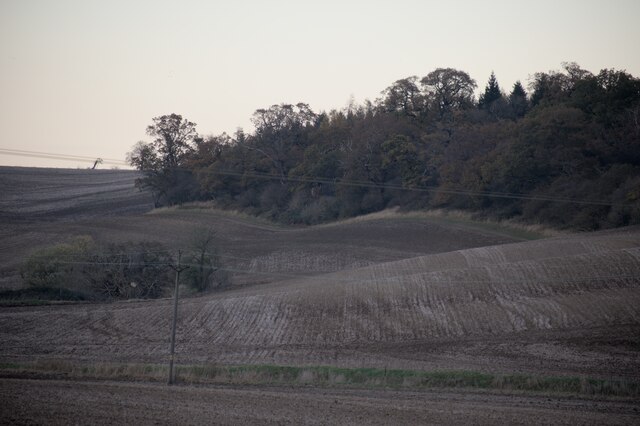
Bytham Plantation is a picturesque woodland area located in Lincolnshire, England. Covering an expansive area, it is considered one of the largest plantations in the region. With its dense growth of trees and lush greenery, Bytham Plantation is a haven for nature enthusiasts and a popular destination for outdoor activities.

The plantation is primarily composed of deciduous and coniferous trees, creating a diverse and vibrant ecosystem. Among the tree species found here are oak, beech, pine, and spruce. The varying heights and ages of the trees contribute to the plantation's unique beauty, with sunlight filtering through the canopy and creating enchanting patterns on the forest floor.

Bytham Plantation offers numerous walking trails and paths, allowing visitors to explore the woodland at their own pace. These trails provide opportunities for birdwatching, as the plantation is home to a wide range of bird species, including woodpeckers, buzzards, and owls. Additionally, the plantation is inhabited by various mammals, such as deer, foxes, and squirrels, further enhancing the wildlife experience.

The plantation is well-maintained and managed, with careful consideration given to preserving its natural beauty and ecological balance. It serves as a vital habitat for both flora and fauna, contributing to the overall biodiversity of the area. The management team also organizes educational programs and guided tours to promote awareness and appreciation of the plantation's ecological significance.

In conclusion, Bytham Plantation in Lincolnshire is a stunning woodland area that offers a serene and immersive experience in nature. With its diverse range of trees, abundant wildlife, and well-maintained trails, it is a must-visit destination for anyone seeking tranquility and a deeper connection with the natural world.

If you have any feedback on the listing, please let us know in the comments section below.

Bytham Plantation Images

Images are sourced within 2km of 52.747495/-0.48192377 or Grid Reference TF0217. Thanks to Geograph Open Source API. All images are credited.

25kV in the garden When this row of houses were built, the bit of land where the 25kV feed lines for the railway convert from overhead to underground was sold to the end house.
25kV in the garden
When this row of houses were built, the bit of land where the 25kV feed lines for the railway convert from overhead to underground was sold to the end house.
25kV single phase Two separate 25kV single phase lines from Bourne East substation to the East Coast Main Line at Little Bytham, striding out of the Grimsthorpe estate and across a field.
25kV single phase
Two separate 25kV single phase lines from Bourne East substation to the East Coast Main Line at Little Bytham, striding out of the Grimsthorpe estate and across a field.
Physalis alkekengi The plant known as "Chinese Lantern" among garden centres is not native to the UK, and we are a little cold for it really.  But here it is growing in a hedgerow by the road, probably as a garden escapee.  There are individuals on the other side of the road too.
Physalis alkekengi
The plant known as "Chinese Lantern" among garden centres is not native to the UK, and we are a little cold for it really. But here it is growing in a hedgerow by the road, probably as a garden escapee. There are individuals on the other side of the road too.
Chinese Lanterns in the verge One of the patches of Physalis alkekengi growing in the roadside hedge. (see <a href="https://www.geograph.org.uk/photo/6946355">TF0117 : Physalis alkekengi</a>).
Chinese Lanterns in the verge
One of the patches of Physalis alkekengi growing in the roadside hedge. (see TF0117 : Physalis alkekengi).
Fibre to the Cabinet One of the cubicles erected to bring high-speed internet to the country.
Fibre to the Cabinet
One of the cubicles erected to bring high-speed internet to the country.
Beautiful Berries Hawthorn berries, or haws, in a hedge.
Beautiful Berries
Hawthorn berries, or haws, in a hedge.
Odder than it looks The use of overhead power distribution in these villages is not unusual.  But this one is.  What is it feeding?  It is in the garden of one of the 4 houses build on the former goods yard of Little Bytham station (itself an oddity, because it is in the parish of Careby, not Little Bytham).  The pole predates the houses by at least half a century.    It is one end of a run of  overhead wiring  in the village (three phases plus neutral) and all four wires are terminated on this pole to cables that go underground.  Normally that would be 3 phase and neutral, but it is not - it is two two-wire circuits (each of Live & Neutral) if you track the distribution past the pub to the end of the village.

This is the infeed end - hence the 4 terminations.  It appears to feed the rest of the village, but not the 4 houses here.

So where do we find two separate phases?  Why, on the poles in the background that bring two 25kV phases from Bourne West to the railway.  There must be, somewhere out of sight, a substation that steps that 25kV down to 240V for the older homes in the village - and perhaps the new ones, too, albeit underground.  See <a href="https://www.geograph.org.uk/photo/6946381">TF0117 : Warning label</a> which implies this assumption is correct.
Odder than it looks
The use of overhead power distribution in these villages is not unusual. But this one is. What is it feeding? It is in the garden of one of the 4 houses build on the former goods yard of Little Bytham station (itself an oddity, because it is in the parish of Careby, not Little Bytham). The pole predates the houses by at least half a century. It is one end of a run of overhead wiring in the village (three phases plus neutral) and all four wires are terminated on this pole to cables that go underground. Normally that would be 3 phase and neutral, but it is not - it is two two-wire circuits (each of Live & Neutral) if you track the distribution past the pub to the end of the village. This is the infeed end - hence the 4 terminations. It appears to feed the rest of the village, but not the 4 houses here. So where do we find two separate phases? Why, on the poles in the background that bring two 25kV phases from Bourne West to the railway. There must be, somewhere out of sight, a substation that steps that 25kV down to 240V for the older homes in the village - and perhaps the new ones, too, albeit underground. See TF0117 : Warning label which implies this assumption is correct.
Warning label The conjecture in <a href="https://www.geograph.org.uk/photo/6946370">TF0117 : Odder than it looks</a> that the village is fed via the supply to the railway system is amply borne out by this notice on the pole, which says
"East Midlands Electricity
If delivering shutdown cards to this location please contact Engineering Clerical immediately.
In the case of emergency for connection of supply contact British Rail on 01 340 2785 or 01 348 9542"

Both telephone numbers are, of course, decades out of date.
Warning label
The conjecture in TF0117 : Odder than it looks that the village is fed via the supply to the railway system is amply borne out by this notice on the pole, which says "East Midlands Electricity If delivering shutdown cards to this location please contact Engineering Clerical immediately. In the case of emergency for connection of supply contact British Rail on 01 340 2785 or 01 348 9542" Both telephone numbers are, of course, decades out of date.
Wiring details If you look at <a href="https://www.geograph.org.uk/photo/6945830">TF0117 : 25kV in the garden</a> and <a href="https://www.geograph.org.uk/photo/6945836">TF0117 : 25kV single phase</a> you will see that there are two groups of four wires coming from the power station at <a href="https://www.geograph.org.uk/photo/399639">TF0619 : Bourne West electricity sub-station</a>.  This is the 25kV supply for the railway overhead power.  

So here are four of the wires.  The top two are bridged together, and connected to a downfeed cable through the large insulator (<a href="https://www.geograph.org.uk/photo/6947644">TF0117 : Feed-through insulator</a>).  This is a single phase 25kV line.  The other two are also bridged together, and connected to a much lighter downfeed.  These are the Neutral, which is essentially at earth potential on the running rail.  

The other 25kV on the other set of posts is arranged in the same way.

Railway infeeds are complex, often providing a split-phase "supply" and "feeder" which combined with trackside autotransformers can reduce the longitudinal volt drop.  It is likely that these two are set up in the same way - one being the infeed and one the feeder, with 120 degree phase shift (a consequence of the conversion from three-phase at the substation).
Wiring details
If you look at TF0117 : 25kV in the garden and TF0117 : 25kV single phase you will see that there are two groups of four wires coming from the power station at TF0619 : Bourne West electricity sub-station. This is the 25kV supply for the railway overhead power. So here are four of the wires. The top two are bridged together, and connected to a downfeed cable through the large insulator (TF0117 : Feed-through insulator). This is a single phase 25kV line. The other two are also bridged together, and connected to a much lighter downfeed. These are the Neutral, which is essentially at earth potential on the running rail. The other 25kV on the other set of posts is arranged in the same way. Railway infeeds are complex, often providing a split-phase "supply" and "feeder" which combined with trackside autotransformers can reduce the longitudinal volt drop. It is likely that these two are set up in the same way - one being the infeed and one the feeder, with 120 degree phase shift (a consequence of the conversion from three-phase at the substation).
Feed-through insulator The large cable interface and feed-through insulator for the incoming 25kV seen in <a href="https://www.geograph.org.uk/photo/6947641">TF0117 : Wiring details</a>, showing how it is bonded to both the upper wires
Feed-through insulator
The large cable interface and feed-through insulator for the incoming 25kV seen in TF0117 : Wiring details, showing how it is bonded to both the upper wires
Station Road Looking north, where Station Road comes out from the arch of the former Midland and Great Northern line, which crossed the East Coast Main Line on an elevated bridge.
Station Road
Looking north, where Station Road comes out from the arch of the former Midland and Great Northern line, which crossed the East Coast Main Line on an elevated bridge.
Countryside at dusk
Countryside at dusk
Stanton's Pit
Stanton's Pit
Roadside trees A flash of late afternoon low angle sunlight.
Roadside trees
A flash of late afternoon low angle sunlight.
Viaduct, Little Bytham The giant Great Northern Railway viaduct looms large in this small village, and still carries the main East Coast line. It appears to be built of blue engineering brick. I haven't found a date beyond that it is Victorian.
Viaduct, Little Bytham
The giant Great Northern Railway viaduct looms large in this small village, and still carries the main East Coast line. It appears to be built of blue engineering brick. I haven't found a date beyond that it is Victorian.
Country road near Little Bytham
Willoughby Arms, Little Bytham Quite an imposing country pub which originally lay close to a railway station (<a href="https://www.geograph.org.uk/photo/4426796">TF0117 : The Willoughby Arms at Little Bytham, near Bourne, Lincolnshire</a>).
Willoughby Arms, Little Bytham
Quite an imposing country pub which originally lay close to a railway station (TF0117 : The Willoughby Arms at Little Bytham, near Bourne, Lincolnshire).
Little Bytham High Street Looking through the road arch of the magnificent Victorian railway viaduct that carries the 4-track East Coast Main Line over the village <a href="https://www.geograph.org.uk/photo/1622243">TF0118 : Railway Viaduct, Little Bytham</a>. The spire of the Church of St. Medard and St. Gildard is in the distance.
Little Bytham High Street
Looking through the road arch of the magnificent Victorian railway viaduct that carries the 4-track East Coast Main Line over the village TF0118 : Railway Viaduct, Little Bytham. The spire of the Church of St. Medard and St. Gildard is in the distance.
Show me another place!

Bytham Plantation is located at Grid Ref: TF0217 (Lat: 52.747495, Lng: -0.48192377)

Administrative County: Lincolnshire

District: South Kesteven

Police Authority: Lincolnshire

What 3 Words

///released.kitchens.binds. Near Pickworth, Rutland

Related Wikis

Little Bytham railway station

Little Bytham railway station was a station in Little Bytham, Lincolnshire on the Great Northern Railway main line. It closed in 1959. The Midland and...

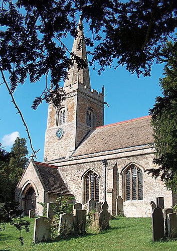
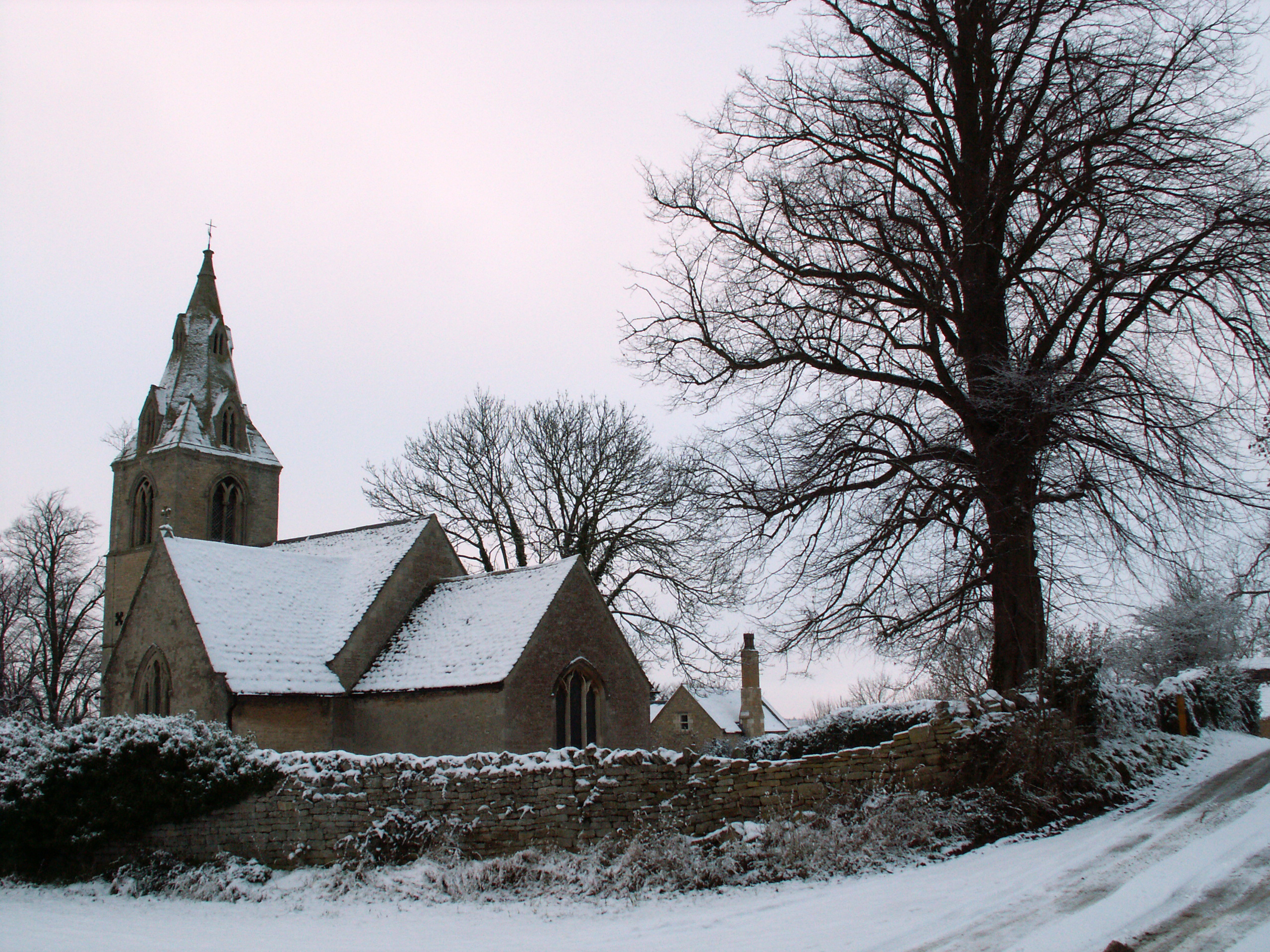
St Medardus and St Gildardus Church, Little Bytham

The church of St Medardus and St Gildardus in Little Bytham, Lincolnshire, England, is a Grade I listed building. It is dedicated to two 6th-century French...
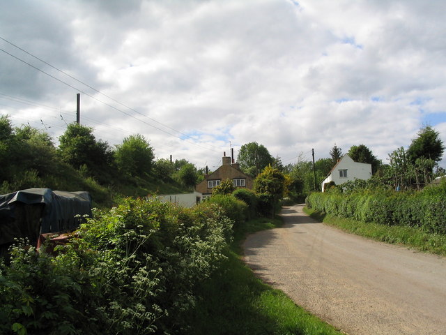
Little Bytham

Little Bytham is a village and civil parish in the South Kesteven district of Lincolnshire, England. The population of the civil parish at the 2011 census...

Careby

Careby is the principal village in the a civil parish of Careby Aunby and Holywell [in which the population is included] in the South Kesteven district...

Careby Aunby and Holywell

Careby Aunby and Holywell is a civil parish in the district of South Kesteven, south-west Lincolnshire, in England. It stretches from the county border...

Bourne Rural District

Bourne was a rural district in Lincolnshire, Parts of Kesteven from 1894 to 1931. It was created by the Local Government Act 1894 based on the Bourne rural...

Counthorpe

Counthorpe is a hamlet in the civil parish of Counthorpe and Creeton in the South Kesteven district of Lincolnshire, England. It adjoins the hamlet of...

Creeton

Creeton is a hamlet in the civil parish of Counthorpe and Creeton in the South Kesteven district of Lincolnshire, England. It is situated 3 miles (5 km...

Nearby Amenities

Located within 500m of 52.747495,-0.48192377
Power: pole
Lat/Long: 52.7466054/-0.4887123
Power: pole
Lat/Long: 52.7468605/-0.4882008
Power: pole
Lat/Long: 52.7473101/-0.4872668
Power: pole
Lat/Long: 52.7480133/-0.4858141
Power: pole
Lat/Long: 52.7486797/-0.4844892
Power: pole
Lat/Long: 52.7487077/-0.4832666
Power: pole
Lat/Long: 52.7487195/-0.4754221
Power: pole
Lat/Long: 52.7487416/-0.4820708
Power: pole
Lat/Long: 52.7487467/-0.4768504
Power: pole
Lat/Long: 52.7487549/-0.479734
Power: pole
Lat/Long: 52.7487585/-0.478425
Power: pole
Lat/Long: 52.7487637/-0.4811429
Little Blytham Lodge
Place: isolated_dwelling
Source: Bing
Lat/Long: 52.7458003/-0.4786576
Warren Cottage
Place: isolated_dwelling
Source: Bing
Lat/Long: 52.7448707/-0.4771547
Barrier: yes
Lat/Long: 52.7443156/-0.4826244
Power: pole
Lat/Long: 52.747161/-0.4885664
Power: pole
Lat/Long: 52.7470225/-0.4871467
Power: pole
Lat/Long: 52.746867/-0.4853348
Power: pole
Lat/Long: 52.7467058/-0.4835929
Power: pole
Lat/Long: 52.7465193/-0.4818089
The data included in this document is from www.openstreetmap.org. The data is made available under ODbL.

Have you been to Bytham Plantation?

Leave your review of Bytham Plantation below (or comments, questions and feedback).