The Cut

Wood, Forest in Sussex Chichester

England

The Cut

Woodland at Arundel Holt
Woodland at Arundel Holt Credit: Martyn Pattison

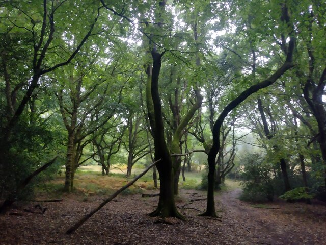
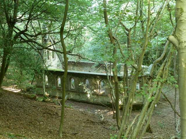
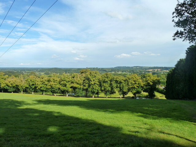
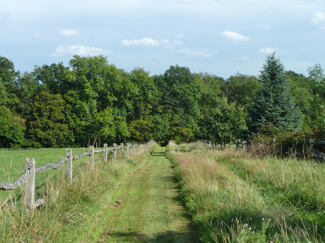
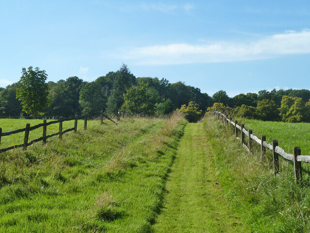
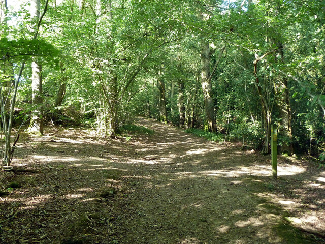
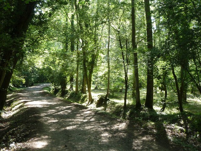
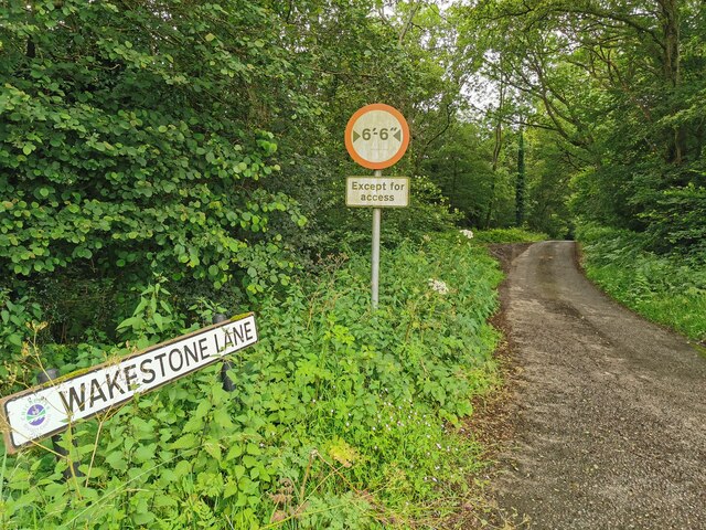
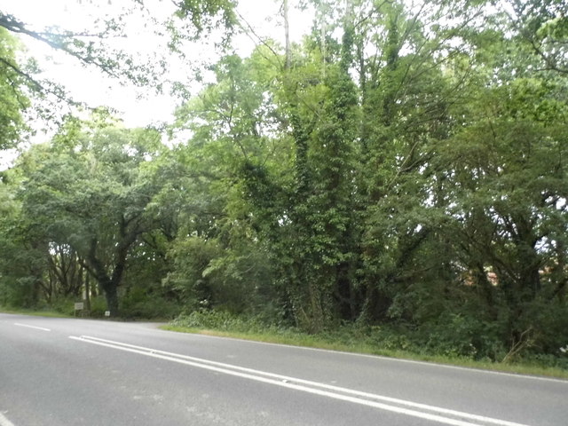
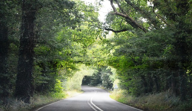
The Cut, Sussex, also known as Wood or Forest, is a picturesque area located in the county of Sussex, England. Covering an approximate area of several acres, The Cut is renowned for its dense woodland and lush greenery. It is a popular destination for nature enthusiasts, hikers, and photographers seeking solace in the midst of nature's beauty.

The wood is characterized by a diverse range of tree species, including oak, beech, birch, and pine, which create a stunning canopy of foliage throughout the year. The forest floor is adorned with an array of wildflowers, ferns, and mosses, adding to the enchanting atmosphere of the surroundings.

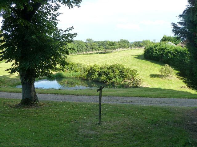
The Cut offers numerous trails and pathways, allowing visitors to explore the area and discover its hidden treasures. These pathways wind through the forest, leading to secluded clearings, babbling brooks, and serene ponds, providing ample opportunities for wildlife spotting and birdwatching. The forest is home to various species of animals, including deer, squirrels, rabbits, and a wide variety of bird species, making it a haven for nature lovers.

The management of The Cut, Sussex focuses on preserving the natural ecosystem and maintaining the delicate balance between human enjoyment and the protection of wildlife habitats. As such, visitors are encouraged to follow designated paths and respect the environment by not littering or disturbing the flora and fauna.

Overall, The Cut, Sussex (Wood, Forest) is a captivating natural landscape that offers a tranquil retreat for anyone seeking a peaceful and immersive experience in the heart of nature.

If you have any feedback on the listing, please let us know in the comments section below.

The Cut Images

Images are sourced within 2km of 51.00114/-0.5441365 or Grid Reference TQ0223. Thanks to Geograph Open Source API. All images are credited.

Woodland at Arundel Holt
Ruin, Bedham Built 1880 as a church and school, the school use closing in 1925 and final closure in 1959.
Ruin, Bedham
Built 1880 as a church and school, the school use closing in 1925 and final closure in 1959.
View east over field north of Mockbeggars
Footpath past pond by Mockbeggars Public footpath 776 passes between the pond and the buildings of Mockbeggars off to the right.
Footpath past pond by Mockbeggars
Public footpath 776 passes between the pond and the buildings of Mockbeggars off to the right.
Footpath 776 south-west from Mockbeggars
Footpath 776 towards Mockbeggars and Bedham Lane
Crossways in Quay Copse Bridleway 709, straight on, crosses footpath 776, right and left.
Crossways in Quay Copse
Bridleway 709, straight on, crosses footpath 776, right and left.
Bridleway 3421 in Quay Copse A way up from Pallingham Quay.
Bridleway 3421 in Quay Copse
A way up from Pallingham Quay.
Wakestone Lane
Wakestone Lane
Woodland by the A272, Strood Green
A272, Foxhill The A272 is a very rural A road, which follows an east to west route from near Heathfield to Winchester, passing through the Sussex countryside. It runs 86 miles from Sutton Scotney to Five Ashes <a href="https://www.geograph.org.uk/photo/6669405">TQ5523 : A267, A272 junction</a>.
<span class="nowrap"><a title="http://www.sabre-roads.org.uk/wiki/index.php?title=A272" rel="nofollow ugc noopener" href="http://www.sabre-roads.org.uk/wiki/index.php?title=A272">Link</a><img style="margin-left:2px;" alt="External link" title="External link - shift click to open in new window" src="https://s1.geograph.org.uk/img/external.png" width="10" height="10"/></span> 
Wikipedia: <span class="nowrap"><a title="http://en.wikipedia.org/wiki/A272_road" rel="nofollow ugc noopener" href="http://en.wikipedia.org/wiki/A272_road">Link</a><img style="margin-left:2px;" alt="External link" title="External link - shift click to open in new window" src="https://s1.geograph.org.uk/img/external.png" width="10" height="10"/></span>
A272, Foxhill
The A272 is a very rural A road, which follows an east to west route from near Heathfield to Winchester, passing through the Sussex countryside. It runs 86 miles from Sutton Scotney to Five Ashes TQ5523 : A267, A272 junction. LinkExternal link Wikipedia: LinkExternal link
A272 The A272 is a very rural A road, which follows an east to west route from near Heathfield to Winchester, passing through the Sussex countryside. It runs 86 miles from Sutton Scotney to Five Ashes <a href="https://www.geograph.org.uk/photo/6669405">TQ5523 : A267, A272 junction</a>.
<span class="nowrap"><a title="http://www.sabre-roads.org.uk/wiki/index.php?title=A272" rel="nofollow ugc noopener" href="http://www.sabre-roads.org.uk/wiki/index.php?title=A272">Link</a><img style="margin-left:2px;" alt="External link" title="External link - shift click to open in new window" src="https://s1.geograph.org.uk/img/external.png" width="10" height="10"/></span> 
Wikipedia: <span class="nowrap"><a title="http://en.wikipedia.org/wiki/A272_road" rel="nofollow ugc noopener" href="http://en.wikipedia.org/wiki/A272_road">Link</a><img style="margin-left:2px;" alt="External link" title="External link - shift click to open in new window" src="https://s1.geograph.org.uk/img/external.png" width="10" height="10"/></span>
A272
The A272 is a very rural A road, which follows an east to west route from near Heathfield to Winchester, passing through the Sussex countryside. It runs 86 miles from Sutton Scotney to Five Ashes TQ5523 : A267, A272 junction. LinkExternal link Wikipedia: LinkExternal link
A272, The Mens The A272 is a very rural A road, which follows an east to west route from near Heathfield to Winchester, passing through the Sussex countryside. It runs 86 miles from Sutton Scotney to Five Ashes <a href="https://www.geograph.org.uk/photo/6669405">TQ5523 : A267, A272 junction</a>.
<span class="nowrap"><a title="http://www.sabre-roads.org.uk/wiki/index.php?title=A272" rel="nofollow ugc noopener" href="http://www.sabre-roads.org.uk/wiki/index.php?title=A272">Link</a><img style="margin-left:2px;" alt="External link" title="External link - shift click to open in new window" src="https://s1.geograph.org.uk/img/external.png" width="10" height="10"/></span> 
Wikipedia: <span class="nowrap"><a title="http://en.wikipedia.org/wiki/A272_road" rel="nofollow ugc noopener" href="http://en.wikipedia.org/wiki/A272_road">Link</a><img style="margin-left:2px;" alt="External link" title="External link - shift click to open in new window" src="https://s1.geograph.org.uk/img/external.png" width="10" height="10"/></span>
A272, The Mens
The A272 is a very rural A road, which follows an east to west route from near Heathfield to Winchester, passing through the Sussex countryside. It runs 86 miles from Sutton Scotney to Five Ashes TQ5523 : A267, A272 junction. LinkExternal link Wikipedia: LinkExternal link
A272 The A272 is a very rural A road, which follows an east to west route from near Heathfield to Winchester, passing through the Sussex countryside. It runs 86 miles from Sutton Scotney to Five Ashes <a href="https://www.geograph.org.uk/photo/6669405">TQ5523 : A267, A272 junction</a>.
<span class="nowrap"><a title="http://www.sabre-roads.org.uk/wiki/index.php?title=A272" rel="nofollow ugc noopener" href="http://www.sabre-roads.org.uk/wiki/index.php?title=A272">Link</a><img style="margin-left:2px;" alt="External link" title="External link - shift click to open in new window" src="https://s1.geograph.org.uk/img/external.png" width="10" height="10"/></span> 
Wikipedia: <span class="nowrap"><a title="http://en.wikipedia.org/wiki/A272_road" rel="nofollow ugc noopener" href="http://en.wikipedia.org/wiki/A272_road">Link</a><img style="margin-left:2px;" alt="External link" title="External link - shift click to open in new window" src="https://s1.geograph.org.uk/img/external.png" width="10" height="10"/></span>
A272
The A272 is a very rural A road, which follows an east to west route from near Heathfield to Winchester, passing through the Sussex countryside. It runs 86 miles from Sutton Scotney to Five Ashes TQ5523 : A267, A272 junction. LinkExternal link Wikipedia: LinkExternal link
A272, eastbound The A272 is a very rural A road, which follows an east to west route from near Heathfield to Winchester, passing through the Sussex countryside. It runs 86 miles from Sutton Scotney to Five Ashes <a href="https://www.geograph.org.uk/photo/6669405">TQ5523 : A267, A272 junction</a>.
<span class="nowrap"><a title="http://www.sabre-roads.org.uk/wiki/index.php?title=A272" rel="nofollow ugc noopener" href="http://www.sabre-roads.org.uk/wiki/index.php?title=A272">Link</a><img style="margin-left:2px;" alt="External link" title="External link - shift click to open in new window" src="https://s1.geograph.org.uk/img/external.png" width="10" height="10"/></span> 
Wikipedia: <span class="nowrap"><a title="http://en.wikipedia.org/wiki/A272_road" rel="nofollow ugc noopener" href="http://en.wikipedia.org/wiki/A272_road">Link</a><img style="margin-left:2px;" alt="External link" title="External link - shift click to open in new window" src="https://s1.geograph.org.uk/img/external.png" width="10" height="10"/></span>
A272, eastbound
The A272 is a very rural A road, which follows an east to west route from near Heathfield to Winchester, passing through the Sussex countryside. It runs 86 miles from Sutton Scotney to Five Ashes TQ5523 : A267, A272 junction. LinkExternal link Wikipedia: LinkExternal link
Furnacepond Cottages Approaching the Furnacepond Cottages on the Wey-South path.
Furnacepond Cottages
Approaching the Furnacepond Cottages on the Wey-South path.
Crossing the National Park Boundary At the junction with Pallingham Lane the Wey-South path passes over the South Downs National Park boundary.
Crossing the National Park Boundary
At the junction with Pallingham Lane the Wey-South path passes over the South Downs National Park boundary.
Wey-South Path Junction As the Wey-South path heads towards the Bedham Hills a footpath leaves to the right and drops to cross a small valley.
Wey-South Path Junction
As the Wey-South path heads towards the Bedham Hills a footpath leaves to the right and drops to cross a small valley.
Show me another place!

The Cut is located at Grid Ref: TQ0223 (Lat: 51.00114, Lng: -0.5441365)

Administrative County: West Sussex

District: Chichester

Police Authority: Sussex

What 3 Words

///distract.resonates.fittingly. Near Petworth, West Sussex

Related Wikis

The Mens

The Mens is a 205.2-hectare (507-acre) biological Site of Special Scientific Interest west of Billingshurst in West Sussex. It is a Nature Conservation...

Bognor Common Quarry

Bognor Common Quarry is a 25.1-hectare (62-acre) geological Site of Special Scientific Interest east of Petworth in West Sussex. It is a Geological Conservation...

Upper Arun

Upper Arun is a 17.6-hectare (43-acre) biological Site of Special Scientific Interest between Billingshurst and Pulborough in West Sussex.This 13-kilometre...

Kirdford

Kirdford is a village and civil parish in the Chichester District of West Sussex, England. Its nearest town is Petworth, located 6.5 miles (10.5 km) southwest...

River Kird

The River Kird is a river located in the Chichester District of West Sussex, England that is a tributary to the River Arun. It is located in South Downs...

Bedham

Bedham is a hamlet 4 kilometres (2+1⁄2 miles) east of Petworth in the Chichester District of West Sussex, England. It is in the civil parish of Wisborough...

Wisborough Green

Wisborough Green is a village and civil parish in the north of the Chichester district of West Sussex, England, 2 miles (3.2 km) west of Billingshurst...

Petworth (electoral division)

Petworth is an electoral division of West Sussex in the United Kingdom, and returns one member to sit on West Sussex County Council. == Extent == The division...

Nearby Amenities

Located within 500m of 51.00114,-0.5441365
Post Box
Brand: Royal Mail
Brand Wikidata: Q638098
Note: This postbox is of a brand new EIIR lamp design.
Old Ref: RH14 1
Operator: Royal Mail
Operator Wikidata: Q638098
Post Box Type: lamp
Ref: RH14 1D
Royal Cypher: EIIR
Royal Cypher Wikidata: Q33102113
Lat/Long: 50.9996765/-0.5386304
Traffic Calming: bump
Lat/Long: 50.9988536/-0.5396303
Grit Bin
Colour: green
Source: survey
Survey Date: 2022-06-11
Lat/Long: 50.9996488/-0.5386736
Parking
Access: yes
Capacity: 10
Fee: no
Parking: surface
Surface: ground
Lat/Long: 51.0036433/-0.5428722
The data included in this document is from www.openstreetmap.org. The data is made available under ODbL.

Have you been to The Cut?

Leave your review of The Cut below (or comments, questions and feedback).