Ashurst Bridge

Settlement in Hampshire New Forest

England

Ashurst Bridge

Fields south of Lyndhurst Road, Ashurst
Fields south of Lyndhurst Road, Ashurst Credit: David Martin

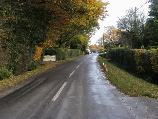
Ashurst Bridge is a small village located in the county of Hampshire, England. Situated near the New Forest National Park, it lies approximately 5 miles west of the town of Southampton. The village gets its name from the bridge that crosses over the River Test, a prominent feature in the area.

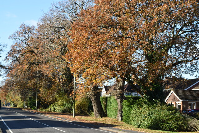
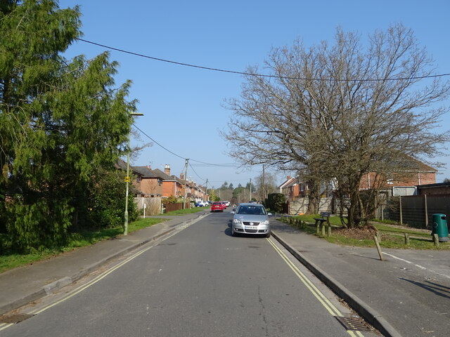
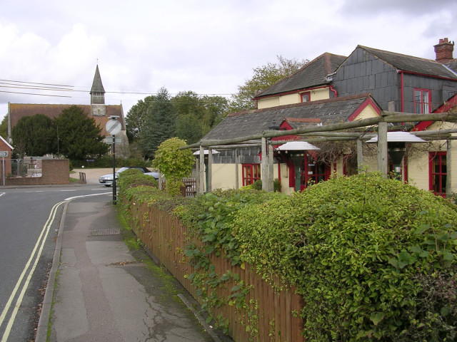
Ashurst Bridge is a rural settlement characterized by its picturesque surroundings and tranquil atmosphere. It consists mainly of a scattering of houses, cottages, and farms. The village is known for its charming thatched roofs and traditional architecture, contributing to its quaint and timeless appearance.

The River Test, which runs through the heart of Ashurst Bridge, is renowned for its clear waters and excellent fishing opportunities. Anglers often gather at the bridge to try their luck in catching brown trout or grayling. The surrounding landscape is also popular among walkers and nature enthusiasts, with several walking trails and paths leading through the nearby New Forest.

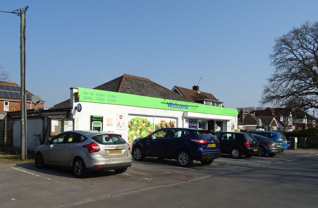
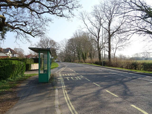
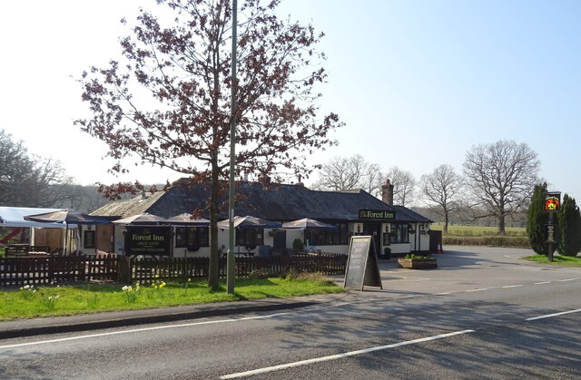
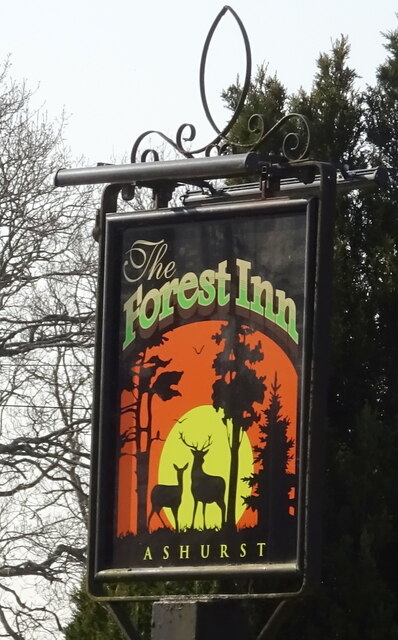
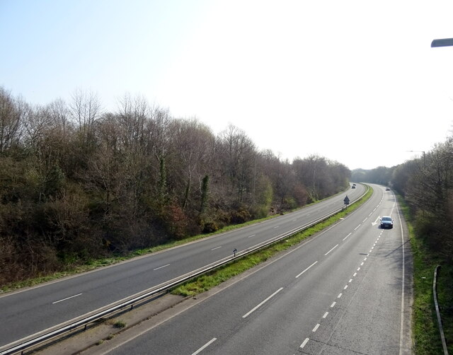
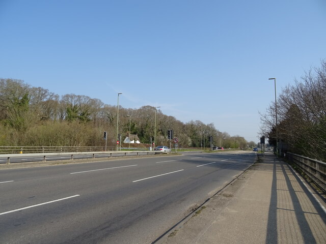
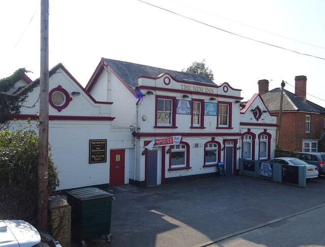
Despite its small size, Ashurst Bridge boasts a few local amenities. These include a village hall, a church, and a pub, providing a sense of community for its residents. The village is well-connected by road, with the A35 passing nearby, providing easy access to Southampton and other nearby towns.

Ashurst Bridge offers a peaceful and idyllic setting for those seeking a rural retreat. Its close proximity to the New Forest and the River Test make it an attractive destination for outdoor activities and nature lovers.

If you have any feedback on the listing, please let us know in the comments section below.

Ashurst Bridge Images

Images are sourced within 2km of 50.908828/-1.514814 or Grid Reference SU3412. Thanks to Geograph Open Source API. All images are credited.

Fields south of Lyndhurst Road, Ashurst
Autumnal trees beside Lyndhurst Road
Morrisons Supermarket This large branch of Morrisons is on the western edge of Totton close to the bypass.
Morrisons Supermarket
This large branch of Morrisons is on the western edge of Totton close to the bypass.
Totton recreation ground The site of the Annual Totton Fair, which has been operating since the end of the 2nd World War, apart from during the covid hiatus.
Totton recreation ground
The site of the Annual Totton Fair, which has been operating since the end of the 2nd World War, apart from during the covid hiatus.
Totton bypass Viewed from the Rushington roundabout bus stop.
Totton bypass
Viewed from the Rushington roundabout bus stop.
Railway towards Southampton
Bus stop and shelter on Lyndhurst Road (A35) The A35 is a major (and regularly congested) route along England's south coast. It runs for 97 miles, connecting Honiton in Devon with Southampton in Hampshire, via Poole and Bournemouth, with much of its route passing through Dorset and the New Forest. It is a trunk road for some of its length.
<span class="nowrap"><a title="http://www.sabre-roads.org.uk/wiki/index.php?title=A35" rel="nofollow ugc noopener" href="http://www.sabre-roads.org.uk/wiki/index.php?title=A35">Link</a><img style="margin-left:2px;" alt="External link" title="External link - shift click to open in new window" src="https://s1.geograph.org.uk/img/external.png" width="10" height="10"/></span>  SABRE
Bus stop and shelter on Lyndhurst Road (A35)
The A35 is a major (and regularly congested) route along England's south coast. It runs for 97 miles, connecting Honiton in Devon with Southampton in Hampshire, via Poole and Bournemouth, with much of its route passing through Dorset and the New Forest. It is a trunk road for some of its length. LinkExternal link SABRE
Co-op on Lyndhurst Road
Wood Road
Wood Road
Bus stop and shelter on Lyndhurst Road (A35) The A35 is a major (and regularly congested) route along England's south coast. It runs for 97 miles, connecting Honiton in Devon with Southampton in Hampshire, via Poole and Bournemouth, with much of its route passing through Dorset and the New Forest. It is a trunk road for some of its length.
<span class="nowrap"><a title="http://www.sabre-roads.org.uk/wiki/index.php?title=A35" rel="nofollow ugc noopener" href="http://www.sabre-roads.org.uk/wiki/index.php?title=A35">Link</a><img style="margin-left:2px;" alt="External link" title="External link - shift click to open in new window" src="https://s1.geograph.org.uk/img/external.png" width="10" height="10"/></span>  SABRE
Bus stop and shelter on Lyndhurst Road (A35)
The A35 is a major (and regularly congested) route along England's south coast. It runs for 97 miles, connecting Honiton in Devon with Southampton in Hampshire, via Poole and Bournemouth, with much of its route passing through Dorset and the New Forest. It is a trunk road for some of its length. LinkExternal link SABRE
The Forest Inn
The Forest Inn
Sign for the Forest Inn
Entering Colbury on a path beside the A35 The A35 is a major (and regularly congested) route along England's south coast. It runs for 97 miles, connecting Honiton in Devon with Southampton in Hampshire, via Poole and Bournemouth, with much of its route passing through Dorset and the New Forest. It is a trunk road for some of its length.
<span class="nowrap"><a title="http://www.sabre-roads.org.uk/wiki/index.php?title=A35" rel="nofollow ugc noopener" href="http://www.sabre-roads.org.uk/wiki/index.php?title=A35">Link</a><img style="margin-left:2px;" alt="External link" title="External link - shift click to open in new window" src="https://s1.geograph.org.uk/img/external.png" width="10" height="10"/></span>  SABRE
Entering Colbury on a path beside the A35
The A35 is a major (and regularly congested) route along England's south coast. It runs for 97 miles, connecting Honiton in Devon with Southampton in Hampshire, via Poole and Bournemouth, with much of its route passing through Dorset and the New Forest. It is a trunk road for some of its length. LinkExternal link SABRE
Whartons Lane
Whartons Lane
Bus stop and shelter on the A35 The A35 is a major (and regularly congested) route along England's south coast. It runs for 97 miles, connecting Honiton in Devon with Southampton in Hampshire, via Poole and Bournemouth, with much of its route passing through Dorset and the New Forest. It is a trunk road for some of its length.
<span class="nowrap"><a title="http://www.sabre-roads.org.uk/wiki/index.php?title=A35" rel="nofollow ugc noopener" href="http://www.sabre-roads.org.uk/wiki/index.php?title=A35">Link</a><img style="margin-left:2px;" alt="External link" title="External link - shift click to open in new window" src="https://s1.geograph.org.uk/img/external.png" width="10" height="10"/></span>  SABRE
Bus stop and shelter on the A35
The A35 is a major (and regularly congested) route along England's south coast. It runs for 97 miles, connecting Honiton in Devon with Southampton in Hampshire, via Poole and Bournemouth, with much of its route passing through Dorset and the New Forest. It is a trunk road for some of its length. LinkExternal link SABRE
A326 towards Hythe
A326 towards Hythe
A35 towards Southampton
The New Inn
The New Inn
Show me another place!

Ashurst Bridge is located at Grid Ref: SU3412 (Lat: 50.908828, Lng: -1.514814)

Administrative County: Hampshire

District: New Forest

Police Authority: Hampshire

What 3 Words

///pricing.trading.laugh. Near Totton, Hampshire

Related Wikis

Totton & Eling F.C.

Totton & Eling Football Club are a football club based in Totton & Eling, Hampshire, England. The club is affiliated to the Hampshire Football Association...

Totton College

Totton College is a further education college located in Totton, Hampshire, providing courses for mainly 16- to 19-year-olds as well as adult education...
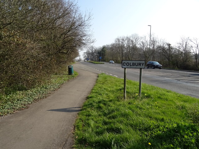
Colbury

Colbury is a small village in the New Forest National Park, in Hampshire, England. The village lies along Deerleap Lane, near the modern village of Ashurst...

Ashurst, Hampshire

Ashurst is a village in the New Forest district of Hampshire, England, which together with Colbury hamlet makes the parish of Ashurst and Colbury. Ashurst...

Netley Marsh

Netley Marsh is a village and civil parish in Hampshire, close to the town of Totton. It lies within the New Forest District, and the New Forest National...
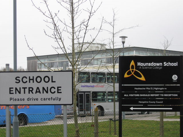
Hounsdown School

Hounsdown School is a secondary school in Totton, near Southampton, Hampshire, England The school has 1,215 pupils, spanning ages 11 to 16. Classes are...

Woodlands, Hampshire

Woodlands is a village in the New Forest National Park of Hampshire, England. The village lies 6 miles (9.7 km) west from Southampton and 2+3⁄4 miles...

Totton and Eling

Totton and Eling () is a civil parish in Hampshire, England, with a population of about 28,100 people. It contains the town of Totton and is situated between...

Nearby Amenities

Located within 500m of 50.908828,-1.514814
Barrier: stile
Lat/Long: 50.9052353/-1.5156038
Ashurst Bridge
Is In: Hampshire, England, UK
Place: village
Lat/Long: 50.9111044/-1.5165561
Bicycle Parking
Capacity: 8
Lat/Long: 50.9104257/-1.5087264
Toilets
Lat/Long: 50.9104545/-1.5088579
Bus Stop
Foxhills School
Bench: no
Bin: no
Bus: yes
Naptan AtcoCode: 1900HA080229
Naptan Bearing: SW
Naptan CommonName: Foxhills School
Naptan Crossing: Knellers Lane
Naptan NaptanCode: hamamjtj
Naptan Street: Foxhills
Naptan Verified: no
Public Transport: platform
Shelter: no
Source: naptan_import
Tactile Paving: no
Lat/Long: 50.90518/-1.5108973
Bus Stop
Foxhills School
Bench: no
Bus: yes
Naptan AtcoCode: 1900HA080230
Naptan Bearing: NE
Naptan CommonName: Foxhills School
Naptan Crossing: Knellers Lane
Naptan NaptanCode: hamamjtd
Naptan Street: Foxhills
Naptan Verified: no
Public Transport: platform
Shelter: no
Source: naptan_import
Tactile Paving: no
Lat/Long: 50.9052433/-1.510982
Power: tower
Source: Bing
Lat/Long: 50.9092099/-1.5218209
Post Box
Collection Times: Mo-Fr 09:00; Sa 07:00
Operator: Royal Mail
Operator Wikidata: Q638098
Post Box Type: lamp
Ref: SO40 246D
Royal Cypher: EIIR
Royal Cypher Wikidata: Q33102113
Lat/Long: 50.9111195/-1.5166119
Power: pole
Lat/Long: 50.9049699/-1.5130037
Power: pole
Lat/Long: 50.9059315/-1.5130936
Poles: bipole
Power: pole
Lat/Long: 50.9066978/-1.5161316
Poles: bipole
Power: pole
Lat/Long: 50.9066161/-1.5161793
Power: pole
Lat/Long: 50.9063119/-1.5142809
Power: pole
Lat/Long: 50.9062346/-1.5143517
Power: pole
Lat/Long: 50.9060164/-1.5130648
Power: pole
Lat/Long: 50.9058118/-1.5122529
Power: pole
Lat/Long: 50.9076318/-1.5209037
Power: pole
Lat/Long: 50.9075996/-1.5209815
Poles: bipole
Power: pole
Lat/Long: 50.907291/-1.5188397
Poles: bipole
Power: pole
Lat/Long: 50.9072149/-1.5189363
Barrier: stile
Lat/Long: 50.9061484/-1.5165924
Barrier: stile
Lat/Long: 50.9076685/-1.5183553
Barrier: stile
Lat/Long: 50.9081546/-1.5192352
Drinking Water
Lat/Long: 50.9103064/-1.5088933
Direction: SW
Generator Method: photovoltaic
Generator Output Electricity: yes
Generator Solar Modules: 8
Generator Source: solar
Generator Type: solar_photovoltaic_panel
Location: roof
Power: generator
Lat/Long: 50.9124311/-1.5115713
Poles: bipole
Power: pole
Source: bing
Lat/Long: 50.9050571/-1.5109503
Power: pole
Source: bing
Lat/Long: 50.9074838/-1.5201715
Power: pole
Source: bing
Lat/Long: 50.907554/-1.5200897
Power: pole
Source: bing
Lat/Long: 50.9055911/-1.5114771
Marker: pedestal
Operator: Esso
Ref: 15.9 km
Utility: oil
Lat/Long: 50.9078604/-1.519557
Marker: pedestal
Operator: Esso
Ref: 15.9 km
Utility: oil
Lat/Long: 50.9078037/-1.5194717
The data included in this document is from www.openstreetmap.org. The data is made available under ODbL.

Have you been to Ashurst Bridge?

Leave your review of Ashurst Bridge below (or comments, questions and feedback).