Beechen Copse

Wood, Forest in Sussex Chichester

England

Beechen Copse

Cottage in Kirdford
Cottage in Kirdford Credit: David Howard

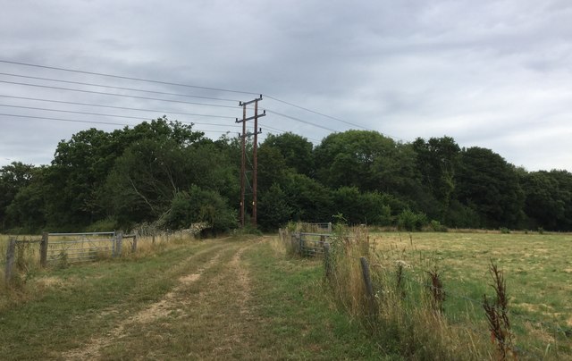
Beechen Copse is a picturesque woodland located in the county of Sussex, England. Covering an area of approximately 100 acres, it is known for its diverse range of tree species and tranquil atmosphere. The copse is situated in the heart of the South Downs National Park, making it a popular destination for nature enthusiasts and outdoor lovers.

The woodland is primarily composed of beech trees, which give it its name, but it also features oak, ash, and other native tree species. The dense canopy formed by these trees provides a haven for a wide variety of flora and fauna. Bluebells, primroses, and wild garlic carpet the forest floor during spring, creating a stunning display of colors.

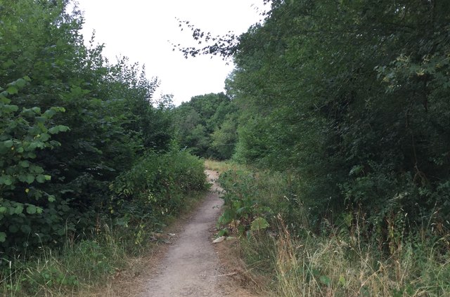
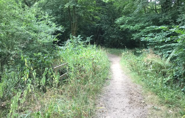
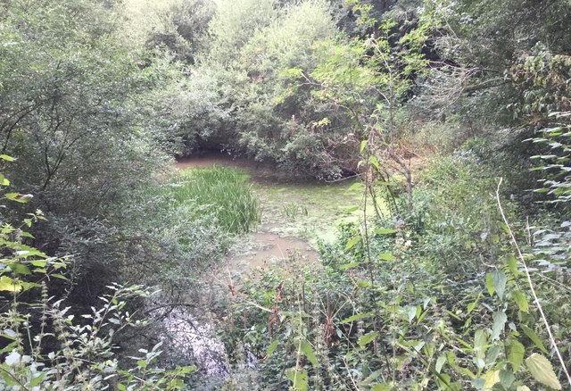
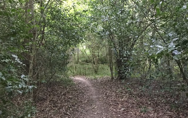
Beechen Copse is crisscrossed by a network of walking trails, allowing visitors to explore the area at their own pace. These paths wind through the woodland, leading to hidden glades and meandering streams. Nature lovers can spot a range of wildlife, including deer, badgers, and a plethora of bird species such as woodpeckers and owls.

The copse is managed by the local wildlife trust, ensuring the conservation and protection of the woodland. It is a designated Site of Special Scientific Interest (SSSI) due to its ecological importance and unique biodiversity. This means that certain activities, such as camping and cycling, are restricted to preserve the natural habitat.

Overall, Beechen Copse is a captivating woodland that offers a peaceful retreat and an opportunity to connect with nature. Its stunning scenery, diverse wildlife, and well-maintained trails make it a must-visit destination for anyone seeking an escape from the bustling city life.

If you have any feedback on the listing, please let us know in the comments section below.

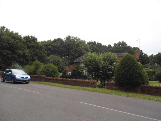
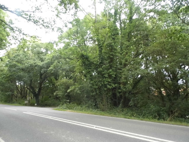
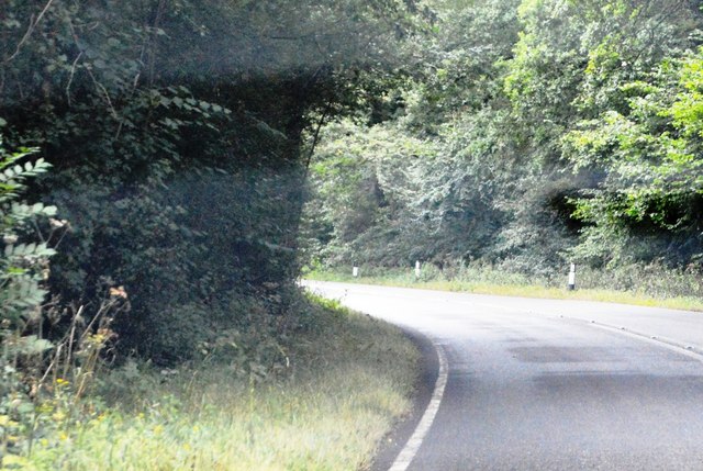
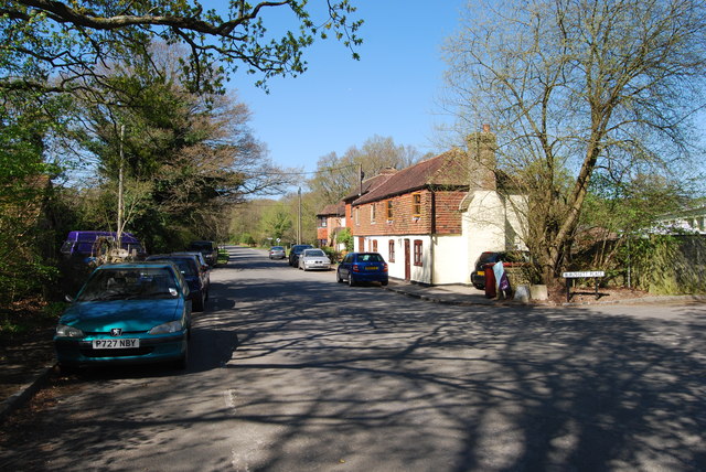
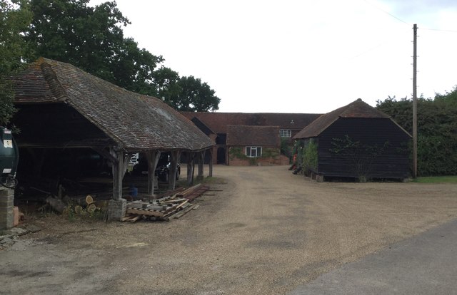
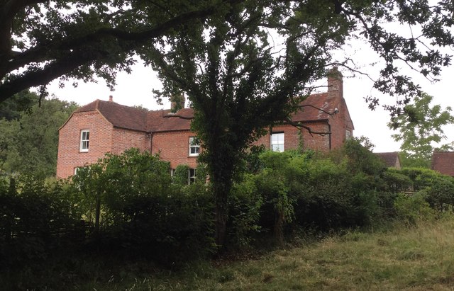
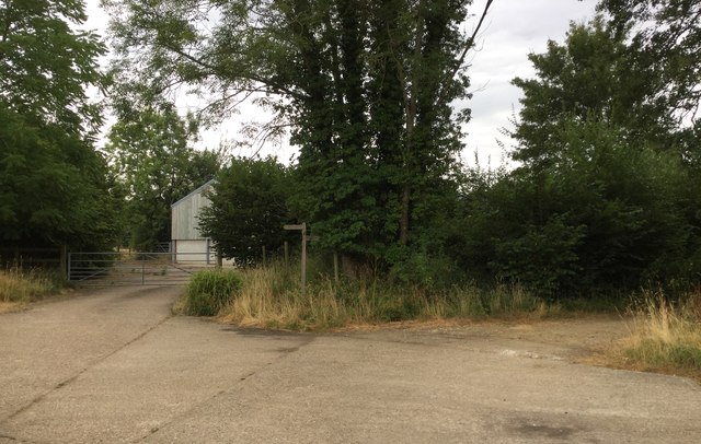
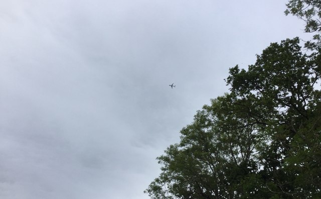
Beechen Copse Images

Images are sourced within 2km of 51.021268/-0.54869617 or Grid Reference TQ0125. Thanks to Geograph Open Source API. All images are credited.

Cottage in Kirdford
Cottage in Kirdford
Woodland by the A272, Strood Green
A272 The A272 is a very rural A road, which follows an east to west route from near Heathfield to Winchester, passing through the Sussex countryside. It runs 86 miles from Sutton Scotney to Five Ashes <a href="https://www.geograph.org.uk/photo/6669405">TQ5523 : A267, A272 junction</a>.
<span class="nowrap"><a title="http://www.sabre-roads.org.uk/wiki/index.php?title=A272" rel="nofollow ugc noopener" href="http://www.sabre-roads.org.uk/wiki/index.php?title=A272">Link</a><img style="margin-left:2px;" alt="External link" title="External link - shift click to open in new window" src="https://s1.geograph.org.uk/img/external.png" width="10" height="10"/></span> 
Wikipedia: <span class="nowrap"><a title="http://en.wikipedia.org/wiki/A272_road" rel="nofollow ugc noopener" href="http://en.wikipedia.org/wiki/A272_road">Link</a><img style="margin-left:2px;" alt="External link" title="External link - shift click to open in new window" src="https://s1.geograph.org.uk/img/external.png" width="10" height="10"/></span>
A272
The A272 is a very rural A road, which follows an east to west route from near Heathfield to Winchester, passing through the Sussex countryside. It runs 86 miles from Sutton Scotney to Five Ashes TQ5523 : A267, A272 junction. LinkExternal link Wikipedia: LinkExternal link
A272, eastbound The A272 is a very rural A road, which follows an east to west route from near Heathfield to Winchester, passing through the Sussex countryside. It runs 86 miles from Sutton Scotney to Five Ashes <a href="https://www.geograph.org.uk/photo/6669405">TQ5523 : A267, A272 junction</a>.
<span class="nowrap"><a title="http://www.sabre-roads.org.uk/wiki/index.php?title=A272" rel="nofollow ugc noopener" href="http://www.sabre-roads.org.uk/wiki/index.php?title=A272">Link</a><img style="margin-left:2px;" alt="External link" title="External link - shift click to open in new window" src="https://s1.geograph.org.uk/img/external.png" width="10" height="10"/></span> 
Wikipedia: <span class="nowrap"><a title="http://en.wikipedia.org/wiki/A272_road" rel="nofollow ugc noopener" href="http://en.wikipedia.org/wiki/A272_road">Link</a><img style="margin-left:2px;" alt="External link" title="External link - shift click to open in new window" src="https://s1.geograph.org.uk/img/external.png" width="10" height="10"/></span>
A272, eastbound
The A272 is a very rural A road, which follows an east to west route from near Heathfield to Winchester, passing through the Sussex countryside. It runs 86 miles from Sutton Scotney to Five Ashes TQ5523 : A267, A272 junction. LinkExternal link Wikipedia: LinkExternal link
Bend, A272 The A272 is a very rural A road, which follows an east to west route from near Heathfield to Winchester, passing through the Sussex countryside. It runs 86 miles from Sutton Scotney to Five Ashes <a href="https://www.geograph.org.uk/photo/6669405">TQ5523 : A267, A272 junction</a>.
<span class="nowrap"><a title="http://www.sabre-roads.org.uk/wiki/index.php?title=A272" rel="nofollow ugc noopener" href="http://www.sabre-roads.org.uk/wiki/index.php?title=A272">Link</a><img style="margin-left:2px;" alt="External link" title="External link - shift click to open in new window" src="https://s1.geograph.org.uk/img/external.png" width="10" height="10"/></span> 
Wikipedia: <span class="nowrap"><a title="http://en.wikipedia.org/wiki/A272_road" rel="nofollow ugc noopener" href="http://en.wikipedia.org/wiki/A272_road">Link</a><img style="margin-left:2px;" alt="External link" title="External link - shift click to open in new window" src="https://s1.geograph.org.uk/img/external.png" width="10" height="10"/></span>
Bend, A272
The A272 is a very rural A road, which follows an east to west route from near Heathfield to Winchester, passing through the Sussex countryside. It runs 86 miles from Sutton Scotney to Five Ashes TQ5523 : A267, A272 junction. LinkExternal link Wikipedia: LinkExternal link
Road through Kirdford
Kiln Copse Kiln Copse viewed from the Kirdford Road.
Kiln Copse
Kiln Copse viewed from the Kirdford Road.
Trade Entrance and Bridleway The trade entrance at Barkfold Manor is also the start of a bridleway.
Trade Entrance and Bridleway
The trade entrance at Barkfold Manor is also the start of a bridleway.
Barkfold Manor Barkfold Manor viewed from the nearby bridleway.
Barkfold Manor
Barkfold Manor viewed from the nearby bridleway.
The Bothy The Bothy at Barkfold Manor.
The Bothy
The Bothy at Barkfold Manor.
Barkfold Farmhouse
Barkfold Farmhouse
Path Junction at Barkfold Farm
Bridleway beside Kiln Copse
Underneath the flight path for Gatwick A number of planes were passing overhead at this point and making a final turn to the right to begin the landing approach for Gatwick Airport. This plane was the Norwegian Air International flight IBK1RL from Oslo at around 5,000 feet according to the Flightradar24 app on my smartphone.
Underneath the flight path for Gatwick
A number of planes were passing overhead at this point and making a final turn to the right to begin the landing approach for Gatwick Airport. This plane was the Norwegian Air International flight IBK1RL from Oslo at around 5,000 feet according to the Flightradar24 app on my smartphone.
Bridge over the Boxal Brook Crossing the Boxal Brook over a fairly well hidden bridge.
Bridge over the Boxal Brook
Crossing the Boxal Brook over a fairly well hidden bridge.
Pond at Boxal Brook A small pond formed by the Boxal Brook, which was probably connected with the former Ironworks sited in Kiln Copse.
Pond at Boxal Brook
A small pond formed by the Boxal Brook, which was probably connected with the former Ironworks sited in Kiln Copse.
Path through Kiln Copse
Approaching Barkfold Rough
Show me another place!

Beechen Copse is located at Grid Ref: TQ0125 (Lat: 51.021268, Lng: -0.54869617)

Administrative County: West Sussex

District: Chichester

Police Authority: Sussex

What 3 Words

///making.marmalade.crusted. Near Petworth, West Sussex

Related Wikis

Kirdford

Kirdford is a village and civil parish in the Chichester District of West Sussex, England. Its nearest town is Petworth, located 6.5 miles (10.5 km) southwest...

The Mens

The Mens is a 205.2-hectare (507-acre) biological Site of Special Scientific Interest west of Billingshurst in West Sussex. It is a Nature Conservation...

Petworth (electoral division)

Petworth is an electoral division of West Sussex in the United Kingdom, and returns one member to sit on West Sussex County Council. == Extent == The division...

Wisborough Green

Wisborough Green is a village and civil parish in the north of the Chichester district of West Sussex, England, 2 miles (3.2 km) west of Billingshurst...

St Ronan's School

Saint Ronan's School is an independent co-educational preparatory school for boys and girls from 3 to 13 years located in Hawkhurst in Kent, England. It...

Balls Cross

Balls Cross is a hamlet in Ebernoe civil parish in the Chichester District of West Sussex, England.The hamlet comprises a few houses together with a small...

River Kird

The River Kird is a river located in the Chichester District of West Sussex, England that is a tributary to the River Arun. It is located in South Downs...

Bognor Common Quarry

Bognor Common Quarry is a 25.1-hectare (62-acre) geological Site of Special Scientific Interest east of Petworth in West Sussex. It is a Geological Conservation...

Nearby Amenities

Located within 500m of 51.021268,-0.54869617
Power: tower
Lat/Long: 51.0185072/-0.5499995
Power: tower
Lat/Long: 51.020137/-0.5446716
The data included in this document is from www.openstreetmap.org. The data is made available under ODbL.

Have you been to Beechen Copse?

Leave your review of Beechen Copse below (or comments, questions and feedback).