Creeton Road Plantation

Wood, Forest in Lincolnshire South Kesteven

England

Creeton Road Plantation

Swinstead
Swinstead Credit: Tim Heaton

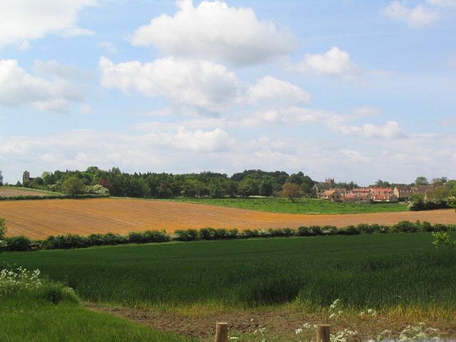
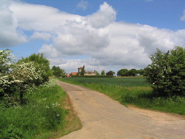
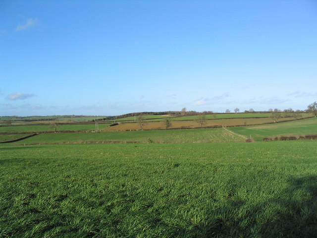
Creeton Road Plantation is a woodland located in Lincolnshire, England. Situated near the small village of Creeton, this plantation covers a vast area of approximately 500 acres. It is known for its dense and diverse collection of trees, making it a significant forested area in the region.

The plantation mainly consists of native tree species, including oak, ash, birch, and beech. These trees provide a suitable habitat for a wide range of flora and fauna, making it an important ecological site. The woodland floor is adorned with a variety of wildflowers and ground-covering plants, creating a rich and vibrant undergrowth.

Creeton Road Plantation is a popular destination for nature enthusiasts, hikers, and bird watchers. The forest is home to numerous bird species, including woodpeckers, owls, and various songbirds. Visitors can enjoy the peaceful surroundings while listening to the melodic chirping of birds or spotting the occasional hare or deer.

There are several walking trails and paths that wind through the woodland, allowing visitors to explore the plantation at their leisure. These trails offer stunning views of the surrounding countryside and provide an opportunity to immerse oneself in the natural beauty of the area.

Overall, Creeton Road Plantation is a cherished natural asset within Lincolnshire. Its thriving ecosystem, scenic beauty, and recreational opportunities make it a cherished destination for locals and tourists alike.

If you have any feedback on the listing, please let us know in the comments section below.

Creeton Road Plantation Images

Images are sourced within 2km of 52.786749/-0.49270265 or Grid Reference TF0122. Thanks to Geograph Open Source API. All images are credited.

Swinstead
Swinstead
Church of St Mary, Swinstead
Track to Woodlands Farm Off the road from Corby Glen to Swinstead
Track to Woodlands Farm
Off the road from Corby Glen to Swinstead
Swinstead from Forstedd Hill
Track to Tower Farm
Track to Tower Farm
'The Drift', east of Swayfield 'Drift' is not an uncommon name for lanes in this area, and presumably refers to their use for driving cattle. This attractive lane runs for about 2 miles, from the road junction on the east side of Swayfield (distance), south to Creeton. Marred only by the sound of trains on the nearby East Coast main line.
'The Drift', east of Swayfield
'Drift' is not an uncommon name for lanes in this area, and presumably refers to their use for driving cattle. This attractive lane runs for about 2 miles, from the road junction on the east side of Swayfield (distance), south to Creeton. Marred only by the sound of trains on the nearby East Coast main line.
View east from The Drift The West Glen River flows along the foot of the escarpment, with 'The Ram' plantation on the hill.
View east from The Drift
The West Glen River flows along the foot of the escarpment, with 'The Ram' plantation on the hill.
Valley of the West Glen River A footpath runs from The Drift (behind camera), alongside the hedge bounding Gorse Hill plantation (left), across the river, and up the far bank to Swinstead.
Valley of the West Glen River
A footpath runs from The Drift (behind camera), alongside the hedge bounding Gorse Hill plantation (left), across the river, and up the far bank to Swinstead.
'The Drift', north of Creeton View north of this attractive lane, which runs parallel to the West Glen River (to right)
'The Drift', north of Creeton
View north of this attractive lane, which runs parallel to the West Glen River (to right)
Footbridge over the West Glen River View north, with Croakhill Plantation on the right. The footpath runs from The Drift (left) to Creeton Farm on the Creeton-Swinstead road (right)
Footbridge over the West Glen River
View north, with Croakhill Plantation on the right. The footpath runs from The Drift (left) to Creeton Farm on the Creeton-Swinstead road (right)
Creeton Farm
Creeton Farm
View north-west of TF0120 Showing most of square TF0120, with Croakhill Plantation in the distance. Taken from the footpath running east from Creeton toward Grimsthorpe Park, which cuts across the south-east corner of the square.
View north-west of TF0120
Showing most of square TF0120, with Croakhill Plantation in the distance. Taken from the footpath running east from Creeton toward Grimsthorpe Park, which cuts across the south-east corner of the square.
Swinstead Road, north of Creeton 'Spring Buildings Plantation' to the left of the road at the top of the hill.
Swinstead Road, north of Creeton
'Spring Buildings Plantation' to the left of the road at the top of the hill.
Mistletoe in lime trees; Steel's Riding, Grimsthorpe Park The track running west-east through the southern part of Grimsthorpe Park is lined with lime trees, heavily infested with mistletoe. The trees look rather sick - but I've only seen them in their leaf-free, winter months.
Mistletoe in lime trees; Steel's Riding, Grimsthorpe Park
The track running west-east through the southern part of Grimsthorpe Park is lined with lime trees, heavily infested with mistletoe. The trees look rather sick - but I've only seen them in their leaf-free, winter months.
Western end of 'Steel's Riding', Grimsthorpe Park With one of the many mistletoe-infested lime trees.
Western end of 'Steel's Riding', Grimsthorpe Park
With one of the many mistletoe-infested lime trees.
View north towards Park House, Grimsthorpe Park
Farm buildings, Grimsthorpe Park The track runs north-west towards Swinstead.
Farm buildings, Grimsthorpe Park
The track runs north-west towards Swinstead.
Road running east into Grimsthorpe Park Much of the central part of this large Park estate is farmed, but the remainder is attractive woodland.
Road running east into Grimsthorpe Park
Much of the central part of this large Park estate is farmed, but the remainder is attractive woodland.
Show me another place!

Creeton Road Plantation is located at Grid Ref: TF0122 (Lat: 52.786749, Lng: -0.49270265)

Administrative County: Lincolnshire

District: South Kesteven

Police Authority: Lincolnshire

What 3 Words

///rear.retraced.melons. Near Corby Glen, Lincolnshire

Related Wikis

Swinstead

Swinstead is a village and civil parish in the South Kesteven district of Lincolnshire, England. It is situated 5 miles (8.0 km) west from Bourne, 9 miles...

South Kesteven

South Kesteven is a local government district in Lincolnshire, England, forming part of the traditional Kesteven division of the county. Its council is...

Grantham and Stamford (UK Parliament constituency)

Grantham and Stamford is a constituency in Lincolnshire represented in the House of Commons of the UK Parliament since 2019 by Gareth Davies, a Conservative...

Vaudey Abbey

Vaudey Abbey , also known as Vandy Abbey or Vandey Abbey, was an English Cistercian abbey. It was founded in 1147 by William, Count of Aumale, Earl of...

Nearby Amenities

Located within 500m of 52.786749,-0.49270265
Swinstead
Is In: Lincolnshire, England, UK
Place: village
Source: NPE
Lat/Long: 52.7905915/-0.491407
Turning Circle
Lat/Long: 52.7898259/-0.4926818
Bus Stop
St Marys Church
Naptan AtcoCode: 270000014551
Naptan Bearing: N
Naptan CommonName: St Marys Church
Naptan Indicator: N - bound
Naptan Landmark: St Marys Church
Naptan NaptanCode: linjpwjt
Naptan Street: Creeton Road
Naptan Verified: no
Source: naptan_import
Lat/Long: 52.7900147/-0.4915661
Bus Stop
St Marys Church
Naptan AtcoCode: 270000014552
Naptan Bearing: S
Naptan CommonName: St Marys Church
Naptan Indicator: S - bound
Naptan Landmark: St Marys Church
Naptan NaptanCode: linjpwjw
Naptan Street: Creeton Road
Naptan Verified: no
Source: naptan_import
Lat/Long: 52.790049/-0.4914314
Bus Stop
Memorial
Naptan AtcoCode: 2700LSM02647
Naptan Bearing: W
Naptan CommonName: Memorial
Naptan Indicator: W - bound
Naptan Landmark: Memorial
Naptan NaptanCode: linatjdw
Naptan Street: High Street
Naptan Verified: no
Source: naptan_import
Lat/Long: 52.7904257/-0.4920709
Bus Stop
Memorial
Naptan AtcoCode: 2700LSP00667
Naptan Bearing: E
Naptan CommonName: Memorial
Naptan Indicator: E - bound
Naptan Landmark: Memorial
Naptan NaptanCode: linagawm
Naptan Street: High Street
Naptan Verified: no
Source: naptan_import
Lat/Long: 52.7905317/-0.491919
Ele: 66.0000000
Lat/Long: 52.7889512/-0.4869976
Ele: 66.0000000
Lat/Long: 52.7888914/-0.4868566
Pub
The Windmill Inn
Source: View from E
Lat/Long: 52.7905075/-0.4903818
Ancaster Mews
Place: neighbourhood
Source: Bing
Lat/Long: 52.7907774/-0.494747
Ele: 80
Natural: peak
Source: Bing
Lat/Long: 52.7845498/-0.4974827
South Lodge
Place: isolated_dwelling
Source: Bing
Lat/Long: 52.782495/-0.4950141
Building: yes
Lat/Long: 52.7890538/-0.4890932
Shelter
Shelter Type: public_transport
Lat/Long: 52.7903909/-0.492367
Telephone
Booth: K6
Covered: booth
Listed Status: Grade II
Operator: BT
Phone: +44 1476 550340
Lat/Long: 52.7904051/-0.4924039
Post Box
Post Box Type: lamp
Lat/Long: 52.7904112/-0.4923305
The data included in this document is from www.openstreetmap.org. The data is made available under ODbL.

Have you been to Creeton Road Plantation?

Leave your review of Creeton Road Plantation below (or comments, questions and feedback).