Ash Woods

Wood, Forest in Sussex Arun

England

Ash Woods

Birches near the edge of Houghton Forest
Birches near the edge of Houghton Forest Credit: Ian Cunliffe

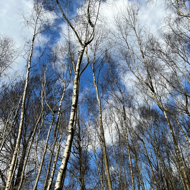
Ashdown Forest, located in Sussex, England, is a stunning area of ancient woodland covering approximately 2,000 hectares. This enchanting forest, also known as Ash Woods, is renowned for its picturesque landscapes, diverse wildlife, and rich history.

The woodland is predominantly made up of oak and birch trees, with the occasional ash tree dotting the landscape. This mix of tree species creates a beautiful tapestry of colors throughout the year, particularly during the autumn season when the leaves turn vibrant shades of red, orange, and gold.

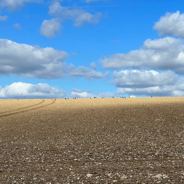
Ash Woods is not only a haven for nature lovers but also a sanctuary for wildlife. The forest is home to a variety of species, including deer, foxes, badgers, and a wide range of birdlife. Birdwatchers flock to the area to catch glimpses of rare species such as nightjars and woodlarks.

The forest also holds historical significance, as it was once a royal hunting ground. In fact, it is believed that Ash Woods served as the inspiration for the setting of A. A. Milne's Winnie the Pooh stories, with landmarks such as the "Enchanted Place" and "Galleon's Lap" being featured in the books.

Visitors to Ash Woods can explore the area through a network of well-maintained footpaths and trails, allowing them to fully immerse themselves in the natural beauty of the forest. The forest is a popular destination for walking, cycling, and horse riding, with designated routes catering to all levels of fitness and ability.

Overall, Ash Woods in Sussex offers a captivating blend of natural beauty, diverse wildlife, and historical significance, making it a must-visit destination for nature enthusiasts and history buffs alike.

If you have any feedback on the listing, please let us know in the comments section below.

Ash Woods Images

Images are sourced within 2km of 50.880989/-0.55529012 or Grid Reference TQ0110. Thanks to Geograph Open Source API. All images are credited.

Birches near the edge of Houghton Forest
Farmland between the A29 and Houghton Forest I thought the birds in the distance added a little interest to this scene. This flinty soil is typical of that on the South Downs. Somewhere in the direction of the photo there's an antiquity marked as "The Mill Ball" on the OS Map. Apparently it's a "bowl barrow", but it doesn't appear in this shot.
Farmland between the A29 and Houghton Forest
I thought the birds in the distance added a little interest to this scene. This flinty soil is typical of that on the South Downs. Somewhere in the direction of the photo there's an antiquity marked as "The Mill Ball" on the OS Map. Apparently it's a "bowl barrow", but it doesn't appear in this shot.
Amberly Station Amberley Station opened in 1863. It is located between Pulborough and Arundel on the Arun Valley Line.
Amberly Station
Amberley Station opened in 1863. It is located between Pulborough and Arundel on the Arun Valley Line.
Boating at Houghton Bridge Although this photo was taken about 70 years ago, the basics of the site has remained unchanged.
Caravans, parking, tea rooms, and boating, though I believe that oars have now been replaced by outboard motors!
Boating at Houghton Bridge
Although this photo was taken about 70 years ago, the basics of the site has remained unchanged. Caravans, parking, tea rooms, and boating, though I believe that oars have now been replaced by outboard motors!
Woodland east of Dry Lodge Plantation This is in the access land on the east side of Arundel Park.
Woodland east of Dry Lodge Plantation
This is in the access land on the east side of Arundel Park.
Black Rabbit pub sign
Black Rabbit pub
Black Rabbit pub
Madehurst Road Route through Houghton Forest to Madehurst.
Madehurst Road
Route through Houghton Forest to Madehurst.
Warning security cameras in use Electricity supply lines adjacent to Madehurst Road in Houghton Forest.
Warning security cameras in use
Electricity supply lines adjacent to Madehurst Road in Houghton Forest.
A29, Rewell Hill Wood The A29 runs for 34 miles from the A24 at Capel, south of Dorking, through Billingshurst and Pulborough, crossing the South Downs at Bury Hill and passing Fontwell Park Racecourse before terminating on the B2166 on Bognor Regis sea front.
From Capel to Hardham, south of Pulborough, the road largely follows the path of the old Roman road, Stane Street.
A29, Rewell Hill Wood
The A29 runs for 34 miles from the A24 at Capel, south of Dorking, through Billingshurst and Pulborough, crossing the South Downs at Bury Hill and passing Fontwell Park Racecourse before terminating on the B2166 on Bognor Regis sea front. From Capel to Hardham, south of Pulborough, the road largely follows the path of the old Roman road, Stane Street.
Footpath marker post in Rewell Hill Wood
Track through the Rewell Hill Plantation
In Houghton Forest An area of mainly beech.
In Houghton Forest
An area of mainly beech.
Dalesdown Wood near Arundel Bluebell time.
Dalesdown Wood near Arundel
Bluebell time.
The valley of the River Arun from B2139 The start of a gentle slope to Houghton and the bridge over the river at Amberley
The valley of the River Arun from B2139
The start of a gentle slope to Houghton and the bridge over the river at Amberley
B2139 crossing the valley of the Arun Between Houghton and Amberley the road is slightly raised above the fields in the flood plain
B2139 crossing the valley of the Arun
Between Houghton and Amberley the road is slightly raised above the fields in the flood plain
Houghton Bridge over River Arun
River Arun at Houghton Bridge
Show me another place!

Ash Woods is located at Grid Ref: TQ0110 (Lat: 50.880989, Lng: -0.55529012)

Administrative County: West Sussex

District: Arun

Police Authority: Sussex

What 3 Words

///heaven.conned.highly. Near Arundel, West Sussex

Nearby Locations

South Wood Ash Woods

Related Wikis

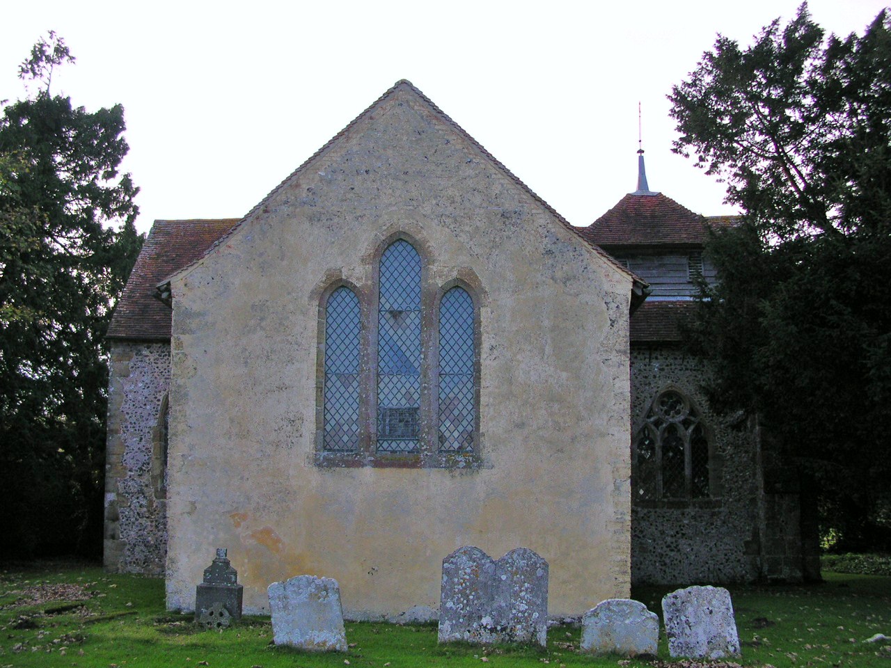
St Mary the Virgin's Church, North Stoke

North Stoke Church, rededicated in 2007 to St Mary the Virgin after its medieval dedication was unexpectedly rediscovered, is a former Church of England...

North Stoke, West Sussex

North Stoke is a village and former civil parish, now in the parish of Amberley, in the Horsham district of West Sussex, England. It is just over 2 miles...

South Stoke, West Sussex

South Stoke is a rural village and civil parish in the Arun District of West Sussex, England. It is centred two miles (3 km) north of Arundel also on...
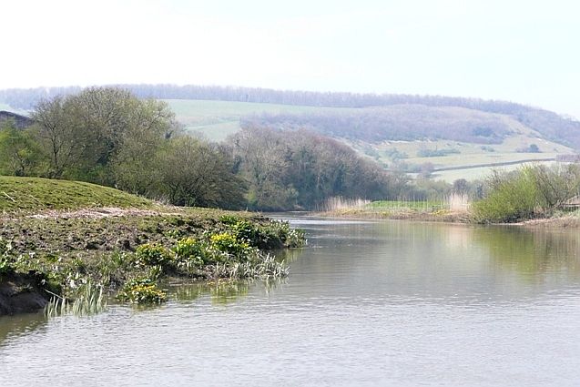
Arun Banks

Arun Banks is a 25.8-hectare (64-acre) biological Site of Special Scientific Interest north of Arundel in West Sussex.This site consists of a tidal stretch...

Nearby Amenities

Located within 500m of 50.880989,-0.55529012
Source: Lansdat photo
Lat/Long: 50.8801094/-0.5488337
Source: Lansdat photo
Lat/Long: 50.8810906/-0.5525471
Source: Lansdat photo
Lat/Long: 50.8820922/-0.5557642
Source: Lansdat photo
Lat/Long: 50.883499/-0.5573953
Source: Lansdat photo
Lat/Long: 50.8841797/-0.5584166
Barrier: kissing_gate
Bicycle: no
Horse: no
Lat/Long: 50.8839647/-0.5588471
Arundel Park
Hiking: yes
Information: map
Map Size: site
Map Type: scheme
Tourism: information
Lat/Long: 50.8839649/-0.5588365
The data included in this document is from www.openstreetmap.org. The data is made available under ODbL.

Have you been to Ash Woods?

Leave your review of Ash Woods below (or comments, questions and feedback).