Eaton Socon

Settlement in Bedfordshire Huntingdonshire

England

Eaton Socon

Electricity Pylon at Wyboston
Electricity Pylon at Wyboston Credit: Anthony Parkes

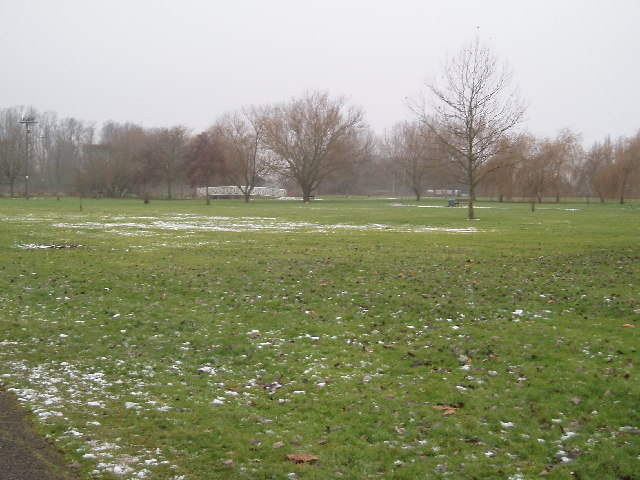
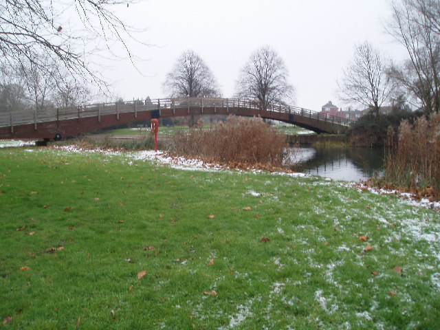
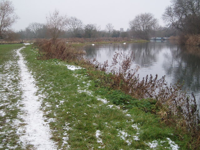
Eaton Socon is a small village located in the county of Bedfordshire, England. It is situated on the banks of the River Great Ouse, just south of the town of St Neots. With a population of around 8,000 people, it is a relatively quiet and peaceful area.

The village has a rich history that dates back to medieval times. It was originally known as Eaton until it merged with the neighboring village of Socon in the 19th century. As a result, Eaton Socon now encompasses both areas.

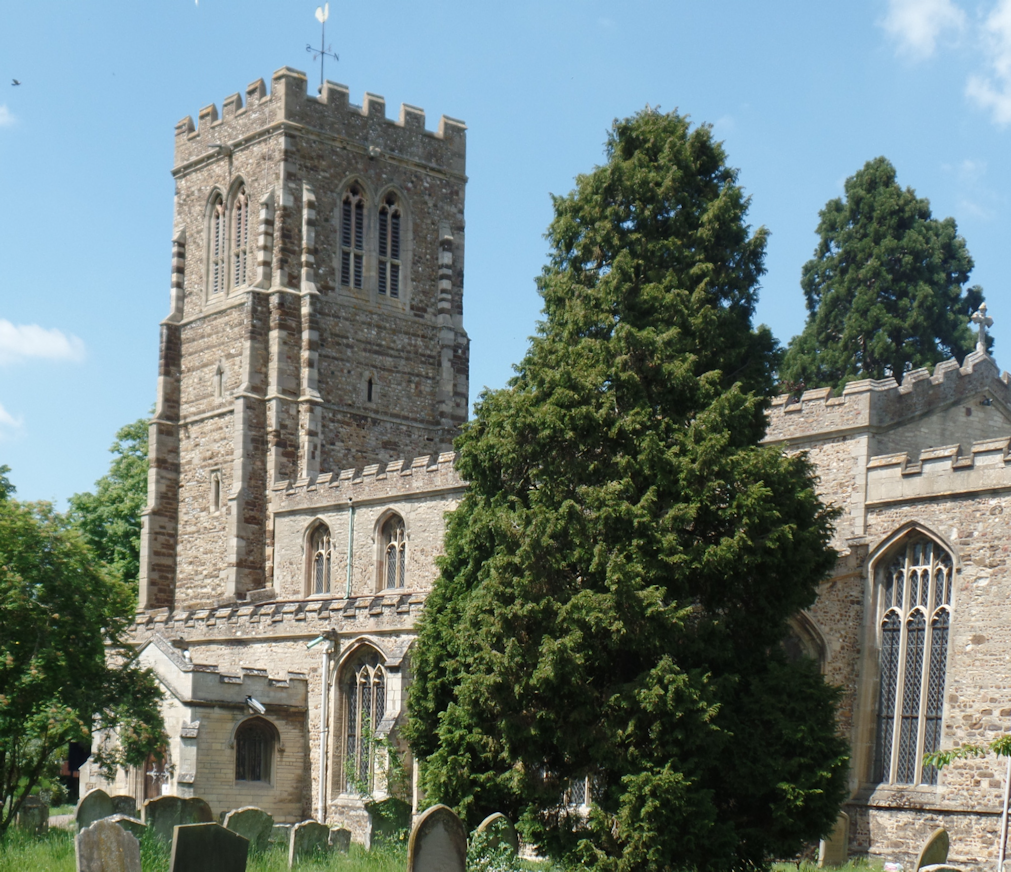
One of the notable landmarks in Eaton Socon is the St Mary's Church, which dates back to the 12th century. The church boasts an impressive tower and has undergone several renovations over the years. It serves as a reminder of the village's historical significance.

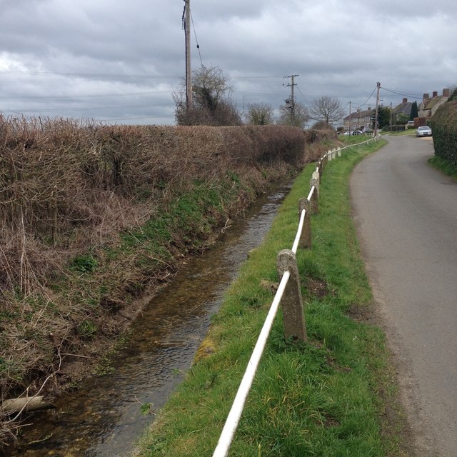
Eaton Socon has a range of amenities and facilities to cater to its residents. These include a primary school, a community center, a library, and several shops and pubs. The village is also surrounded by picturesque countryside, making it an ideal location for outdoor activities such as walking and cycling.

Transport links to Eaton Socon are convenient, with regular bus services connecting the village to St Neots and other nearby towns. The A1 road is also easily accessible, providing connections to larger cities such as Cambridge and London.

Overall, Eaton Socon offers a peaceful and picturesque setting, with a rich history and a strong sense of community.

If you have any feedback on the listing, please let us know in the comments section below.

Eaton Socon Images

Images are sourced within 2km of 52.217764/-0.296097 or Grid Reference TL1659. Thanks to Geograph Open Source API. All images are credited.
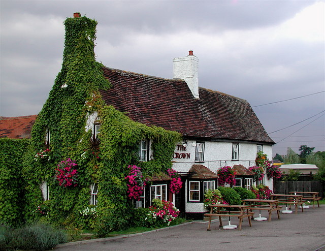
Electricity Pylon at Wyboston
Roundabout exit at Eaton Socon The A428 meets the A1 [entering from the immediate left], and the left leads to a small commercial area, which is a cul-de-sac, and includes The Crown.
Roundabout exit at Eaton Socon
The A428 meets the A1 [entering from the immediate left], and the left leads to a small commercial area, which is a cul-de-sac, and includes The Crown.
The Riverside Park, St Neots
Footbridge over Great Ouse
Ouse Valley Way
Ouse Valley Way
Weir on River Great Ouse
Eynesbury Manor Moorings Footbridge This bridge, and the development opposite, all looks very new; not shown on my 1999 Explorer map. The lifting bridge is hydraulically operated from a control panel nearby.
Eynesbury Manor Moorings Footbridge
This bridge, and the development opposite, all looks very new; not shown on my 1999 Explorer map. The lifting bridge is hydraulically operated from a control panel nearby.
Rape field.
Rape field.
Signpost.
Signpost.
The A1. Looking north up the A1 from the Bushmead Road bridge.
The A1.
Looking north up the A1 from the Bushmead Road bridge.
Footpath. Picture showing a signposted footpath over farmland.
Footpath.
Picture showing a signposted footpath over farmland.
Farm track. Farm track and rubbish dumping area across road from Tithe Farm.
Farm track.
Farm track and rubbish dumping area across road from Tithe Farm.
Farmland. A view looking across the fields towards Tithe Farm.
Farmland.
A view looking across the fields towards Tithe Farm.
The Crown at Eaton Socon, St. Neots The original part of the Crown Inn building on the Great North Road is said to be a coaching house dating back 300 years. It is now trapped in a triangle of busy roads formed by the A1, the A428 and a slip road linking the two.
The Crown at Eaton Socon, St. Neots
The original part of the Crown Inn building on the Great North Road is said to be a coaching house dating back 300 years. It is now trapped in a triangle of busy roads formed by the A1, the A428 and a slip road linking the two.
Wyboston Leisure Park A view across the southern lake on a summer evening at Wyboston Leisure Park near St. Neots, Cambridgeshire.
Wyboston Leisure Park
A view across the southern lake on a summer evening at Wyboston Leisure Park near St. Neots, Cambridgeshire.
War Memorial, Eaton Socon, Hunts/Cambs situated on The Green beside the Great North Road.
War Memorial, Eaton Socon, Hunts/Cambs
situated on The Green beside the Great North Road.
Parish church, Eaton Socon, Hunts/Cambs The church of St Mary the Virgin originally built in the beginning of the 15th century, burned down 8 Feb 1930, but it was immediately rebuilt and consecrated in 1932.
Parish church, Eaton Socon, Hunts/Cambs
The church of St Mary the Virgin originally built in the beginning of the 15th century, burned down 8 Feb 1930, but it was immediately rebuilt and consecrated in 1932.
Eaton Socon Cage, School Lane, Eaton Socon, Hunts/Cambs This lock-up was built in 1826 for the confinement of local malefactors; it was restored in 1963 and placed in the care of the Bedfordshire and Huntingdonshire Naturalists' Trust.
Eaton Socon Cage, School Lane, Eaton Socon, Hunts/Cambs
This lock-up was built in 1826 for the confinement of local malefactors; it was restored in 1963 and placed in the care of the Bedfordshire and Huntingdonshire Naturalists' Trust.
Show me another place!

Eaton Socon is located at Grid Ref: TL1659 (Lat: 52.217764, Lng: -0.296097)

Administrative County: Cambridgeshire

District: Huntingdonshire

Police Authority: Cambridgeshire

What 3 Words

///crinkled.reckon.cropping. Near Eaton Socon, Cambridgeshire

Nearby Locations

Eaton Socon

Related Wikis

Eaton Socon

Eaton Socon is a community in the civil parish of St Neots, in the Huntingdonshire district, in the county of Cambridgeshire, England. Eaton Socon is...

Eaton Socon Rural District

Eaton Socon was a rural district in Bedfordshire, England from 1894 to 1934. The district had its origins in the St Neots Rural Sanitary District. This...

Eaton Socon Castle

Eaton Socon Castle was a Norman fortification. It was constructed next to the River Great Ouse in what is now Eaton Socon, Cambridgeshire, England. It...

Duloe Brook

Duloe Brook is a minor, roughly 9 km (5.59 mi) long river (or brook) in Bedfordshire that is a tributary to the River Great Ouse. The brook rises in the...

Nearby Amenities

Located within 500m of 52.217764,-0.296097
Post Office
Eaton Socon Post Office
Addr City: St Neots
Addr Country: GB
Addr Postcode: PE19 8EF
Brand: Post Office
Brand Wikidata: Q1783168
Contact Website: https://www.postoffice.co.uk/branch-finder/2812304/eaton-socon
Ref Pol Id: 11266
Lat/Long: 52.2176314/-0.2891675
Turning Circle
Lat/Long: 52.2208672/-0.2975297
Turning Circle
Lat/Long: 52.2182556/-0.2964335
Turning Circle
Lat/Long: 52.2178104/-0.2930516
Turning Circle
Lat/Long: 52.2179125/-0.2939915
Turning Circle
Lat/Long: 52.2179941/-0.2948911
Turning Circle
Lat/Long: 52.2160551/-0.2968101
Turning Circle
Lat/Long: 52.2189653/-0.2901662
Turning Circle
Lat/Long: 52.2186178/-0.2926728
Turning Circle
Lat/Long: 52.2167793/-0.2948637
Turning Circle
Lat/Long: 52.2170122/-0.2947513
Turning Circle
Lat/Long: 52.2159182/-0.2934217
Bus Stop
Bus: yes
Public Transport: platform
Lat/Long: 52.2185211/-0.2889635
Post Box
Lat/Long: 52.2195516/-0.2944399
Insulators: tension
Line Attachment: anchor
Power: tower
Source: visual survey from footpath to S
Lat/Long: 52.2143003/-0.2996976
Turning Circle
Lat/Long: 52.2199182/-0.2982478
Addr City: St Neots
Addr Country: GB
Addr Housenumber: 108
Addr Postcode: PE19 8TZ
Addr Street: Cornwallis Drive
Lat/Long: 52.2177125/-0.2982906
Design: barrel
Line Attachment: anchor
Material: steel
Power: tower
Structure: lattice
Lat/Long: 52.2185243/-0.3028474
Bus Stop
Nelson Road
Bus: yes
Naptan AtcoCode: 0500HSTNS016
Naptan Bearing: E
Naptan CommonName: Nelson Road
Naptan Indicator: opp
Naptan Landmark: Nelson Road
Naptan NaptanCode: cmbdtdag
Naptan ShortCommonName: Nelson Road
Naptan Street: Bushmead Road
Naptan Verified: no
Public Transport: platform
Source: naptan_import
Lat/Long: 52.2197602/-0.2953078
Bus Stop
Duchess Close
Bus: yes
Naptan AtcoCode: 0500HSTNS030
Naptan Bearing: S
Naptan CommonName: Duchess Close
Naptan Indicator: opp
Naptan Landmark: Duchess Close
Naptan NaptanCode: cmbdtdjd
Naptan ShortCommonName: Duchess Close
Naptan Street: Monarch Road
Naptan Verified: no
Public Transport: platform
Source: naptan_import
Lat/Long: 52.221256/-0.2967731
Bus Stop
Wilkinson Close
Bus: yes
Naptan AtcoCode: 0500HSTNS035
Naptan Bearing: S
Naptan CommonName: Wilkinson Close
Naptan Indicator: opp
Naptan Landmark: Wilkinson Close
Naptan NaptanCode: cmbdtdjw
Naptan ShortCommonName: Wilkinson Close
Naptan Street: Great North Road
Naptan Verified: no
Public Transport: platform
Source: naptan_import
Lat/Long: 52.2183822/-0.2889339
Bus Stop
Nelson Road
Bus: yes
Naptan AtcoCode: 0500HSTNS054
Naptan Bearing: W
Naptan BusStopType: CUS
Naptan CommonName: Nelson Road
Naptan Indicator: near
Naptan Landmark: Nelson Road
Naptan NaptanCode: cmbdtdtm
Naptan ShortCommonName: Nelson Road
Naptan Street: Bushmead Road
Naptan Verified: no
Public Transport: platform
Source: naptan_import
Lat/Long: 52.2196883/-0.2953106
Bus Stop
Kings Road
Bus: yes
Naptan AtcoCode: 0500HSTNS057
Naptan Bearing: N
Naptan CommonName: Kings Road
Naptan Indicator: near
Naptan Landmark: Kings Road
Naptan NaptanCode: cmbdtdwa
Naptan ShortCommonName: Kings Road
Naptan Street: Queens Gardens
Naptan Verified: no
Public Transport: platform
Source: naptan_import
Lat/Long: 52.2201691/-0.2924959
Bus Stop
Duchess Close
Bus: yes
Naptan AtcoCode: 0500HSTNS075
Naptan Bearing: N
Naptan BusStopType: CUS
Naptan CommonName: Duchess Close
Naptan Indicator: near
Naptan Landmark: Duchess Close
Naptan NaptanCode: cmbdtgdp
Naptan ShortCommonName: Duchess Close
Naptan Street: Monarch Road
Naptan Verified: no
Public Transport: platform
Source: naptan_import
Lat/Long: 52.2213214/-0.2969463
Bus Stop
St Mary's Church
Bus: yes
Naptan AtcoCode: 0500HSTNS081
Naptan Bearing: N
Naptan CommonName: St Mary's Church
Naptan Indicator: opp
Naptan Landmark: Peppercorns Lane
Naptan NaptanCode: cmbdtgjm
Naptan ShortCommonName: St Mary's Church
Naptan Street: Great North Road
Naptan Verified: no
Public Transport: platform
Source: naptan_import
Lat/Long: 52.2165202/-0.2895031
Bus Stop
Kings Road
Bus: yes
Naptan AtcoCode: 0500HSTNS105
Naptan Bearing: S
Naptan BusStopType: CUS
Naptan CommonName: Kings Road
Naptan Indicator: opp
Naptan Landmark: Kings Road
Naptan NaptanCode: cmbdtgtw
Naptan ShortCommonName: Kings Road
Naptan Street: Queens Gardens
Naptan Verified: no
Public Transport: platform
Source: naptan_import
Lat/Long: 52.2201668/-0.2923349
Insulators: tension
Power: tower
Source: visual survey from footpath to S
Type: termination
Lat/Long: 52.2142595/-0.3005175
Power: tower
Source: Bing
Lat/Long: 52.2156105/-0.3010833
Power: tower
Source: Bing
Lat/Long: 52.215393/-0.2998843
Power: tower
Source: Bing
Lat/Long: 52.2151111/-0.3007475
Crossing
Crossing: unmarked
Crossing Markings: no
Lat/Long: 52.2197077/-0.2951719
Leisure: playground
Lat/Long: 52.215598/-0.2959078
Power: pole
Lat/Long: 52.2177027/-0.3015824
Power: pole
Lat/Long: 52.2176993/-0.3013088
Power: pole
Lat/Long: 52.2196992/-0.3023122
Power: pole
Lat/Long: 52.2190222/-0.3020333
Power: pole
Lat/Long: 52.218871/-0.3022264
Power: pole
Lat/Long: 52.2183815/-0.3016363
Power: transformer
Voltage Primary: 400000
Voltage Secondary: 132000
Lat/Long: 52.2149694/-0.3017246
Power: transformer
Voltage Primary: 400000
Voltage Secondary: 132000
Lat/Long: 52.215185/-0.3018762
Recycling
Lat/Long: 52.2155473/-0.2900057
Atm
Lat/Long: 52.2156788/-0.2898528
Turning Circle
Lat/Long: 52.217668/-0.2922562
Turning Circle
Lat/Long: 52.2148604/-0.2926947
Turning Circle
Lat/Long: 52.2143115/-0.2936268
Turning Circle
Lat/Long: 52.2152622/-0.2946997
Turning Circle
Lat/Long: 52.2157741/-0.2942665
Turning Circle
Lat/Long: 52.2159393/-0.294748
Entrance: main
Lat/Long: 52.2156838/-0.2897683
Power: pole
Lat/Long: 52.2176993/-0.3013088
Generator Method: photovoltaic
Generator Output Electricity: yes
Generator Source: solar
Generator Type: solar_photovoltaic_panel
Location: roof
Power: generator
Lat/Long: 52.2177716/-0.2937797
Generator Method: photovoltaic
Generator Output Electricity: yes
Generator Source: solar
Generator Type: solar_photovoltaic_panel
Location: roof
Power: generator
Lat/Long: 52.2177683/-0.2937233
Generator Method: photovoltaic
Generator Output Electricity: yes
Generator Source: solar
Generator Type: solar_photovoltaic_panel
Location: roof
Power: generator
Lat/Long: 52.2172178/-0.2939943
Generator Method: photovoltaic
Generator Output Electricity: yes
Generator Source: solar
Generator Type: solar_photovoltaic_panel
Location: roof
Power: generator
Lat/Long: 52.2168908/-0.2957994
Generator Method: photovoltaic
Generator Output Electricity: yes
Generator Source: solar
Generator Type: solar_photovoltaic_panel
Location: roof
Power: generator
Lat/Long: 52.2159228/-0.2975509
Generator Method: photovoltaic
Generator Output Electricity: yes
Generator Source: solar
Generator Type: solar_photovoltaic_panel
Location: roof
Power: generator
Lat/Long: 52.2146311/-0.2936724
Generator Method: photovoltaic
Generator Output Electricity: yes
Generator Source: solar
Generator Type: solar_photovoltaic_panel
Location: roof
Power: generator
Lat/Long: 52.214572/-0.2932084
Generator Method: photovoltaic
Generator Output Electricity: yes
Generator Source: solar
Generator Type: solar_photovoltaic_panel
Location: roof
Power: generator
Lat/Long: 52.214429/-0.2936214
Generator Method: photovoltaic
Generator Output Electricity: yes
Generator Source: solar
Generator Type: solar_photovoltaic_panel
Location: roof
Power: generator
Lat/Long: 52.2139097/-0.2953944
Generator Method: photovoltaic
Generator Output Electricity: yes
Generator Source: solar
Generator Type: solar_photovoltaic_panel
Location: roof
Power: generator
Lat/Long: 52.2138571/-0.2953032
Generator Method: photovoltaic
Generator Output Electricity: yes
Generator Source: solar
Generator Type: solar_photovoltaic_panel
Location: roof
Power: generator
Lat/Long: 52.21483/-0.2917627
Generator Method: photovoltaic
Generator Output Electricity: yes
Generator Source: solar
Generator Type: solar_photovoltaic_panel
Location: roof
Power: generator
Lat/Long: 52.2147429/-0.2912235
Generator Method: photovoltaic
Generator Output Electricity: yes
Generator Source: solar
Generator Type: solar_photovoltaic_panel
Location: roof
Power: generator
Lat/Long: 52.2153855/-0.2907005
Generator Method: photovoltaic
Generator Output Electricity: yes
Generator Source: solar
Generator Type: solar_photovoltaic_panel
Location: roof
Power: generator
Lat/Long: 52.217604/-0.292578
Generator Method: photovoltaic
Generator Output Electricity: yes
Generator Source: solar
Generator Type: solar_photovoltaic_panel
Location: roof
Power: generator
Lat/Long: 52.2177666/-0.2924761
Generator Method: photovoltaic
Generator Output Electricity: yes
Generator Source: solar
Generator Type: solar_photovoltaic_panel
Location: roof
Power: generator
Lat/Long: 52.2180559/-0.2906173
Generator Method: photovoltaic
Generator Output Electricity: yes
Generator Source: solar
Generator Type: solar_photovoltaic_panel
Location: roof
Power: generator
Lat/Long: 52.218396/-0.2902472
Generator Method: photovoltaic
Generator Output Electricity: yes
Generator Source: solar
Generator Type: solar_photovoltaic_panel
Location: roof
Power: generator
Lat/Long: 52.218396/-0.2901989
Generator Method: photovoltaic
Generator Output Electricity: yes
Generator Source: solar
Generator Type: solar_photovoltaic_panel
Location: roof
Power: generator
Lat/Long: 52.218046/-0.2904296
Generator Method: photovoltaic
Generator Output Electricity: yes
Generator Source: solar
Generator Type: solar_photovoltaic_panel
Location: roof
Power: generator
Lat/Long: 52.2184453/-0.2904698
Generator Method: photovoltaic
Generator Output Electricity: yes
Generator Source: solar
Generator Type: solar_photovoltaic_panel
Location: roof
Power: generator
Lat/Long: 52.2191733/-0.2925271
Generator Method: photovoltaic
Generator Output Electricity: yes
Generator Source: solar
Generator Type: solar_photovoltaic_panel
Location: roof
Power: generator
Lat/Long: 52.2190024/-0.2970171
Generator Method: photovoltaic
Generator Output Electricity: yes
Generator Source: solar
Generator Type: solar_photovoltaic_panel
Location: roof
Power: generator
Lat/Long: 52.2188528/-0.295279
Generator Method: photovoltaic
Generator Output Electricity: yes
Generator Source: solar
Generator Type: solar_photovoltaic_panel
Location: roof
Power: generator
Lat/Long: 52.220266/-0.2921248
Generator Method: photovoltaic
Generator Output Electricity: yes
Generator Source: solar
Generator Type: solar_photovoltaic_panel
Location: roof
Power: generator
Lat/Long: 52.2197533/-0.2942544
Generator Method: photovoltaic
Generator Output Electricity: yes
Generator Source: solar
Generator Type: solar_photovoltaic_panel
Location: roof
Power: generator
Lat/Long: 52.2199554/-0.2958611
Generator Method: photovoltaic
Generator Output Electricity: yes
Generator Source: solar
Generator Type: solar_photovoltaic_panel
Location: roof
Power: generator
Lat/Long: 52.2209052/-0.2963278
Generator Method: photovoltaic
Generator Output Electricity: yes
Generator Source: solar
Generator Type: solar_photovoltaic_panel
Location: roof
Power: generator
Lat/Long: 52.220943/-0.296663
Generator Method: photovoltaic
Generator Output Electricity: yes
Generator Source: solar
Generator Type: solar_photovoltaic_panel
Location: roof
Power: generator
Lat/Long: 52.221247/-0.2966765
Generator Method: photovoltaic
Generator Output Electricity: yes
Generator Source: solar
Generator Type: solar_photovoltaic_panel
Location: roof
Power: generator
Lat/Long: 52.2212453/-0.2962875
Generator Method: photovoltaic
Generator Output Electricity: yes
Generator Source: solar
Generator Type: solar_photovoltaic_panel
Location: roof
Power: generator
Lat/Long: 52.2219207/-0.2959979
Generator Method: photovoltaic
Generator Output Electricity: yes
Generator Source: solar
Generator Type: solar_photovoltaic_panel
Location: roof
Power: generator
Lat/Long: 52.2217202/-0.2946045
Generator Method: photovoltaic
Generator Output Electricity: yes
Generator Source: solar
Generator Type: solar_photovoltaic_panel
Location: roof
Power: generator
Lat/Long: 52.2217219/-0.2946702
Barrier: kerb
Lat/Long: 52.2197953/-0.295692
Barrier: kerb
Kerb: lowered
Lat/Long: 52.2197532/-0.2951947
Crossing
Crossing: unmarked
Crossing Markings: no
Tactile Paving: yes
Lat/Long: 52.2199221/-0.2967445
Crossing
Crossing: unmarked
Crossing Markings: no
Tactile Paving: yes
Lat/Long: 52.2201763/-0.297394
Crossing
Crossing: unmarked
Crossing Markings: no
Traffic Calming: table
Lat/Long: 52.2197505/-0.2960581
Crossing
Crossing: unmarked
Crossing Markings: no
Tactile Paving: yes
Lat/Long: 52.2198253/-0.2965851
Crossing
Crossing: unmarked
Crossing Markings: no
Lat/Long: 52.214166/-0.2977593
Crossing
Crossing: unmarked
Crossing Markings: no
Lat/Long: 52.2143807/-0.2980572
Eaton Socon Shop
Historic: memorial
Inscription: There has been a shop on this site for centuries. From the 1790s up to the 1870s the Flawn family had a blacksmiths shop. The Peck family then built a butchers shop and, in the 1960s, the Anderson family took over the butchers.
Memorial: plaque
Openplaques Id: 59504
Lat/Long: 52.2168725/-0.2895759
Ingles Coachbuilders
Historic: memorial
Inscription: A farmhouse in 1800 and a bakery by the 1840s, this cottage has seen many changes. In the latter part of the nineteenth century a plumber and painter lived here followed by a coal dealer. In the yard at the back the last successful coachbuilding business
Memorial: plaque
Openplaques Id: 59570
Lat/Long: 52.2177361/-0.2891821
The data included in this document is from www.openstreetmap.org. The data is made available under ODbL.

Have you been to Eaton Socon?

Leave your review of Eaton Socon below (or comments, questions and feedback).