Eaton Bray

Settlement in Bedfordshire

England

Eaton Bray

B440 Leighton Road Towards Leighton Buzzard, leaving Church End, Edlesborough.
B440 Leighton Road Credit: Robin Webster

Eaton Bray is a charming village located in the county of Bedfordshire, England. Situated approximately four miles north of Dunstable and six miles south of Leighton Buzzard, it occupies a picturesque spot within the Chiltern Hills. With a population of around 2,000 people, Eaton Bray maintains a close-knit community feel.

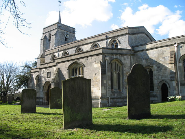
The village dates back to medieval times and is steeped in history. Its most notable landmark is St. Mary's Church, a beautiful 13th-century building that stands proudly at its center. The church features stunning architectural details, including a tower that offers panoramic views of the surrounding countryside.

Eaton Bray is surrounded by rolling hills, providing residents and visitors with ample opportunities for outdoor activities. The nearby Ivinghoe Beacon, part of the National Trust's Ashridge Estate, offers breathtaking views and scenic walks. The village also benefits from its close proximity to the Whipsnade Zoo, one of the UK's largest zoos.

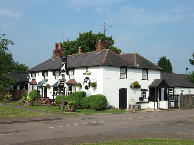
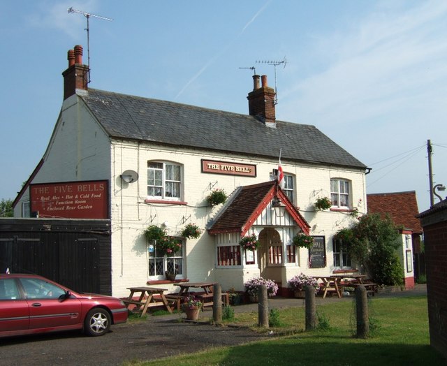
Amenities in Eaton Bray include a village store, a post office, a pub, and a primary school, which serves the local community. The village hosts various events throughout the year, including a summer fete and a Christmas market, fostering a strong sense of community spirit.

Transport links in Eaton Bray are convenient, with the A5 road passing nearby and providing easy access to neighboring towns and cities. The nearby towns of Dunstable and Leighton Buzzard offer additional amenities and transport options.

Overall, Eaton Bray is a delightful village that combines a rich history, stunning natural surroundings, and a strong sense of community, making it an attractive place to live or visit.

If you have any feedback on the listing, please let us know in the comments section below.
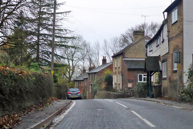
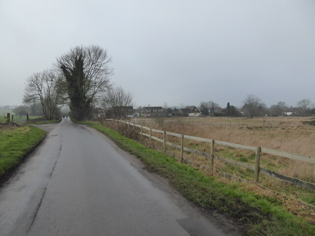
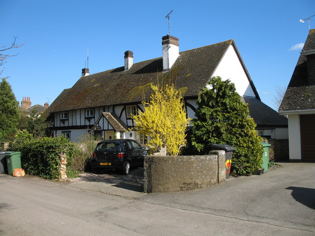
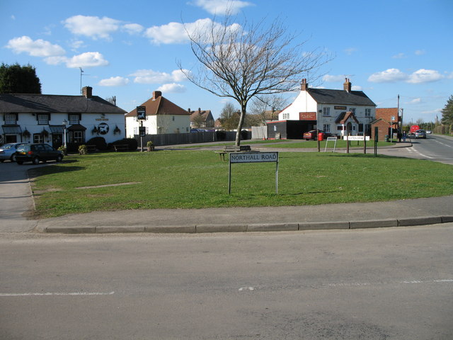
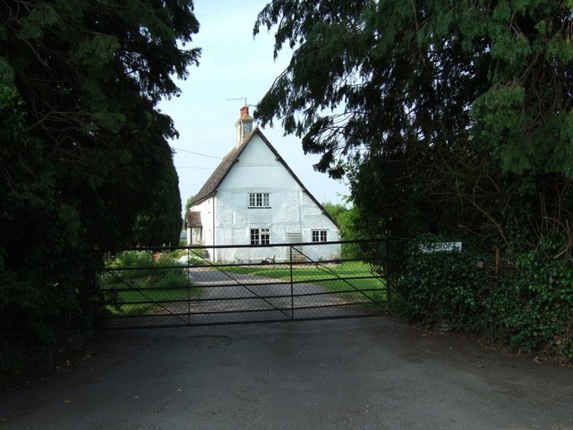
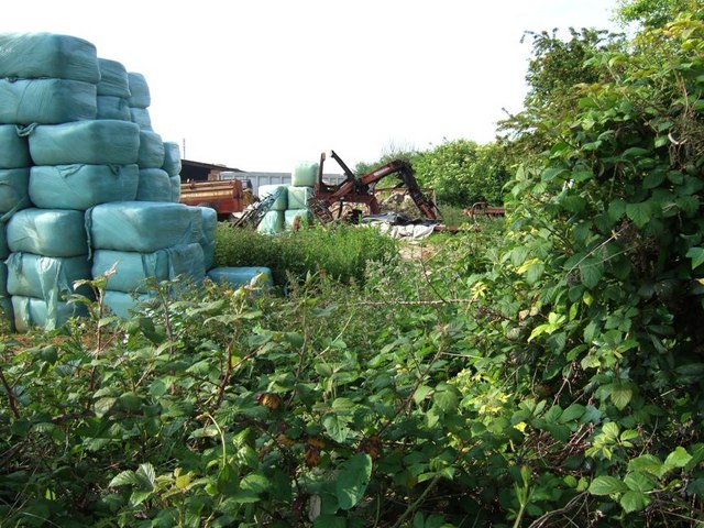
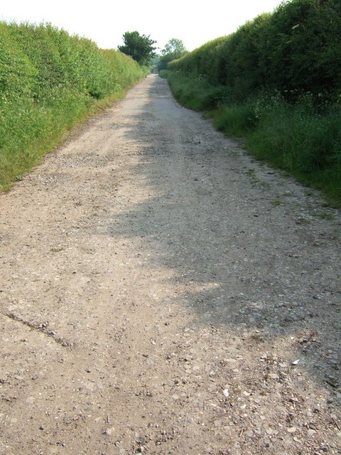
Eaton Bray Images

Images are sourced within 2km of 51.878567/-0.585718 or Grid Reference SP9720. Thanks to Geograph Open Source API. All images are credited.

B440 Leighton Road Towards Leighton Buzzard, leaving Church End, Edlesborough.
B440 Leighton Road
Towards Leighton Buzzard, leaving Church End, Edlesborough.
B440 Leighton Road, Church End, Edlesborough Towards Leighton Buzzard.
B440 Leighton Road, Church End, Edlesborough
Towards Leighton Buzzard.
Ford on the lane With  a raised walkway on the right.
Ford on the lane
With a raised walkway on the right.
Water channel beside the road With interesting wooden hurdles fitted in the stream bed to, reduce erosion or flow, I assume.
Water channel beside the road
With interesting wooden hurdles fitted in the stream bed to, reduce erosion or flow, I assume.
Lane approaching the village The rough grazing here looks like it will be developed for housing.
Lane approaching the village
The rough grazing here looks like it will be developed for housing.
Dormer bungalows on Townside Dormer bungalows are not really bungalows, as they have two storeys, but they are a nice amalgam. These date from the 1960s I think. Extremely well kept. As you would expect.
Dormer bungalows on Townside
Dormer bungalows are not really bungalows, as they have two storeys, but they are a nice amalgam. These date from the 1960s I think. Extremely well kept. As you would expect.
Beacon View Nice executive homes.
Beacon View
Nice executive homes.
Northall Village Hall A great local amenity. Nicely maintained too.
Northall Village Hall
A great local amenity. Nicely maintained too.
Parish Paths Partnership PPP is a measure to ensure paths stay used and open, through promoting their benefits. Surely a valuable lesson against the backdrop of a national virus pandemic, lockdowns, furlough schemes, lifestyle re-evaluations, mental health benefits of outdoor exercise, community spirit and social cohesion etc.
Parish Paths Partnership
PPP is a measure to ensure paths stay used and open, through promoting their benefits. Surely a valuable lesson against the backdrop of a national virus pandemic, lockdowns, furlough schemes, lifestyle re-evaluations, mental health benefits of outdoor exercise, community spirit and social cohesion etc.
The Swan public house Another nice pub.
The Swan public house
Another nice pub.
September Cottage and No.2 Charming semi-detached cottages on the south side of Church Lane, Eaton Bray.
September Cottage and No.2
Charming semi-detached cottages on the south side of Church Lane, Eaton Bray.
St Mary the Virgin - Eaton Bray The church dates to the 13th Century and is built from stone quarried in the nearby village of Totternhoe.   There is further information and a virtual tour at <span class="nowrap"><a title="http://www.stmaryseatonbray.org.uk/About-Our-Church/" rel="nofollow ugc noopener" href="http://www.stmaryseatonbray.org.uk/About-Our-Church/">Link</a><img style="margin-left:2px;" alt="External link" title="External link - shift click to open in new window" src="https://s1.geograph.org.uk/img/external.png" width="10" height="10"/></span>
St Mary the Virgin - Eaton Bray
The church dates to the 13th Century and is built from stone quarried in the nearby village of Totternhoe. There is further information and a virtual tour at LinkExternal link
Village Green - Eaton Bray The green is divided by a road and served by two pubs - The Five Bells on the Right and The White Horse on the left.
Village Green - Eaton Bray
The green is divided by a road and served by two pubs - The Five Bells on the Right and The White Horse on the left.
"Barncroft", Eaton Bray This is one of several houses and cottages along a lane called "The Rye" leading westwards out of Eaton Bray. It looks quite old, and seems to have had its timbers painted over rather than the usual black & white appearance of such half-timbered buildings.
"Barncroft", Eaton Bray
This is one of several houses and cottages along a lane called "The Rye" leading westwards out of Eaton Bray. It looks quite old, and seems to have had its timbers painted over rather than the usual black & white appearance of such half-timbered buildings.
The White Horse, Eaton Bray One of two pubs virtually next to each other in the middle of Eaton Bray. The other pub is <a href="https://www.geograph.org.uk/photo/183109">SP9620 : The Five Bells, Eaton Bray</a>
The White Horse, Eaton Bray
One of two pubs virtually next to each other in the middle of Eaton Bray. The other pub is SP9620 : The Five Bells, Eaton Bray
The Five Bells, Eaton Bray This pub advertises itself as a Thai restaurant. It is adjacent to <a href="https://www.geograph.org.uk/photo/183107">SP9620 : The White Horse, Eaton Bray</a>
The Five Bells, Eaton Bray
This pub advertises itself as a Thai restaurant. It is adjacent to SP9620 : The White Horse, Eaton Bray
Great Green Farm, Eaton Bray A rather messy looking farmyard on The Rye, Eaton Bray.
Great Green Farm, Eaton Bray
A rather messy looking farmyard on The Rye, Eaton Bray.
Track near New Cloud Farm This track leads to a spinney. It had a closed gate across the entrance and does not seem to be any kind of right-of-way. The spinney to which it leads can be seen in the distance in <a href="https://www.geograph.org.uk/photo/193404">SP9622 : Oats !</a>
Track near New Cloud Farm
This track leads to a spinney. It had a closed gate across the entrance and does not seem to be any kind of right-of-way. The spinney to which it leads can be seen in the distance in SP9622 : Oats !
Show me another place!

Eaton Bray is located at Grid Ref: SP9720 (Lat: 51.878567, Lng: -0.585718)

Unitary Authority: Central Bedfordshire

Police Authority: Bedfordshire

What 3 Words

///tickles.boomed.giraffes. Near Eaton Bray, Bedfordshire

Nearby Locations

Eaton Bray Moor End

Related Wikis

Eaton Bray Rural District

Eaton Bray was a rural district in Bedfordshire, England from 1894 to 1933. == History == The district had its origins in the Leighton Buzzard Rural Sanitary...

Church of St Mary, Eaton Bray

Church of St Mary is a Grade I listed church in Eaton Bray, Bedfordshire, England. It became a listed building on 3 February 1967. The arcades of the nave...

Eaton Bray

Eaton Bray is a village and civil parish in Bedfordshire, England. It is situated about three miles south-west of the town of Dunstable and is part of...

The Cross Keys, Totternhoe

The Cross Keys is a Grade II listed pub in Totternhoe, Bedfordshire, England It is a 17th-century thatched building and the first floor is timber-framed...

Nearby Amenities

Located within 500m of 51.878567,-0.585718
Turning Circle
Turning Circle: hammer
Lat/Long: 51.8809748/-0.5912319
Turning Circle
Turning Circle: square
Lat/Long: 51.8791648/-0.5918229
Turning Circle
Turning Circle: square
Lat/Long: 51.8756205/-0.5896332
Turning Circle
Turning Circle: knuckle
Lat/Long: 51.8777997/-0.5915357
Turning Circle
Turning Circle: square
Lat/Long: 51.8780413/-0.5877134
Post Box
Collection Times: Mo-Fr 17:15; Sa 11:30
Operator: Royal Mail
Ref: LU6 63
Source: survey
Lat/Long: 51.875313/-0.586822
Eaton Bray Stores
Addr City: Eaton Bray
Addr Country: GB
Addr Housenumber: 96
Addr Postcode: LU6 2DP
Addr Street: High Street
Fhrs Authority: Central Bedfordshire
Fhrs Id: 450698
Fhrs Local Authority Id: 67470
Shop: convenience
Source: Bing
Lat/Long: 51.8752277/-0.5869658
Fast Food
Happy Valley
Addr City: Eaton Bray
Addr Country: GB
Addr Housenumber: 64
Addr Postcode: LU6 2DP
Addr Street: High Street
Cuisine: chinese
Fhrs Authority: Central Bedfordshire
Fhrs Id: 892185
Fhrs Local Authority Id: 159552
Source: Bing
Takeaway: yes
Lat/Long: 51.8759469/-0.5891684
High Street Hair
Shop: hairdresser
Lat/Long: 51.8759171/-0.5890629
Giblins
Office: estate_agent
Lat/Long: 51.8765632/-0.5896047
Place Of Worship
The Salvation Army
Addr City: Dunstable
Addr Country: GB
Addr Postcode: LU6 2DR
Addr Street: Booth Place
Addr Village: Eaton Bray
Denomination: salvation_army
Email: eaton.bray@salvationarmy.org.uk
Phone: 01525 222087
Religion: christian
Website: https://www.salvationarmy.org.uk/eaton-bray
Lat/Long: 51.8759638/-0.5900047
Hines Family Butcher
Addr City: Eaton Bray
Addr Country: GB
Addr Housenumber: 98
Addr Postcode: LU6 2DP
Addr Street: High Street
Fhrs Authority: Central Bedfordshire
Fhrs Id: 1136171
Fhrs Local Authority Id: 170459
Shop: butcher
Lat/Long: 51.8751807/-0.5867102
Crossing
Lat/Long: 51.8798592/-0.5866866
Defibrillator
Emergency: defibrillator
Lat/Long: 51.8767998/-0.5914936
Direction: 165
Generator Method: photovoltaic
Generator Output Electricity: yes
Generator Solar Modules: 12
Generator Source: solar
Generator Type: solar_photovoltaic_panel
Location: roof
Power: generator
Lat/Long: 51.8784416/-0.5923551
Direction: 180
Generator Method: photovoltaic
Generator Output Electricity: yes
Generator Solar Modules: 18
Generator Source: solar
Generator Type: solar_photovoltaic_panel
Location: roof
Power: generator
Lat/Long: 51.8768164/-0.5867869
Direction: 205
Generator Method: photovoltaic
Generator Output Electricity: yes
Generator Solar Modules: 8
Generator Source: solar
Generator Type: solar_photovoltaic_panel
Location: roof
Note: undersize panels?
Power: generator
Lat/Long: 51.8776767/-0.5899475
Direction: 185
Generator Method: photovoltaic
Generator Output Electricity: yes
Generator Solar Modules: 21
Generator Source: solar
Generator Type: solar_photovoltaic_panel
Location: roof
Power: generator
Lat/Long: 51.8804136/-0.5916309
Direction: 210
Generator Method: photovoltaic
Generator Output Electricity: yes
Generator Solar Modules: 16
Generator Source: solar
Generator Type: solar_photovoltaic_panel
Location: roof
Power: generator
Lat/Long: 51.8775238/-0.5894923
Direction: 205
Generator Method: photovoltaic
Generator Output Electricity: yes
Generator Solar Modules: 16
Generator Source: solar
Generator Type: solar_photovoltaic_panel
Location: roof
Power: generator
Lat/Long: 51.8777176/-0.590123
Direction: 155
Generator Method: photovoltaic
Generator Output Electricity: yes
Generator Solar Modules: 16
Generator Source: solar
Generator Type: solar_photovoltaic_panel
Location: roof
Power: generator
Lat/Long: 51.8776514/-0.5905342
Parking
Lat/Long: 51.8758795/-0.5900938
Turning Circle
Turning Circle: knuckle
Lat/Long: 51.8762822/-0.5882656
Turning Circle
Turning Circle: knuckle
Lat/Long: 51.8761325/-0.5864879
Direction: 0
Generator Method: photovoltaic
Generator Output Electricity: yes
Generator Solar Modules: 6
Generator Source: solar
Generator Type: solar_photovoltaic_panel
Location: roof
Power: generator
Lat/Long: 51.8775641/-0.5868869
Direction: 270
Generator Method: photovoltaic
Generator Output Electricity: yes
Generator Solar Modules: 10
Generator Source: solar
Generator Type: solar_photovoltaic_panel
Location: roof
Power: generator
Lat/Long: 51.8775394/-0.5869604
Parking
Lat/Long: 51.877436/-0.5859772
The data included in this document is from www.openstreetmap.org. The data is made available under ODbL.

Have you been to Eaton Bray?

Leave your review of Eaton Bray below (or comments, questions and feedback).