Eaton

Settlement in Norfolk Norwich

England

Eaton

Goodwood Steps, UEA campus Anthony Caro sculpture which sits well with the stepped nature of the campus buildings behind.
Goodwood Steps, UEA campus Credit: Hugh Venables

Eaton is a small village located in the county of Norfolk, England. Situated approximately 6 miles southwest of the city of Norwich, it falls within the administrative district of South Norfolk. The village is nestled in a picturesque countryside setting, surrounded by fields and farmland.

Eaton is known for its charming and traditional English village atmosphere. It features a mix of old and new architecture, with some buildings dating back to the 16th century. The village is centered around a beautiful village green, which serves as a gathering place for local events and activities.

A prominent landmark in Eaton is the All Saints Church, a historic parish church that dates back to the 12th century. The church is an architectural gem, displaying a mix of Norman and Gothic styles. It is a popular destination for those interested in history and religious heritage.

Despite its small size, Eaton offers a range of amenities and facilities to its residents. These include a village hall, a primary school, a pub, and a few local businesses. The village is well-connected to nearby towns and cities, with good transportation links and access to major roads.

The surrounding area provides ample opportunities for outdoor activities and exploration. The nearby Eaton Park offers beautiful green spaces, a boating lake, and sports facilities, making it a popular spot for leisure and recreation.

Overall, Eaton exudes a peaceful and idyllic charm, making it an attractive place to live for those seeking a quiet countryside retreat, while still having easy access to urban amenities.

If you have any feedback on the listing, please let us know in the comments section below.
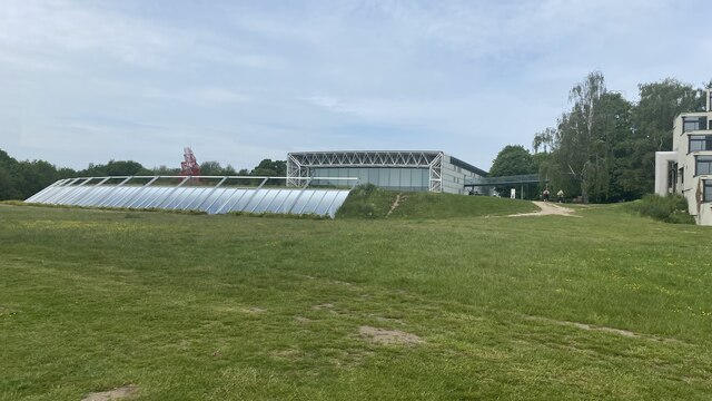
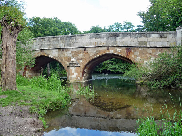
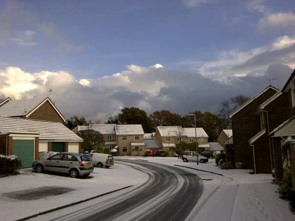
Eaton Images

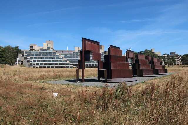
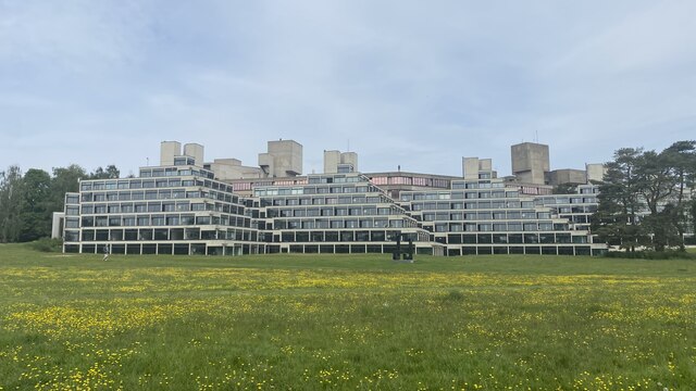
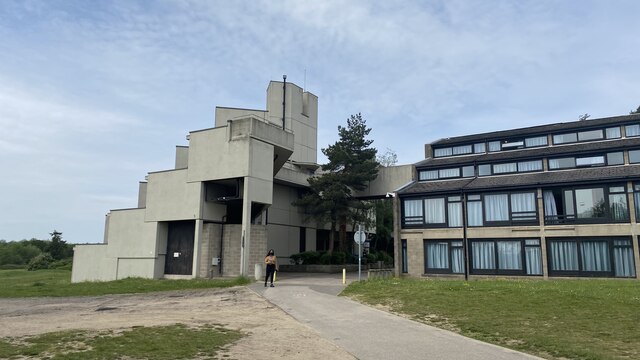
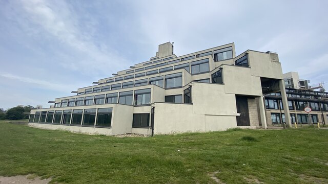
Images are sourced within 2km of 52.613341/1.262101 or Grid Reference TG2006. Thanks to Geograph Open Source API. All images are credited.

Goodwood Steps, UEA campus Anthony Caro sculpture which sits well with the stepped nature of the campus buildings behind.
Goodwood Steps, UEA campus
Anthony Caro sculpture which sits well with the stepped nature of the campus buildings behind.
Suffolk Terrace (ziggurats), University of East Anglia
Sainsbury Centre, University of East Anglia
Footbridge leading into the Sainsbury Centre, University of East Anglia The Sainsbury Centre at the University of East Anglia is a renowned art gallery, housed in a pioneering example by Norman Foster of high-tech architecture.
Footbridge leading into the Sainsbury Centre, University of East Anglia
The Sainsbury Centre at the University of East Anglia is a renowned art gallery, housed in a pioneering example by Norman Foster of high-tech architecture.
Bridge, Cringleford Built in 1520, replacing a bridge washed away in 1519, and widened in 1780. The facings are in limestone, "a rarity in Norfolk other than for churches and bridges". Grade II* listed.
It carries Eaton Street over the River Yare.
Bridge, Cringleford
Built in 1520, replacing a bridge washed away in 1519, and widened in 1780. The facings are in limestone, "a rarity in Norfolk other than for churches and bridges". Grade II* listed. It carries Eaton Street over the River Yare.
UEA: Lasdun's Ziggurats The University of East Anglia's architecturally remarkable grade II-listed Ziggurats,  Norfolk and Suffolk Terrace, were designed by Denys Lasdun (1964-8).  Internally updated, they provide on campus student accommodation.  

Grade II listed: <span class="nowrap"><a title="https://historicengland.org.uk/listing/the-list/list-entry/1390647" rel="nofollow ugc noopener" href="https://historicengland.org.uk/listing/the-list/list-entry/1390647">Link</a><img style="margin-left:2px;" alt="External link" title="External link - shift click to open in new window" src="https://s1.geograph.org.uk/img/external.png" width="10" height="10"/></span>

The University of East Anglia was founded in 1960, and Lasdun was commissioned as consultant architect in April 1962. The site is on 165 acres of parkland on the edge of Norwich.
UEA: Lasdun's Ziggurats
The University of East Anglia's architecturally remarkable grade II-listed Ziggurats, Norfolk and Suffolk Terrace, were designed by Denys Lasdun (1964-8). Internally updated, they provide on campus student accommodation. Grade II listed: LinkExternal link The University of East Anglia was founded in 1960, and Lasdun was commissioned as consultant architect in April 1962. The site is on 165 acres of parkland on the edge of Norwich.
Play space, Dragonfly Lane, Cringleford
Cringleford Primary School, Dragonfly Lane, Cringleford
Play space, Dragonfly Lane, Cringleford
Unthank Road, Norwich A close-up of the post box can be seen in <a href="https://www.geograph.org.uk/photo/7000311">TG2208 : Post box, Clarendon Road, Norwich</a>.
Unthank Road, Norwich
A close-up of the post box can be seen in TG2208 : Post box, Clarendon Road, Norwich.
Grosvenor Road, Norwich
Post box, Unthank Road, Norwich This post baxk can be seen in context in <a href="https://www.geograph.org.uk/photo/7000343">TG2108 : Unthank Road, Norwich</a>.
Post box, Unthank Road, Norwich
This post baxk can be seen in context in TG2108 : Unthank Road, Norwich.
Unthank Road, Norwich A close-up of the post box can be seen in <a href="https://www.geograph.org.uk/photo/7000342">TG2108 : Post box, Unthank Road, Norwich</a>.
Unthank Road, Norwich
A close-up of the post box can be seen in TG2108 : Post box, Unthank Road, Norwich.
The Amnesty Bookshop, Unthank Road, Norwich Dover street and Onley Street join Unthank Road at this point.
The Amnesty Bookshop, Unthank Road, Norwich
Dover street and Onley Street join Unthank Road at this point.
The junction of Unthank Road and Bury Street, Norwich A close-up of the post box can be seen in <a href="https://www.geograph.org.uk/photo/7000347">TG2107 : Post box, Unthank Road, Norwich</a>.
The junction of Unthank Road and Bury Street, Norwich
A close-up of the post box can be seen in TG2107 : Post box, Unthank Road, Norwich.
Post box, Unthank Road, Norwich This post box can be seen in context in <a href="https://www.geograph.org.uk/photo/7000346">TG2107 : The junction of Unthank Road and Bury Street, Norwich</a>.
Post box, Unthank Road, Norwich
This post box can be seen in context in TG2107 : The junction of Unthank Road and Bury Street, Norwich.
Show me another place!

Eaton is located at Grid Ref: TG2006 (Lat: 52.613341, Lng: 1.262101)

Administrative County: Norfolk

District: Norwich

Police Authority: Norfolk

What 3 Words

///flags.manliness.glory. Near Cringleford, Norfolk

Nearby Locations

Eaton

Related Wikis

Eaton, Norfolk

Eaton is a suburb of the city of Norwich, in the Norwich district, in the county town of Norfolk, England. Anciently the superiority of manor of Eaton...

Eaton Chalk Pit

Eaton Chalk Pit is a 0.16-hectare (0.40-acre) biological Site of Special Scientific Interest on the southern outskirts of Norwich in Norfolk. These former...

Eaton Park Miniature Railway

The Eaton Park Miniature Railway (EPMR) is situated in Eaton Park, in Norwich, Norfolk. Construction began in 1957 and the 365-foot (111 m) loop of elevated...
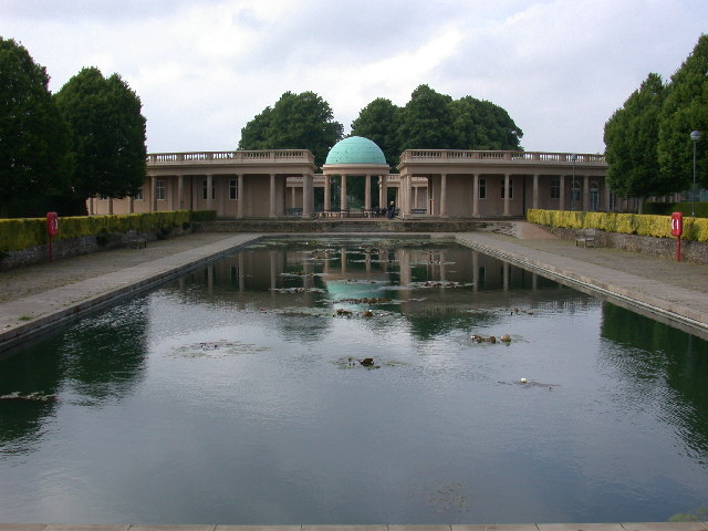
Eaton Park

Eaton Park is a large public park located in Eaton, Norwich, England. It is 80 acres in area. == History == The park was laid out in 1923 as part of a...

Nearby Amenities

Located within 500m of 52.613341,1.262101
Post Box
Collection Times: Mo-Fr 09:00; Sa 07:00
Operator: Royal Mail
Post Box Type: pillar
Ref: NR4 401D
Royal Cypher: EIIR
Royal Cypher Wikidata: Q33102113
Lat/Long: 52.6091006/1.2606691
Eaton
Place: suburb
Wikidata: Q5331326
Lat/Long: 52.6131518/1.2626649
Post Box
Collection Times: Mo-Fr 16:45; Sa 11:30
Operator: Royal Mail
Post Box Type: pillar
Ref: NR4 413
Royal Cypher: GR
Royal Cypher Wikidata: Q33102273
Lat/Long: 52.6128974/1.2690596
Post Box
Collection Times: Mo-Fr 09:00; Sa 07:00
Operator: Royal Mail
Operator Wikidata: Q638098
Post Box Type: pillar
Ref: NR4 433D
Royal Cypher: VR
Royal Cypher Wikidata: Q33102356
Lat/Long: 52.6159926/1.2613262
Post Box
Check Date Collection Times: 2023-02-17
Collection Times: Mo-Fr 09:00; Sa 07:00
Operator: Royal Mail
Post Box Type: pillar
Ref: NR4 414D
Royal Cypher: EIIR
Royal Cypher Wikidata: Q33102113
Lat/Long: 52.6134237/1.2638985
Post Box
Collection Times: Mo-Fr 09:00; Sa 07:00
Operator: Royal Mail
Post Box Type: lamp
Ref: NR4 432D
Royal Cypher: EIIR
Royal Cypher Wikidata: Q33102113
Lat/Long: 52.6156975/1.2649653
Second World War Memorial
Historic: memorial
Lat/Long: 52.6112092/1.2569443
Building: yes
Note: Water pumping station
Operator: Morgan Marine Ltd
Ref: P3717
Lat/Long: 52.6114995/1.2577563
Building: yes
Note: Gas installation
Operator: Transco
Ref: Site 4220
Lat/Long: 52.6138119/1.2654009
Waste Basket
Check Date: 2021-11-19
Colour: green
Material: plastic
Lat/Long: 52.6118252/1.2636636
Man Made: serving_area_interface
Operator: BT
Lat/Long: 52.613305/1.255695
Man Made: serving_area_interface
Operator: BT
Lat/Long: 52.6160526/1.2613788
Man Made: service_area_interface
Operator: BT
Lat/Long: 52.6134087/1.2639931
Bus Stop
Norwich / Newmarket Road / Branksome Road
Bench: no
Bin: no
Lit: no
Naptan AtcoCode: 2900N12356
Naptan Bearing: SW
Naptan CommonName: Branksome Road
Naptan Indicator: adj
Naptan Landmark: Branksome Road
Naptan Latitude: 52.614443
Naptan Locality: Norwich
Naptan Longitude: 1.2673172
Naptan NaptanCode: nfodjpaj
Naptan PlusbusZoneRef: NRCH
Naptan Street: Newmarket Road
Operator: First Eastern Counties;Anglian Coaches Ltd.;Konectbus;H. Semmence & Co;Norfolk Green
Shelter: yes
Source: naptan_import;survey
Tactile Paving: no
Lat/Long: 52.6143842/1.2671155
Bus Stop
Norwich / Newmarket Road / Branksome Road
Bench: yes
Bin: yes
Check Date Shelter: 2021-06-06
Naptan AtcoCode: 2900N12357
Naptan Bearing: NE
Naptan CommonName: Branksome Road
Naptan Indicator: opp
Naptan Landmark: Branksome Road
Naptan Latitude: 52.6143312
Naptan Locality: Norwich
Naptan Longitude: 1.2664814
Naptan NaptanCode: nfodjpam
Naptan PlusbusZoneRef: NRCH
Naptan Street: Newmarket Road
Operator: First Eastern Counties;Anglian Coaches Ltd.;Konectbus;H. Semmence & Co;Norfolk Green
Shelter: yes
Source: naptan_import;survey
Tactile Paving: no
Lat/Long: 52.6141007/1.265886
Bus Stop
Norwich / Newmarket Road / Judges Walk
Bench: yes
Bin: no
Check Date Shelter: 2021-06-06
Lit: no
Naptan AtcoCode: 2900N12358
Naptan Bearing: SW
Naptan CommonName: Judges Walk
Naptan Indicator: opp
Naptan Landmark: Judges Walk
Naptan Locality: Norwich
Naptan NaptanCode: nfodjpap
Naptan PlusbusZoneRef: NRCH
Naptan Street: Newmarket Road
Operator: First Eastern Counties;Anglian Coaches Ltd.;Konectbus;H. Semmence & Co;Norfolk Green
Shelter: no
Source: naptan_import;survey
Tactile Paving: no
Lat/Long: 52.6133207/1.2635562
Bus Stop
Newmarket Rd / Judges Walk
Bench: no
Bin: no
Check Date Shelter: 2021-06-06
Lit: yes
Naptan AtcoCode: 2900N12359
Naptan Bearing: NE
Naptan CommonName: Judges Walk
Naptan Indicator: adj
Naptan Landmark: Judges Walk
Naptan Latitude: 52.6131641
Naptan Locality: Norwich
Naptan Longitude: 1.2624938
Naptan NaptanCode: nfodjpat
Naptan PlusbusZoneRef: NRCH
Naptan Street: Newmarket Road
Operator: First Eastern Counties;Anglian Coaches Ltd.;Konectbus;H. Semmence & Co;Norfolk Green
Shelter: no
Source: naptan_import;survey
Tactile Paving: yes
Lat/Long: 52.6128512/1.2615505
Bus Stop
Norwich / Newmarket Road / Elveden Close
Bench: no
Bin: no
Check Date Shelter: 2021-06-06
Naptan AtcoCode: 2900N12360
Naptan Bearing: SW
Naptan CommonName: Elveden Close
Naptan Indicator: adj
Naptan Locality: Norwich
Naptan NaptanCode: nfodjpda
Naptan PlusbusZoneRef: NRCH
Naptan Street: Newmarket Road
Operator: First Eastern Counties;Anglian Coaches Ltd.;Konectbus;H.Semmence & Co. Ltd.;Norfolk Green
Shelter: no
Source: naptan_import;survey
Tactile Paving: yes
Lat/Long: 52.611228/1.256443
Bus Stop
Elveden Close, opp
Bench: no
Check Date Shelter: 2021-06-04
Naptan AtcoCode: 2900N12361
Naptan Bearing: NE
Naptan CommonName: Elveden Close
Naptan Indicator: opp
Naptan Locality: Norwich
Naptan NaptanCode: nfodjpdg
Naptan PlusbusZoneRef: NRCH
Naptan Street: Newmarket Road
Naptan Verified: no
Operator: First Eastern Counties;Anglian Coaches Ltd.;Konectbus;H Semmence & Co;Norfolk Green
Shelter: no
Source: naptan_import
Lat/Long: 52.6112784/1.2561776
Man Made: service_area_interface
Operator: BT
Lat/Long: 52.6128496/1.261541
Waste Basket
Check Date: 2021-06-06
Lat/Long: 52.6140914/1.2658499
Crossing
Bicycle: yes
Crossing: unmarked
Lat/Long: 52.611088/1.2563191
Crossing
Bicycle: yes
Check Date Tactile Paving: 2020-11-20
Crossing: unmarked
Crossing Island: no
Tactile Paving: no
Lat/Long: 52.613651/1.264785
Crossing
Bicycle: no
Button Operated: yes
Crossing: traffic_signals
Crossing Island: yes
Crossing Ref: puffin
Island: yes
Tactile Paving: yes
Lat/Long: 52.6138368/1.2651762
Crossing
Bicycle: yes
Crossing: marked
Crossing Island: no
Tactile Paving: no
Lat/Long: 52.6146588/1.2680679
Crossing
Bicycle: yes
Crossing: unmarked
Crossing Island: no
Tactile Paving: no
Lat/Long: 52.614265/1.2667705
Priority: equal
Lat/Long: 52.60948/1.2646424
Barrier: bollard
Lat/Long: 52.611712/1.2639581
Barrier: bollard
Bollard: fixed
Material: wood
Lat/Long: 52.6090826/1.2602211
Barrier: cycle_barrier
Bicycle: dismount
Lat/Long: 52.6093668/1.2601303
Barrier: bollard
Lat/Long: 52.6105584/1.2630804
Barrier: bollard
Lat/Long: 52.6118352/1.2637166
Bench
Backrest: yes
Check Date: 2021-06-06
Colour: gray
Inscription: Presented by / EATON VILLAGE / Residents’ Association / November 2013
Material: plastic
Lat/Long: 52.6112454/1.2570276
Grit Bin
Lat/Long: 52.6095113/1.263298
Grit Bin
Lat/Long: 52.6109524/1.2580189
Barrier: cycle_barrier
Bicycle: yes
Lat/Long: 52.6098366/1.2615578
Barrier: cycle_barrier
Bicycle: yes
Lat/Long: 52.6104272/1.2621763
Barrier: bollard
Lat/Long: 52.616315/1.2603799
Milestone
Distance Norwich: 2 mi
Distance Thetford: 27 mi
Material: stone
Lat/Long: 52.6126193/1.2612981
Give Way
Lat/Long: 52.614638/1.2680976
Give Way
Lat/Long: 52.6142386/1.2667955
Barrier: fence
Lat/Long: 52.6126234/1.2568107
Crossing
Crossing: unmarked
Lat/Long: 52.6121315/1.2551303
Crossing
Crossing: unmarked
Lat/Long: 52.6130686/1.2555043
Crossing
Crossing: unmarked
Lat/Long: 52.6142622/1.2576828
Crossing
Crossing: unmarked
Lat/Long: 52.614499/1.2586325
Crossing
Crossing: unmarked
Lat/Long: 52.6148185/1.2594619
Crossing
Crossing: unmarked
Lat/Long: 52.6161777/1.2615368
Give Way
Lat/Long: 52.6159103/1.2613826
Crossing
Crossing: unmarked
Lat/Long: 52.6163926/1.2618897
Crossing
Crossing: unmarked
Lat/Long: 52.6167727/1.2627138
Crossing
Crossing: unmarked
Lat/Long: 52.6172854/1.2635084
Generator Method: photovoltaic
Generator Output Electricity: yes
Generator Source: solar
Generator Type: solar_photovoltaic_panel
Location: roof
Power: generator
Lat/Long: 52.6132097/1.2646508
Generator Method: photovoltaic
Generator Output Electricity: yes
Generator Source: solar
Generator Type: solar_photovoltaic_panel
Location: roof
Power: generator
Lat/Long: 52.6138937/1.2641358
Generator Method: photovoltaic
Generator Output Electricity: yes
Generator Source: solar
Generator Type: solar_photovoltaic_panel
Location: roof
Power: generator
Lat/Long: 52.6126852/1.2666222
Generator Method: photovoltaic
Generator Output Electricity: yes
Generator Source: solar
Generator Type: solar_photovoltaic_panel
Location: roof
Power: generator
Lat/Long: 52.6124751/1.2662816
Generator Method: photovoltaic
Generator Output Electricity: yes
Generator Source: solar
Generator Type: solar_photovoltaic_panel
Location: roof
Power: generator
Lat/Long: 52.6123758/1.2664345
Generator Method: photovoltaic
Generator Output Electricity: yes
Generator Source: solar
Generator Type: solar_photovoltaic_panel
Location: roof
Power: generator
Lat/Long: 52.6121152/1.2674698
Generator Method: photovoltaic
Generator Output Electricity: yes
Generator Source: solar
Generator Type: solar_photovoltaic_panel
Location: roof
Power: generator
Lat/Long: 52.610967/1.2655869
Generator Method: photovoltaic
Generator Output Electricity: yes
Generator Source: solar
Generator Type: solar_photovoltaic_panel
Location: roof
Power: generator
Lat/Long: 52.6119735/1.2653697
Generator Method: photovoltaic
Generator Output Electricity: yes
Generator Source: solar
Generator Type: solar_photovoltaic_panel
Location: roof
Power: generator
Lat/Long: 52.6118611/1.2655413
Generator Method: photovoltaic
Generator Output Electricity: yes
Generator Source: solar
Generator Type: solar_photovoltaic_panel
Location: roof
Power: generator
Lat/Long: 52.6121201/1.2647957
Generator Method: photovoltaic
Generator Output Electricity: yes
Generator Source: solar
Generator Type: solar_photovoltaic_panel
Location: roof
Power: generator
Lat/Long: 52.6120452/1.2646267
Generator Method: photovoltaic
Generator Output Electricity: yes
Generator Source: solar
Generator Type: solar_photovoltaic_panel
Location: roof
Power: generator
Lat/Long: 52.6120175/1.264388
Generator Method: photovoltaic
Generator Output Electricity: yes
Generator Source: solar
Generator Type: solar_photovoltaic_panel
Location: roof
Power: generator
Lat/Long: 52.6122748/1.2640902
Generator Method: photovoltaic
Generator Output Electricity: yes
Generator Source: solar
Generator Type: solar_photovoltaic_panel
Location: roof
Power: generator
Lat/Long: 52.611125/1.2627438
Generator Method: photovoltaic
Generator Output Electricity: yes
Generator Source: solar
Generator Type: solar_photovoltaic_panel
Location: roof
Power: generator
Lat/Long: 52.6093627/1.2635592
Traffic Signals
Crossing: no
Traffic Signals Direction: forward
Lat/Long: 52.6138146/1.265097
Traffic Signals
Crossing: no
Traffic Signals Direction: backward
Lat/Long: 52.6138536/1.2652336
Waste Basket
Colour: green
Material: plastic
Lat/Long: 52.6159935/1.2614538
Waste Basket
Colour: green
Material: plastic
Lat/Long: 52.613909/1.2650742
Waste Basket
Colour: green
Material: plastic
Lat/Long: 52.6160548/1.2613387
Give Way
Lat/Long: 52.6092755/1.2614012
Give Way
Lat/Long: 52.6090609/1.2630335
Give Way
Lat/Long: 52.6111281/1.2681637
Communication Mobile Phone: yes
Layer: 1
Man Made: mast
Material: metal
Operator: O2-UK;Vodafone UK
Tower Construction: freestanding
Tower Type: communication
Lat/Long: 52.6165498/1.2613437
The data included in this document is from www.openstreetmap.org. The data is made available under ODbL.

Have you been to Eaton?

Leave your review of Eaton below (or comments, questions and feedback).