Dunston Pillar Wood
Wood, Forest in Lincolnshire North Kesteven
England
Dunston Pillar Wood

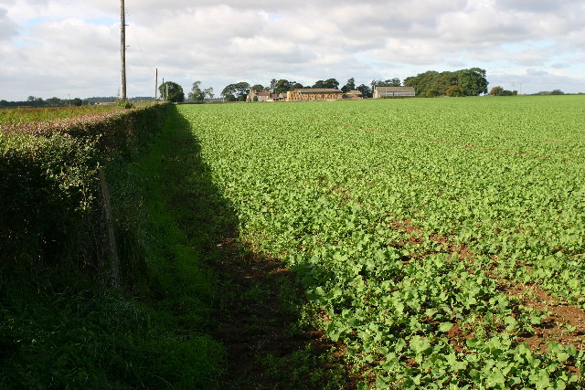
Dunston Pillar Wood is a picturesque woodland located in the county of Lincolnshire, England. Situated just outside the village of Dunston, this woodland area covers an expansive stretch of approximately 100 acres. The wood is part of the larger Dunston Pillar and Woodland Site of Special Scientific Interest (SSSI), highlighting its ecological significance.
The woodland itself is characterized by a diverse range of tree species, including oak, beech, ash, and birch. These trees create a dense canopy, providing shelter and habitat for a variety of wildlife. Visitors to the wood can expect to encounter a rich assortment of bird species, such as woodpeckers, owls, and various songbirds. Additionally, mammals like squirrels, foxes, and deer are known to inhabit the area.
Dunston Pillar Wood offers an idyllic setting for nature enthusiasts and walkers. The wood features several well-maintained footpaths that wind through its enchanting landscape, allowing visitors to explore its beauty at their own pace. Along these paths, individuals can enjoy the tranquility of the woodland, admiring the vibrant colors of the changing seasons and listening to the soothing sounds of rustling leaves and birdsong.
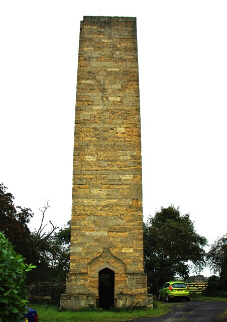
Moreover, the wood holds historical significance as it is home to Dunston Pillar, a tall monument erected in the early 19th century to commemorate the Battle of Trafalgar and Lord Nelson's victory. The pillar stands as a prominent landmark within the woodland, adding an extra layer of interest for those visiting.
Overall, Dunston Pillar Wood is a captivating natural haven, offering a diverse ecosystem, scenic trails, and a touch of history.
If you have any feedback on the listing, please let us know in the comments section below.
Dunston Pillar Wood Images
Images are sourced within 2km of 53.146715/-0.4901619 or Grid Reference TF0162. Thanks to Geograph Open Source API. All images are credited.


Dunston Pillar Wood is located at Grid Ref: TF0162 (Lat: 53.146715, Lng: -0.4901619)
Administrative County: Lincolnshire
District: North Kesteven
Police Authority: Lincolnshire
What 3 Words
///bind.burst.stint. Near Waddington, Lincolnshire
Nearby Locations
Related Wikis
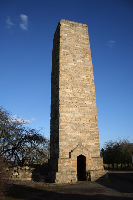
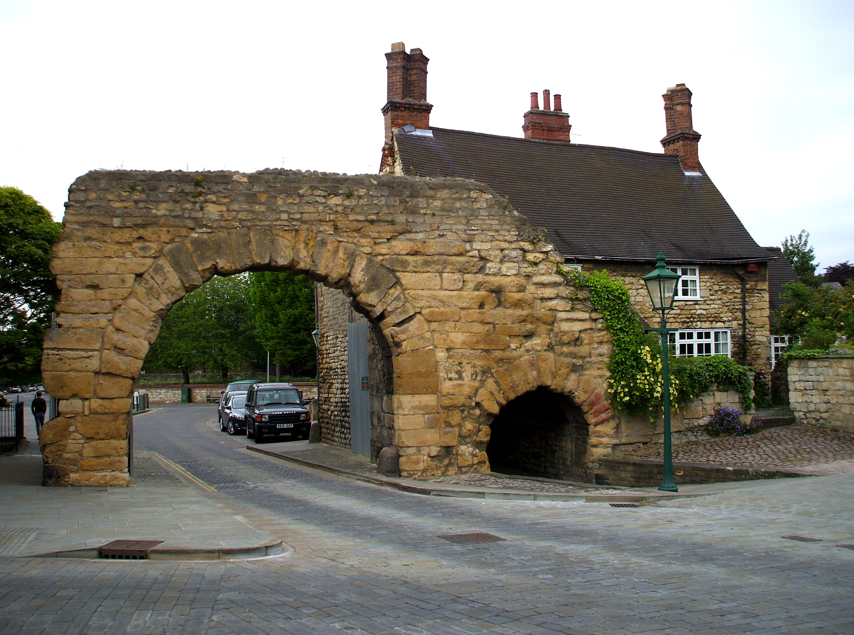
Dunston Pillar
Dunston Pillar is a Grade II listed stone tower in Lincolnshire, England and a former 'land lighthouse'. It stands beside the A15 road approximately 6...
North Kesteven
North Kesteven is a local government district in Lincolnshire, England. The council is based in Sleaford. The district also contains the town of North...
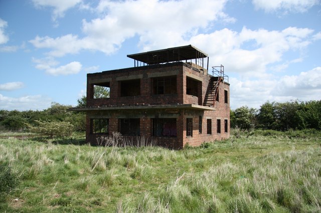
RAF Coleby Grange
Royal Air Force Coleby Grange or more simply RAF Coleby Grange was a Royal Air Force satellite station situated alongside the western edge of the A15 on...
Ermine Street
Ermine Street is a major Roman road in England that ran from London (Londinium) to Lincoln (Lindum Colonia) and York (Eboracum). The Old English name...
Nearby Amenities
Located within 500m of 53.146715,-0.4901619Have you been to Dunston Pillar Wood?
Leave your review of Dunston Pillar Wood below (or comments, questions and feedback).