Beggars Copse

Wood, Forest in Sussex Chichester

England

Beggars Copse

Foxbridge Golf Club from the air Wephurst Wood lies to the east of the course; Furze Field and Broad Field, also shown in <a href="https://www.geograph.org.uk/photo/5151386">TQ0129 : Woodland near Ifold from the air</a>, are at lower left. Ifold is the village set in woodland at the top.
Foxbridge Golf Club from the air Credit: Derek Harper

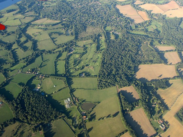
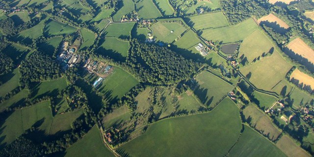
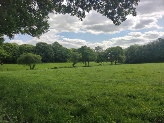
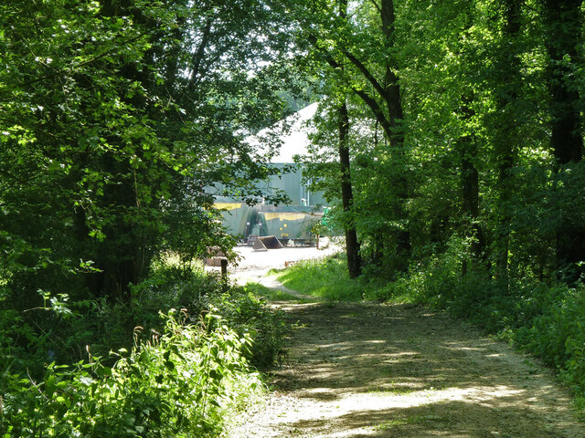
Beggars Copse is a picturesque woodland located in Sussex, England. Situated in the heart of the South Downs National Park, this serene forest covers an area of approximately 50 acres. The copse is named after the beggars who used to seek shelter in the area during the medieval times.

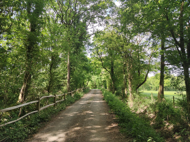
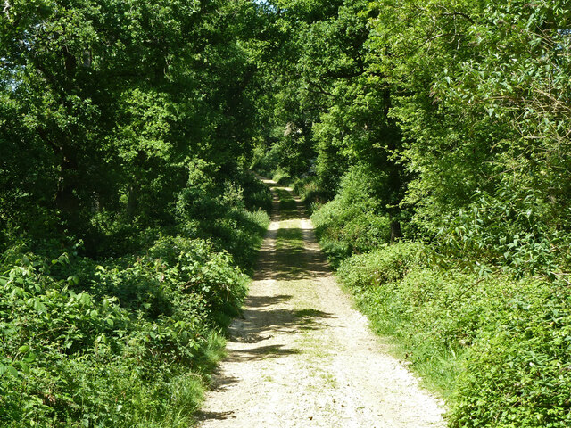
The woodland is predominantly composed of oak and beech trees, creating a rich and diverse ecosystem. The towering trees provide a dense canopy, allowing only dappled sunlight to filter through to the forest floor. This creates a unique ambiance where the air is cool and the sounds of birdsong and rustling leaves fill the air.

Beggars Copse is known for its tranquil beauty and is a popular spot for nature enthusiasts and hikers alike. The forest offers a network of well-maintained trails that wind through the trees, providing visitors with the opportunity to explore the copse at their own pace. These trails lead to various viewpoints, where one can admire the breathtaking vistas of the surrounding countryside.

The woodland is also home to a diverse range of wildlife. Squirrels can be seen scurrying among the branches, while deer quietly graze in the undergrowth. Birdwatchers can spot a variety of species, including woodpeckers, owls, and warblers.

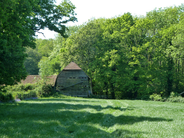
Beggars Copse is not only a haven for nature lovers but also a site of historical significance. The area is dotted with remnants of ancient settlements, including burial mounds and Iron Age hillforts. Archaeological excavations have revealed artifacts that date back thousands of years, giving insight into the rich history of the region.

In summary, Beggars Copse is a stunning woodland in Sussex, boasting a diverse ecosystem, scenic trails, and a rich historical heritage. It offers a peaceful escape from the bustling city life, allowing visitors to reconnect with nature and immerse themselves in the beauty of the English countryside.

If you have any feedback on the listing, please let us know in the comments section below.

Beggars Copse Images

Images are sourced within 2km of 51.066879/-0.56169954 or Grid Reference TQ0030. Thanks to Geograph Open Source API. All images are credited.

Foxbridge Golf Club from the air Wephurst Wood lies to the east of the course; Furze Field and Broad Field, also shown in <a href="https://www.geograph.org.uk/photo/5151386">TQ0129 : Woodland near Ifold from the air</a>, are at lower left. Ifold is the village set in woodland at the top.
Foxbridge Golf Club from the air
Wephurst Wood lies to the east of the course; Furze Field and Broad Field, also shown in TQ0129 : Woodland near Ifold from the air, are at lower left. Ifold is the village set in woodland at the top.
Woodland near Ifold from the air The woods at Furze Field and Broad Field also appear in the aerial shot at <a href="https://www.geograph.org.uk/photo/5151368">TQ0229 : Foxbridge Golf Club from the air</a>. The houses at the top are along Rickman's Lane. Left of the wood is Crouchlands Farm.
Woodland near Ifold from the air
The woods at Furze Field and Broad Field also appear in the aerial shot at TQ0229 : Foxbridge Golf Club from the air. The houses at the top are along Rickman's Lane. Left of the wood is Crouchlands Farm.
Farm Lane The Lane leading to Lanelands Farm and Spitwick Barn.
Farm Lane
The Lane leading to Lanelands Farm and Spitwick Barn.
Costrong Farm Costrong Farm viewed from the Plaistow Road near the point where a public footpath leaves on the right.
Costrong Farm
Costrong Farm viewed from the Plaistow Road near the point where a public footpath leaves on the right.
Costrong Farm on the Plaistow Road
Fruit Farm and Nursery
Ravensnest by the Plaistow Road
Lanes meet at the Corner Rickman’s Lane and Foxbridge Lane meet with the Plaistow Road at the corner.
Lanes meet at the Corner
Rickman’s Lane and Foxbridge Lane meet with the Plaistow Road at the corner.
Bridleway to Wephurst Wood Access through the gated entrance is required at all times to the Electricity Sub Station a short distance down the track.
Bridleway to Wephurst Wood
Access through the gated entrance is required at all times to the Electricity Sub Station a short distance down the track.
Electricity Sub Station The Sub Station beside the bridleway to Wephurst Wood.
Electricity Sub Station
The Sub Station beside the bridleway to Wephurst Wood.
Approaching Wephurst Wood
Log Pile at Wephurst Wood The log pile as you enter Wephurst Wood just beyond a path junction.
Log Pile at Wephurst Wood
The log pile as you enter Wephurst Wood just beyond a path junction.
Path through Wephurst Wood The long grasses on either side were overhanging the path, but made it a pleasant experience to “wade” through compared to nettles.
Path through Wephurst Wood
The long grasses on either side were overhanging the path, but made it a pleasant experience to “wade” through compared to nettles.
Fields near Hardnip's Copse
Bridleway next to Hardnip's Copse
Restricted byway 633 from Mackerel's Common to Plaistow
Hardnip's Barn
Hardnip's Barn
Restricted byway 633 from Plaistow to Mackerel's Common Approaching Crouchland Farm.
Restricted byway 633 from Plaistow to Mackerel's Common
Approaching Crouchland Farm.
Show me another place!

Beggars Copse is located at Grid Ref: TQ0030 (Lat: 51.066879, Lng: -0.56169954)

Administrative County: West Sussex

District: Chichester

Police Authority: Sussex

What 3 Words

///isolated.coffee.mixing. Near Chiddingfold, Surrey

Related Wikis

Plaistow, West Sussex

Plaistow ( PLAST-oh) is a village and civil parish in the north of the Chichester District of West Sussex, England. There is a village green, a recreation...

Ifold

Ifold is a hamlet in West Sussex and part of the civil Parish of Plaistow, of which it is the largest settlement. Ifold is classified as a hamlet, because...

St Ronan's School

Saint Ronan's School is an independent co-educational preparatory school for boys and girls from 3 to 13 years located in Hawkhurst in Kent, England. It...

Chiddingfold Forest

Chiddingfold Forest is a 542.5-hectare (1,341-acre) biological Site of Special Scientific Interest in Chiddingfold in Surrey and West Sussex. One part...

Loxwood

Loxwood is a small village and civil parish with several outlying settlements, in the Chichester district of West Sussex, England, within the Low Weald...

Loxwood F.C.

Loxwood Football Club is a football club based in Loxwood, West Sussex, England. Nicknamed "The Magpies" and affiliated to the Surrey County FA, they are...

Shillinglee Lake

Shillinglee Lake is a 17-hectare (42-acre) biological Site of Special Scientific Interest west of Plaistow in West Sussex.The lake has been designated...

Kirdford

Kirdford is a village and civil parish in the Chichester District of West Sussex, England. Its nearest town is Petworth, located 6.5 miles (10.5 km) southwest...

Nearby Amenities

Located within 500m of 51.066879,-0.56169954
Post Office
Plaistow Village Store
Addr City: Billingshurst
Addr Postcode: RH14 0PX
Addr Street: Loxwood Road
Addr Suburb: Plaistow
Fhrs Authority: Chichester
Fhrs Id: 147977
Fhrs Local Authority Id: 92/01989/FOOD
Shop: convenience
Source: survey
Source Addr: FHRS Open Data
Lat/Long: 51.0687186/-0.5649734
Bus Stop
Bushfield
Naptan AtcoCode: 4400HR0262
Naptan Bearing: SE
Naptan BusStopType: CUS
Naptan CommonName: Bushfield
Naptan Indicator: opp Bushfield
Naptan Landmark: Bushfield
Naptan NaptanCode: wsxatwtd
Naptan Street: Rickmans Lane
Naptan Verified: no
Source: naptan_import
Lat/Long: 51.0650335/-0.5634797
Bus Stop
Bushfield
Naptan AtcoCode: 4400HR0263
Naptan Bearing: E
Naptan BusStopType: CUS
Naptan CommonName: Bushfield
Naptan Indicator: adj Bushfield
Naptan Landmark: Bushfield
Naptan NaptanCode: wsxatwtg
Naptan Street: Rickmans Lane
Naptan Verified: no
Source: naptan_import
Lat/Long: 51.0655538/-0.5648337
Primary School
Naptan AtcoCode: 4400HR0266
Naptan Bearing: E
Naptan BusStopType: CUS
Naptan CommonName: Primary School
Naptan Indicator: o/s School
Naptan Landmark: The Street
Naptan NaptanCode: wsxatwtp
Naptan Street: Loxwood Road
Naptan Verified: no
Source: naptan_import
Lat/Long: 51.069429/-0.5666513
Bus Stop
Quennells
Naptan AtcoCode: 4400HR0909
Naptan Bearing: E
Naptan BusStopType: CUS
Naptan CommonName: Quennells
Naptan Indicator: opp
Naptan Landmark: Hail & Ride
Naptan NaptanCode: wsxgajam
Naptan Street: Loxwood Road
Naptan Verified: no
Public Transport: platform
Source: naptan_import
Lat/Long: 51.0689267/-0.5585757
Bus Stop
Quennells
Naptan AtcoCode: 4400HR0910
Naptan Bearing: W
Naptan BusStopType: CUS
Naptan CommonName: Quennells
Naptan Indicator: adj
Naptan Landmark: Hail & Ride
Naptan NaptanCode: wsxgajap
Naptan Street: Loxwood Road
Naptan Verified: no
Public Transport: platform
Source: naptan_import
Lat/Long: 51.0688248/-0.5585409
Plaistow
Place: village
Wikidata: Q7200801
Lat/Long: 51.0690124/-0.5668957
Naptan Bearing: SE
Naptan BusStopType: CUS
Naptan CommonName: Post Office
Naptan Indicator: outside Hall
Naptan Landmark: Village Hall
Naptan NaptanCode: wsxatwpw
Naptan Street: Loxwood Road
Naptan Verified: no
Source: naptan_import
Lat/Long: 51.0687809/-0.5658124
Entrance: main
Source: survey
Lat/Long: 51.0686804/-0.565015
Leisure: playground
Source: survey
Lat/Long: 51.0680361/-0.5659633
Fixme: continues
Lat/Long: 51.0711751/-0.5596325
Barrier: stile
Lat/Long: 51.0666478/-0.5684923
Barrier: stile
Material: wood
Stile: stepover
Lat/Long: 51.066728/-0.5682313
Cafe
Corner Kitchen Cafe
Lat/Long: 51.0686932/-0.5648926
Post Box
Post Box Type: pillar
Ref: RH14 135
Royal Cypher: EIIR
Royal Cypher Wikidata: Q33102113
Lat/Long: 51.0686055/-0.5650871
Turning Loop
Lat/Long: 51.0683037/-0.5594922
Public Bookcase
Booth: K6
Disused Amenity: telephone
Listed Status: Grade II
Man Made: telephone_box
Public Bookcase Type: phone_box
Lat/Long: 51.0691848/-0.5676361
Kindergarten
Plaistow Pre-School
Addr City: Billingshurst
Addr Housename: Winterton Hall
Addr Postcode: RH14 0PX
Addr Street: Loxwood Road
Addr Suburb: Plaistow
Fhrs Authority: Chichester
Fhrs Id: 198546
Fhrs Local Authority Id: 12/00026/FOOD
Lat/Long: 51.0690706/-0.5654526
The data included in this document is from www.openstreetmap.org. The data is made available under ODbL.

Have you been to Beggars Copse?

Leave your review of Beggars Copse below (or comments, questions and feedback).