Inside Copse

Wood, Forest in Surrey Waverley

England

Inside Copse

Woodland track going southwards from the Sussex Border Path(2)
Woodland track going southwards from the Sussex Border Path(2) Credit: Shazz

Inside Copse is a small woodland area located in Surrey, England. Situated in the southern part of the county, Inside Copse is known for its lush greenery and diverse range of flora and fauna. Covering an area of approximately 50 acres, this woodland is a popular destination for nature enthusiasts and outdoor lovers.

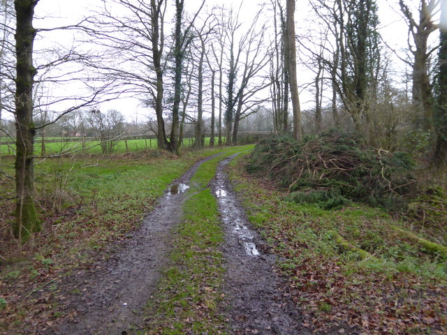
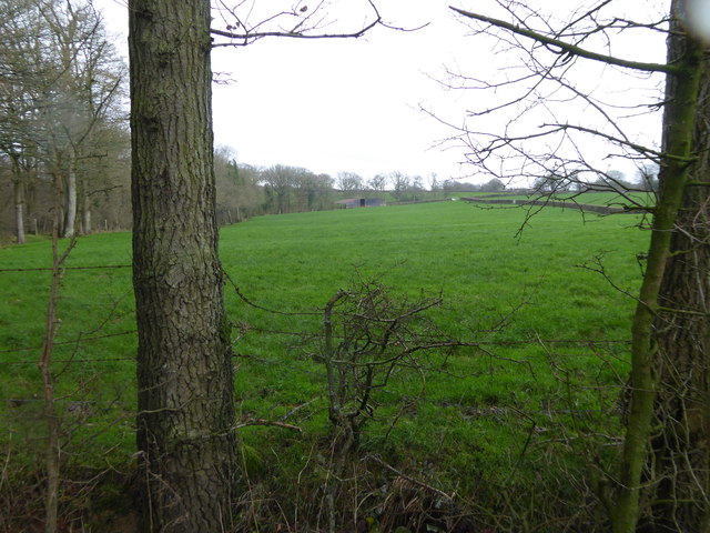
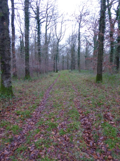
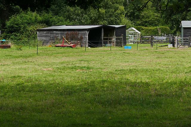
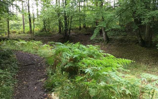
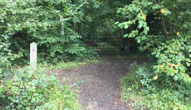
Inside Copse is characterized by its dense canopy of trees, which includes a variety of species such as oak, beech, and birch. The woodland floor is covered with a thick layer of leaf litter, providing a habitat for numerous small mammals, insects, and fungi. The area is also home to a variety of bird species, including woodpeckers, owls, and warblers.

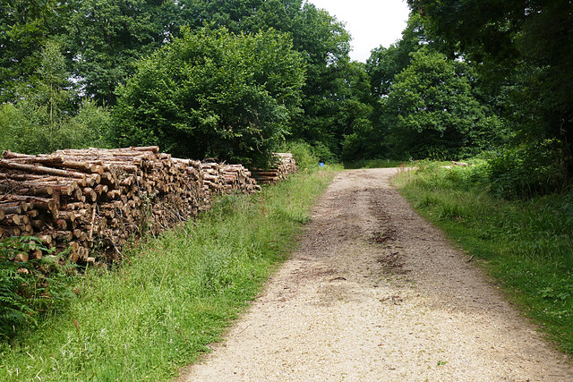
Visitors to Inside Copse can enjoy a network of well-maintained walking trails that wind through the woodland, offering opportunities for exploration and relaxation. The peaceful atmosphere and serene surroundings make it an ideal spot for picnics, nature walks, and wildlife observation. The woodland is also a great place for photography enthusiasts, as it offers stunning views and unique perspectives.

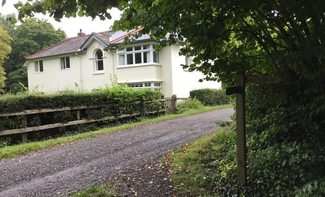
Inside Copse is easily accessible by both car and public transport, with a parking area available for visitors. The woodland is managed by the local council, which ensures the preservation of its natural beauty and the safety of its visitors.

In conclusion, Inside Copse in Surrey is a charming woodland area that offers a tranquil escape from the hustle and bustle of everyday life. With its diverse ecosystem and picturesque surroundings, it is a haven for nature lovers and a must-visit destination for those seeking a peaceful retreat in the heart of nature.

If you have any feedback on the listing, please let us know in the comments section below.

Inside Copse Images

Images are sourced within 2km of 51.091388/-0.56132497 or Grid Reference TQ0033. Thanks to Geograph Open Source API. All images are credited.

Woodland track going southwards from the Sussex Border Path(2)
View across field to large barn On the left is the western edge of Weald Barkfold Copse.
View across field to large barn
On the left is the western edge of Weald Barkfold Copse.
Woodland track going south from the Sussex Border Path (1)
Howicks, Hurlands Lane, Dunsfold Grade II listed building (incorrectly listed as 'Lowicks') <span class="nowrap"><a title="http://www.heritagegateway.org.uk/Gateway/Results_Single.aspx?uid=1044357&resourceID=5" rel="nofollow ugc noopener" href="http://www.heritagegateway.org.uk/Gateway/Results_Single.aspx?uid=1044357&resourceID=5">Link</a><img style="margin-left:2px;" alt="External link" title="External link - shift click to open in new window" src="https://s1.geograph.org.uk/img/external.png" width="10" height="10"/></span>
Howicks, Hurlands Lane, Dunsfold
Grade II listed building (incorrectly listed as 'Lowicks') LinkExternal link
Paddocks, Sedgehurst The Paddocks of Sedgehurst, a property enclosed within the Forest Enterprise Sidney Wood.
Paddocks, Sedgehurst
The Paddocks of Sedgehurst, a property enclosed within the Forest Enterprise Sidney Wood.
Sidney Wood, Dunsfold The main north south forestry track through Sidney Wood approaching the junction with the east west track.
Sidney Wood, Dunsfold
The main north south forestry track through Sidney Wood approaching the junction with the east west track.
Hog Wood from the air Woods and fields northwest of Ifold, with many bocage fields close to the wood. Left of centre is Sydney Farm.
Hog Wood from the air
Woods and fields northwest of Ifold, with many bocage fields close to the wood. Left of centre is Sydney Farm.
Wey and Arun Canal Footbridge A wooden footbridge over the disused Wey and Arun Canal close to the fishing lakes.
Wey and Arun Canal Footbridge
A wooden footbridge over the disused Wey and Arun Canal close to the fishing lakes.
High Bridge A property at High Bridge which stands beside the disused Wey and Arun Canal.
High Bridge
A property at High Bridge which stands beside the disused Wey and Arun Canal.
Wey-South Path in Sidney Wood At this point the Wey-South Path follows a track through woodland just north of the route of the disused canal.
Wey-South Path in Sidney Wood
At this point the Wey-South Path follows a track through woodland just north of the route of the disused canal.
Old wooden building Beside the Wey-South Path stands a dilapidated wooden building which is marked on the OS Map.
Old wooden building
Beside the Wey-South Path stands a dilapidated wooden building which is marked on the OS Map.
Gated Entrance to the Old Lock House The Old Lock House in Sidney Wood was built beside the now disused Wey and Arun Canal. The canal route past the house is not accessible to the public and only the driveway to the house can be seen from the Wey-South Path.
Gated Entrance to the Old Lock House
The Old Lock House in Sidney Wood was built beside the now disused Wey and Arun Canal. The canal route past the house is not accessible to the public and only the driveway to the house can be seen from the Wey-South Path.
Towpath beside the Wey and Arun Canal A straight section of the Wey and Arun Canal in Sidney Wood used as part of the Wey-South Path.
Towpath beside the Wey and Arun Canal
A straight section of the Wey and Arun Canal in Sidney Wood used as part of the Wey-South Path.
Site of Old Lock This is the site of one of the old locks on the Wey and Arun Canal in Sidney Wood.
Site of Old Lock
This is the site of one of the old locks on the Wey and Arun Canal in Sidney Wood.
Wey and Arun Canal At this point the Wey and Arun Canal takes a sharp turn to the left.
Wey and Arun Canal
At this point the Wey and Arun Canal takes a sharp turn to the left.
Gentle turn of the old Canal The disused Wey and Arun Canal takes a number of turns as it passes through Sidney Wood.
Gentle turn of the old Canal
The disused Wey and Arun Canal takes a number of turns as it passes through Sidney Wood.
Path Junction beside the Wey and Arun Canal As the Wey-South Path continues along the old towpath a footpath leads off to the left.
Path Junction beside the Wey and Arun Canal
As the Wey-South Path continues along the old towpath a footpath leads off to the left.
Path Junction in Sidney Wood Approaching a path junction on the Wey-South Path in Sidney Wood.
Path Junction in Sidney Wood
Approaching a path junction on the Wey-South Path in Sidney Wood.
Show me another place!

Inside Copse is located at Grid Ref: TQ0033 (Lat: 51.091388, Lng: -0.56132497)

Administrative County: Surrey

District: Waverley

Police Authority: Surrey

What 3 Words

///empty.judges.brilliant. Near Chiddingfold, Surrey

Related Wikis

Chiddingfold Forest

Chiddingfold Forest is a 542.5-hectare (1,341-acre) biological Site of Special Scientific Interest in Chiddingfold in Surrey and West Sussex. One part...

Fir Tree Copse

Fir Tree Copse is a 6-hectare (15-acre) nature reserve south-east of Dunsfold in Surrey. It is managed by the Surrey Wildlife Trust and is part of the...

Plaistow, West Sussex

Plaistow ( PLAST-oh) is a village and civil parish in the north of the Chichester District of West Sussex, England. There is a village green, a recreation...

Dunsfold

Dunsfold is a village in the borough of Waverley, Surrey, England, 8.7 miles (14.0 kilometres) south of Guildford. It lies in the Weald and reaches in...

Nearby Amenities

Located within 500m of 51.091388,-0.56132497
Upper Ifold
Place: isolated_dwelling
Source: npe
Lat/Long: 51.0904242/-0.5637454
Garden Cottage
Building: yes
Lat/Long: 51.0902192/-0.5639423
The Barn House
Building: yes
Lat/Long: 51.0900423/-0.5632601
The Thatched Cottage
Building: yes
Lat/Long: 51.0907315/-0.5633215
Upper Ifold House
Building: yes
Lat/Long: 51.0904549/-0.5636391
Barrier: stile
Foot: yes
Lat/Long: 51.0914094/-0.5626537
Barrier: stile
Foot: yes
Lat/Long: 51.0923094/-0.562531
Barrier: stile
Foot: yes
Lat/Long: 51.0939801/-0.5633287
Post Box
Letters Only: yes
Operator: Royal Mail
Post Box Type: lamp
Ref: GU8 113
Royal Cypher: GR
Royal Cypher Wikidata: Q33102273
Lat/Long: 51.0916097/-0.5576339
The data included in this document is from www.openstreetmap.org. The data is made available under ODbL.

Have you been to Inside Copse?

Leave your review of Inside Copse below (or comments, questions and feedback).