Coombe Wood

Wood, Forest in Sussex Chichester

England

Coombe Wood

View NW towards Bignor Hill I took this from the South Downs Way.
View NW towards Bignor Hill Credit: Ian Cunliffe

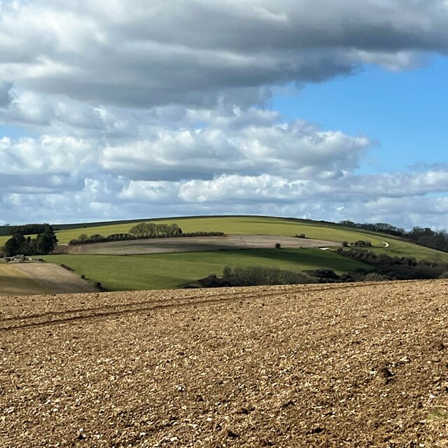
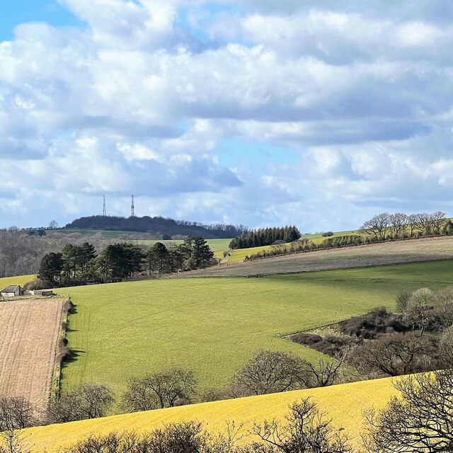
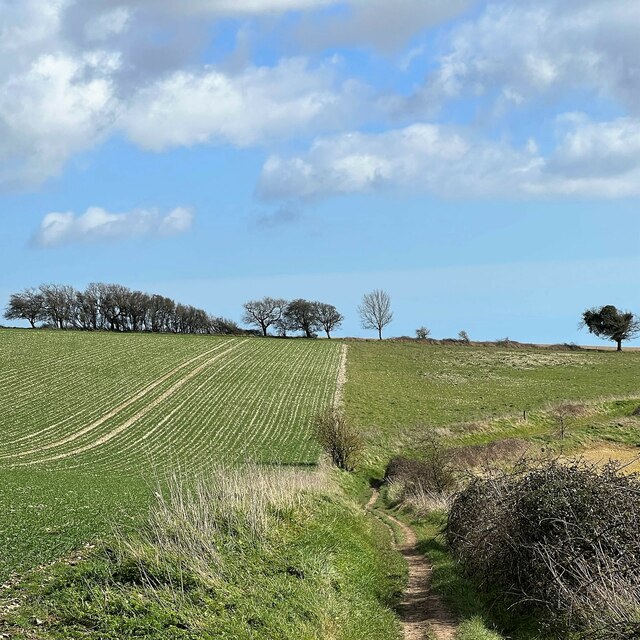
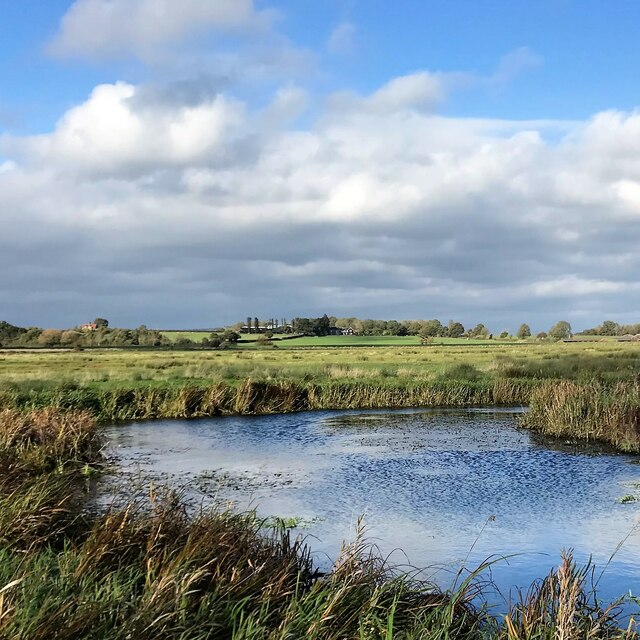
Coombe Wood is a picturesque woodland located in Sussex, England. Covering an area of approximately 50 acres, it is known for its natural beauty and diverse range of flora and fauna. The wood is situated near the village of Coombe, just a short distance from the town of Lewes.

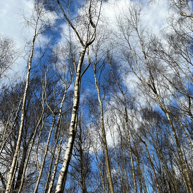
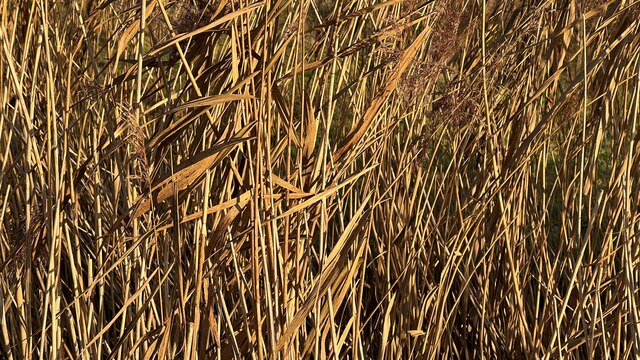
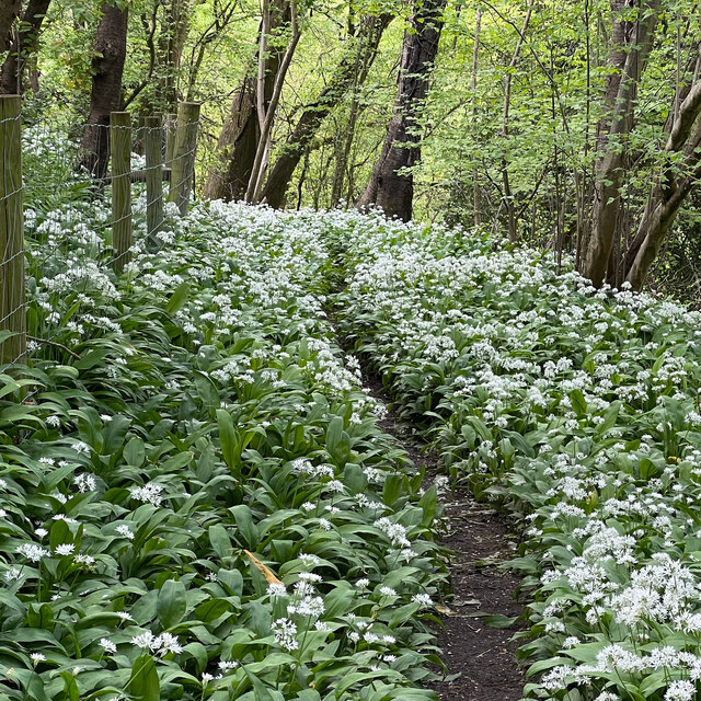
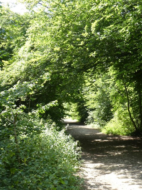
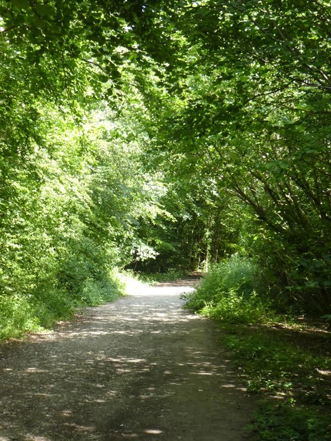
The woodland is characterized by its dense canopy of mature trees, including oak, beech, and birch. These towering trees provide a tranquil and shaded environment, perfect for leisurely walks or nature enthusiasts looking to explore the local ecosystem. The forest floor is adorned with an array of wildflowers, creating a colorful and vibrant display during the spring and summer months.

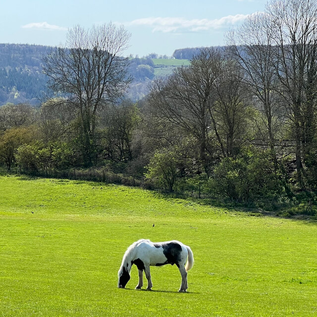
Coombe Wood is home to a rich variety of wildlife, making it a popular spot for birdwatchers and nature lovers. Visitors may spot species such as woodpeckers, jays, and owls, as well as small mammals like foxes, badgers, and squirrels. The wood also boasts a network of well-maintained trails, making it accessible to walkers of all abilities.

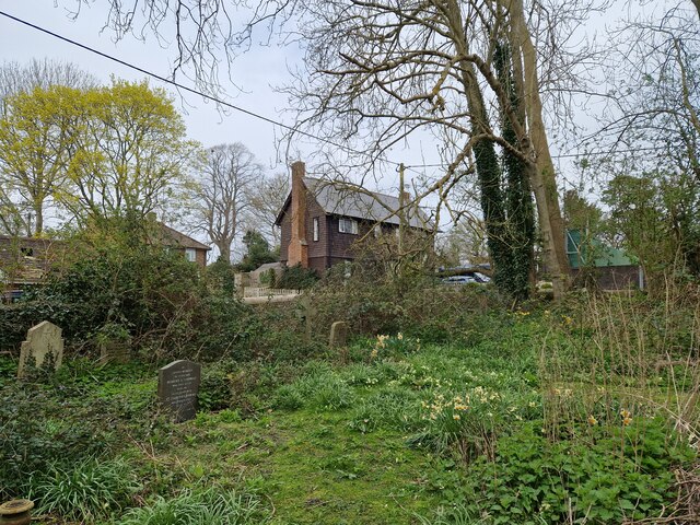
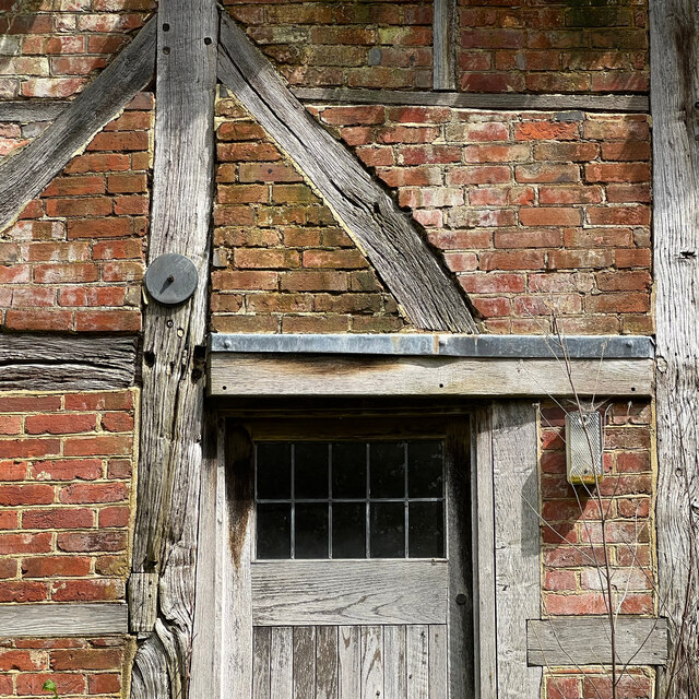
In addition to its natural beauty, Coombe Wood has a rich historical background. The wood was once used as a source of timber for local industries, and remnants of this past can still be seen today. There are also several archaeological sites within the woodland, including Iron Age earthworks and the remains of an old Roman road.

Overall, Coombe Wood offers a peaceful retreat for those seeking tranquility in nature, with its stunning scenery, abundant wildlife, and fascinating historical features.

If you have any feedback on the listing, please let us know in the comments section below.

Coombe Wood Images

Images are sourced within 2km of 50.900016/-0.56822573 or Grid Reference TQ0012. Thanks to Geograph Open Source API. All images are credited.

View NW towards Bignor Hill I took this from the South Downs Way.
View NW towards Bignor Hill
I took this from the South Downs Way.
View WNW towards Glatting Beacon You can see the communications masts on Glatting Beacon. I took this photo from the South Downs Way.
View WNW towards Glatting Beacon
You can see the communications masts on Glatting Beacon. I took this photo from the South Downs Way.
View ESE towards Bury Hill I took this from the South Downs Way.
View ESE towards Bury Hill
I took this from the South Downs Way.
View north over the flood plain to the west of Amberley I took this photo from a point a little to the north of the public footpath leading west from Amberley.
View north over the flood plain to the west of Amberley
I took this photo from a point a little to the north of the public footpath leading west from Amberley.
Birches near the edge of Houghton Forest
Farmland between the A29 and Houghton Forest I thought the birds in the distance added a little interest to this scene. This flinty soil is typical of that on the South Downs. Somewhere in the direction of the photo there's an antiquity marked as "The Mill Ball" on the OS Map. Apparently it's a "bowl barrow", but it doesn't appear in this shot.
Farmland between the A29 and Houghton Forest
I thought the birds in the distance added a little interest to this scene. This flinty soil is typical of that on the South Downs. Somewhere in the direction of the photo there's an antiquity marked as "The Mill Ball" on the OS Map. Apparently it's a "bowl barrow", but it doesn't appear in this shot.
Reed sweet-grass by the River Arun
Reed sweet-grass stems
Amberly Station Amberley Station opened in 1863. It is located between Pulborough and Arundel on the Arun Valley Line.
Amberly Station
Amberley Station opened in 1863. It is located between Pulborough and Arundel on the Arun Valley Line.
Daffodils in Bury Churchyard
Horse in a field adjacent to the B2139
Sydenham Cottage This cottage seemed unlived-in - which, I imagine, is unusual in a prosperous village like West Burton.
Sydenham Cottage
This cottage seemed unlived-in - which, I imagine, is unusual in a prosperous village like West Burton.
Wild garlic by the West Sussex Literary Trail There was an abundance of wild garlic (ramsons) hereabouts - though oddly you could hardly smell it. I guess the strength of the smell depends on the flowering stage that the plant has reached?
Wild garlic by the West Sussex Literary Trail
There was an abundance of wild garlic (ramsons) hereabouts - though oddly you could hardly smell it. I guess the strength of the smell depends on the flowering stage that the plant has reached?
Madehurst Road Route through Houghton Forest to Madehurst.
Madehurst Road
Route through Houghton Forest to Madehurst.
Warning security cameras in use Electricity supply lines adjacent to Madehurst Road in Houghton Forest.
Warning security cameras in use
Electricity supply lines adjacent to Madehurst Road in Houghton Forest.
A29, Rewell Hill Wood The A29 runs for 34 miles from the A24 at Capel, south of Dorking, through Billingshurst and Pulborough, crossing the South Downs at Bury Hill and passing Fontwell Park Racecourse before terminating on the B2166 on Bognor Regis sea front.
From Capel to Hardham, south of Pulborough, the road largely follows the path of the old Roman road, Stane Street.
A29, Rewell Hill Wood
The A29 runs for 34 miles from the A24 at Capel, south of Dorking, through Billingshurst and Pulborough, crossing the South Downs at Bury Hill and passing Fontwell Park Racecourse before terminating on the B2166 on Bognor Regis sea front. From Capel to Hardham, south of Pulborough, the road largely follows the path of the old Roman road, Stane Street.
Cycle track in Houghton Forest
Cycle track in Houghton Forest (2)
Show me another place!

Coombe Wood is located at Grid Ref: TQ0012 (Lat: 50.900016, Lng: -0.56822573)

Administrative County: West Sussex

District: Chichester

Police Authority: Sussex

What 3 Words

///highly.motels.shields. Near Arundel, West Sussex

Nearby Locations

Coombe Wood

Related Wikis

Bury Hill, Arundel

Bury Hill is an area of West Sussex, England, north of Arundel and southwest of Bury. In the 18th century, its name may have sometimes been spelled Berry...

Bury, West Sussex

Bury is a village and civil parish in the Chichester district of West Sussex, England. It is located on the A29 road, around 5 miles (8 km) south-west...

Houghton, West Sussex

Houghton () is a low-population, linear settlement with a large elevated tract of land which is mostly wooded and two main farms forming its civil parish...

Dorset House School

Dorset House School is a co-educational preparatory school near Pulborough in West Sussex, England. == History == The school was founded in 1784 as Totteridge...

St Mary the Virgin's Church, North Stoke

North Stoke Church, rededicated in 2007 to St Mary the Virgin after its medieval dedication was unexpectedly rediscovered, is a former Church of England...

North Stoke, West Sussex

North Stoke is a village and former civil parish, now in the parish of Amberley, in the Horsham district of West Sussex, England. It is just over 2 miles...

Amberley railway station

Amberley railway station is a railway station in West Sussex, England. It serves the village of Amberley, about half a mile away, and was opened by the...

West Burton, West Sussex

West Burton is a small hamlet in the Parish of Bury and the Chichester district of West Sussex, England. It lies between Bignor and Bury on the Lower Greensand...

Nearby Amenities

Located within 500m of 50.900016,-0.56822573
Bus Stop
A29
Bus: yes
Naptan AtcoCode: 4400LH0769
Naptan Bearing: S
Naptan BusStopType: CUS
Naptan CommonName: A29
Naptan Indicator: HAR
Naptan Landmark: Hail & Ride
Naptan NaptanCode: wsxdtwtj
Naptan Street: A29
Naptan Verified: no
Public Transport: platform
Source: naptan_import
Lat/Long: 50.8972398/-0.5737118
Bus Stop
A29
Bus: yes
Naptan AtcoCode: 4400LH0770
Naptan Bearing: N
Naptan BusStopType: CUS
Naptan CommonName: A29
Naptan Indicator: HAR
Naptan Landmark: Hail & Ride
Naptan NaptanCode: wsxdtwtm
Naptan Street: A29
Naptan Verified: no
Public Transport: platform
Source: naptan_import
Lat/Long: 50.9036167/-0.5671594
Bus Stop
A29
Bus: yes
Naptan AtcoCode: 4400LH0771
Naptan Bearing: S
Naptan BusStopType: CUS
Naptan CommonName: A29
Naptan Indicator: HAR
Naptan Landmark: Hail & Ride
Naptan NaptanCode: wsxdtwtp
Naptan Street: A29
Naptan Verified: no
Public Transport: platform
Source: naptan_import
Lat/Long: 50.9035942/-0.5667903
Barrier: bollard
Lat/Long: 50.8981829/-0.5736334
The data included in this document is from www.openstreetmap.org. The data is made available under ODbL.

Have you been to Coombe Wood?

Leave your review of Coombe Wood below (or comments, questions and feedback).