Flitwick Plantation

Wood, Forest in Bedfordshire

England

Flitwick Plantation

Farmland, Eversholt A footpath through peas on the approach to Water End.
Farmland, Eversholt Credit: Andrew Smith

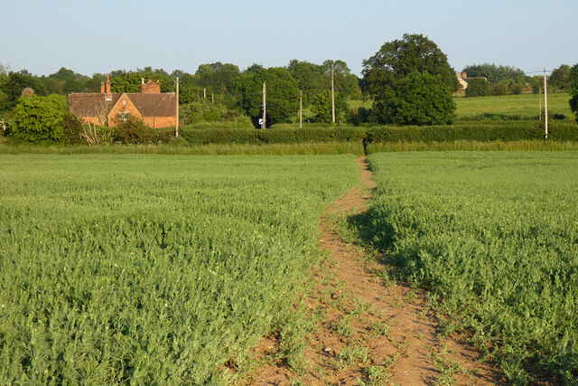
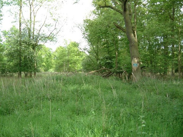
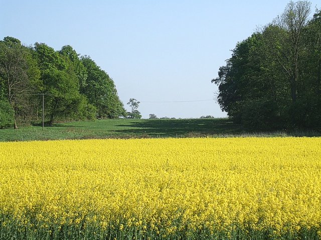
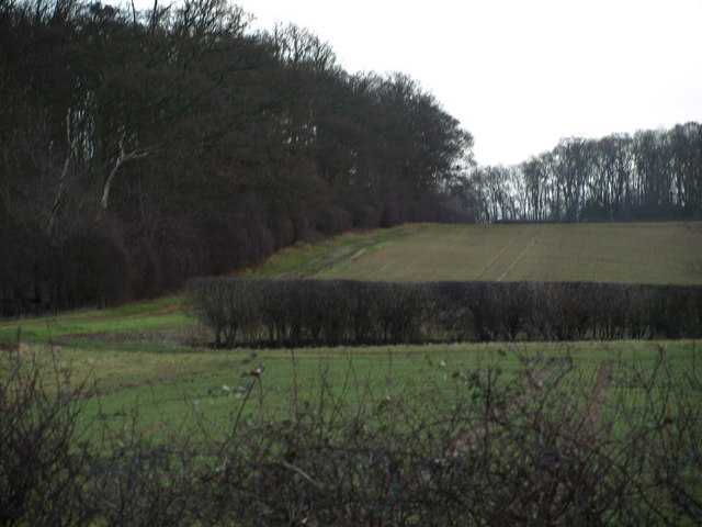
Flitwick Plantation is a picturesque woodland area located in Bedfordshire, England. It spans over a vast area and is a popular destination for nature enthusiasts and outdoor enthusiasts alike. The plantation is known for its diverse range of flora and fauna, making it a haven for wildlife.

The woodland is predominantly made up of deciduous trees such as oak, beech, and birch, which create a beautiful canopy of foliage throughout the year. In spring, the plantation comes alive with vibrant colors as wildflowers bloom and birdsong fills the air. The dense vegetation provides a perfect habitat for a variety of animal species, including deer, foxes, squirrels, and a wide array of bird species.

Visitors to Flitwick Plantation can enjoy a network of well-maintained walking trails that wind through the woodland, offering stunning views and ample opportunities for wildlife spotting. There are also designated picnic areas and benches for visitors to relax and take in the peaceful surroundings.

The plantation is managed by the local authority, ensuring the preservation of its natural beauty and biodiversity. Conservation efforts are in place to protect the native species and maintain the delicate balance of the ecosystem.

Flitwick Plantation is easily accessible, with ample parking facilities and nearby amenities. It provides a tranquil escape from the hustle and bustle of daily life, allowing visitors to immerse themselves in the serenity of nature. Whether it's a leisurely stroll, birdwatching, or simply enjoying a picnic in the great outdoors, Flitwick Plantation offers something for everyone to enjoy.

If you have any feedback on the listing, please let us know in the comments section below.

Flitwick Plantation Images

Images are sourced within 2km of 51.99723/-0.53382605 or Grid Reference TL0034. Thanks to Geograph Open Source API. All images are credited.

Farmland, Eversholt A footpath through peas on the approach to Water End.
Farmland, Eversholt
A footpath through peas on the approach to Water End.
B road crossing M1 southbound
Footbridge crossing M1 southbound
Matrix gantry - M1 southbound
Kingshoe Wood The little green sign says "Private Woods, Keep Out". This wood borders the M1 for about half a mile.
Kingshoe Wood
The little green sign says "Private Woods, Keep Out". This wood borders the M1 for about half a mile.
View back to M1 from near Kingshoe Wood Taken from the opposite side of the road from Kingshoe Wood (See <a href="https://www.geograph.org.uk/photo/171929">SP9934 : Kingshoe Wood</a>), this view is across fields to where the M1 cuts straight across the fields. The line of the M1 can be made out by the three thin lampposts.
View back to M1 from near Kingshoe Wood
Taken from the opposite side of the road from Kingshoe Wood (See SP9934 : Kingshoe Wood), this view is across fields to where the M1 cuts straight across the fields. The line of the M1 can be made out by the three thin lampposts.
Water End Barns They don't look much like barns to me - but that's what the sign says !
I presume that this was an old mill of some kind. It has now been converted into living accommodation. I wonder if the chimney still works, you could have a roaring fire with the updraft that'd produce !
Water End Barns
They don't look much like barns to me - but that's what the sign says ! I presume that this was an old mill of some kind. It has now been converted into living accommodation. I wonder if the chimney still works, you could have a roaring fire with the updraft that'd produce !
Water End Barns from nearby junction Another view of <a href="https://www.geograph.org.uk/photo/183094">SP9933 : Water End Barns</a> from a little further away showing the length of this substantial building.
Water End Barns from nearby junction
Another view of SP9933 : Water End Barns from a little further away showing the length of this substantial building.
Rape field and two woods A bright yellow field of Rape makes a dazzling foreground to a gap between two woods. The wood on the left is Wakes End Wood, while on the right is Birchall's Wood. The photo was taken from Cobblers Lane.
Rape field and two woods
A bright yellow field of Rape makes a dazzling foreground to a gap between two woods. The wood on the left is Wakes End Wood, while on the right is Birchall's Wood. The photo was taken from Cobblers Lane.
Rads End Farm This mellow bricked farm is on a right/left kink in the lane through Higher & Lower Rads End. I think the wooden top to the roof is a dovecote, and it looks as though two of its residents are flying above it.
Rads End Farm
This mellow bricked farm is on a right/left kink in the lane through Higher & Lower Rads End. I think the wooden top to the roof is a dovecote, and it looks as though two of its residents are flying above it.
Fields and Trees Large woodland bordered by the Greensand Ridge Walk
Fields and Trees
Large woodland bordered by the Greensand Ridge Walk
Gap in the Hedge Start of a footpath going through some woodland, close to M1.  Not used very often - hence the overgrown appearance
Gap in the Hedge
Start of a footpath going through some woodland, close to M1. Not used very often - hence the overgrown appearance
Road Junction Close to Eversholt.
Road Junction
Close to Eversholt.
M1 Bridge This bridge takes the M1 over Cobblers Lane.
M1 Bridge
This bridge takes the M1 over Cobblers Lane.
Pumping Station, Steppingley ... and a white van. Not one of the fine Victorian Gothic pumping stations - more Brutalist really ! The track continuing on past the pumping station is part of the John Bunyan Trail.
Pumping Station, Steppingley
... and a white van. Not one of the fine Victorian Gothic pumping stations - more Brutalist really ! The track continuing on past the pumping station is part of the John Bunyan Trail.
The French Horn, Steppingley Now Steppingley's only pub, as the other one is now an Indian restaurant called "Saffron"
The French Horn, Steppingley
Now Steppingley's only pub, as the other one is now an Indian restaurant called "Saffron"
Near Flitwick Plantation On the road between Steppingley and Eversholt. The North-Eastern border of Flitwick Plantation is just ahead to the left of the road while a bluebell wood (<a href="https://www.geograph.org.uk/photo/173716">TL0034 : Bluebells in Rod Wood</a>) on the right near Warren Farm stops a little further on.
Near Flitwick Plantation
On the road between Steppingley and Eversholt. The North-Eastern border of Flitwick Plantation is just ahead to the left of the road while a bluebell wood (TL0034 : Bluebells in Rod Wood) on the right near Warren Farm stops a little further on.
Peakes End, Steppingley Peakes End (no sign of an apostrophe) is a little back lane in Steppingley. It leads to Park Farm which is in the adjacent southern square ([TL0134])
Peakes End, Steppingley
Peakes End (no sign of an apostrophe) is a little back lane in Steppingley. It leads to Park Farm which is in the adjacent southern square ([TL0134])
Show me another place!

Flitwick Plantation is located at Grid Ref: TL0034 (Lat: 51.99723, Lng: -0.53382605)

Unitary Authority: Central Bedfordshire

Police Authority: Bedfordshire

What 3 Words

///tribune.copies.supported. Near Steppingley, Bedfordshire

Nearby Locations

Flitwick Plantation

Related Wikis

Steppingley

Steppingley is a rural village and civil parish in Bedfordshire, England. It stands on high ground in the centre of a small parish of about 562 ha on...

Flitwick Wood

Flitwick Wood is a 14.2 hectares (35 acres) Local Nature Reserve in Flitwick in Bedfordshire. It is owned and managed by Central Bedfordshire Council.The...

Church of St Nicholas, Tingrith

The Church of St Nicholas is a Grade I listed church in Tingrith, Bedfordshire, England. It became a listed building on 23 January 1961.The brown sandstone...

Eversholt

Eversholt is a village and civil parish located in Bedfordshire, England. It was mentioned in the Domesday Book and is over 1000 years old. "Eversholt...

Nearby Amenities

Located within 500m of 51.99723,-0.53382605
Power: tower
Lat/Long: 51.9961596/-0.5382173
Power: tower
Lat/Long: 51.9986315/-0.540447
Power: tower
Lat/Long: 51.9940011/-0.5363269
Barrier: kissing_gate
Lat/Long: 51.9951729/-0.5294084
Barrier: swing_gate
Lat/Long: 51.9953151/-0.5346748
The data included in this document is from www.openstreetmap.org. The data is made available under ODbL.

Have you been to Flitwick Plantation?

Leave your review of Flitwick Plantation below (or comments, questions and feedback).