Eastwood

Settlement in Nottinghamshire Broxtowe

England

Eastwood

Playing fields No one is using the pitches at the moment.
Playing fields Credit: Malcolm Neal

Eastwood is a small town located in the county of Nottinghamshire, England. It is situated approximately 8 miles northwest of Nottingham city center and 10 miles southeast of the town of Mansfield. The town has a population of around 18,000 residents.

Historically, Eastwood is famous for being the birthplace of D.H. Lawrence, the renowned English writer. The town has several sites of interest associated with Lawrence, including his childhood home and the DH Lawrence Birthplace Museum, which provides insights into his life and works.

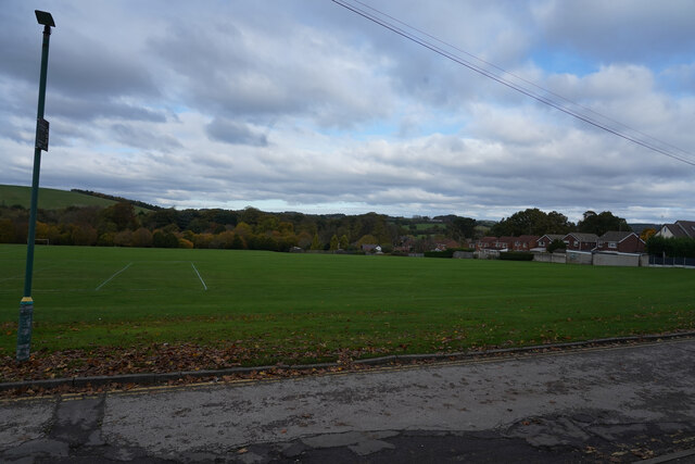
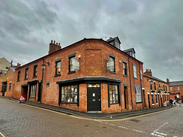
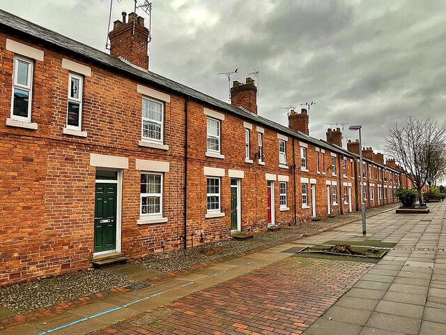
Eastwood is primarily a residential area with a mix of housing styles, ranging from Victorian terraces to modern developments. The town center features a variety of shops, cafes, and local amenities, catering to the needs of the local community. There are also a number of parks and green spaces, providing recreational opportunities for residents.

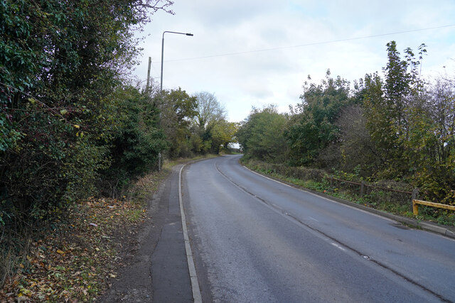
Transportation in Eastwood is well-served by the A610 road, which connects the town to Nottingham and the wider road network. Additionally, there are regular bus services that operate in and around the town, offering convenient connections to neighboring areas.

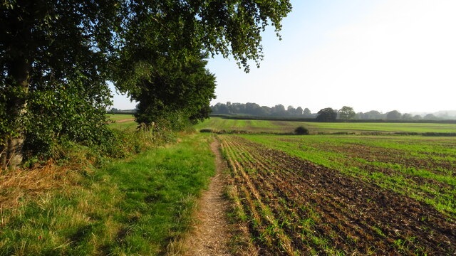
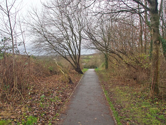
The town has a strong sense of community, with various local events and festivals taking place throughout the year. Eastwood also benefits from its proximity to the beautiful Nottinghamshire countryside, offering residents the opportunity to enjoy outdoor activities such as hiking and cycling.

Overall, Eastwood is a charming and historic town, known for its connections to D.H. Lawrence and providing a pleasant living environment for its residents.

If you have any feedback on the listing, please let us know in the comments section below.

Eastwood Images

Images are sourced within 2km of 53.017373/-1.3025895 or Grid Reference SK4646. Thanks to Geograph Open Source API. All images are credited.
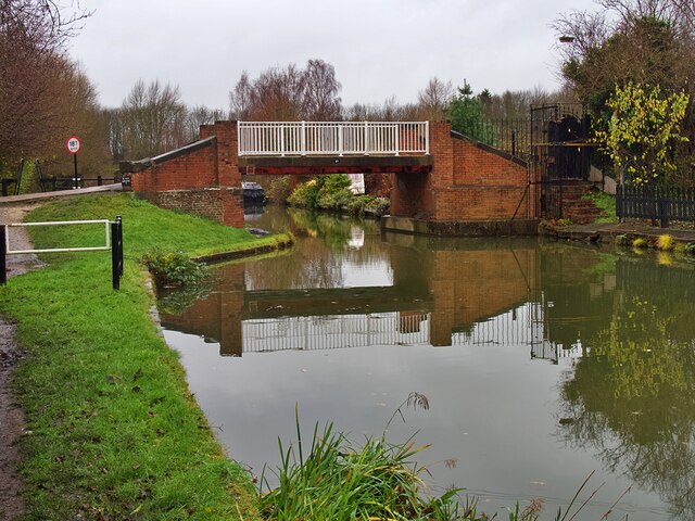
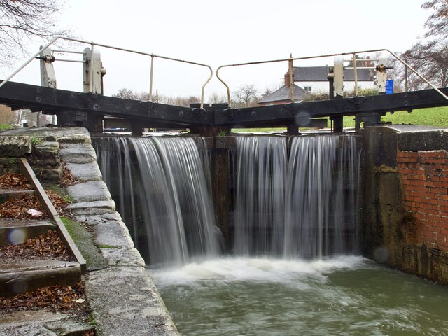
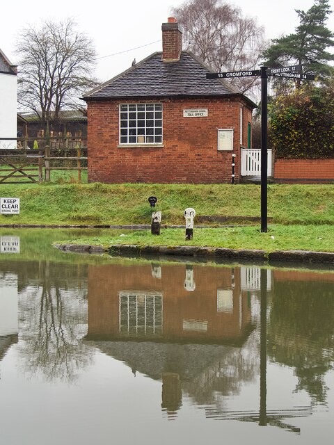
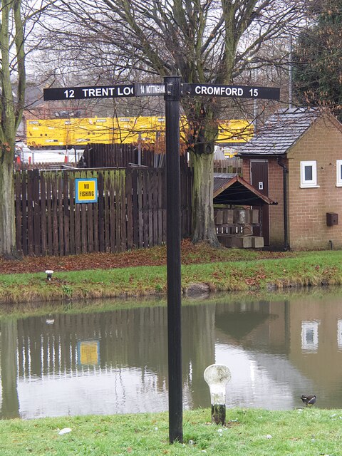
Playing fields No one is using the pitches at the moment.
Playing fields
No one is using the pitches at the moment.
Mansfield Road Autumnal leaf fall on the edge of Mansfield Road.
Mansfield Road
Autumnal leaf fall on the edge of Mansfield Road.
Robin Hood Way leading northeast towards Greasley
D.H. Lawrence Birthplace Museum The Museum is located in the childhood home of the author D.H. Lawrence in the ex-mining town of Eastwood.
D.H. Lawrence Birthplace Museum
The Museum is located in the childhood home of the author D.H. Lawrence in the ex-mining town of Eastwood.
Princes Street, Eastwood One of a group of streets known locally as "the squares" this now pedestrianised street of terraced houses was built by the local colliery company in the 1850s.  DH Lawrence's home was nearby <a href="https://www.geograph.org.uk/photo/7043172">SK4647 : D.H. Lawrence Birthplace Museum</a> and he later described the houses as "sordid and hideous". They look very clean and smart today.
Princes Street, Eastwood
One of a group of streets known locally as "the squares" this now pedestrianised street of terraced houses was built by the local colliery company in the 1850s. DH Lawrence's home was nearby SK4647 : D.H. Lawrence Birthplace Museum and he later described the houses as "sordid and hideous". They look very clean and smart today.
The Erewash Canal at Bridge #25 Approaching Shipley Lock
The Erewash Canal at Bridge #25
Approaching Shipley Lock
Bridge #25 on the Erewash Canal Below Shipley Lock #72 on the canal.
Bridge #25 on the Erewash Canal
Below Shipley Lock #72 on the canal.
The Old Slaughterhouse Where worn-out canal tow horses came at the end of their working life.
The Old Slaughterhouse
Where worn-out canal tow horses came at the end of their working life.
Shipley Lock Lock #72 on the Erewash Canal
Shipley Lock
Lock #72 on the Erewash Canal
The Erewash Canal below Eastwood Lock Lock #73 on the canal. The towpath switches to the opposite bank here.
The Erewash Canal below Eastwood Lock
Lock #73 on the canal. The towpath switches to the opposite bank here.
The Erewash Canal and towpath south of bridge #26
Bridge #27 on the Erewash Canal Carrying Anchor Road over the canal
Bridge #27 on the Erewash Canal
Carrying Anchor Road over the canal
Narrowboat 'Gone Roaming' But not roaming today as it's moored below Anchor Bridge <a href="https://www.geograph.org.uk/photo/7044756">SK4546 : Bridge #27 on the Erewash Canal</a>]
Narrowboat 'Gone Roaming'
But not roaming today as it's moored below Anchor Bridge SK4546 : Bridge #27 on the Erewash Canal]
Water overflowing the lock gates at Langley Mill Lock Langley Mill Basin is where the Erewash Canal joins the Cromford and Nottingham Canals.
Water overflowing the lock gates at Langley Mill Lock
Langley Mill Basin is where the Erewash Canal joins the Cromford and Nottingham Canals.
The junction of the Cromford and Nottingham Canals The building is the former toll office for the Nottingham Canal. This location is unusual in that three canals meet here, the third being the Erewash Canal to Trent Lock. The three way finger post <a href="https://www.geograph.org.uk/photo/7044762">SK4547 : Direction signpost at Langley Mill Basin</a> is a recent addition, not present when the location was last geographed in 2017 <a href="https://www.geograph.org.uk/photo/5607048">SK4547 : Junction of the Nottingham and Cromford Canals</a>
The junction of the Cromford and Nottingham Canals
The building is the former toll office for the Nottingham Canal. This location is unusual in that three canals meet here, the third being the Erewash Canal to Trent Lock. The three way finger post SK4547 : Direction signpost at Langley Mill Basin is a recent addition, not present when the location was last geographed in 2017 SK4547 : Junction of the Nottingham and Cromford Canals
Direction signpost at Langley Mill Basin An unusual location where three canals meet: the Erewash, Nottingham and Cromford Canals.
Direction signpost at Langley Mill Basin
An unusual location where three canals meet: the Erewash, Nottingham and Cromford Canals.
Ghost sign on Derby Road, Eastwood It appears that this sign for Neville's Garage was mostly covered by an advertising hoarding when the gable end was repainted, obliterating part of the N and G when the hoarding was removed and the sign re-appeared.
Ghost sign on Derby Road, Eastwood
It appears that this sign for Neville's Garage was mostly covered by an advertising hoarding when the gable end was repainted, obliterating part of the N and G when the hoarding was removed and the sign re-appeared.
Public footpath in Eastwood Running between Garden Road and Walker Street
Public footpath in Eastwood
Running between Garden Road and Walker Street
Show me another place!

Eastwood is located at Grid Ref: SK4646 (Lat: 53.017373, Lng: -1.3025895)

Administrative County: Nottinghamshire

District: Broxtowe

Police Authority: Nottinghamshire

What 3 Words

///baths.thundered.sector. Near Eastwood, Nottinghamshire

Related Wikis

Eastwood, Nottinghamshire

Eastwood is a former coal mining town in the Broxtowe district of Nottinghamshire, England, 8 miles (13 km) northwest of Nottingham and 10 miles (16 km...

D. H. Lawrence Birthplace Museum

The D. H. Lawrence Birthplace Museum is a writer's home museum dedicated to the writer D. H. Lawrence situated in Eastwood, near Nottingham. It is the...

Eastwood Town F.C.

Eastwood Town Football Club was an English football club based in Eastwood, Nottinghamshire. The club last participated in the Northern Premier League...

Eastwood C.F.C.

Eastwood Community Football Club is a football club based in Eastwood, Nottinghamshire, England. They are currently members of the United Counties League...
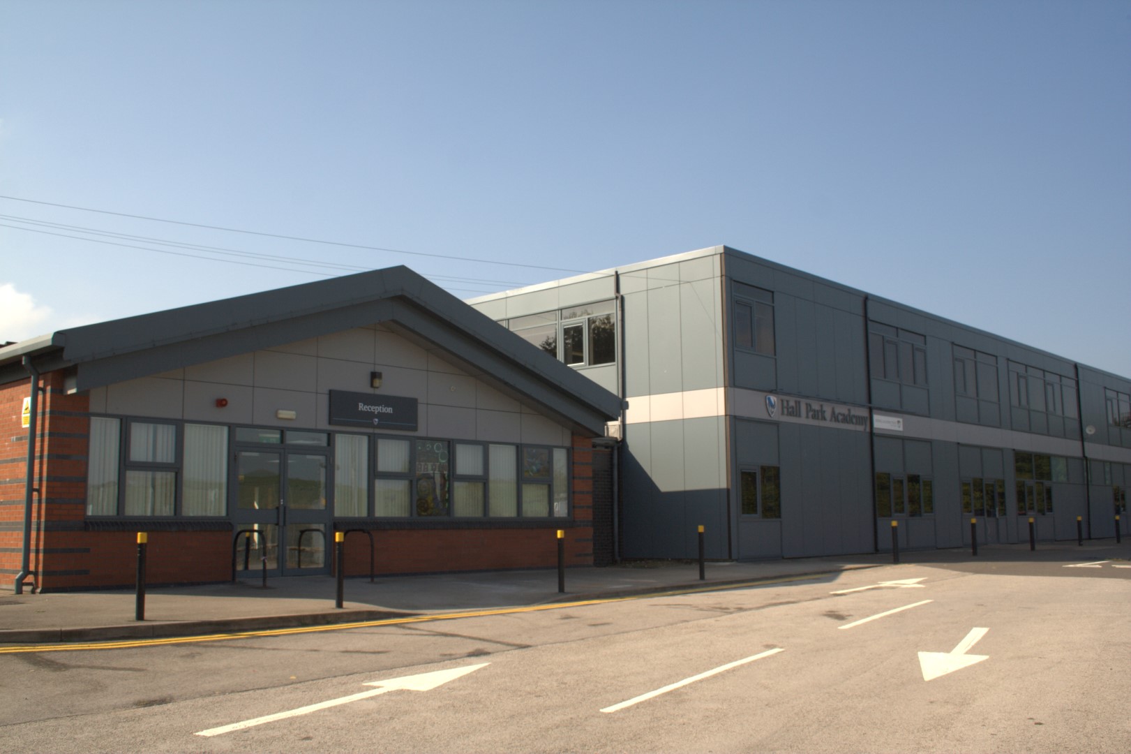
Hall Park Academy

Hall Park Academy (formerly Eastwood Comprehensive School) is a coeducational secondary school and sixth form located in Eastwood in the English county...

Raleigh Bicycle Company

The Raleigh Bicycle Company is a British bicycle manufacturer based in Nottingham, England and founded by Woodhead and Angois in 1885. Using Raleigh as...

A610 road

The A610 is an A-road in England, which runs from Nottingham to Ambergate, where it joins the A6. == Route == === Nottingham to Eastwood === The road starts...

Eastwood and Langley Mill railway station

Eastwood and Langley Mill railway station is a former railway station serving the town of Eastwood and the village of Langley Mill in Derbyshire, England...

Nearby Amenities

Located within 500m of 53.017373,-1.3025895
Eastwood
Is In: Nottinghamshire, United Kingdom
Is In County: Nottinghamshire
Place: town
Wikidata: Q2736112
Wikipedia: en:Eastwood, Nottinghamshire
Lat/Long: 53.0171751/-1.30386
Crossing
Crossing: traffic_signals
Crossing Ref: pelican
Lat/Long: 53.0202779/-1.3079028
Traffic Signals
Crossing: traffic_signals
Crossing Ref: pelican
Lat/Long: 53.0191084/-1.3084264
Crossing
Crossing: traffic_signals
Crossing Ref: pelican
Source: survey
Lat/Long: 53.0180507/-1.3084277
Fuel
Morrisons
Addr Postcode: NG16 3SG
Addr Street: Kelham Way
Brand: Morrisons
Brand Wikidata: Q922344
Brand Wikipedia: en:Morrisons
Old Fhrs Id: 566665
Source Addr: Food hygiene opendata
Website: https://my.morrisons.com/storefinder/239/eastwood
Lat/Long: 53.019228/-1.3090404
Traffic Signals
Crossing: traffic_signals
Crossing Ref: pelican
Source: survey
Lat/Long: 53.0179501/-1.3093814
Barrier: lift_gate
Lat/Long: 53.0191164/-1.3087412
Source: Bing
Traffic Calming: cushion
Lat/Long: 53.0217364/-1.3042474
Crossing
Crossing: uncontrolled
Crossing Ref: zebra
Source: survey
Lat/Long: 53.0180456/-1.3066022
Entrance: main
Lat/Long: 53.018649/-1.3069982
Entrance: main
Lat/Long: 53.0173915/-1.3028572
Entrance: main
Lat/Long: 53.0169668/-1.3015164
Turning Circle
Lat/Long: 53.0199413/-1.3063721
Automatic: yes
Barrier: bollard
Lat/Long: 53.0173789/-1.3069745
Bus Stop
Plumptre Way
Bus: yes
Naptan AtcoCode: 3300BR0011
Naptan Bearing: SW
Naptan CommonName: Plumptre Way
Naptan Indicator: SW-bound
Naptan Landmark: The Island
Naptan NaptanCode: ntsdgdgm
Naptan Notes: none
Naptan Street: Plumptre Way
Naptan Verified: yes
Public Transport: platform
Shelter: no
Source: naptan_import
Lat/Long: 53.0133496/-1.3030456
Bus Stop
Lawrence Avenue
Bus: yes
Naptan AtcoCode: 3300BR0012
Naptan Bearing: SW
Naptan CommonName: Lawrence Avenue
Naptan Crossing: Lawrence Avenue
Naptan Indicator: opp
Naptan Landmark: Hilltop House
Naptan NaptanCode: ntsdgdgp
Naptan Notes: none
Naptan Street: Plumptre Way
Naptan Verified: no
Public Transport: platform
Source: naptan_import
Lat/Long: 53.0159529/-1.3000251
Bus Stop
Lawrence Avenue
Bus: yes
Naptan AtcoCode: 3300BR0014
Naptan Bearing: NE
Naptan CommonName: Lawrence Avenue
Naptan Crossing: Lawrence Avenue
Naptan Indicator: adj
Naptan NaptanCode: ntsdgdgt
Naptan Notes: none
Naptan Street: Plumptre Way
Naptan Verified: no
Public Transport: platform
Source: naptan_import
Lat/Long: 53.0160005/-1.3004715
Bus Stop
Plumptre Way
Bus: yes
Naptan AtcoCode: 3300BR0074
Naptan Bearing: NE
Naptan CommonName: Plumptre Way
Naptan Indicator: NE-bound
Naptan Landmark: The Island
Naptan NaptanCode: ntsdatma
Naptan Notes: none
Naptan Street: Plumptre Way
Naptan Verified: no
Public Transport: platform
Source: naptan_import
Lat/Long: 53.0136611/-1.3031775
Bus Stop
Greenhills Avenue
Bus: yes
Naptan AtcoCode: 3300BR0158
Naptan Bearing: E
Naptan CommonName: Greenhills Avenue
Naptan Crossing: Greenhills Avenue
Naptan Indicator: opp
Naptan NaptanCode: ntsdawda
Naptan Notes: none
Naptan Street: Greenhills Road
Naptan Verified: no
Public Transport: platform
Source: naptan_import
Lat/Long: 53.0215386/-1.3005757
Bus Stop
St Marys Church
Bus: yes
Local Ref: BR0173
Naptan AtcoCode: 3300BR0173
Naptan Bearing: N
Naptan CommonName: St Marys Church
Naptan Indicator: opp
Naptan Landmark: St. Marys Church
Naptan NaptanCode: ntsawgtw
Naptan Notes: none
Naptan Street: Church Street
Naptan Verified: yes
Note: 103
Public Transport: platform
Shelter: no
Source: naptan_import
Lat/Long: 53.0166268/-1.3083263
Bus Stop
Midland Road
Bus: yes
Naptan AtcoCode: 3300BR0188
Naptan Bearing: E
Naptan CommonName: Midland Road
Naptan Crossing: Pickering Avenue
Naptan Indicator: E-bound
Naptan NaptanCode: ntsdpwaj
Naptan Notes: none
Naptan Street: Midland Road
Naptan Verified: no
Public Transport: platform
Source: naptan_import
Lat/Long: 53.013899/-1.3054393
Bus Stop
Alexandra Street
Bus: yes
Public Transport: platform
Shelter: yes
Lat/Long: 53.0178526/-1.3055246
Bus Stop
Library
Bus: yes
Public Transport: platform
Shelter: no
Lat/Long: 53.0172344/-1.3022196
Bus Stop
Library
Bus: yes
Public Transport: platform
Shelter: yes
Lat/Long: 53.0170871/-1.3014617
Bus Stop
Edward Road
Bus: yes
Naptan AtcoCode: 3300BR0327
Naptan NaptanCode: ntsdpwjg
Public Transport: platform
Lat/Long: 53.0158019/-1.2970787
Bus Stop
Edward Road
Bus: yes
Naptan AtcoCode: 3300BR0328
Naptan NaptanCode: ntsdpwjm
Public Transport: platform
Lat/Long: 53.0156649/-1.2969054
Bus Stop
Alexandra Street
Bus: yes
Public Transport: platform
Shelter: yes
Lat/Long: 53.017983/-1.3058973
Bus Stop
Morrisons
Bus: yes
Public Transport: platform
Shelter: yes
Lat/Long: 53.0187277/-1.3095349
Bus Stop
Derby Road
Bus: yes
Public Transport: platform
Shelter: yes
Lat/Long: 53.0178426/-1.3090742
Traffic Signals
Crossing: traffic_signals
Crossing Ref: pelican
Lat/Long: 53.0189678/-1.3083821
Entrance: main
Lat/Long: 53.0181202/-1.3081991
HE Ref: 1391721
Historic: memorial
Listed Status: Grade II
Memorial: war_memorial
Source Listed Status: Historic England
Lat/Long: 53.0164972/-1.2998683
Entrance: main
Lat/Long: 53.0181311/-1.3069793
Crossing
Crossing: traffic_signals
Crossing Ref: pelican
Lat/Long: 53.0184418/-1.3093891
Recycling
Recycling Glass: yes
Source: survey
Lat/Long: 53.0188178/-1.3091084
Post Box
Collection Times: Mo-Fr 16:30; Sa 12:30
Operator: Royal Mail
Operator Type: private
Operator Wikidata: Q638098
Post Box Design: type_b
Post Box Type: pillar
Ref: NG16 8
Royal Cypher: EIIR
Royal Cypher Wikidata: Q33102113
Source: survey
Lat/Long: 53.0176566/-1.3085183
Entrance: main
Lat/Long: 53.0178009/-1.3052272
Barrier: cycle_barrier
Ele: 103.0000000
Lat/Long: 53.0163861/-1.2970396
Ele: 104.0000000
Lat/Long: 53.0174662/-1.2955626
Entrance: main
Lat/Long: 53.0167506/-1.3064789
Entrance: main
Step Count: 2
Lat/Long: 53.0168693/-1.3061412
Crossing
Crossing: uncontrolled
Crossing Ref: zebra
Lat/Long: 53.0145494/-1.3076821
Crossing
Crossing: uncontrolled
Crossing Ref: zebra
Lat/Long: 53.0155759/-1.3077758
Entrance: main
Lat/Long: 53.0174506/-1.3024955
Post Box
Collection Times: Mo-Fr 17:30; Sa 12:30
Post Box Design: type_a
Post Box Type: pillar
Ref: NG16 120
Royal Cypher: EIIR
Royal Cypher Wikidata: Q33102113
Source: survey
Lat/Long: 53.0173418/-1.3027361
Post Box
Collection Times: Mo-Fr 17:30; Sa 12:30
Post Box Design: type_a
Post Box Type: pillar
Ref: NG16 12
Royal Cypher: EIIR
Royal Cypher Wikidata: Q33102113
Source: survey
Lat/Long: 53.017348/-1.3027309
Crossing
Crossing: uncontrolled
Crossing Ref: zebra
Source: survey
Lat/Long: 53.0174685/-1.302783
Traffic Signals
Crossing: traffic_signals
Crossing Ref: pelican
Source: survey
Lat/Long: 53.0178583/-1.3092363
Traffic Signals
Crossing: traffic_signals
Crossing Ref: pelican
Source: survey
Lat/Long: 53.0179831/-1.3091911
Barrier: cycle_barrier
Lat/Long: 53.0169549/-1.2981587
Crossing
Crossing: uncontrolled
Crossing Ref: zebra
Source: survey
Lat/Long: 53.017739/-1.3040591
Telephone
Booth: KX100
Covered: booth
Source: survey
Lat/Long: 53.0177879/-1.3039283
Bicycle Parking
Bicycle Parking: stands
Capacity: 8
Covered: no
Source: survey
Lat/Long: 53.0172146/-1.3016143
Entrance: main
Lat/Long: 53.0173492/-1.3015721
Barrier: bollard
Lat/Long: 53.0182269/-1.3039441
Entrance: main
Lat/Long: 53.0172079/-1.30218
Entrance: main
Lat/Long: 53.0172446/-1.3023046
Entrance: main
Lat/Long: 53.0172683/-1.3023834
Entrance: main
Lat/Long: 53.0172796/-1.3024206
Entrance: main
Lat/Long: 53.0173025/-1.302501
Entrance: main
Lat/Long: 53.0179917/-1.3037821
Entrance: main
Lat/Long: 53.0180059/-1.3038193
Entrance: main
Lat/Long: 53.0180433/-1.3039179
Entrance: main
Lat/Long: 53.0180462/-1.3042067
Entrance: main
Lat/Long: 53.0180477/-1.3041071
Entrance: main
Lat/Long: 53.0180496/-1.3039821
Note: Residential on upper floors
Lat/Long: 53.0181339/-1.3039624
Entrance: main
Lat/Long: 53.0174985/-1.3031637
Entrance: main
Lat/Long: 53.0176068/-1.3036082
Addr City: Nottingham
Addr Housenumber: 24A
Addr Street: Nottingham Road
Addr Suburb: Eastwood
Entrance: main
Source: survey
Lat/Long: 53.0180458/-1.3077649
Addr City: Nottingham
Addr Flats: 1;2
Addr Housenumber: 28-30
Addr Postcode: NG16 3NQ
Addr Street: Nottingham Road
Addr Suburb: Eastwood
Entrance: yes
Source: survey
Source Addr: interpolation;survey
Lat/Long: 53.0180444/-1.3074538
Traffic Signals
Source: survey
Lat/Long: 53.0178868/-1.3084498
Entrance: main
Lat/Long: 53.0180213/-1.3082823
Entrance: main
Lat/Long: 53.0180232/-1.3082036
Entrance: main
Lat/Long: 53.018025/-1.3081268
Crossing
Crossing: traffic_signals
Crossing Ref: pelican
Source: survey
Lat/Long: 53.0180424/-1.308556
Entrance: main
Lat/Long: 53.0180402/-1.3079426
Entrance: main
Lat/Long: 53.0180446/-1.3075209
Entrance: main
Lat/Long: 53.0180456/-1.3077399
Entrance: main
Lat/Long: 53.0180457/-1.307659
Entrance: main
Lat/Long: 53.0180446/-1.3078361
Traffic Signals
Crossing: traffic_signals
Crossing Ref: pelican
Source: survey
Lat/Long: 53.0180703/-1.3081906
Entrance: main
Lat/Long: 53.018126/-1.30788
Entrance: main
Lat/Long: 53.0181362/-1.3071382
Entrance: main
Source: survey
Lat/Long: 53.018135/-1.3076829
Entrance: service
Lat/Long: 53.0181379/-1.3071967
Entrance: main
Lat/Long: 53.0181397/-1.3072355
Entrance: main
Lat/Long: 53.0181409/-1.3075447
Entrance: main
Lat/Long: 53.0181433/-1.3073804
Traffic Signals
Crossing: traffic_signals
Crossing Ref: pelican
Source: survey
Lat/Long: 53.0181796/-1.3085055
Traffic Signals
Crossing: traffic_signals
Crossing Ref: pelican
Source: survey
Lat/Long: 53.01818/-1.3083796
Entrance: yes
Use: residential
Lat/Long: 53.0181849/-1.307778
Traffic Signals
Crossing: traffic_signals
Crossing Ref: pelican
Lat/Long: 53.0190124/-1.3082158
Addr City: Nottingham
Addr Housenumber: 32-34
Addr Postcode: NG16 3NQ
Addr Street: Nottingham Road
Addr Suburb: Eastwood
Entrance: yes
Source: survey
Source Addr Postcode: interpolation
Lat/Long: 53.018043/-1.3074242
Addr City: Nottingham
Addr Housenumber: 36A
Addr Postcode: NG16 3NQ
Addr Street: Nottingham Road
Addr Suburb: Eastwood
Entrance: gate
Source: survey
Source Addr Postcode: interpolation
Lat/Long: 53.0180286/-1.3071546
Addr City: Nottingham
Addr Housenumber: 40
Addr Postcode: NG16 3NQ
Addr Street: Nottingham Road
Addr Suburb: Eastwood
Entrance: main
Source: survey
Source Addr Postcode: interpolation
Lat/Long: 53.0180199/-1.3070691
Entrance: main
Lat/Long: 53.0179969/-1.3067786
Entrance: main
Lat/Long: 53.0180024/-1.3068612
Entrance: main
Lat/Long: 53.0180074/-1.3069255
Entrance: main
Lat/Long: 53.0180231/-1.3070977
Entrance: main
Lat/Long: 53.0180302/-1.3071781
Entrance: main
Lat/Long: 53.0180364/-1.30727
Entrance: main
Lat/Long: 53.0180411/-1.30738
Entrance: service
Lat/Long: 53.0182358/-1.3069792
Addr City: Nottingham
Addr Housenumber: 33A
Addr Street: Nottingham Road
Addr Suburb: Eastwood
Entrance: main
Source: survey
Lat/Long: 53.0181144/-1.3066833
Addr City: Nottingham
Addr Housenumber: 41A
Addr Street: Nottingham Road
Addr Suburb: Eastwood
Entrance: main
Source: survey
Lat/Long: 53.0180906/-1.3063596
Addr City: Nottingham
Addr Housenumber: 45A;47A
Addr Street: Nottingham Road
Addr Suburb: Eastwood
Entrance: main
Source: survey
Lat/Long: 53.0180625/-1.3060988
Entrance: main
Lat/Long: 53.0180146/-1.3057071
Entrance: main
Lat/Long: 53.0180287/-1.3058522
Entrance: service
Lat/Long: 53.0180373/-1.3059112
Entrance: main
Lat/Long: 53.0180604/-1.3060815
Entrance: main
Lat/Long: 53.0180657/-1.306121
Entrance: main
Lat/Long: 53.0180775/-1.3062146
Entrance: main
Lat/Long: 53.018096/-1.3064254
Entrance: main
Lat/Long: 53.0181024/-1.3065041
Entrance: gate
Lat/Long: 53.0181038/-1.3065227
Entrance: main
Lat/Long: 53.0181061/-1.3065524
Entrance: main
Lat/Long: 53.018112/-1.3066399
Entrance: main
Lat/Long: 53.0186523/-1.3074361
Entrance: main
Lat/Long: 53.018653/-1.3073425
Entrance: service
Lat/Long: 53.0186532/-1.3073139
Entrance: main
Lat/Long: 53.0186533/-1.3072868
Entrance: main
Lat/Long: 53.0186541/-1.3071876
Entrance: service
Lat/Long: 53.0186543/-1.3068751
Entrance: main
Lat/Long: 53.0186543/-1.3071553
Entrance: main
Lat/Long: 53.0186548/-1.3067902
Entrance: service
Lat/Long: 53.0186556/-1.307057
Entrance: main
Lat/Long: 53.0186882/-1.3083081
Firetop Mountain
Addr City: Nottingham
Addr Housenumber: 22
Addr Postcode: NG16 3AQ
Addr Street: Mansfield Road
Addr Suburb: Eastwood
Entrance: main
Old Fhrs Id: 566740
Shop: toys
Source: survey
Source Addr Postcode: interpolation
Lat/Long: 53.0187042/-1.308107
Cafe
Julie's
Addr City: Nottingham
Addr Housenumber: 18
Addr Postcode: NG16 3AQ
Addr Street: Mansfield Road
Addr Suburb: Eastwood
Entrance: main
Fhrs Id: 1017556
Old Name: Fresh Hair By Heather
Old Shop: hairdresser
Source: survey
Source Addr Postcode: Companies House open data
Lat/Long: 53.0185967/-1.3081207
Glints
Addr City: Nottingham
Addr Housenumber: 22E
Addr Street: Mansfield Road
Addr Suburb: Eastwood
Entrance: main
Shop: hairdresser
Source: survey
Lat/Long: 53.0187001/-1.3078269
Addr City: Nottingham
Addr Housenumber: 1
Addr Postcode: NG16 3BP
Addr Street: Church Street
Addr Suburb: Eastwood
Entrance: main
Source: survey
Source Addr Postcode: NCC open data planning
Lat/Long: 53.0179657/-1.3083532
Addr City: Nottingham
Addr Housenumber: 18A;18B;20A;20B
Addr Postcode: NG16 3AQ
Addr Street: Mansfield Road
Addr Suburb: Eastwood
Entrance: main
Source: survey
Source Addr Postcode: interpolation
Lat/Long: 53.0186302/-1.3081165
Addr City: Nottingham
Addr Housenumber: 22A;22B;22D
Addr Street: Mansfield Road
Addr Suburb: Eastwood
Entrance: main
Source: survey
Lat/Long: 53.0186984/-1.3079628
Addr City: Nottingham
Addr Housenumber: 22C
Addr Street: Mansfield Road
Addr Suburb: Eastwood
Entrance: main
Source: survey
Lat/Long: 53.0186975/-1.307942
Love Stationery
Addr City: Nottingham
Addr Housenumber: 18C
Addr Street: Mansfield Road
Addr Suburb: Eastwood
Craft: design
Design: stationery
Entrance: main
Source: survey
Website: http://www.lovestationery.co.uk/
Lat/Long: 53.0185991/-1.3079351
Not Just Crafty
Addr City: Nottingham
Addr Housenumber: 18
Addr Street: Mansfield Road
Addr Suburb: Eastwood
Entrance: main
Gift: craft
Shop: gift
Source: survey
Lat/Long: 53.0186238/-1.3079478
Princes Street
Information: board
Network: The Blue Line Trail
Ref: 2
Source: survey
Tourism: information
Lat/Long: 53.019257/-1.3079351
Bar
The Library
Addr Housenumber: 24
Addr Postcode: NG16 3AQ
Addr Street: Mansfield Road
Entrance: main
Source: survey
Website: http://www.phoenixcuesports.com/librarybar/
Lat/Long: 53.0187442/-1.3077495
The Nail Retreat
Addr City: Nottingham
Addr Housenumber: 20
Addr Postcode: NG16 3AQ
Addr Street: Mansfield Road
Addr Suburb: Eastwood
Beauty: nails
Entrance: main
Shop: beauty
Source: survey
Source Addr: interpolation
Lat/Long: 53.0186441/-1.3081147
The Sewing Parlour
Addr City: Nottingham
Addr Housenumber: 18D
Addr Street: Mansfield Road
Addr Suburb: Eastwood
Entrance: main
Shop: sewing
Source: survey
Lat/Long: 53.0186274/-1.3078317
Entrance: main
Lat/Long: 53.0174147/-1.3051263
Entrance: main
Lat/Long: 53.0174391/-1.3048733
Entrance: main
Lat/Long: 53.0174418/-1.3051175
Atm
TSB
Brand: TSB
Brand Wikidata: Q7671560
Brand Wikipedia: en:TSB Bank (United Kingdom)
Operator: TSB
Operator Wikidata: Q7671560
Source: survey
Lat/Long: 53.0177444/-1.3050489
Bench
Source: survey
Lat/Long: 53.017731/-1.3050118
Entrance: main
Lat/Long: 53.0177398/-1.3094399
Entrance: main
Lat/Long: 53.0177866/-1.3092008
Entrance: main
Lat/Long: 53.0177892/-1.3051306
Entrance: service
Lat/Long: 53.0178028/-1.3052434
Crossing
Crossing: uncontrolled
Crossing Ref: zebra
Source: survey
Lat/Long: 53.0178071/-1.3047164
Entrance: main
Lat/Long: 53.0178105/-1.3053066
Entrance: main
Lat/Long: 53.0178198/-1.3053826
Entrance: main
Lat/Long: 53.0178297/-1.3057644
Entrance: main
Lat/Long: 53.0178306/-1.3056294
Entrance: main
Lat/Long: 53.0179239/-1.3083507
Entrance: main
Lat/Long: 53.0179389/-1.3060642
Bench
Source: survey
Lat/Long: 53.0179437/-1.3052992
Entrance: main
Lat/Long: 53.0179528/-1.3061783
Entrance: main
Lat/Long: 53.0179603/-1.306252
Entrance: main
Lat/Long: 53.0179664/-1.3048934
Entrance: main
Lat/Long: 53.0179695/-1.3063536
Entrance: main
Lat/Long: 53.0179767/-1.3064402
Entrance: main
Lat/Long: 53.0179796/-1.3064907
Entrance: main
Lat/Long: 53.0179838/-1.3065621
Entrance: main
Lat/Long: 53.0179889/-1.3066463
Entrance: main
Lat/Long: 53.0180091/-1.3055677
Bench
Source: survey
Lat/Long: 53.0180399/-1.3095318
Bench
Source: survey
Lat/Long: 53.0180696/-1.3095489
Entrance: main
Note: Flats 1 and 3
Lat/Long: 53.018193/-1.3068616
Entrance: main
Lat/Long: 53.018208/-1.3068612
Entrance: main
Lat/Long: 53.0182371/-1.3082002
Entrance: main
Lat/Long: 53.0182639/-1.3068608
Entrance: main
Lat/Long: 53.0182643/-1.3081975
Bicycle Parking
Bicycle Parking: stands
Capacity: 8
Covered: no
Source: survey
Lat/Long: 53.0182676/-1.3085199
Entrance: main
Lat/Long: 53.0183068/-1.3081928
Entrance: main
Lat/Long: 53.0183134/-1.3068605
Entrance: main
Lat/Long: 53.018353/-1.3068603
Grit Bin
Source: survey
Lat/Long: 53.0184761/-1.3087137
Entrance: main
Lat/Long: 53.0185261/-1.3081288
Bench
Source: survey
Lat/Long: 53.0186051/-1.3079013
Bench
Source: survey
Lat/Long: 53.0186089/-1.3078532
Entrance: yes
Note: Firetop Mountain
Lat/Long: 53.0186893/-1.3079774
Entrance: service
Lat/Long: 53.0187689/-1.3081027
Entrance: main
Lat/Long: 53.018823/-1.3081001
Entrance: main
Lat/Long: 53.0189771/-1.3080884
Entrance: main
Lat/Long: 53.0192291/-1.3080803
Bench
Source: survey
Lat/Long: 53.0173301/-1.302739
Entrance: exit
Lat/Long: 53.017469/-1.3025606
Entrance: main
Lat/Long: 53.0176536/-1.3040607
Entrance: main
Lat/Long: 53.0176983/-1.3043218
Entrance: main
Lat/Long: 53.0177132/-1.3044433
Entrance: main
Lat/Long: 53.017717/-1.3045189
Entrance: main
Lat/Long: 53.0177186/-1.3045796
Entrance: main
Lat/Long: 53.0177239/-1.3046494
Entrance: main
Lat/Long: 53.0177339/-1.3047325
Entrance: main
Lat/Long: 53.0177607/-1.303722
Bench
Source: survey
Lat/Long: 53.0178226/-1.3041032
Entrance: main
Lat/Long: 53.0178539/-1.3046877
Entrance: service
Lat/Long: 53.0178606/-1.3047587
Entrance: main
Lat/Long: 53.0178643/-1.304797
Entrance: main
Lat/Long: 53.0180085/-1.3044351
Entrance: main
Lat/Long: 53.0180295/-1.3044348
Entrance: main
Lat/Long: 53.0181214/-1.3044246
Entrance: main
Lat/Long: 53.0181429/-1.304425
Social Facility
Citizens Advice Broxtowe
Addr City: Nottingham
Addr Postcode: NG16 3GB
Addr Street: Nottingham Road
Addr Suburb: Eastwood
Brand: Citizens Advice
Brand Wikidata: Q5122657
Brand Wikipedia: en:Citizens Advice
Entrance: main
Social Facility: outreach
Website: https://www.citizensadvice.org.uk/bureau_detail.htm?serialnumber=561483
Lat/Long: 53.017372/-1.3016403
Addr City: Nottingham
Addr Housenumber: 79A
Addr Postcode: NG16 3AJ
Addr Street: Nottingham Road
Addr Suburb: Eastwood
Entrance: main
Source: survey
Source Addr Postcode: extrapolation
Lat/Long: 53.0177318/-1.3035754
Addr City: Nottingham
Addr Housenumber: 89A
Addr Postcode: NG16 3AJ
Addr Street: Nottingham Road
Addr Suburb: Eastwood
Entrance: main
Source: survey
Source Addr Postcode: interpolation
Lat/Long: 53.0176066/-1.3030429
Addr City: Nottingham
Addr Housenumber: 91A
Addr Postcode: NG16 3AJ
Addr Street: Nottingham Road
Addr Suburb: Eastwood
Entrance: main
Source: survey
Source Addr Postcode: interpolation
Lat/Long: 53.017601/-1.3030232
Entrance: main
Lat/Long: 53.01705/-1.3016962
Entrance: main
Lat/Long: 53.0171007/-1.3018396
Entrance: main
Lat/Long: 53.0171175/-1.3018954
Entrance: yes
Lat/Long: 53.0171252/-1.3019208
Entrance: main
Lat/Long: 53.0171341/-1.3019493
Entrance: service
Lat/Long: 53.0171555/-1.3020167
Entrance: main
Lat/Long: 53.0171812/-1.302096
Bench
Source: survey
Lat/Long: 53.0172596/-1.3017162
Clock
Source: survey
Lat/Long: 53.0172779/-1.3018308
Bench
Source: survey
Lat/Long: 53.017336/-1.3016562
Defibrillator
Emergency: defibrillator
Source: survey
Lat/Long: 53.0173408/-1.3020789
Bench
Source: survey
Lat/Long: 53.0173708/-1.3017755
Entrance: main
Lat/Long: 53.0173858/-1.3019901
Entrance: main
Lat/Long: 53.0175007/-1.3026722
Entrance: main
Lat/Long: 53.0175217/-1.3027455
Entrance: main
Lat/Long: 53.0175477/-1.3028321
Entrance: main
Lat/Long: 53.0175671/-1.3029033
Entrance: main
Lat/Long: 53.0175971/-1.3030093
Entrance: main
Lat/Long: 53.0176205/-1.3030938
Entrance: main
Lat/Long: 53.0176377/-1.3031591
Entrance: main
Lat/Long: 53.0176666/-1.3032683
Entrance: main
Lat/Long: 53.0176758/-1.3033092
Entrance: main
Lat/Long: 53.0177228/-1.3035314
Dee Macie Photography
Addr City: Nottingham
Addr Housenumber: 160B
Addr Street: Nottingham Road
Addr Suburb: Eastwood
Craft: photographer
Level: 1
Source: survey
Website: https://www.deemaciephotography.co.uk/
Lat/Long: 53.0167869/-1.3008433
Addr City: Nottingham
Addr Housenumber: 156A
Addr Street: Nottingham Road
Addr Suburb: Eastwood
Entrance: main
Source: survey
Lat/Long: 53.0168297/-1.3009539
Addr City: Nottingham
Addr Housenumber: 160A;160C
Addr Street: Nottingham Road
Addr Suburb: Eastwood
Entrance: main
Source: survey
Lat/Long: 53.0167941/-1.3008381
Bench
Lat/Long: 53.0154162/-1.2959544
Note: Sign pointing along here for 'Registry Office', but has now moved.
Lat/Long: 53.0159147/-1.2992778
Telephone
Booth: KX100
Source: survey
Lat/Long: 53.0163448/-1.2989739
Entrance: main
Lat/Long: 53.0166565/-1.3003966
Entrance: service
Lat/Long: 53.0167335/-1.3007391
Entrance: main
Lat/Long: 53.0167694/-1.3007529
Entrance: main
Lat/Long: 53.0167824/-1.3007969
Entrance: main
Lat/Long: 53.0168039/-1.3008704
Entrance: main
Lat/Long: 53.0168243/-1.300936
Entrance: main
Lat/Long: 53.0168359/-1.3009745
Entrance: service
Lat/Long: 53.0168554/-1.3010406
Entrance: main
Lat/Long: 53.0168849/-1.3011355
Entrance: service
Lat/Long: 53.0169342/-1.3012942
Entrance: service
Lat/Long: 53.0171872/-1.3013059
Entrance: main
Gender: female
Lat/Long: 53.0171956/-1.301334
Entrance: main
Gender: male
Lat/Long: 53.0172081/-1.301376
Entrance: yes
Lat/Long: 53.0177825/-1.2984629
Entrance: yes
Lat/Long: 53.0178637/-1.2985888
Entrance: main
Lat/Long: 53.0130146/-1.3034516
Entrance: yes
Step Count: 3
Lat/Long: 53.0134494/-1.3044033
Entrance: yes
Lat/Long: 53.0134997/-1.3043417
Entrance: main
Lat/Long: 53.015838/-1.3079629
D.H. Lawrence House
Historic: memorial_plaque
Inscription: D.H. Lawrence House / A meeting place for the arts, industry and education / The Lawrence family lived here 1887-1891
Source: survey
Lat/Long: 53.0206183/-1.2984243
The Breach House
Information: board
Network: The Blue Line Trail
Ref: 6
Source: survey
Tourism: information
Lat/Long: 53.0205661/-1.298463
Leisure: pitch
Source: survey
Sport: skateboard
Lat/Long: 53.0141082/-1.2990427
Historic: memorial_plaque
Inscription: D.H. Lawrence lived here 1887-1891
Source: survey
Lat/Long: 53.0206102/-1.2984066
View from Walker Street
Information: board
Network: The Blue Line Trail
Ref: 9
Source: survey
Tourism: information
Lat/Long: 53.0183695/-1.2975388
Addr City: Nottingham
Addr Housenumber: 5; 9
Addr Postcode: NG16 3LS
Addr Street: The Island
Addr Suburb: Eastwood
Entrance: yes
Note: Actually two entrances: 5 (ground floor) and 9 (1st floor)
Source Addr Postcode: OS Opendata Codepoint
Lat/Long: 53.0135954/-1.3040484
Addr City: Nottingham
Addr Housenumber: 6;7;10;11
Addr Postcode: NG16 3LS
Addr Street: The Island
Addr Suburb: Eastwood
Entrance: yes
Source Addr Postcode: OS Opendata Codepoint
Lat/Long: 53.0135537/-1.3038716
Addr City: Nottingham
Addr Housenumber: 8; 12
Addr Postcode: NG16 3LS
Addr Street: The Island
Addr Suburb: Eastwood
Entrance: yes
Note: Actually two entrances: 8 (ground floor) and 12 (1st floor)
Source Addr Postcode: OS Opendata Codepoint
Lat/Long: 53.0135649/-1.3036594
Social Facility
Eastwood Volunteer Bureau
Addr City: Nottingham
Addr Postcode: NG16 3GB
Addr Street: Wellington Place
Addr Suburb: Eastwood
Entrance: main
Office: charity
Old Fhrs Id: 566594
Social Facility: outreach
Website: http://eastwoodvolunteerbureau.org.uk/
Lat/Long: 53.0174752/-1.3014541
Man Made: surveillance
Surveillance: public
Lat/Long: 53.0175112/-1.3012618
Source: Bing
Traffic Calming: cushion
Lat/Long: 53.0215113/-1.3020171
Source: Bing
Traffic Calming: cushion
Lat/Long: 53.021626/-1.3030707
Source: Bing
Traffic Calming: cushion
Lat/Long: 53.0214516/-1.3000139
Source: Bing
Traffic Calming: cushion
Lat/Long: 53.0214986/-1.3010435
Entrance: main
Lat/Long: 53.0190439/-1.3080873
Bench
Lat/Long: 53.0182137/-1.3082837
Entrance: service
Lat/Long: 53.0181372/-1.3071745
Atm
HSBC UK
Brand: HSBC UK
Brand Wikidata: Q64767453
Operator: HSBC UK
Operator Wikidata: Q64767453
Lat/Long: 53.0181532/-1.3057
Waste Basket
Lat/Long: 53.0179745/-1.3054968
Waste Basket
Lat/Long: 53.0178164/-1.3052212
Primesight
Advertising: poster_box
Source: survey
Lat/Long: 53.0176506/-1.3039794
Waste Basket
Lat/Long: 53.0178192/-1.3042577
Atm
Lat/Long: 53.0180348/-1.3038956
Entrance: main
Lat/Long: 53.0174424/-1.3029659
Entrance: main
Lat/Long: 53.0172393/-1.3028554
Waste Basket
Lat/Long: 53.0173606/-1.3026919
Entrance: main
Lat/Long: 53.017377/-1.30281
Defibrillator
Emergency: defibrillator
Lat/Long: 53.0172767/-1.3027916
Entrance: yes
Lat/Long: 53.0145608/-1.3075152
Entrance: main
Lat/Long: 53.0178014/-1.3085429
Waste Basket
Lat/Long: 53.0179426/-1.3086417
Bench
Lat/Long: 53.0179394/-1.3086712
Grit Bin
Lat/Long: 53.0179124/-1.3085479
Grit Bin
Lat/Long: 53.0173981/-1.3089609
Waste Basket
Lat/Long: 53.0174602/-1.308521
Bench
Lat/Long: 53.0174449/-1.3085398
Entrance: main
Lat/Long: 53.0173432/-1.307192
Grit Bin
Lat/Long: 53.0172714/-1.3052219
Waste Basket
Lat/Long: 53.0177176/-1.305014
Atm
TSB
Brand: TSB
Brand Wikidata: Q7671560
Brand Wikipedia: en:TSB Bank (United Kingdom)
Operator: TSB
Operator Wikidata: Q7671560
Source: survey
Lat/Long: 53.01767/-1.3050744
Entrance: main
Lat/Long: 53.0171649/-1.3049929
Entrance: yes
Lat/Long: 53.0167577/-1.306848
Entrance: yes
Lat/Long: 53.0168359/-1.307296
Entrance: home
Lat/Long: 53.0178836/-1.3083132
Entrance: home
Lat/Long: 53.0178466/-1.3083125
Entrance: home
Lat/Long: 53.0178071/-1.3083192
Entrance: home
Lat/Long: 53.0177746/-1.3082917
Bench
Lat/Long: 53.0173101/-1.3082669
Waste Basket
Lat/Long: 53.0169602/-1.3082302
Entrance: service
Lat/Long: 53.0166309/-1.3079727
Entrance: yes
Lat/Long: 53.0167323/-1.3074505
Entrance: service
Lat/Long: 53.0166353/-1.3073857
Animal Boarding
Cats @ Ratcliffe
Addr Housenumber: 6
Addr Postcode: NG16 3BN
Addr Street: Ratcliffe Street
Animal Boarding: cat
Source Addr Postcode: OS OpenData Codepoint
Website: https://www.catsatratcliffe.co.uk/
Lat/Long: 53.0157522/-1.3068379
Entrance: main
Lat/Long: 53.0167857/-1.3077798
Social Facility
Eastwood Volunteer Bureau and Food Bank
Addr Postcode: NG16 3GB
Addr Street: Wellington Place
Fhrs Id: 1057640
Lat/Long: 53.0173857/-1.3015733
Bar
Mellor's Mews
Addr Housenumber: 68A
Addr Postcode: NG16 3NQ
Addr Street: Nottingham Road
Fhrs Id: 1029961
Note: Approx location from housenumber
Lat/Long: 53.0178684/-1.3057816
Direction: 185
Generator Method: photovoltaic
Generator Output Electricity: yes
Generator Solar Modules: 12
Generator Source: solar
Generator Type: solar_photovoltaic_panel
Location: roof
Power: generator
Lat/Long: 53.0212445/-1.3018763
Direction: 185
Generator Method: photovoltaic
Generator Output Electricity: yes
Generator Solar Modules: 10
Generator Source: solar
Generator Type: solar_photovoltaic_panel
Location: roof
Power: generator
Lat/Long: 53.0209913/-1.300495
Direction: S
Generator Method: photovoltaic
Generator Output Electricity: yes
Generator Solar Modules: 12
Generator Source: solar
Generator Type: solar_photovoltaic_panel
Location: roof
Power: generator
Lat/Long: 53.0207847/-1.3009469
Direction: S
Generator Method: photovoltaic
Generator Output Electricity: yes
Generator Solar Modules: 15
Generator Source: solar
Generator Type: solar_photovoltaic_panel
Location: roof
Power: generator
Lat/Long: 53.0207863/-1.3010978
Direction: S
Generator Method: photovoltaic
Generator Output Electricity: yes
Generator Solar Modules: 13
Generator Source: solar
Generator Type: solar_photovoltaic_panel
Location: roof
Power: generator
Lat/Long: 53.0207848/-1.3011877
Direction: S
Generator Method: photovoltaic
Generator Output Electricity: yes
Generator Solar Modules: 17
Generator Source: solar
Generator Type: solar_photovoltaic_panel
Location: roof
Power: generator
Lat/Long: 53.0207799/-1.3013358
Direction: S
Generator Method: photovoltaic
Generator Output Electricity: yes
Generator Solar Modules: 15
Generator Source: solar
Generator Type: solar_photovoltaic_panel
Location: roof
Power: generator
Lat/Long: 53.0207702/-1.3015679
Direction: S
Generator Method: photovoltaic
Generator Output Electricity: yes
Generator Solar Modules: 13
Generator Source: solar
Generator Type: solar_photovoltaic_panel
Location: roof
Power: generator
Lat/Long: 53.0207694/-1.3019005
Direction: S
Generator Method: photovoltaic
Generator Output Electricity: yes
Generator Solar Modules: 13
Generator Source: solar
Generator Type: solar_photovoltaic_panel
Location: roof
Power: generator
Lat/Long: 53.0207923/-1.3020454
Direction: S
Generator Method: photovoltaic
Generator Output Electricity: yes
Generator Solar Modules: 13
Generator Source: solar
Generator Type: solar_photovoltaic_panel
Location: roof
Power: generator
Lat/Long: 53.0204814/-1.3022485
Direction: S
Generator Method: photovoltaic
Generator Output Electricity: yes
Generator Solar Modules: 15
Generator Source: solar
Generator Type: solar_photovoltaic_panel
Location: roof
Power: generator
Lat/Long: 53.0204778/-1.3021607
Direction: S
Generator Method: photovoltaic
Generator Output Electricity: yes
Generator Solar Modules: 13
Generator Source: solar
Generator Type: solar_photovoltaic_panel
Location: roof
Power: generator
Lat/Long: 53.0205282/-1.3012735
Direction: 190
Generator Method: photovoltaic
Generator Output Electricity: yes
Generator Solar Modules: 13
Generator Source: solar
Generator Type: solar_photovoltaic_panel
Location: roof
Power: generator
Lat/Long: 53.0204084/-1.2992243
Direction: 190
Generator Method: photovoltaic
Generator Output Electricity: yes
Generator Solar Modules: 13
Generator Source: solar
Generator Type: solar_photovoltaic_panel
Location: roof
Power: generator
Lat/Long: 53.0203871/-1.2990701
Direction: 100
Generator Method: photovoltaic
Generator Output Electricity: yes
Generator Solar Modules: 5
Generator Source: solar
Generator Type: solar_photovoltaic_panel
Location: roof
Power: generator
Lat/Long: 53.0188154/-1.3036386
Direction: 190
Generator Method: photovoltaic
Generator Output Electricity: yes
Generator Solar Modules: 3
Generator Source: solar
Generator Type: solar_photovoltaic_panel
Location: roof
Power: generator
Lat/Long: 53.018797/-1.3036838
Direction: 280
Generator Method: photovoltaic
Generator Output Electricity: yes
Generator Solar Modules: 5
Generator Source: solar
Generator Type: solar_photovoltaic_panel
Location: roof
Power: generator
Lat/Long: 53.0188236/-1.3037153
Direction: E
Generator Method: photovoltaic
Generator Output Electricity: yes
Generator Solar Modules: 8
Generator Source: solar
Generator Type: solar_photovoltaic_panel
Location: roof
Power: generator
Lat/Long: 53.0186044/-1.3037401
Direction: W
Generator Method: photovoltaic
Generator Output Electricity: yes
Generator Solar Modules: 8
Generator Source: solar
Generator Type: solar_photovoltaic_panel
Location: roof
Power: generator
Lat/Long: 53.018603/-1.3038138
Direction: SW
Generator Method: photovoltaic
Generator Output Electricity: yes
Generator Solar Modules: 12
Generator Source: solar
Generator Type: solar_photovoltaic_panel
Location: roof
Power: generator
Lat/Long: 53.0206788/-1.3043098
Direction: 190
Generator Method: photovoltaic
Generator Output Electricity: yes
Generator Solar Modules: 10
Generator Source: solar
Generator Type: solar_photovoltaic_panel
Location: roof
Power: generator
Lat/Long: 53.0217934/-1.3031373
Direction: 185
Generator Method: photovoltaic
Generator Output Electricity: yes
Generator Solar Modules: 12
Generator Source: solar
Generator Type: solar_photovoltaic_panel
Location: roof
Power: generator
Lat/Long: 53.0207916/-1.3054918
Direction: 190
Generator Method: photovoltaic
Generator Output Electricity: yes
Generator Solar Modules: 16
Generator Source: solar
Generator Type: solar_photovoltaic_panel
Location: roof
Power: generator
Lat/Long: 53.0205847/-1.3033787
Direction: 195
Generator Method: photovoltaic
Generator Output Electricity: yes
Generator Solar Modules: 5
Generator Source: solar
Generator Type: solar_photovoltaic_panel
Location: roof
Power: generator
Lat/Long: 53.0137927/-1.3070709
Direction: 195
Generator Method: photovoltaic
Generator Output Electricity: yes
Generator Solar Modules: 5
Generator Source: solar
Generator Type: solar_photovoltaic_panel
Location: roof
Power: generator
Lat/Long: 53.0139955/-1.3070581
Direction: 195
Generator Method: photovoltaic
Generator Output Electricity: yes
Generator Solar Modules: 5
Generator Source: solar
Generator Type: solar_photovoltaic_panel
Location: roof
Power: generator
Lat/Long: 53.0139802/-1.3069254
Direction: SE
Generator Method: photovoltaic
Generator Output Electricity: yes
Generator Solar Modules: 15
Generator Source: solar
Generator Type: solar_photovoltaic_panel
Location: roof
Power: generator
Lat/Long: 53.0137212/-1.3019385
Direction: 195
Generator Method: photovoltaic
Generator Output Electricity: yes
Generator Solar Modules: 18
Generator Source: solar
Generator Type: solar_photovoltaic_panel
Location: roof
Power: generator
Lat/Long: 53.0144627/-1.3032588
Direction: SSW
Generator Method: photovoltaic
Generator Output Electricity: yes
Generator Solar Modules: 16
Generator Source: solar
Generator Type: solar_photovoltaic_panel
Location: roof
Power: generator
Lat/Long: 53.0151421/-1.3047367
Direction: 165
Generator Method: photovoltaic
Generator Output Electricity: yes
Generator Solar Modules: 8
Generator Source: solar
Generator Type: solar_photovoltaic_panel
Location: roof
Power: generator
Lat/Long: 53.0159428/-1.305481
Direction: 165
Generator Method: photovoltaic
Generator Output Electricity: yes
Generator Solar Modules: 10
Generator Source: solar
Generator Type: solar_photovoltaic_panel
Location: roof
Power: generator
Lat/Long: 53.0159658/-1.3053201
Direction: 185
Generator Method: photovoltaic
Generator Output Electricity: yes
Generator Solar Modules: 16
Generator Source: solar
Generator Type: solar_photovoltaic_panel
Location: roof
Power: generator
Lat/Long: 53.0162105/-1.3094195
Direction: 215
Generator Method: photovoltaic
Generator Output Electricity: yes
Generator Solar Modules: 8
Generator Source: solar
Generator Type: solar_photovoltaic_panel
Location: roof
Power: generator
Lat/Long: 53.0172848/-1.2989696
Direction: 215
Generator Method: photovoltaic
Generator Output Electricity: yes
Generator Solar Modules: 16
Generator Source: solar
Generator Type: solar_photovoltaic_panel
Location: roof
Power: generator
Lat/Long: 53.0169762/-1.2984955
Direction: SE
Generator Method: photovoltaic
Generator Output Electricity: yes
Generator Solar Modules: 20
Generator Source: solar
Generator Type: solar_photovoltaic_panel
Location: roof
Power: generator
Lat/Long: 53.0166455/-1.2964051
Direction: SE
Generator Method: photovoltaic
Generator Output Electricity: yes
Generator Solar Modules: 20
Generator Source: solar
Generator Type: solar_photovoltaic_panel
Location: roof
Power: generator
Lat/Long: 53.0166081/-1.2963262
Direction: SSW
Generator Method: photovoltaic
Generator Output Electricity: yes
Generator Solar Modules: 14
Generator Source: solar
Generator Type: solar_photovoltaic_panel
Location: roof
Power: generator
Lat/Long: 53.0161235/-1.3027467
Direction: SSW
Generator Method: photovoltaic
Generator Output Electricity: yes
Generator Solar Modules: 10
Generator Source: solar
Generator Type: solar_photovoltaic_panel
Location: roof
Power: generator
Lat/Long: 53.0180781/-1.3026309
Direction: 165
Generator Method: photovoltaic
Generator Output Electricity: yes
Generator Solar Modules: 11
Generator Source: solar
Generator Type: solar_photovoltaic_panel
Location: roof
Power: generator
Lat/Long: 53.0183123/-1.2967629
Direction: 165
Generator Method: photovoltaic
Generator Output Electricity: yes
Generator Solar Modules: 6
Generator Source: solar
Generator Type: solar_photovoltaic_panel
Location: roof
Power: generator
Lat/Long: 53.0182873/-1.2967354
Camera Mount: wall
Camera Type: dome
Man Made: surveillance
Surveillance: public
Surveillance Type: camera
Surveillance Zone: town
Lat/Long: 53.0178278/-1.3044474
Camera Mount: wall
Camera Type: dome
Man Made: surveillance
Surveillance: public
Surveillance Type: camera
Surveillance Zone: town
Lat/Long: 53.0181433/-1.3082369
Camera Mount: wall
Camera Type: dome
Man Made: surveillance
Surveillance: public
Surveillance Type: camera
Surveillance Zone: town
Lat/Long: 53.0181097/-1.3082004
Camera Mount: wall
Camera Type: dome
Man Made: surveillance
Surveillance: public
Surveillance Type: camera
Surveillance Zone: town
Lat/Long: 53.017819/-1.3054818
Camera Mount: wall
Camera Type: dome
Man Made: surveillance
Surveillance: public
Surveillance Type: camera
Surveillance Zone: town
Lat/Long: 53.0181259/-1.3069744
Camera Mount: pole
Camera Type: dome
Man Made: surveillance
Surveillance: public
Surveillance Type: camera
Surveillance Zone: town
Lat/Long: 53.0176747/-1.3015944
Camera Direction: 300
Camera Mount: wall
Camera Type: fixed
Man Made: surveillance
Surveillance: outdoor
Surveillance Type: camera
Surveillance Zone: area
Lat/Long: 53.0176811/-1.3042126
Camera Direction: 110
Camera Mount: wall
Camera Type: fixed
Man Made: surveillance
Surveillance: outdoor
Surveillance Type: camera
Surveillance Zone: area
Lat/Long: 53.0176777/-1.3041896
Camera Mount: wall
Camera Type: dome
Man Made: surveillance
Surveillance: public
Surveillance Type: camera
Surveillance Zone: town
Lat/Long: 53.0174242/-1.30248
Social Facility
Hopkins Court
Addr City: Nottingham
Addr Postcode: NG16 3AZ
Addr Street: Scargill Walk
Addr Suburb: Eastwood
Old Fhrs Id: 566768
Social Facility: group_home
Social Facility For: senior
Website: https://www.broxtowe.gov.uk/for-you/housing/find-a-home-garage/independent-living-service/independent-living-schemes/eastwood-schemes/#hopkins
Lat/Long: 53.0187977/-1.3064192
Yummy36
Addr City: Nottingham
Addr Housenumber: 1
Addr Parentstreet: Nottingham Road
Addr Postcode: NG16 3BT
Addr Street: The Hollies
Addr Suburb: Eastwood
Craft: caterer
Fhrs Id: 1550950
Lat/Long: 53.0181036/-1.3042063
Cafe
Santa Cruz
Addr City: Nottingham
Addr Housenumber: 108
Addr Postcode: NG16 3NP
Addr Street: Nottingham Road
Contact Facebook: https://www.facebook.com/people/Santa-Cruz-Nottingham-Eastwood/100091269447015/
Fhrs Id: 1646222
Shop: convenience
Lat/Long: 53.017536/-1.3035426
The data included in this document is from www.openstreetmap.org. The data is made available under ODbL.

Have you been to Eastwood?

Leave your review of Eastwood below (or comments, questions and feedback).