Beech Plantation

Wood, Forest in Lincolnshire North Kesteven

England

Beech Plantation

Autumn sown crop near Brauncewell
Autumn sown crop near Brauncewell Credit: Jonathan Thacker

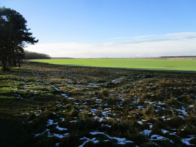
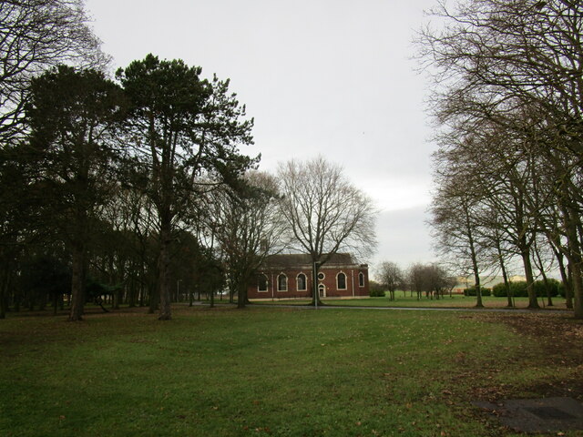
Beech Plantation, located in Lincolnshire, is a sprawling woodland area known for its dense population of beech trees. Covering an expansive area, the plantation is a popular destination for nature enthusiasts and hikers seeking solace in a peaceful and picturesque environment.

The plantation boasts a variety of flora and fauna, but it is the beech trees that dominate the landscape. These majestic trees, with their smooth silver-gray trunks and vibrant green leaves, create a captivating and serene atmosphere. The dense canopy they form provides shade during hot summer days, making it an ideal spot for picnics and leisurely walks.

Aside from its natural beauty, Beech Plantation is also home to a diverse range of wildlife. Visitors may catch glimpses of deer, rabbits, squirrels, and a myriad of bird species while exploring the forest. The tranquil atmosphere is further enhanced by the gentle sound of birdsong, adding to the overall sense of tranquility.

The plantation offers well-maintained walking trails, allowing visitors to explore the woodland at their own pace. These trails wind through the dense forest, leading to hidden clearings, babbling brooks, and breathtaking viewpoints. Additionally, there are designated picnic areas and benches strategically placed throughout the plantation, providing ample opportunities for visitors to relax and soak in the natural beauty.

Beech Plantation, Lincolnshire, is a cherished natural gem that offers a respite from the hustle and bustle of everyday life. With its magnificent beech trees, diverse wildlife, and tranquil ambiance, it is a destination that promises a rejuvenating and memorable experience for all who venture within its boundaries.

If you have any feedback on the listing, please let us know in the comments section below.

Beech Plantation Images

Images are sourced within 2km of 53.035714/-0.5041391 or Grid Reference TF0049. Thanks to Geograph Open Source API. All images are credited.

Autumn sown crop near Brauncewell
Sugar beet loading area Waiting for the call to the Newark sugar factory.
Sugar beet loading area
Waiting for the call to the Newark sugar factory.
Snow by the path under the trees Snow fell on 4th December and most quickly disappeared but some still lingers here 48 hours after it fell.
Snow by the path under the trees
Snow fell on 4th December and most quickly disappeared but some still lingers here 48 hours after it fell.
Autumn sown crop Lord Bristol's Plantation on the left. A little snow lingering from two days ago.
Autumn sown crop
Lord Bristol's Plantation on the left. A little snow lingering from two days ago.
Bridleway to Cranwell This surfaced bridleway leads to RAF Cranwell which is just beyond the trees on the horizon.
Bridleway to Cranwell
This surfaced bridleway leads to RAF Cranwell which is just beyond the trees on the horizon.
Airfield to North of Main RAF Cranwell Air Base Generally used for Gliders now.  Once used as base for Sea Scout Airships.
Airfield to North of Main RAF Cranwell Air Base
Generally used for Gliders now. Once used as base for Sea Scout Airships.
View from Plantation Road Playing fields and golf course leading towards buildings at RAF Cranwell.
The road to the left is 'Lighter than Air Road'.
View from Plantation Road
Playing fields and golf course leading towards buildings at RAF Cranwell. The road to the left is 'Lighter than Air Road'.
View from Lighter Than Air Road This vast area is an airstrip used mainly by gliders rather than airships, which once were based here at RAF Cranwell, hence the name of the road.
View from Lighter Than Air Road
This vast area is an airstrip used mainly by gliders rather than airships, which once were based here at RAF Cranwell, hence the name of the road.
Looking from Plantation Road Towards RAF Cranwell College The College tower features a lighthouse which is visible from miles around.
Looking from Plantation Road Towards RAF Cranwell College
The College tower features a lighthouse which is visible from miles around.
Trees Alongside Bristol House Road Fine group of trees adjoining the road around the houses at RAF Cranwell.
Trees Alongside Bristol House Road
Fine group of trees adjoining the road around the houses at RAF Cranwell.
Texaco Water Tank Nice to see recycling at work in all sorts of ways.
Texaco Water Tank
Nice to see recycling at work in all sorts of ways.
Long Lane, Brauncewell Heading west from a 57 metre spot height.
Long Lane, Brauncewell
Heading west from a 57 metre spot height.
Potato field, west of Brauncewell On the south side of Long Lane.
Potato field, west of Brauncewell
On the south side of Long Lane.
Barley field, west of Brauncewell On the south side of Long Lane.
Barley field, west of Brauncewell
On the south side of Long Lane.
Dark skies over golden barley West of Brauncewell, on the south side of Long Lane.
Dark skies over golden barley
West of Brauncewell, on the south side of Long Lane.
Public bridleway to Cranwell Heading south from Long Lane, Brauncewell.
Public bridleway to Cranwell
Heading south from Long Lane, Brauncewell.
Potato plants in flower Casting a ghostly white glow over the field.
Potato plants in flower
Casting a ghostly white glow over the field.
Church of St Michael and All Angels, RAF Cranwell
Show me another place!

Beech Plantation is located at Grid Ref: TF0049 (Lat: 53.035714, Lng: -0.5041391)

Administrative County: Lincolnshire

District: North Kesteven

Police Authority: Lincolnshire

What 3 Words

///frog.handbags.passages. Near Cranwell, Lincolnshire

Nearby Locations

Beech Plantation

Related Wikis

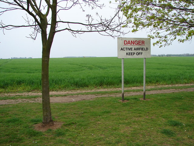
Royal Air Force College Cranwell

The Royal Air Force College (RAFC) is the Royal Air Force military academy which provides initial training to all RAF personnel who are preparing to become...

Central Flying School

The Central Flying School (CFS) is the Royal Air Force's primary institution for the training of military flying instructors. Established in 1912 at the...
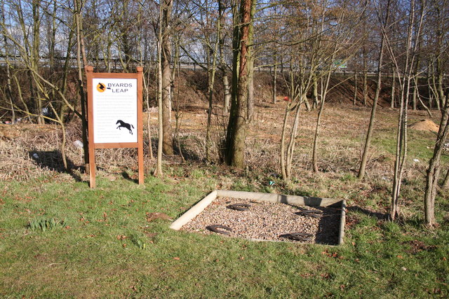
Byard's Leap

Byard's Leap is a hamlet in the North Kesteven district of Lincolnshire, England. It is situated approximately 3 miles (5 km) west from Cranwell, and is...
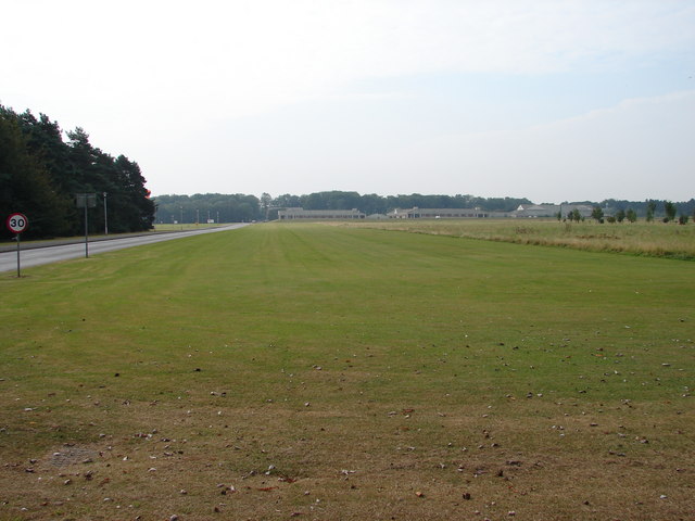
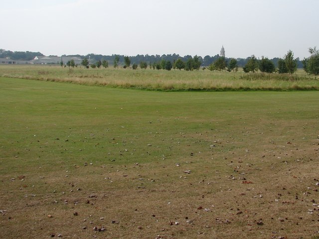
RAF Cranwell

Royal Air Force Cranwell or more simply RAF Cranwell (ICAO: EGYD) is a Royal Air Force station in Lincolnshire, England, close to the village of Cranwell...

Nearby Amenities

Located within 500m of 53.035714,-0.5041391
Bus Stop
The Hive
Naptan AtcoCode: 270000008385
Naptan Bearing: E
Naptan CommonName: The Hive
Naptan Indicator: adj
Naptan Landmark: The Hive
Naptan NaptanCode: lingptwa
Naptan Street: Cranwell Avenue
Naptan Verified: no
Source: naptan_import
Lat/Long: 53.0359882/-0.4976553
Bus Stop
The Hive
Naptan AtcoCode: 270000008386
Naptan Bearing: W
Naptan CommonName: The Hive
Naptan Indicator: opp
Naptan Landmark: The Hive
Naptan NaptanCode: lingptwd
Naptan Street: Cranwell Avenue
Naptan Verified: no
Source: naptan_import
Lat/Long: 53.0359459/-0.4971496
Bus Stop
St Michael & All Angels' Church
Naptan AtcoCode: 2700LCR02697
Naptan Bearing: NE
Naptan CommonName: St Michael & All Angels' Church
Naptan Indicator: adj
Naptan Landmark: St Michael & All Angels' Church
Naptan NaptanCode: linatmag
Naptan Street: Cranwell Avenue
Naptan Verified: no
Source: naptan_import
Lat/Long: 53.0353191/-0.5066272
Place Of Worship
St Michael and All Angels' Church
Denomination: anglican
Node Id: 775988133
Religion: christian
Source Name: OS Open Local Important Buildings Layer
Lat/Long: 53.0362329/-0.5073158
Place Of Worship
St Peter's Church
Denomination: anglican
Node Id: 775988138
Religion: christian
Source Name: OS Open Local Important Buildings Layer
Lat/Long: 53.0366835/-0.5050104
Place Of Worship
St Andrew's Church
Node Id: 775988141
Religion: christian
Source Name: OS Open Local Important Buildings Layer
Lat/Long: 53.0350176/-0.5042917
Barrier: swing_gate
Lat/Long: 53.0354281/-0.5068142
Barrier: lift_gate
Lat/Long: 53.035515/-0.4990888
Barrier: lift_gate
Lat/Long: 53.0355456/-0.4991505
Restaurant
Hive Coffee Shop
Cuisine: coffee_shop;donut;sandwich
Operator: Starbucks
Lat/Long: 53.0361344/-0.4988572
Camera Mount: pole
Camera Type: panning
Man Made: surveillance
Surveillance: public
Surveillance Type: camera
Surveillance Zone: area
Lat/Long: 53.0358105/-0.4988481
Barrier: lift_gate
Lat/Long: 53.0347571/-0.5058747
Barrier: swing_gate
Foot: private
Material: metal
Lat/Long: 53.0351295/-0.5101881
Barrier: swing_gate
Foot: private
Lat/Long: 53.0351459/-0.509991
Barrier: lift_gate
Lat/Long: 53.0359729/-0.5025666
Barrier: lift_gate
Lat/Long: 53.0359686/-0.5024882
Barrier: lift_gate
Lat/Long: 53.0359654/-0.5026514
The data included in this document is from www.openstreetmap.org. The data is made available under ODbL.

Have you been to Beech Plantation?

Leave your review of Beech Plantation below (or comments, questions and feedback).