Badger Wood

Wood, Forest in Hertfordshire Dacorum

England

Badger Wood

Traditional telegraph pole on Nettleden Road, Little Gaddesden
Traditional telegraph pole on Nettleden Road, Little Gaddesden Credit: David Howard

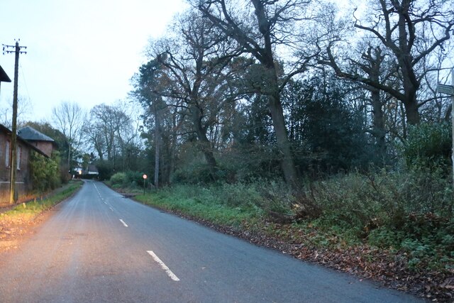
Badger Wood is a picturesque forest located in the county of Hertfordshire, England. Covering an area of approximately 150 acres, this woodland is nestled in a rural landscape, offering visitors a tranquil and natural setting to explore.

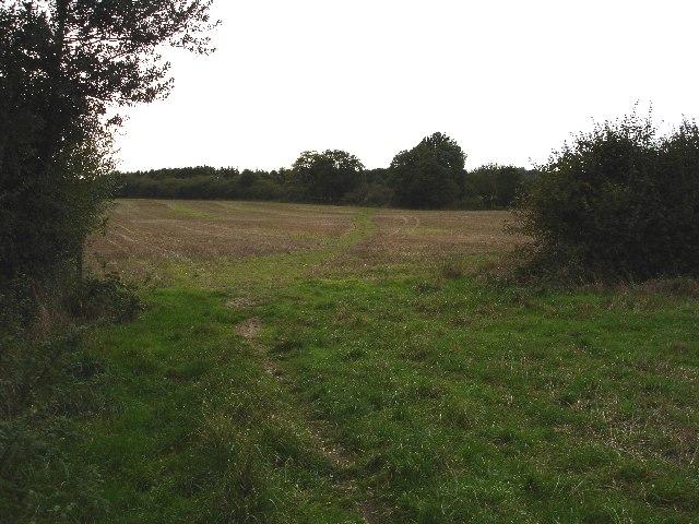
The wood is characterized by its dense canopy of trees, dominated by species such as oak, beech, and birch. These towering trees create a cool and shaded environment, perfect for those seeking respite from the summer sun. The forest floor is covered with a thick layer of fallen leaves, providing a soft carpet underfoot and a habitat for various woodland creatures.

Badger Wood is home to a diverse range of wildlife, including its namesake, the European badger. These elusive creatures can often be spotted foraging for food or creating their burrows within the forest. Other notable wildlife species that call this woodland home include deer, foxes, and a variety of bird species. Nature enthusiasts and birdwatchers are sure to be delighted by the sight of woodpeckers, owls, and songbirds fluttering among the treetops.

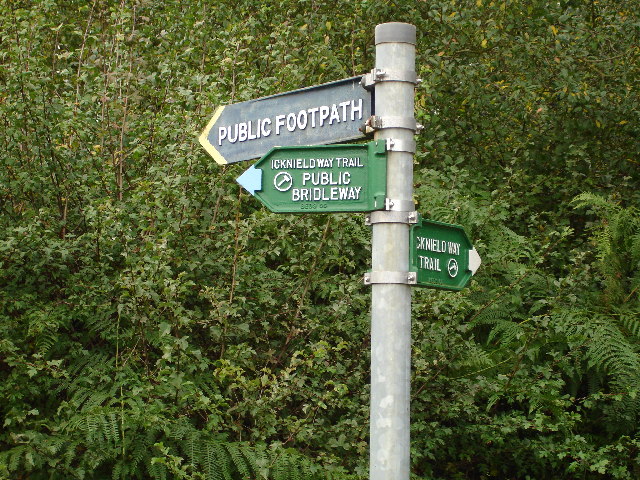
Several well-maintained paths wind their way through the wood, allowing visitors to explore its depths and discover its hidden treasures. These paths offer a peaceful and idyllic setting for leisurely walks, jogging, or even a family picnic surrounded by nature's beauty.

Badger Wood is a popular destination for nature lovers, offering a serene escape from the hustle and bustle of everyday life. With its lush greenery, abundant wildlife, and peaceful ambiance, this woodland is truly a hidden gem in Hertfordshire's natural landscape.

If you have any feedback on the listing, please let us know in the comments section below.
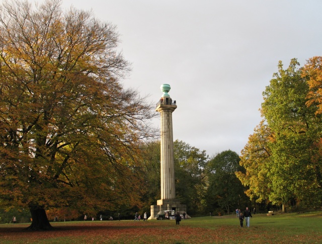
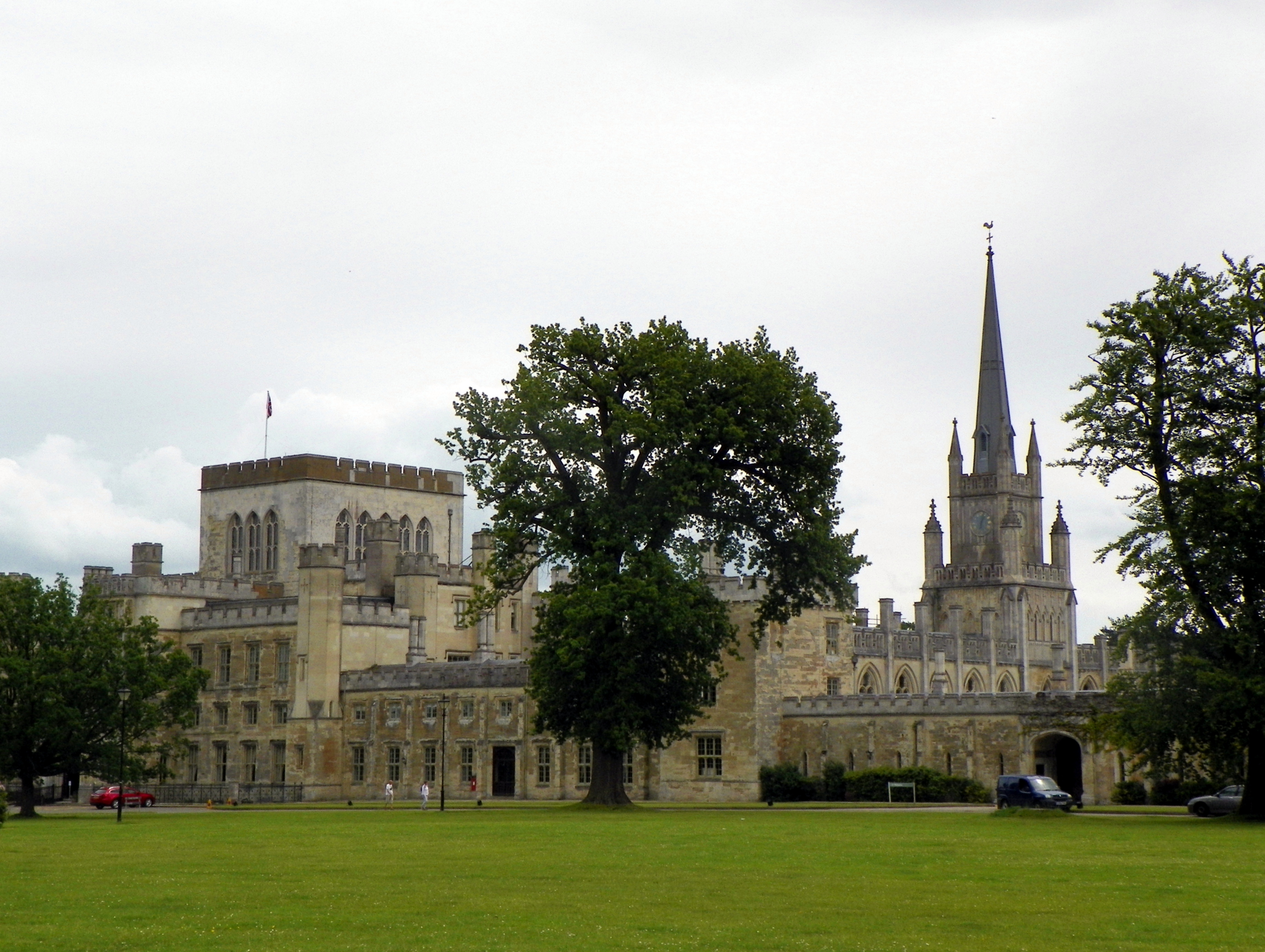
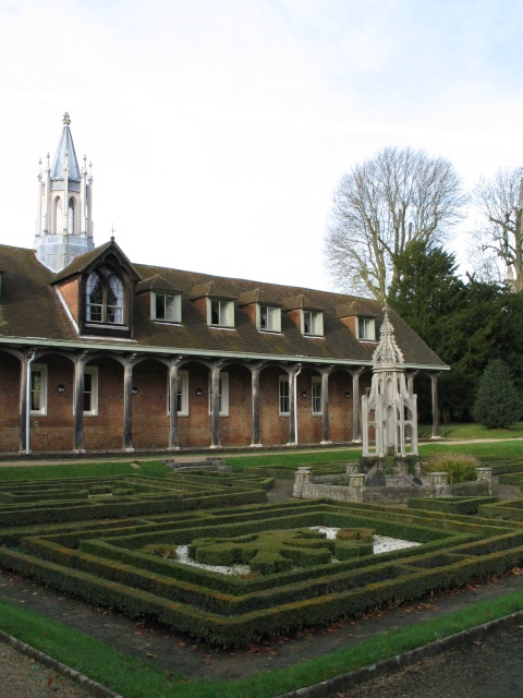
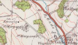
Badger Wood Images

Images are sourced within 2km of 51.815255/-0.54578893 or Grid Reference TL0013. Thanks to Geograph Open Source API. All images are credited.

Traditional telegraph pole on Nettleden Road, Little Gaddesden
Nettleden Road, Little Gaddesden
Herts / Beds border The green track crossing this field is the footpath that follows the Herts Beds border for 100 yards or so.  By the time the path reached the trees on the far side it has re-entered Beds .
Herts / Beds border
The green track crossing this field is the footpath that follows the Herts Beds border for 100 yards or so. By the time the path reached the trees on the far side it has re-entered Beds .
View to Studham Hall Farm This view is uphill towards Studham Hall farm across the field from the Icknield Way.
View to Studham Hall Farm
This view is uphill towards Studham Hall farm across the field from the Icknield Way.
Mason's Plantation. This plantation does not appear on the 1940's OS maps so is a reasonably young wood.  It seems to have been planted primarily to give cover to pheasants.
Mason's Plantation.
This plantation does not appear on the 1940's OS maps so is a reasonably young wood. It seems to have been planted primarily to give cover to pheasants.
Junction of Icknield Way and road south out of Studham These point all over the place.  The paths are clear but the pointers have been twisted around.
Junction of Icknield Way and road south out of Studham
These point all over the place. The paths are clear but the pointers have been twisted around.
River Gade at Hudnall Corner Viewed looking southwards and downstream from Pedley Hill road, the Gade is nothing more than a dry ditch here.
River Gade at Hudnall Corner
Viewed looking southwards and downstream from Pedley Hill road, the Gade is nothing more than a dry ditch here.
Pond Lane, Hudnall This seems to be a new lane in Hudnall as I can't see it on any of my maps. It has a Dacorum borough road sign, so it would seem that it has been adopted - which is quite surprising as it is gravelled.
Pond Lane, Hudnall
This seems to be a new lane in Hudnall as I can't see it on any of my maps. It has a Dacorum borough road sign, so it would seem that it has been adopted - which is quite surprising as it is gravelled.
Ashridge Estate lane at Hudnall The National Trust sign says "Ashridge Estate : Authorised Vehicles Only : No Through Road : No turning Beyond this point"
Ashridge Estate lane at Hudnall
The National Trust sign says "Ashridge Estate : Authorised Vehicles Only : No Through Road : No turning Beyond this point"
Buttercup Meadow, Hudnall This large field full of buttercups is surrounded by woodland. It is along a lane that leads from Hudnall to Great Gaddesden.
Buttercup Meadow, Hudnall
This large field full of buttercups is surrounded by woodland. It is along a lane that leads from Hudnall to Great Gaddesden.
Oak avenue An avenue comprising mostly oaks along the lane from Hudnall to Great Gaddesden. This view is looking back towards Hudnall.
Oak avenue
An avenue comprising mostly oaks along the lane from Hudnall to Great Gaddesden. This view is looking back towards Hudnall.
Milebarn Farm On the busy A4146 is this extensive farm which seems to have other businesses using some of the farm building in the background. A better idea of the extent of the farm can be gained from <a href="https://www.geograph.org.uk/photo/335723">TL0014 : Milebarn Farm from nearby hill</a>
Milebarn Farm
On the busy A4146 is this extensive farm which seems to have other businesses using some of the farm building in the background. A better idea of the extent of the farm can be gained from TL0014 : Milebarn Farm from nearby hill
Milebarn Farm from nearby hill This view of <a href="https://www.geograph.org.uk/photo/335714">TL0014 : Milebarn Farm</a> is from a footpath up a hill in the adjacent gridsquare. From this perspective the extent of the farm and its buildings is more apparent than from the close-up of the linked image. A Red Kite was wheeling overhead as I took the photo.
Milebarn Farm from nearby hill
This view of TL0014 : Milebarn Farm is from a footpath up a hill in the adjacent gridsquare. From this perspective the extent of the farm and its buildings is more apparent than from the close-up of the linked image. A Red Kite was wheeling overhead as I took the photo.
Looking towards Ravensdell Wood This is the view uphill in the direction of Ravensdell Wood from the footpath that strikes off to the northeast from the A4146 overlooking <a href="https://www.geograph.org.uk/photo/335714">TL0014 : Milebarn Farm</a> (see also <a href="https://www.geograph.org.uk/photo/335723">TL0014 : Milebarn Farm from nearby hill</a>)
The telecom mast to the right of the main clump of trees must be quite a recent addition as it doesn't feature on any of the online OS maps.
Looking towards Ravensdell Wood
This is the view uphill in the direction of Ravensdell Wood from the footpath that strikes off to the northeast from the A4146 overlooking TL0014 : Milebarn Farm (see also TL0014 : Milebarn Farm from nearby hill) The telecom mast to the right of the main clump of trees must be quite a recent addition as it doesn't feature on any of the online OS maps.
View downhill to Gade Plas This is the view downhill from the same point that <a href="https://www.geograph.org.uk/photo/335738">TL0114 : Looking towards Ravensdell Wood</a> & <a href="https://www.geograph.org.uk/photo/335723">TL0014 : Milebarn Farm from nearby hill</a>  were taken. The building on the left is Gade Plas which lies on the opposite side of the A4146 in the adjacent gridsquare (TL0014) at TL00961406
See also <a href="https://www.geograph.org.uk/photo/336998">TL0114 : Sweeping Farmland</a>
View downhill to Gade Plas
This is the view downhill from the same point that TL0114 : Looking towards Ravensdell Wood & TL0014 : Milebarn Farm from nearby hill were taken. The building on the left is Gade Plas which lies on the opposite side of the A4146 in the adjacent gridsquare (TL0014) at TL00961406 See also TL0114 : Sweeping Farmland
Sweeping Farmland The field in the foreground is in this gridsquare (TL0114) while the building on the right is Gade Plas which is in TL0014 (at TL00961406 - see also <a href="https://www.geograph.org.uk/photo/335754">TL0114 : View downhill to Gade Plas</a>) and the farm in the centre of the image is Valley Farm which is in yet another square, TL0113 at TL01011388
Sweeping Farmland
The field in the foreground is in this gridsquare (TL0114) while the building on the right is Gade Plas which is in TL0014 (at TL00961406 - see also TL0114 : View downhill to Gade Plas) and the farm in the centre of the image is Valley Farm which is in yet another square, TL0113 at TL01011388
Milebarn Farm & A4146 Taken from the beginning of the drive to the back of the farm looking along the A4146 towards Dagnall. Hoo Wood (see <a href="https://www.geograph.org.uk/photo/193359">SP9914 : Lamsey Farm</a>) near Ringshall can be seen in the background 
For Milebarn Farm, see also <a href="https://www.geograph.org.uk/photo/335714">TL0014 : Milebarn Farm</a> & <a href="https://www.geograph.org.uk/photo/335723">TL0014 : Milebarn Farm from nearby hill</a>
Milebarn Farm & A4146
Taken from the beginning of the drive to the back of the farm looking along the A4146 towards Dagnall. Hoo Wood (see SP9914 : Lamsey Farm) near Ringshall can be seen in the background For Milebarn Farm, see also TL0014 : Milebarn Farm & TL0014 : Milebarn Farm from nearby hill
Chiltern Way Chiltern Way heading to houses by Hudnall Common
Chiltern Way
Chiltern Way heading to houses by Hudnall Common
Show me another place!

Badger Wood is located at Grid Ref: TL0013 (Lat: 51.815255, Lng: -0.54578893)

Administrative County: Hertfordshire

District: Dacorum

Police Authority: Hertfordshire

What 3 Words

///reckoned.afflict.oath. Near Kensworth, Bedfordshire

Related Wikis

Little Gaddesden

Little Gaddesden (pronounced ) is a village and civil parish in the borough of Dacorum, Hertfordshire 3 miles (4.8 km) north of Berkhamsted. As well as...

Ringshall, Berkhamsted

Ringshall is a hamlet in the Chiltern Hills of England. It is located on the border of the counties of Buckinghamshire and Hertfordshire; parts of the...

Ashridge Golf Club

Ashridge Golf Club, also Ashridge Artisans Golf Club, is a golf club in Little Gaddesden, on the border of Hertfordshire and Bedfordshire, England, 2.5...

Ashridge

Ashridge is a country estate and stately home in Hertfordshire, England. It is situated in the Chiltern Hills, an Area of Outstanding Natural Beauty, about...

Hult Ashridge

Hult Ashridge (also known as the Ashridge Programme or Ashridge) is the executive education programme of Hult International Business School, housed in...

Ashridge Priory

Ashridge Priory was a medieval college of Austin canons called variously the "Brothers of Penitence" or the "Boni Homines". It was founded by Edmund of...

Church of St Mary, Studham

Church of St Mary is a Grade I listed church in Studham, Bedfordshire, England. It became a listed building on 3 February 1967. == See also == Grade...

St Margaret's Convent, Hertfordshire

St Margaret's Convent was a convent of the Benedictine order near Great Gaddesden in Hertfordshire, England. Founded in 1160, it was abolished as a consequence...

Nearby Amenities

Located within 500m of 51.815255,-0.54578893
Barrier: kissing_gate
Foot: yes
Source: GPS, observation
Lat/Long: 51.8137107/-0.5510385
Church Farm
Created By: Potlatch 0.8a
Place: farm
Source: NPE
Lat/Long: 51.8154091/-0.5507097
The data included in this document is from www.openstreetmap.org. The data is made available under ODbL.

Have you been to Badger Wood?

Leave your review of Badger Wood below (or comments, questions and feedback).