Emply Ten Acres

Wood, Forest in Surrey Waverley

England

Emply Ten Acres

Downs Link near Bramley The Downs Link path follows a dismantled railway line for most of its length.  It also forms part of route 223 of the National Cycle Network.

From this point, near Bramley, into Guildford, the path is also on the route of National Cycle Network route 22.
Downs Link near Bramley Credit: Malc McDonald

Ten Acres, Surrey, also known as Wood or Forest, is a picturesque and expansive wooded area located in the county of Surrey, England. Covering approximately 10 acres of land, this natural haven is a popular destination for nature lovers, hikers, and outdoor enthusiasts.

The woodland is characterized by a mix of deciduous and evergreen trees, creating a diverse and vibrant ecosystem. Tall oak, beech, and ash trees dominate the landscape, providing ample shade and a serene ambiance. The forest floor is adorned with a carpet of lush green ferns, mosses, and wildflowers, adding to the area's natural beauty.

Numerous walking trails crisscross the woodland, offering visitors the opportunity to explore its hidden treasures. These well-maintained paths lead to various points of interest, such as babbling brooks, peaceful ponds, and secluded picnic spots. Wildlife is abundant in Ten Acres, with a wide array of bird species, including woodpeckers and owls, calling the forest their home. Squirrels, foxes, and rabbits can also be spotted darting through the undergrowth.

The tranquility and serenity of Ten Acres make it an ideal escape from the hustle and bustle of city life. Families often visit the woodland for leisurely walks, picnics, and to introduce children to the wonders of nature. Photographers and artists are drawn to the area's natural beauty, finding inspiration in its captivating landscapes and abundant wildlife.

Overall, Ten Acres, Surrey, is a treasured natural gem that offers visitors a chance to immerse themselves in the beauty and tranquility of the English countryside.

If you have any feedback on the listing, please let us know in the comments section below.

Emply Ten Acres Images

Images are sourced within 2km of 51.181214/-0.56631402 or Grid Reference TQ0043. Thanks to Geograph Open Source API. All images are credited.

Downs Link near Bramley The Downs Link path follows a dismantled railway line for most of its length.  It also forms part of route 223 of the National Cycle Network.

From this point, near Bramley, into Guildford, the path is also on the route of National Cycle Network route 22.
Downs Link near Bramley
The Downs Link path follows a dismantled railway line for most of its length. It also forms part of route 223 of the National Cycle Network. From this point, near Bramley, into Guildford, the path is also on the route of National Cycle Network route 22.
National Cycle Network route 22 near Bramley This path, shared by pedestrians and cyclists, forms part of National Cycle Network route 22.  The bridge ahead carries the Downs Link path, on a former railway alignment, across the path.
National Cycle Network route 22 near Bramley
This path, shared by pedestrians and cyclists, forms part of National Cycle Network route 22. The bridge ahead carries the Downs Link path, on a former railway alignment, across the path.
Wey & Arun Canal near Bramley The Wey and Arun Canal is a 23-mile-long canal in the south of England, between the River Wey at Shalford, Surrey and the River Arun at Pallingham, in West Sussex.
Passing through a rural landscape, there was little freight traffic to justify its continued existence, and the canal was officially abandoned in 1871.
Without maintenance, the canal gradually became derelict over much of its length. However, since 1970, active restoration by The Wey & Arun Canal Trust has resulted in several miles of the waterway being restored to navigable standard. Work is continuing, with the ultimate aim of re-opening the entire canal to navigation.
 <span class="nowrap"><a title="http://www.weyandarun.co.uk/" rel="nofollow ugc noopener" href="http://www.weyandarun.co.uk/">Link</a><img style="margin-left:2px;" alt="External link" title="External link - shift click to open in new window" src="https://s1.geograph.org.uk/img/external.png" width="10" height="10"/></span> 
Part of the River Wey navigations. <span class="nowrap"><a title="http://www.weyandarun.co.uk/hist1.php" rel="nofollow ugc noopener" href="http://www.weyandarun.co.uk/hist1.php">Link</a><img style="margin-left:2px;" alt="External link" title="External link - shift click to open in new window" src="https://s1.geograph.org.uk/img/external.png" width="10" height="10"/></span>  <a title="https://www.geograph.org.uk/snippet/2588" href="https://www.geograph.org.uk/snippet/2588">Link</a>
Wey & Arun Canal near Bramley
The Wey and Arun Canal is a 23-mile-long canal in the south of England, between the River Wey at Shalford, Surrey and the River Arun at Pallingham, in West Sussex. Passing through a rural landscape, there was little freight traffic to justify its continued existence, and the canal was officially abandoned in 1871. Without maintenance, the canal gradually became derelict over much of its length. However, since 1970, active restoration by The Wey & Arun Canal Trust has resulted in several miles of the waterway being restored to navigable standard. Work is continuing, with the ultimate aim of re-opening the entire canal to navigation. LinkExternal link Part of the River Wey navigations. LinkExternal link Link
National Cycle Network route 22 near Bramley This path, shared by people walking and cycling, forms part of National Cycle Network route 22.  The bridge ahead carries another shared path, the Downs Link, which follows the course of a dismantled railway.
National Cycle Network route 22 near Bramley
This path, shared by people walking and cycling, forms part of National Cycle Network route 22. The bridge ahead carries another shared path, the Downs Link, which follows the course of a dismantled railway.
National Cycle Network route 22 near Bramley At this junction, the path to the right forms part of National Cycle Network route 22.  The path is shared by pedestrians and cyclists.  The path to the left is only for pedestrians.
National Cycle Network route 22 near Bramley
At this junction, the path to the right forms part of National Cycle Network route 22. The path is shared by pedestrians and cyclists. The path to the left is only for pedestrians.
Bramley - Level Crossing Gates These still extant gates flank Station Road beside the former Bramley and Wonersh railway station. The former trackbed is now followed by the long distance path, Downslink.
Bramley - Level Crossing Gates
These still extant gates flank Station Road beside the former Bramley and Wonersh railway station. The former trackbed is now followed by the long distance path, Downslink.
Bramley - Canal Restoration Works Excavation in progress by the Wey & Arun Canal Trust south of Bramley and adjacent to the Downslink footpath.
<span class="nowrap"><a title="www.weyarun.org.uk" rel="nofollow ugc noopener" href="http://www.weyarun.org.uk">Link</a><img style="margin-left:2px;" alt="External link" title="External link - shift click to open in new window" src="https://s1.geograph.org.uk/img/external.png" width="10" height="10"/></span>
Bramley - Canal Restoration Works
Excavation in progress by the Wey & Arun Canal Trust south of Bramley and adjacent to the Downslink footpath. LinkExternal link
Bramley - Wey and Arun Canal Section of the old canal which is slowly being restored by the Wey & Arun Canal Trust in sections.
<span class="nowrap"><a title="www.weyarun.org.uk" rel="nofollow ugc noopener" href="http://www.weyarun.org.uk">Link</a><img style="margin-left:2px;" alt="External link" title="External link - shift click to open in new window" src="https://s1.geograph.org.uk/img/external.png" width="10" height="10"/></span>
Bramley - Wey and Arun Canal
Section of the old canal which is slowly being restored by the Wey & Arun Canal Trust in sections. LinkExternal link
Bramley - Playground Play space with a railway theme beside the Downsway, a long distance footpath that here follows the former Guildford-Horsham rail track.
Bramley - Playground
Play space with a railway theme beside the Downsway, a long distance footpath that here follows the former Guildford-Horsham rail track.
Bramley - Railway Relics Replica level crossing gates and Southern Railway station, Bramley and Wonersh, on the former railway line Guildford-Horsham. The trackway is now a section of long distance path, Downslink.
Bramley - Railway Relics
Replica level crossing gates and Southern Railway station, Bramley and Wonersh, on the former railway line Guildford-Horsham. The trackway is now a section of long distance path, Downslink.
Bramley and Wonersh Replica railway station sign on the site of this former halt on the Guildford-Horsham line, closed by the Dr Beeching cuts. The sign is in green and white Southern Railway livery.
Bramley and Wonersh
Replica railway station sign on the site of this former halt on the Guildford-Horsham line, closed by the Dr Beeching cuts. The sign is in green and white Southern Railway livery.
Bramley - Letter Box The box is all that remains from the railway station master's house that once stood at Bramley and Wonersh Station. Its casing is painted in Southern Railway's livery of green and white. In the background is a recreated shelter on the old platform, a halt on the old Guildford-Horsham line.
Bramley - Letter Box
The box is all that remains from the railway station master's house that once stood at Bramley and Wonersh Station. Its casing is painted in Southern Railway's livery of green and white. In the background is a recreated shelter on the old platform, a halt on the old Guildford-Horsham line.
Bramley - Old Pound This pleasant little walled garden beside the parish church on Bramley's High Street was used in the 19th century as a cattle pound.
Bramley - Old Pound
This pleasant little walled garden beside the parish church on Bramley's High Street was used in the 19th century as a cattle pound.
Bramley - Jolly Farmer "The Jolly" is an independent and family-run historic pub on Bramley's High Street. Its interior is notable for its "breweriana".
<span class="nowrap"><a title="www.jollyfarmer.co.uk" rel="nofollow ugc noopener" href="http://www.jollyfarmer.co.uk">Link</a><img style="margin-left:2px;" alt="External link" title="External link - shift click to open in new window" src="https://s1.geograph.org.uk/img/external.png" width="10" height="10"/></span>
Bramley - Jolly Farmer
"The Jolly" is an independent and family-run historic pub on Bramley's High Street. Its interior is notable for its "breweriana". LinkExternal link
Bramley - Jolly Farmer Sign "The Jolly" has a jovial pub sign and is an independent and family-run historic pub on Bramley's High Street. Its interior is notable for its "breweriana".
<span class="nowrap"><a title="www.jollyfarmer.co.uk" rel="nofollow ugc noopener" href="http://www.jollyfarmer.co.uk">Link</a><img style="margin-left:2px;" alt="External link" title="External link - shift click to open in new window" src="https://s1.geograph.org.uk/img/external.png" width="10" height="10"/></span>
Bramley - Jolly Farmer Sign
"The Jolly" has a jovial pub sign and is an independent and family-run historic pub on Bramley's High Street. Its interior is notable for its "breweriana". LinkExternal link
Former Bramley and Wonersh station The former railway line here now forms part of National Cycle Network route 22.
Former Bramley and Wonersh station
The former railway line here now forms part of National Cycle Network route 22.
Esso garage on the corner of Station Road, Bramley
Mill Pond, Bramley
Mill Pond, Bramley
Show me another place!

Emply Ten Acres is located at Grid Ref: TQ0043 (Lat: 51.181214, Lng: -0.56631402)

Administrative County: Surrey

District: Waverley

Police Authority: Surrey

What 3 Words

///gives.think.edges. Near Bramley, Surrey

Related Wikis

Orchards, Surrey

Orchards is an Arts and Crafts style house in Bramley in Surrey, England. It is on Bramley's boundary with Busbridge and 1 mile (1.6 km) south-east of...
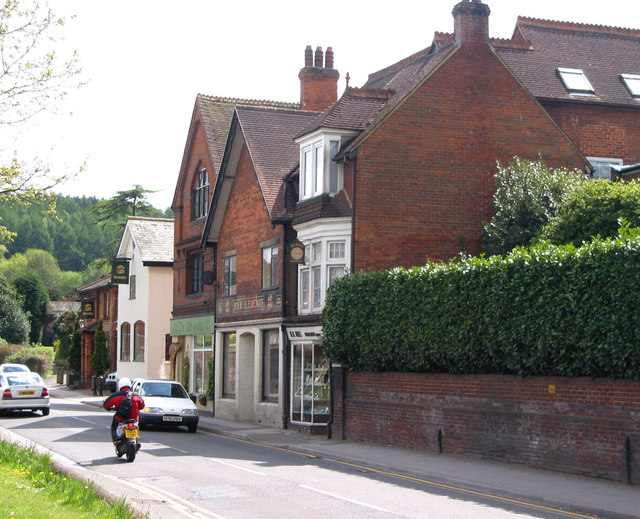
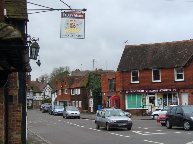
Bramley, Surrey

Bramley is a village and civil parish about three miles (5 km) south of Guildford in the Borough of Waverley in Surrey, south east England. Most of the...

Bramley & Wonersh railway station

Bramley & Wonersh was a railway station on the Cranleigh Line. It served the villages of Bramley and Wonersh in Surrey. == History == Opened in 1865 as...

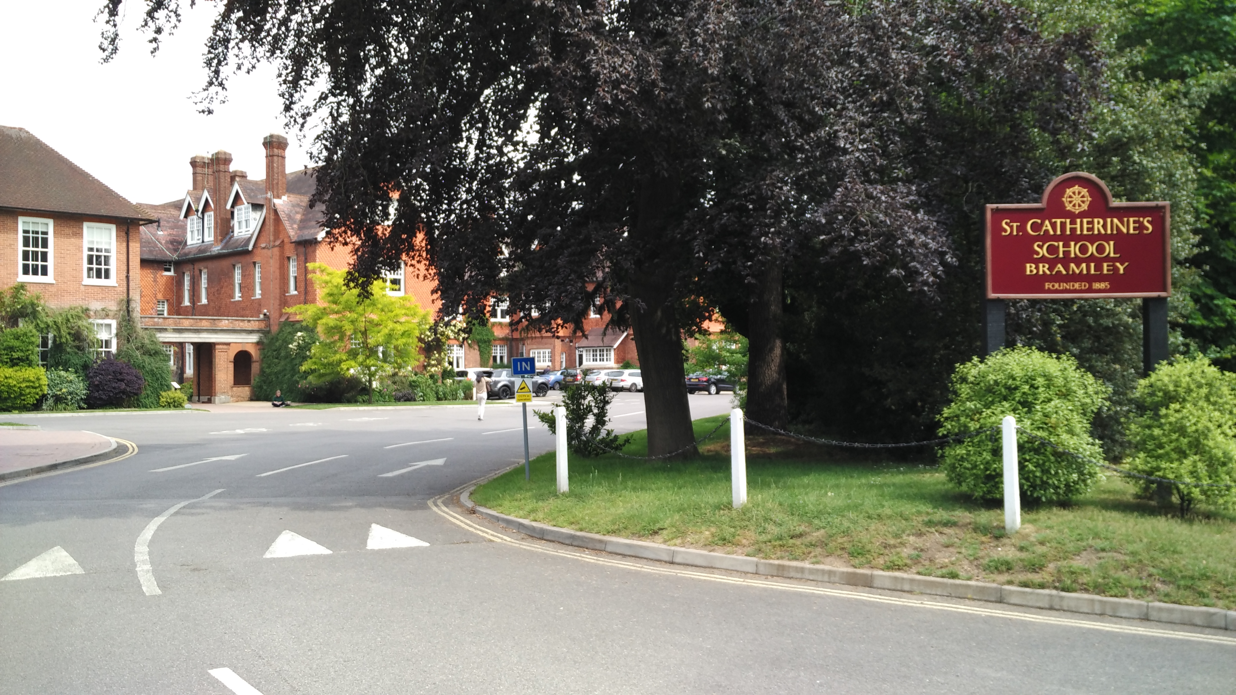
St Catherine's School, Bramley

St Catherine's School is an independent girls' boarding and day school in the village of Bramley, near Guildford, Surrey, England. The school is divided...

Munstead Wood

Munstead Wood is a Grade I listed house and garden in Munstead Heath, Busbridge on the boundary of the town of Godalming in Surrey, England, 1 mile (1...

Wonersh

Wonersh is a village and civil parish in the Waverley district of Surrey, England and Surrey Hills Area of Outstanding Natural Beauty. Wonersh contains...

Busbridge

Busbridge is a village and civil parish in the borough of Waverley in Surrey, England that adjoins the town of Godalming. It forms part of the Waverley...

Jekyll Memorial, Busbridge

The Jekyll Memorial, Busbridge, Surrey, England, commemorates the gardener Gertrude Jekyll and members of her family. Designed by Jekyll's friend and collaborator...

Have you been to Emply Ten Acres?

Leave your review of Emply Ten Acres below (or comments, questions and feedback).