Beckeringspark Moor
Wood, Forest in Bedfordshire
England
Beckeringspark Moor
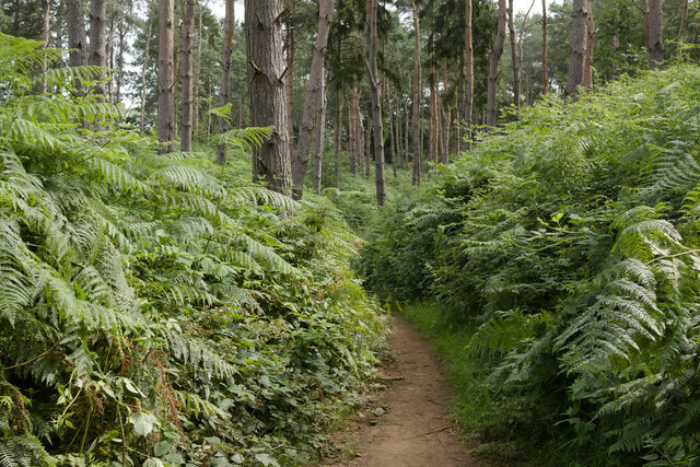
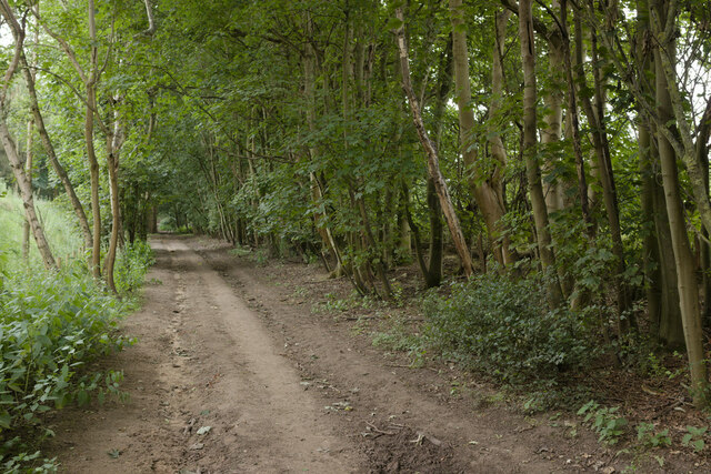
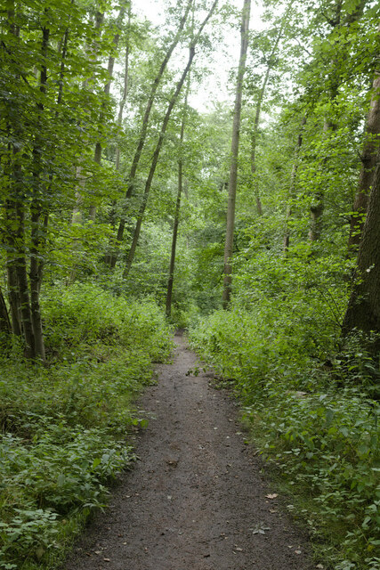
Beckeringspark Moor is a picturesque woodland located in the county of Bedfordshire, England. Spanning over an area of approximately 50 acres, this enchanting forest is nestled in the heart of the rural countryside, providing a tranquil and serene environment for visitors to explore and enjoy.
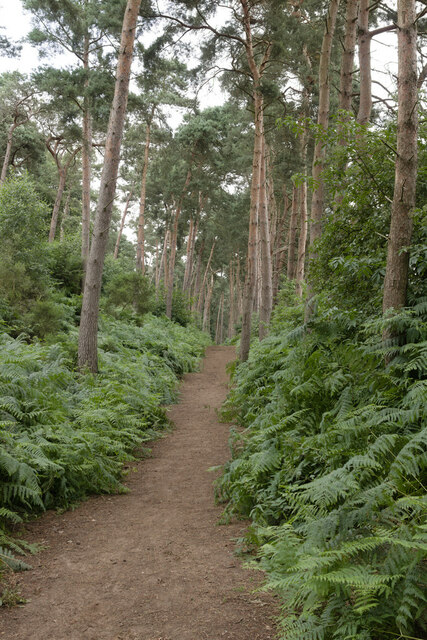
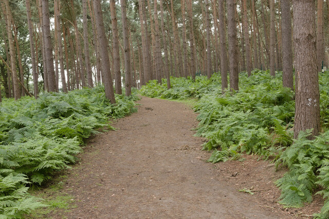
The moor is mainly comprised of dense woodlands, consisting of a variety of native trees such as oak, birch, and beech. These trees form a dense canopy, creating a cool and shaded atmosphere that is perfect for escaping the summer heat. The forest floor is covered in a thick layer of moss and ferns, adding to the natural beauty of the area.
Beckeringspark Moor is home to a diverse range of wildlife, making it a popular spot for nature enthusiasts. Visitors may catch a glimpse of deer, foxes, rabbits, and a variety of bird species as they wander through the woodland. Additionally, there are several hiking trails that wind their way through the forest, allowing visitors to explore the area and admire its natural wonders.
The moor is also home to a small stream that meanders through the woodland, adding to the tranquility of the surroundings. The stream provides a habitat for various aquatic creatures, including frogs and newts, which can be observed by those who venture closer to the water's edge.
Overall, Beckeringspark Moor is a hidden gem in Bedfordshire, offering a peaceful retreat from the hustle and bustle of everyday life. Its natural beauty and diverse wildlife make it a must-visit destination for those seeking a connection with nature.
If you have any feedback on the listing, please let us know in the comments section below.
Beckeringspark Moor Images
Images are sourced within 2km of 52.020114/-0.53967992 or Grid Reference TL0036. Thanks to Geograph Open Source API. All images are credited.


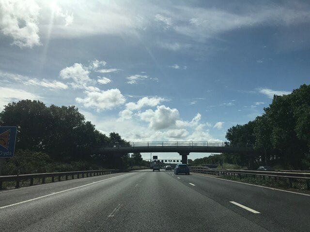
Beckeringspark Moor is located at Grid Ref: TL0036 (Lat: 52.020114, Lng: -0.53967992)
Unitary Authority: Central Bedfordshire
Police Authority: Bedfordshire
What 3 Words
///doubts.coasted.swells. Near Steppingley, Bedfordshire
Nearby Locations
Related Wikis

Steppingley
Steppingley is a rural village and civil parish in Bedfordshire, England. It stands on high ground in the centre of a small parish of about 562 ha on...

Ampthill railway station
Ampthill railway station was built over a mile from the historic market town of Ampthill in the English county of Bedfordshire by the Midland Railway in...

Millbrook Priory
Millbrook Priory was a priory in Bedfordshire, England. It was established in 1097 and disestablished in 1143. The little Priory of Beaulieu at Moddry...

Millbrook, Bedfordshire
Millbrook is a small village and civil parish near Bedford, England. It has a population of 130, increasing to 147 at the 2011 Census. Millbrook railway...

Ampthill Tunnel
Ampthill tunnel is a railway tunnel at Ampthill on the Midland Main Line, being positioned between Bedford and Flitwick. It consists of two separate bores...
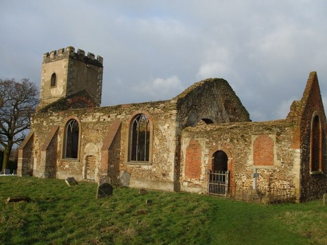
All Saints Church, Segenhoe
All Saints Church, Segenhoe is a ruined medieval church located near the village of Ridgmont, Bedfordshire. It contains architectural details that range...
Millbrook Proving Ground
Millbrook Proving Ground is an English vehicle testing centre located at Millbrook, Bedfordshire. One of the largest vehicle testing centres in Europe...

Cooper's Hill, Bedfordshire
Cooper's Hill is an 18.1-hectare (45-acre) biological Site of Special Scientific Interest in Ampthill in Bedfordshire. It was notified under Section 28...
Related Videos

Center Parcs Holiday Vlog | Woburn Forest 2024
Join my family and I for a long weekend at Center Parcs Woburn Forest! TikTok: www.tiktok.com/@brjccc.

Center Parcs Woburn Forest - Christmas Time Full Tour - British Holiday Destination
Subscribe to see more shows, theme park walk throughs and travel diaries! In today's video follow along as I take you on a tour of ...
Center Parcs, Woburn Forest. February 2023. Birthday holiday. @centerparcsuk
We had a 4 night holiday with Shane's Mum for Shane's 35th Birthday. Our holiday was upgraded from a 3 bed executive lodge to ...
Nearby Amenities
Located within 500m of 52.020114,-0.53967992Have you been to Beckeringspark Moor?
Leave your review of Beckeringspark Moor below (or comments, questions and feedback).